|
Manukau Bus Station
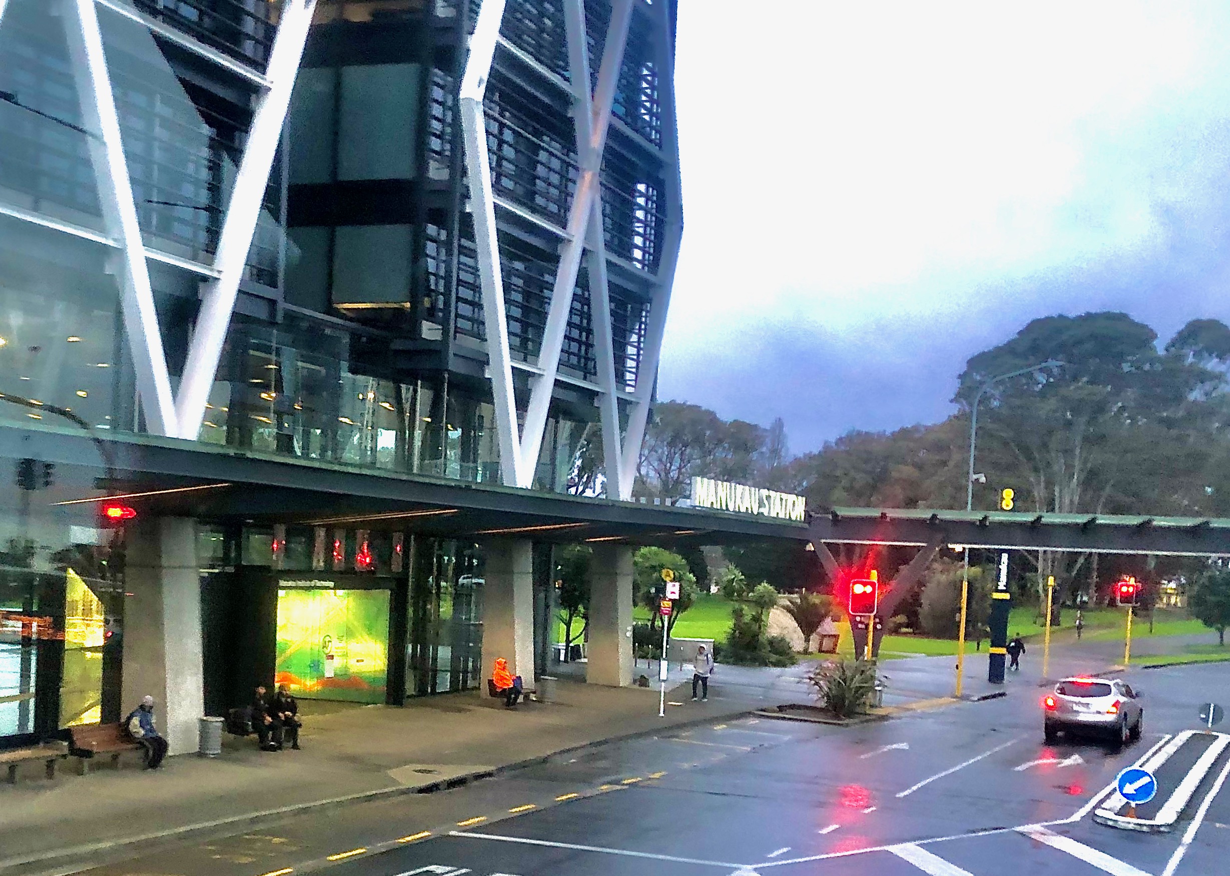
Manukau bus station is a bus station in Auckland, New Zealand, located in Manukau City Centre. The station serves as an important transport hub for South Auckland, serving as an interchange between bus and train services through connections to the adjacent Manukau Train Station. It is also one of the newest transit stations on the AT Metro network - having opened in 2018 - and is prominent for its unique design which has received architectural accolades. History The station was first proposed in 2015 as part of the implementation of the new bus network for South Auckland, forming a transport hub with the adjacent Manukau railway station. This was to make it easier for bus passengers to transfer to train services as an alternative to long bus trips into the central city. It was also intended to provide better connections between bus services and serve as a "gateway" to South Auckland and Auckland Airport. At the time, it was expected to cost $26 million with a completion dat ... [...More Info...] [...Related Items...] OR: [Wikipedia] [Google] [Baidu] |
Manukau Railway Station
Manukau railway station is located at the heart of the campus of the Manukau Institute of Technology in Manukau, a suburb of Auckland, New Zealand. It is the terminus station for Eastern Line services between Manukau and Britomart Transport Centre in central Auckland. Access from the station to ground level and to surrounding streets is by stairs, lift or escalator to the ground floor of the 7-level campus building. Station works were essentially finished by October 2011, and the Manukau Branch line, a 2.5 km spur line off the North Island Main Trunk railway, opened on 15 April 2012. Manukau station is the only station on the branch line. The Eastern Line was the second passenger rail line in Auckland to receive electric train services, following the Onehunga Line in April 2014. Electric trains began running on some Eastern Line off-peak services on 15 August 2014, and were gradually rolled out onto all services over the following month. In December 2014, all trains us ... [...More Info...] [...Related Items...] OR: [Wikipedia] [Google] [Baidu] |
Manukau
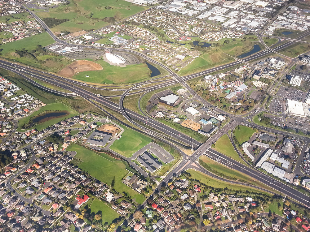
Manukau (), or Manukau Central, is a suburb of South Auckland, New Zealand, centred on the Manukau City Centre business district. It is located 23 kilometres south of the Auckland Central Business District, west of the Southern Motorway, south of Papatoetoe, and north of Manurewa. The industrial and commercial suburb of Wiri lies to the east and south. The suburb is named after the previous Manukau City district, named in 1965 by a poll of residents. The headquarters of Manukau City Council were in Manukau Central until the council was merged into Auckland Council in November 2010. Manukau Central should not be confused with the much larger Manukau City, which was the entire area administered by the city council. Demographics Manukau covers and had an estimated population of as of with a population density of people per km2. Manukau had a population of 3,450 at the 2018 New Zealand census, an increase of 318 people (10.2%) since the 2013 census, and an increase of ... [...More Info...] [...Related Items...] OR: [Wikipedia] [Google] [Baidu] |
Auckland Council
Auckland Council ( mi, Te Kaunihera o Tāmaki Makaurau) is the local government council for the Auckland Region in New Zealand. It is a territorial authority that has the responsibilities, duties and powers of a regional council and so is a unitary authority, according to the Local Government (Auckland Council) Act 2009, which established the council. The governing body consists of a mayor and 20 councillors, elected from 13 wards. There are also 149 members of 21 local boards who make decisions on matters local to their communities. It is the largest council in Oceania, with a $3 billion annual budget, $29 billion of ratepayer equity, and 9,870 full-time staff as of 30 June 2016. The council began operating on 1 November 2010, combining the functions of the previous regional council and the region's seven city and district councils into one "super council" or "super city". The council was established by a number of Acts of Parliament, and an Auckland Transition Agency, als ... [...More Info...] [...Related Items...] OR: [Wikipedia] [Google] [Baidu] |
Onehunga Railway Station
Onehunga railway station is the final station on the Onehunga Line of the Auckland railway network in New Zealand. It is located at the southern end of Onehunga Town Centre and consists of a single side platform which is accessed from Onehunga Mall and Princes Street. History The current station is the second to have served Onehunga. The original station opened in 1873, and was situated adjacent to Princes Street, to the north-east of the current station. Through services to Auckland railway station ceased in 1950, but passenger trains continued running between Onehunga and Penrose, to connect with mainline services into Auckland, until April 1973. The station closed following the withdrawal of passenger service but the line through the station remained open for freight trains until 2006. The new station was opened on 18 September 2010 and services started on 19 September 2010. The station was first served by electric trains on 28 April 2014, with the Onehunga Line being th ... [...More Info...] [...Related Items...] OR: [Wikipedia] [Google] [Baidu] |
Māngere
Māngere () or Mangere is one of the largest suburbs in Auckland, in northern New Zealand. It is located on mainly flat land on the northeastern shore of the Manukau Harbour, to the northwest of Manukau City Centre and 15 kilometres south of the Auckland city centre. It is the location of Auckland Airport, which lies close to the harbour's edge to the south of the suburb. Māngere has three major sub-areas: Māngere Bridge, Māngere Central, and Māngere East, with Favona (in the east) sometimes counted as part of Māngere as well. The suburb is named after Māngere Mountain, one of Auckland's largest volcanic cones. The cone's name comes from the Māori phrase ''hau māngere'', meaning "lazy winds", after the shelter the mountain provides from the prevailing westerly wind. In 2019, the name of the suburb was officially gazetted as Māngere. Demographics Māngere covers and had an estimated population of as of with a population density of people per km2. Māngere had ... [...More Info...] [...Related Items...] OR: [Wikipedia] [Google] [Baidu] |
Papatoetoe Railway Station
Papatoetoe railway station is on the Southern Line (Auckland), Southern Line and Eastern Line (Auckland), Eastern Line of the List of Auckland railway stations, Auckland railway network in New Zealand. It is between Station Road and Shirley Road, across the street from Papatoetoe West School, and has an island platform layout. History Papatoetoe was originally called Papatoitoi, a corruption of its true name. The name was corrected in 1907, by the New Zealand Railways Department, because of the obvious discrepancy with the town it served, which has always been spelt as "Papatoetoe". Old station building The old station building, restored by the Papatoetoe Railway Station Preservation Trust, has been moved to the corner of Station Road, Shirley Road, Tavern Lane & St George Street and repurposed into a café. Parts of this building dated back to 1875. A new station was constructed on the present site. The old station is an integral part of the area's history, with ''Old Papat ... [...More Info...] [...Related Items...] OR: [Wikipedia] [Google] [Baidu] |
Layover
250px, Layover for buses at LACMTA's Warner Center Transit Hub, Los Angeles ">Los_Angeles.html" ;"title="Warner Center Transit Hub, Los Angeles">Warner Center Transit Hub, Los Angeles In scheduled transportation, a layover (also waypoint, way station, or connection) is a point where a vehicle stops, with passengers possibly changing vehicles. In public transit, this typically takes a few minutes at a trip terminal. For air travel, where layovers are longer, passengers will exit the vehicle and wait in the terminal, often to board another vehicle traveling elsewhere. A stopover is a longer form of layover, allowing time to leave the transport system for sightseeing or overnight accommodation. History Historically, a way station was a facility for resting or changing a team of horses drawing a stagecoach. Typically a simple meal was available to passengers, who were also able to use Public toilet, restrooms. Basic overnight accommodations were sometimes available in remote ins ... [...More Info...] [...Related Items...] OR: [Wikipedia] [Google] [Baidu] |
Bus Terminus
A bus terminus is a designated place where a bus or coach starts or ends its scheduled route. The terminus is the designated place that a timetable is timed from. Termini can be located at bus stations, interchanges, bus garages or bus stops. Termini can both start and end at the same place, or may be in different locations for starting and finishing a route. Termini may or may not coincide with the use of bus stands. Size of termini For operational reasons and passenger routes to be their bus garage, where the legal terminus is just outside or nearby. For the purposes of integration of different public transport modes, termini may also be located as part of a transportation hub or 'interchange' or alongside other major amenities such as universities, shopping centres or hospitals. Minor termini may be a bus stop or loop in a residential street, used by very few or just one. Operational considerations While it may be of prime importance to the passenger, the location of a term ... [...More Info...] [...Related Items...] OR: [Wikipedia] [Google] [Baidu] |
Bus Stop
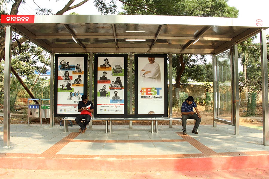
A bus stop is a place where buses stop for passengers to get on and off the bus. The construction of bus stops tends to reflect the level of usage, where stops at busy locations may have shelters, seating, and possibly electronic passenger information systems; less busy stops may use a simple pole and flag to mark the location. Bus stops are, in some locations, clustered together into transport hubs allowing interchange between routes from nearby stops and with other public transport modes to maximise convenience. Types of service For operational purposes, there are three main kinds of stops: Scheduled stops, at which the bus should stop irrespective of demand; request stops (or flag stop), at which the vehicle will stop only on request; and hail and ride stops, at which a vehicle will stop anywhere along the designated section of road on request. Certain stops may be restricted to "discharge/set-down only" or "pick-up only". Some stops may be designated as "timing poin ... [...More Info...] [...Related Items...] OR: [Wikipedia] [Google] [Baidu] |
Hamburg Central Bus Station
The Hamburg Central Bus Station (abbreviated ZOB, German for ''Zentraler Omnibusbahnhof'') is the central bus station, station for long-distance coaches in and out of Hamburg. It is located in the Hamburg-St. Georg, St. Georg district near the Hamburg Hauptbahnhof. The building was designed by the architects ASW Architekten Silcher, Werner und Redante from Hamburg and engineering firm Schlaich Bergermann & Partner from Stuttgart. In 2006, the structure received the Outstanding Structure Award from the International Association for Bridge and Structural Engineering, IABSE. The IABSE described it as a "delightful canopy over a bus station with soaring, transparent cantilevers designed to perfection enhancing the urban infrastructure." Notes External links Official Website Picture of the ZOB Hamburg Buildings and structures in Hamburg-Mitte Transport in Hamburg Bus stations in Germany {{Bus-station-stub ... [...More Info...] [...Related Items...] OR: [Wikipedia] [Google] [Baidu] |
Christchurch
Christchurch ( ; mi, Ōtautahi) is the largest city in the South Island of New Zealand and the seat of the Canterbury Region. Christchurch lies on the South Island's east coast, just north of Banks Peninsula on Pegasus Bay. The Avon River / Ōtākaro flows through the centre of the city, with an urban park along its banks. The city's territorial authority population is people, and includes a number of smaller urban areas as well as rural areas. The population of the urban area is people. Christchurch is the second-largest city by urban area population in New Zealand, after Auckland. It is the major urban area of an emerging sub-region known informally as Greater Christchurch. Notable smaller urban areas within this sub-region include Rangiora and Kaiapoi in Waimakariri District, north of the Waimakariri River, and Rolleston and Lincoln in Selwyn District to the south. The first inhabitants migrated to the area sometime between 1000 and 1250 AD. They hunted moa, which led ... [...More Info...] [...Related Items...] OR: [Wikipedia] [Google] [Baidu] |


Auckland_Libraries_Heritage_Collections_1334-20-8.jpg)


