|
Manila Elks Club
The Elks Club Building is the second and former clubhouse of the Manila Elks Lodge #761—Manila Lodge 761, better known as the Manila Elks Club, in Manila, the Philippines. It was designed by William E. Parsons. The Manila Elks Lodge #761 is a unique branch club of the Benevolent and Protective Order of Elks—BPOE, an American fraternal order. It is one of only two Elks Club established outside of current United States territory, the other being in Panama near the former American territory of the Panama Canal Zone, History The Manila Elks Club was founded after the Spanish–American War ended in 1898 which resulted in the transfer of the Spanish Philippines to the United States control. In 1901, a group of Americans residing in Manila for the "unbridled entrepreneurial possibilities,"and "yearning for camaraderie and solidarity," petitioned the national Elks organization to allow the founding of an Elks Club on American soil in the Philippines. . The Grand Exalted Ruler of ... [...More Info...] [...Related Items...] OR: [Wikipedia] [Google] [Baidu] |
Manila
Manila ( , ; fil, Maynila, ), officially the City of Manila ( fil, Lungsod ng Maynila, ), is the capital of the Philippines, and its second-most populous city. It is highly urbanized and, as of 2019, was the world's most densely populated city proper. Manila is considered to be a global city and rated as an Alpha – City by Globalization and World Cities Research Network (GaWC). It was the first chartered city in the country, designated as such by the Philippine Commission Act 183 of July 31, 1901. It became autonomous with the passage of Republic Act No. 409, "The Revised Charter of the City of Manila", on June 18, 1949. Manila is considered to be part of the world's original set of global cities because its commercial networks were the first to extend across the Pacific Ocean and connect Asia with the Spanish Americas through the galleon trade; when this was accomplished, it marked the first time in world history that an uninterrupted chain of trade routes circling ... [...More Info...] [...Related Items...] OR: [Wikipedia] [Google] [Baidu] |
Museo Pambata Ng Maynila
The Museo Pambata () or the Children's Museum, is a children's museum in the Ermita district of Manila, near Rizal Park, in the Philippines. It is located in the former Elks Club Building, built in 1910, along Roxas Boulevard at the corner of South Drive. Background The Museo Pambata is a children's interactive museum. Unlike traditional museums where items are stored behind glass and touching is highly discouraged, Museo Pambata invites visitors to learn with the exhibits by using their total senses. It envisions itself as a discovery museum and resource center promoting Filipino global culture, children's advocacy programs, and creative educational programs with linkages to global communities. The museum also has regular programs and events for various sectors. History Opened in 1994, Museo Pambata is dream come true of Nina Lim-Yuson, an early childhood educator and mother of four, who once brought her young children to the Boston Children’s Museum in America. They had ... [...More Info...] [...Related Items...] OR: [Wikipedia] [Google] [Baidu] |
Roxas Boulevard
Roxas Boulevard is a popular waterfront promenade in Metro Manila in the Philippines. The boulevard, which runs along the shores of Manila Bay, is well known for its sunsets and stretch of coconut trees. The divided roadway has become a trademark of Philippine tourism, famed for its yacht club, hotels, restaurants, commercial buildings and parks. The boulevard was completed in the 1910s. Originally called ''Cavite Boulevard'', it was renamed ''Dewey Boulevard'' in honor of the American admiral George Dewey, whose forces defeated the Spanish navy in the Battle of Manila Bay in 1898, ''Heiwa Boulevard'' in late 1941 during the Japanese occupation, and finally Roxas Boulevard in the 1960s in honor of President Manuel Roxas, the fifth president of the Philippines. It was also designated as a new alignment of the Manila South Road that connects Manila to the southern provinces of Luzon. The boulevard is also an eight-lane major arterial road in Metro Manila designated as Radial ... [...More Info...] [...Related Items...] OR: [Wikipedia] [Google] [Baidu] |
Santo Tomas Internment Camp
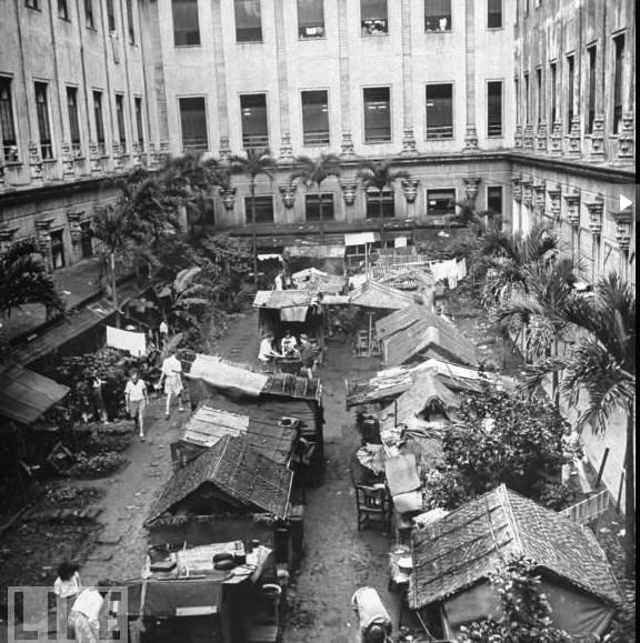
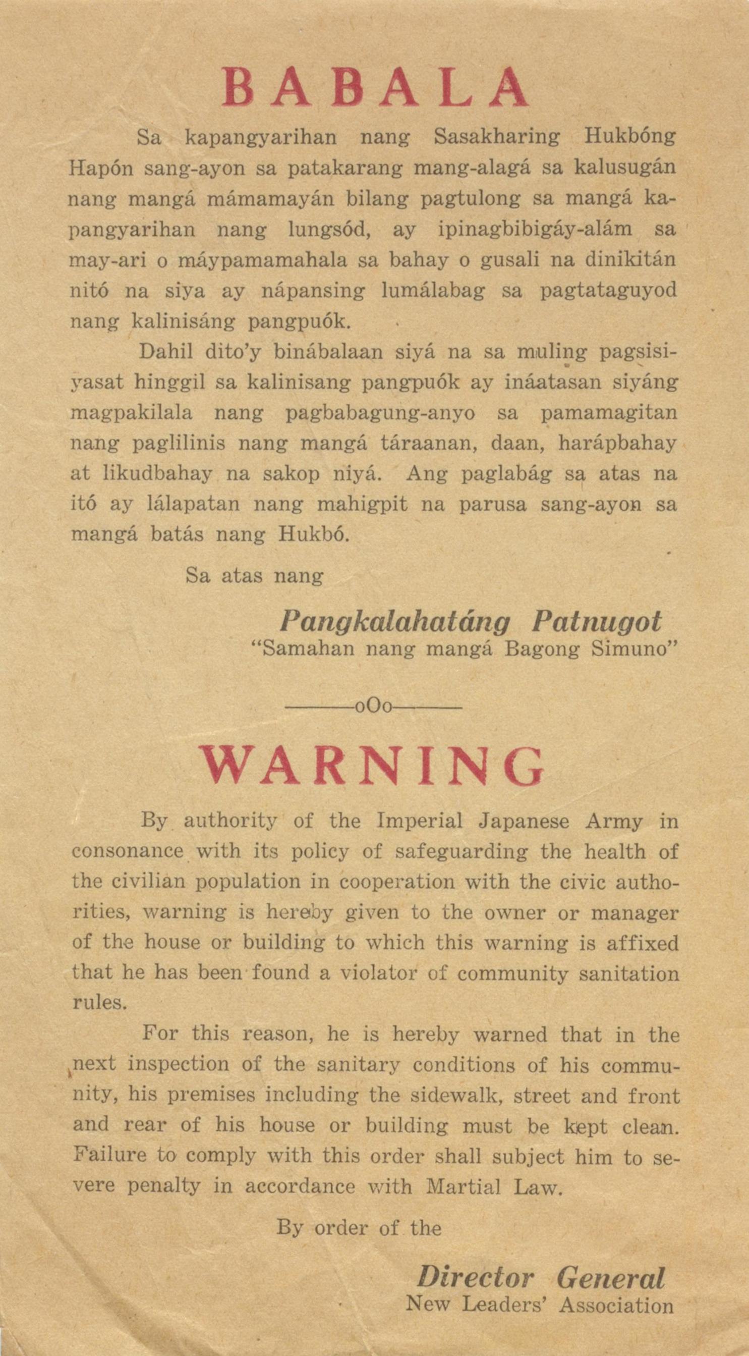
Santo Tomas Internment Camp, also known as the Manila Internment Camp, was the largest of several camps in the Philippines in which the Japanese interned enemy civilians, mostly Americans, in World War II. The campus of the University of Santo Tomas in Manila was utilized for the camp, which housed more than 3,000 internees from January 1942 until February 1945. Conditions for the internees deteriorated during the war and by the time of the liberation of the camp by the U.S. Army many of the internees were near death from lack of food. Background Japan attacked the Philippines on December 8, 1941, the same day as its raid on Pearl Harbor (on the Asian side of the International Date Line). American fighter aircraft were on patrol to meet an expected attack, but ground fog delayed the Japanese aircraft on Formosa. When the attack finally came, most of the American air force was caught on the ground, and destroyed by Japanese bombers. On the same day, the Japanese invaded several ... [...More Info...] [...Related Items...] OR: [Wikipedia] [Google] [Baidu] |
Japanese Occupation Of The Philippines
The Japanese occupation of the Philippines (Filipino: ''Pananakop ng mga Japones sa Filipinas''; ja, 日本のフィリピン占領, Nihon no Firipin Senryō) occurred between 1942 and 1945, when Imperial Japan occupied the Commonwealth of the Philippines during World War II. The invasion of the Philippines started on 8 December 1941, ten hours after the attack on Pearl Harbor. As at Pearl Harbor, American aircraft were severely damaged in the initial Japanese attack. Lacking air cover, the American Asiatic Fleet in the Philippines withdrew to Java on 12 December 1941. General Douglas MacArthur was ordered out, leaving his men at Corregidor on the night of 11 March 1942 for Australia, 4,000 km away. The 76,000 starving and sick American and Filipino defenders in Bataan surrendered on 9 April 1942, and were forced to endure the infamous Bataan Death March on which 7,000–10,000 died or were murdered. The 13,000 survivors on Corregidor surrendered on 6 May. Japan occupie ... [...More Info...] [...Related Items...] OR: [Wikipedia] [Google] [Baidu] |
High Commissioner To The Philippines
The high commissioner to the Philippines was the personal representative of the president of the United States to the Commonwealth of the Philippines during the period 1935–1946. The office was created by the Tydings–McDuffie Act of 1934, which provided for a period of transition from direct American rule to the complete independence of the islands on July 4, 1946. It replaced the office of governor-general of the Philippines, who had direct executive authority. Under the commonwealth, executive power was held by an elected Filipino president. The executive power of the high commissioner was largely ceremonial, and its office is similar to that of an ambassador. The office of high commissioner was held by: *Frank Murphy, November 15, 1935 – December 31, 1936 * Weldon Jones, December 31, 1936 – April 26, 1937 *Paul V. McNutt, April 26, 1937 – July 12, 1939 * Weldon Jones, July 12, 1939 – October 28, 1939 *Francis Bowes Sayre Sr., October 28, 1939 – October 1 ... [...More Info...] [...Related Items...] OR: [Wikipedia] [Google] [Baidu] |
Insular Government
The Insular Government of the Philippine IslandsThis form of the name appeared in the titles of U.S. Supreme Court cases, but was otherwise rarely used. See Costas v. Insular Government of the Philippine Islands, 221 U.S. 623, 1911. The Administrative Code of the Philippine Islands of 1917' gives the formal name of the state as either "Insular Government" or "Government of the Philippine Islands" (p. 5). ( es, Gobierno Insular de las Islas Filipinas) was an unincorporated territory of the United States that was established in 1902 and was reorganized in 1935 in preparation for later independence. The Insular Government was preceded by the United States Military Government of the Philippine Islands and was followed by the Commonwealth of the Philippines. The Philippines were acquired from Spain by the United States in 1898 following the Spanish–American War. Resistance led to the Philippine–American War, in which the United States suppressed the nascent First Philippine R ... [...More Info...] [...Related Items...] OR: [Wikipedia] [Google] [Baidu] |
Commonwealth Of The Philippines
The Commonwealth of the Philippines ( es, Commonwealth de Filipinas or ; tl, Komonwelt ng Pilipinas) was the administrative body that governed the Philippines from 1935 to 1946, aside from a period of exile in the Second World War from 1942 to 1945 when Japan occupied the country. It was established following the Tydings–McDuffie Act to replace the Insular Government, a United States territorial government.. The Commonwealth was designed as a transitional administration in preparation for the country's full achievement of independence. Its foreign affairs remained managed by the United States. During its more than a decade of existence, the Commonwealth had a strong executive and a Supreme Court. Its legislature, dominated by the Nacionalista Party, was at first unicameral, but later bicameral. In 1937, the government selected Tagalog – the language of Manila and its surrounding provinces – as the basis of the national language, although it would be many years befor ... [...More Info...] [...Related Items...] OR: [Wikipedia] [Google] [Baidu] |
Ermita
Ermita is a district in Manila, Philippines. Located at the central part of the city, the district is a significant center of finance, education, culture, and commerce. Ermita serves as the civic center of the city, bearing the seat of city government and a large portion of the area's employment, business, and entertainment activities. Private and government offices, museums, and universities thrive in Ermita. It is also home to famous tourist attractions and landmarks, notably the Rizal Park, the premier national park of the Philippines. Originally, Ermita and its neighboring district Malate were posh neighborhoods for Manila's high society during the early 20th century where large, grandiose mansions once stood. Ermita and its surroundings were heavily bombed and flattened during the Second World War after it became a battleground during the Manila Massacre. After the war, Ermita and its twin district, Malate, had undergone commercialization resulting in a shift from being ... [...More Info...] [...Related Items...] OR: [Wikipedia] [Google] [Baidu] |
Luneta Park
Rizal Park ( fil, Liwasang Rizal, es, link=no, Parque Rizal), also known as Luneta Park or simply Luneta, is a historic urban park located in Ermita, Manila. It is considered one of the largest urban parks in the Philippines, covering an area of 58 hectares (140 acres). The site on where the park is situated was originally known as Bagumbayan during the Spanish colonial period. It is adjacent to the historic Walled City of Intramuros. Situated on the eastern shore of Manila Bay, the park plays a significant role in shaping the history of the Philippines. The execution of Filipino patriot José Rizal on December 30, 1896 in the same area fanned the flames of the 1896 Philippine Revolution against the Kingdom of Spain. The park was officially named in his honor, and the monument enshrining his remains serves as the park's symbolic focal point. The declaration of Philippine independence from the United States was held here on July 4, 1946, as well as later political rallies, i ... [...More Info...] [...Related Items...] OR: [Wikipedia] [Google] [Baidu] |
Architecture Of The California Missions
The architecture of the California missions was influenced by several factors, those being the limitations in the construction materials that were on hand, an overall lack of skilled labor, and a desire on the part of the founding priests to emulate notable structures in their Spanish homeland. While no two mission complexes are identical, they all employed the same basic building style. Site selection and layout Although the missions were considered temporary ventures by the Spanish hierarchy, the development of an individual settlement was not simply a matter of "priestly whim." The founding of a mission followed longstanding rules and procedures; the paperwork involved required months, sometimes years of correspondence, and demanded the attention of virtually every level of the bureaucracy. Once empowered to erect a mission in a given area, the men assigned to it chose a specific site that featured a good water supply, plenty of wood for fires and building material, and ampl ... [...More Info...] [...Related Items...] OR: [Wikipedia] [Google] [Baidu] |
Mission Revival Architecture
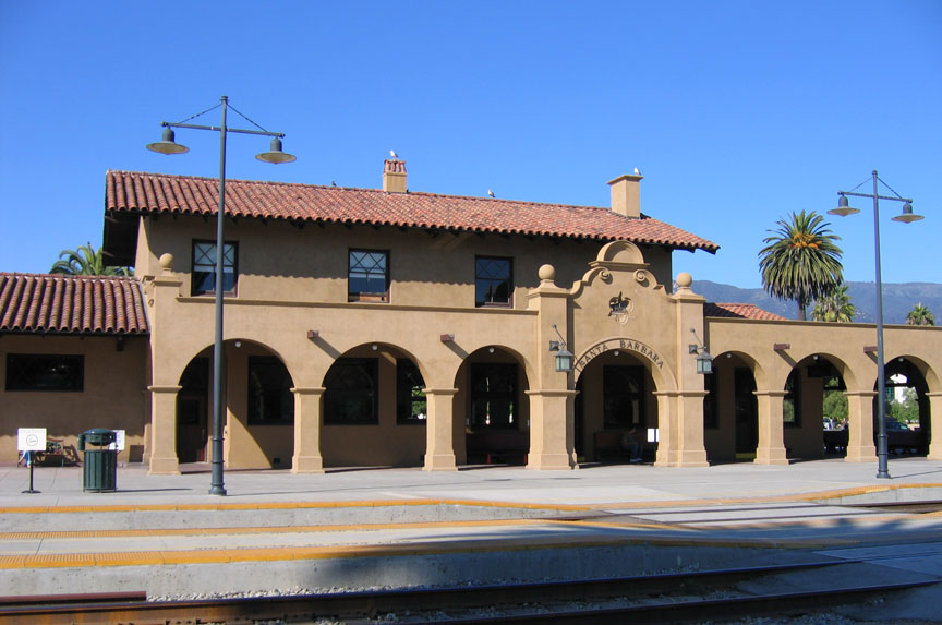
The Mission Revival style was part of an architectural movement, beginning in the late 19th century, for the revival and reinterpretation of American colonial styles. Mission Revival drew inspiration from the late 18th and early 19th century Spanish missions in California. It is sometimes termed California Mission Revival, particularly when used elsewhere, such as in New Mexico and Texas which have their own unique regional architectural styles. In Australia, the style is known as Spanish Mission. The Mission Revival movement was most popular between 1890 and 1915, in numerous residential, commercial and institutional structures, particularly schools and railroad depots. Influences All of the 21 Franciscan Alta California missions (established 1769–1823), including their chapels and support structures, shared certain design characteristics. These commonalities arose because the Franciscan missionaries all came from the same places of previous service in Spain and colonia ... [...More Info...] [...Related Items...] OR: [Wikipedia] [Google] [Baidu] |


