|
Malton And Driffield Junction Railway
The Malton and Driffield Junction Railway, later known as the ''Malton and Driffield branch'' was a railway line in Yorkshire that ran between the towns of Malton, North Yorkshire and Driffield in the East Riding of Yorkshire. The line opened on 13 April 1853. It became part of the North Eastern Railway (1854), then London and North Eastern Railway (1923), becoming part of British Railways in 1948. Passenger services on the line gained the nickname the ''Malton Dodger''. Between the 1920s and 1950s the line saw use transporting chalk from the Burdale and Wharram quarries. Passenger services ended in 1950; the Burdale quarry closed in 1955, and the line closed in 1958. A short section of the original line reopened in 2015 as a heritage attraction operating as the Yorkshire Wolds Railway. There are plans to further extend the heritage railway. History The Malton and Driffield Junction Railway (1846–1870) Promotion of a line between Malton and Driffield dates to at least the ... [...More Info...] [...Related Items...] OR: [Wikipedia] [Google] [Baidu] |
Yorkshire
Yorkshire ( ; abbreviated Yorks), formally known as the County of York, is a Historic counties of England, historic county in northern England and by far the largest in the United Kingdom. Because of its large area in comparison with other English counties, functions have been undertaken over time by its subdivisions, which have also been subject to History of local government in Yorkshire, periodic reform. Throughout these changes, Yorkshire has continued to be recognised as a geographic territory and cultural region. The name is familiar and well understood across the United Kingdom and is in common use in the media and the Yorkshire Regiment, military, and also features in the titles of current areas of civil administration such as North Yorkshire, South Yorkshire, West Yorkshire and the East Riding of Yorkshire. Within the borders of the historic county of Yorkshire are large stretches of countryside, including the Yorkshire Dales, North York Moors and Peak District nationa ... [...More Info...] [...Related Items...] OR: [Wikipedia] [Google] [Baidu] |
Lner
LNER may refer to: *London and North Eastern Railway, a railway company in the United Kingdom from 1923 until 1947 *London North Eastern Railway, a train operating company in the United Kingdom since 2018 * Liquid neutral earthing resistor, a type of Liquid resistor A liquid resistor is an electrical resistor in which the resistive element is a solution. Fixed-value liquid resistors are typically used where very high power dissipation is required. They are used in the rotor circuits of large slip ring indu ... See also *, including articles about LNER locomotives * {{Disambiguation ... [...More Info...] [...Related Items...] OR: [Wikipedia] [Google] [Baidu] |
Wharram Railway Station
Wharram railway station was opened by the Malton and Driffield Railway in May 1853, serving the village of Wharram-le-Street in North Yorkshire, England, although the area was in the East Riding of Yorkshire at the time. The station was also near the deserted medieval village of Wharram Percy and adjacent to Wharram chalk quarry. The single platform station had a passing loop off its southern end, the only one on the line. It had the customary goods facilities for wayside stations, plus a siding into Wharram Quarry, dominated by a large chalk silo. The line was originally conceived as part of a trunk route between Kingston-upon-Hull and the North East of England, but this came to very little. The station remained throughout its life as a country station on a country byway. In some periods of its life four passenger trains a day ran in each direction between and , calling at all stations between, but for the most part just three called, with no Sunday service after the outbr ... [...More Info...] [...Related Items...] OR: [Wikipedia] [Google] [Baidu] |
North Grimston Railway Station
North Grimston railway station was a railway station on the Malton & Driffield Railway. It opened on 19 May 1853, and served the village of North Grimston, North Yorkshire, England. It closed on 5 June 1950 but the station remained open for goods traffic until 18 October 1958 when the line finally closed. The station was unusual in that the single platform was bisected by a road with a level crossing A level crossing is an intersection where a railway line crosses a road, Trail, path, or (in rare situations) airport runway, at the same level, as opposed to the railway line crossing over or under using an Overpass#Railway, overpass .... References * * External links North Grimston station on navigable 1947 O. S. map [...More Info...] [...Related Items...] OR: [Wikipedia] [Google] [Baidu] |
Settrington Railway Station
Settrington railway station was a railway station on the Malton & Driffield Railway in North Yorkshire, England. It opened on 19 May 1853, and served the village of Settrington Settrington is a village and civil parish in the Ryedale district of North Yorkshire, England, about 3 miles (5 km) east of Malton. It was historically part of the East Riding of Yorkshire until 1974. History Sir Francis Bigod of Settringt .... It closed for passengers on 5 June 1950 and goods on 20 October 1958. References * * External links Settrington station on navigable 1947 O. S. map [...More Info...] [...Related Items...] OR: [Wikipedia] [Google] [Baidu] |
Abeyance
Abeyance (from the Old French ''abeance'' meaning "gaping") is a state of expectancy in respect of property, titles or office, when the right to them is not vested in any one person, but awaits the appearance or determination of the true owner. In law, the term ''abeyance'' can be applied only to such future estates as have not yet vested or possibly may not vest. For example, an estate is granted to A for life, with remainder to the heir of B. During B's lifetime, the remainder is in abeyance, for until the death of A it is uncertain who is B's heir. Similarly the freehold of a benefice, on the death of the incumbent, is said to be in abeyance until the next incumbent takes possession. The term hold in abeyance is used in lawsuits and court cases when a case is temporarily put on hold. English peerage law History The most common use of the term is in the case of English peerage dignities. Most such peerages pass to heirs-male, but the ancient baronies created by writ, as ... [...More Info...] [...Related Items...] OR: [Wikipedia] [Google] [Baidu] |
Railway Mania
Railway Mania was an instance of a stock market bubble in the United Kingdom of Great Britain and Ireland in the 1840s. It followed a common pattern: as the price of railway shares increased, speculators invested more money, which further increased the price of railway shares, until the share price collapsed. The mania reached its zenith in 1846, when 263 Acts of Parliament for setting up new railway companies were passed, with the proposed routes totalling . About a third of the railways authorised were never built—the companies either collapsed due to poor financial planning, were bought out by larger competitors before they could build their line, or turned out to be fraudulent enterprises to channel investors' money into other businesses. Causes The world's first recognizably modern inter-city railway, the Liverpool and Manchester Railway (the L&M), opened its railway in 1830 and proved to be successful for transporting both passengers and freight. In the late 1830s an ... [...More Info...] [...Related Items...] OR: [Wikipedia] [Google] [Baidu] |
Railroad Tie
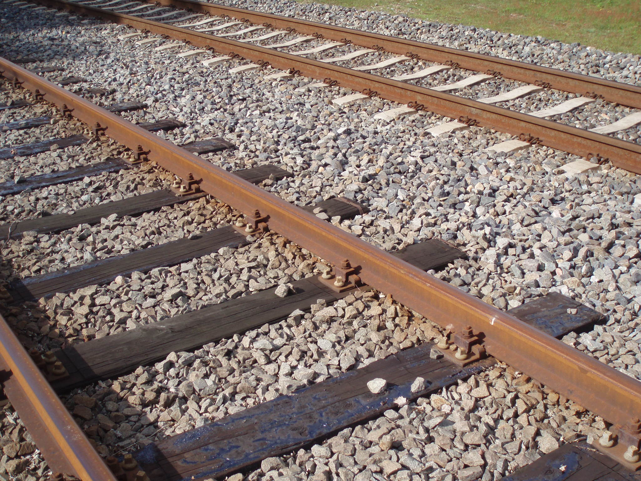
A railroad tie, crosstie (American English), railway tie (Canadian English) or railway sleeper (Australian and British English) is a rectangular support for the rails in railroad tracks. Generally laid perpendicular to the rails, ties transfer loads to the track ballast and subgrade, hold the rails upright and keep them spaced to the correct gauge. Railroad ties are traditionally made of wood, but prestressed concrete is now also widely used, especially in Europe and Asia. Steel ties are common on secondary lines in the UK; plastic composite ties are also employed, although far less than wood or concrete. As of January 2008, the approximate market share in North America for traditional and wood ties was 91.5%, the remainder being concrete, steel, azobé (red ironwood) and plastic composite. Tie spacing may depend on the type of tie, traffic loads and other requirements, for example 2640 concrete ties per mile on North American mainline railroads to 2112 timber ties per mile ... [...More Info...] [...Related Items...] OR: [Wikipedia] [Google] [Baidu] |
Minimum Railway Curve Radius
The minimum railway curve radius is the shortest allowable design radius for the centerline of railway tracks under a particular set of conditions. It has an important bearing on construction costs and operating costs and, in combination with superelevation (difference in elevation of the two rails) in the case of train tracks, determines the maximum safe speed of a curve. The minimum radius of a curve is one parameter in the design of railway vehicles as well as trams; monorails and automated guideways are also subject to a minimum radius. History The first proper railway was the Liverpool and Manchester Railway, which opened in 1830. Like the tram roads that had preceded it over a hundred years, the L&M had gentle curves and gradients. Reasons for these gentle curves include the lack of strength of the track, which might have overturned if the curves were too sharp causing derailments. The gentler the curves, the greater the visibility, thus boosting safety via increased ... [...More Info...] [...Related Items...] OR: [Wikipedia] [Google] [Baidu] |
River Hull
The River Hull is a navigable river in the East Riding of Yorkshire in Northern England. It rises from a series of springs to the west of Driffield, and enters the Humber Estuary at Kingston upon Hull. Following a period when the Archbishops of York charged tolls for its use, it became a free navigation. The upper reaches became part of the Driffield Navigation from 1770, after which they were again subject to tolls, and the section within the city of Hull came under the jurisdiction of the Port of Hull, with the same result. Most of its course is through low-lying land that is at or just above sea level, and regular flooding has been a long-standing problem along the waterway. Drainage schemes to alleviate it were constructed on both sides of the river. The Holderness Drainage scheme to the east was completed in 1772, with a second phase in 1805, and the Beverley and Barmston Drain to the west was completed in 1810. Since 1980, the mouth of the river has been protected by a tid ... [...More Info...] [...Related Items...] OR: [Wikipedia] [Google] [Baidu] |
Great Driffield
Driffield, also known as Great Driffield, is a market town and civil parish in the East Riding of Yorkshire, England. The civil parish is formed by the town of Driffield and the village of Little Driffield. By road, it is north-east of Leeds, north-east of Sheffield, east of York, north of Hull and south-east of Middlesbrough. Driffield is named ''The Capital of the Wolds'', due to its location sitting centrally within the Yorkshire Wolds. According to the 2011 UK census, Driffield parish had a population of 13,080, an increase on the 2001 UK census figure of 11,477. The town was listed in the 2019 Sunday Times report on the Best Places to Live in northern England. History Driffield is of Anglo-Saxon origin, and the name is first attested in the ''Anglo-Saxon Chronicle'' where King Aldfrith of Northumbria died on the 14 December 705. It is also found in ''Domesday Book'' of 1086, meaning "dirty (manured) field". A Bronze Age mound outside Driffield was excavated in ... [...More Info...] [...Related Items...] OR: [Wikipedia] [Google] [Baidu] |


