|
Maiwand District
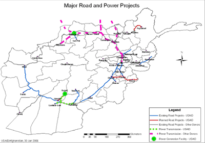
Maiwand District is situated in the western part of the Kandahar Province, Afghanistan. It borders Helmand Province to the west, Ghorak District to the north, Khakrez District to the northeast, Zhari District to the east, and Panjwayi District to the south. The population is 51,900 (2006). The district center is in Hutal, located in the central part of the district. Highway 1 runs through the center of the district and connects two of the major cities in southern Afghanistan, Kandahar and Lashkargah. Battle of Maiwand The Battle of Maiwand was fought at the village of Maiwand on 27 July 1880, during the Second Anglo-Afghan War. To this day a small fort remains from the British presence. Operation Enduring Freedom One casualty was Paula Loyd, a member of a Human Terrain System The Human Terrain System (HTS) was a United States Army, Training and Doctrine Command (TRADOC) support program employing personnel from the social science disciplines – such as anthropology, soci ... [...More Info...] [...Related Items...] OR: [Wikipedia] [Google] [Baidu] |
Districts Of Afghanistan
The districts of Afghanistan, known as ''wuleswali'' ( ps, ولسوالۍ, ''wuləswāləi''; fa, شهرستان, ''shahrestān'') are secondary-level administrative units, one level below provinces. The Afghan government issued its first district map in 1973.''Afghanistan; Districts and Codes by Province'', Edition 2.0, AID / Rep. DC&A Mapping Unit, October 1991, Peshawar, Pakista/ref> It recognized 325 districts, counting ''wuleswalis'' (districts), ''alaqadaries'' (sub-districts), and ''markaz-e-wulaiyat'' (provincial center districts). In the ensuing years, additional districts have been added through splits, and some eliminated through merges. In June 2005, the Afghan government issued a map of 398 districts. It was widely adopted by many information management systems, though usually with the addition of ''Sharak-e-Hayratan'' for 399 districts in total. It remains the ''de facto'' standard as of late 2018, despite a string of government announcements of the creation of ... [...More Info...] [...Related Items...] OR: [Wikipedia] [Google] [Baidu] |
Highway 1 (Afghanistan)
), is a two-lane road network circulating inside Afghanistan, connecting the following major cities (clockwise): Kabul, Maidan Shar, Ghazni, Kandahar, Delaram, Herat, Maymana, Sheberghan, Mazar-i-Sharif, Puli Khumri and back to Kabul. It has extensions that connect Jalalabad, Bamyan, Khost, Lashkargah, Zaranj ( Route 606), Farah, Islam Qala, Torghundi, and Kunduz. It is part of AH1, the longest route of the Asian Highway Network. National Highway 01 consists of four major sections, NH0101 to NH0104, linking the major economic centers. History Part of National Highway 1 has been refurbished since late 2003, particularly the Kabul–Kandahar Highway, with funds provided by the United States, Saudi Arabia and others. Most work on that stretch was done by Turkish, Indian and local companies. Japanese companies were also involved near the southern Afghan province of Kandahar. In the west, Iran participated in the two-lane road construction between Islam Qala and the western Afghan ... [...More Info...] [...Related Items...] OR: [Wikipedia] [Google] [Baidu] |
Human Terrain System
The Human Terrain System (HTS) was a United States Army, Training and Doctrine Command (TRADOC) support program employing personnel from the social science disciplines – such as anthropology, sociology, political science, regional studies, and linguistics – to provide military commanders and staff with an understanding of the local population (i.e. the "human terrain") in the regions in which they are deployed. The concept of HTS was first developed in a paper by Montgomery McFate and Andrea Jackson in 2005, which proposed a pilot version of the project as a response to "identified gaps in S militarycommanders' and staffs' understanding of the local population and culture", such as became particularly visible during the US invasion of Iraq and Afghanistan. HTS was subsequently launched as a proof-of-concept program, run by the United States Army Training and Doctrine Command (TRADOC), in February 2007, with five HTS teams deployed between Iraq and Afghanistan. Since 2007, HT ... [...More Info...] [...Related Items...] OR: [Wikipedia] [Google] [Baidu] |
Second Anglo-Afghan War
The Second Anglo-Afghan War (Dari: جنگ دوم افغان و انگلیس, ps, د افغان-انګرېز دويمه جګړه) was a military conflict fought between the British Raj and the Emirate of Afghanistan from 1878 to 1880, when the latter was ruled by Sher Ali Khan of the Barakzai dynasty, the son of former Emir Dost Mohammad Khan. The war was part of the Great Game between the British and Russian empires. The war was split into two campaigns – the first began in November 1878 with the British invasion of Afghanistan from India. The British were quickly victorious and forced the Amir – Sher Ali Khan to flee. Ali's successor Mohammad Yaqub Khan immediately sued for peace and the Treaty of Gandamak was then signed on 26 May 1879. The British sent an envoy and mission led by Sir Louis Cavagnari to Kabul, but on 3 September this mission was massacred and the conflict was reignited by Ayub Khan which led to the abdication of his brother Yaqub. The second campaign ende ... [...More Info...] [...Related Items...] OR: [Wikipedia] [Google] [Baidu] |
Maiwand
Maiwand is a village in Afghanistan within the Maywand District of Kandahar Province. It is located 50 miles northwest of Kandahar, on the main Kandahar–Lashkargah road. The area is irrigated by the Helmand and Arghandab Valley Authority.(pdf) The Helmand Valley Project in Afghanistan: A.I.D. Evaluation Special Study No. 18 C Clapp-Wicek & E Baldwin, U.S. Agency for International Development, published December 1983 Maiwand is the birthplace of the 13th-century saint . The village is notable f ... [...More Info...] [...Related Items...] OR: [Wikipedia] [Google] [Baidu] |
Battle Of Maiwand
The Battle of Maiwand (Dari: نبرد میوند, Pashto: د ميوند جگړه), fought on 27 July 1880, was one of the principal battles of the Second Anglo-Afghan War. Under the leadership of Ayub Khan, the Afghan forces defeated a much smaller British force consisting of two brigades of British and Indian troops under Brigadier-General George Burrows, albeit at a high price: between 2,050 and 2,750 Afghan warriors were killed, and probably about 1,500 wounded. British and Indian forces suffered 969 soldiers killed and 177 wounded. Prelude Before the battle, the campaign had gone well for the British. They had defeated Afghan tribesmen at Ali Masjid, Peiwar Kotal, Kabul, and the Battle of Ahmed Khel, and they had occupied numerous cities and towns, including Kandahar, Dakka, and Jalalabad. Ayub Khan, Sher Ali Khan's younger son, who had been holding Herat during the British operations at Kabul and Kandahar, set out towards Kandahar with a small army in June, and a brig ... [...More Info...] [...Related Items...] OR: [Wikipedia] [Google] [Baidu] |
Lashkargah
Lashkargāh ( ps, لښکرګاه; fa, لشکرگاه), historically called Bost or Boost (), is a city in southwestern Afghanistan and the capital of Helmand Province. It is located in Lashkargah District, where the Arghandab River merges into the Helmand River. The city has a population of 201,546 as of 2006. Lashkargah is linked by major roads with Kandahar to the east, Zaranj on the border with Iran to the west, and Farah, Afghanistan, Farah and Herat to the north-west. It is mostly very arid and desolate. However, farming does exist around the Helmand and Arghandab rivers. Bost Airport is located on the east bank of the Helmand River, five miles north of the junction of the Helmand and Arghandab rivers. Because of the trading hubs, it is Afghanistan's second largest city in size, after Kabul and before Kandahar. After several weeks of fighting in the Battle of Lashkargah, the city was captured by the Taliban on 13 August 2021, becoming the fourteenth provincial capital to be ... [...More Info...] [...Related Items...] OR: [Wikipedia] [Google] [Baidu] |
Kandahar
Kandahar (; Kandahār, , Qandahār) is a List of cities in Afghanistan, city in Afghanistan, located in the south of the country on the Arghandab River, at an elevation of . It is Afghanistan's second largest city after Kabul, with a population of about 614,118. It is the capital of Kandahar Province as well as the de facto capital of the Taliban, formally known as the Islamic Emirate of Afghanistan. It also happens to be the centre of the larger cultural region called Loy Kandahar. In 1709, Mirwais Hotak made the region an independent kingdom and turned Kandahar into the capital of the Hotak dynasty. In 1747, Ahmad Shah Durrani, founder of the Durrani dynasty, made Kandahar the capital of the Durrani Empire, Afghan Empire. Historically this province is considered as important political area for Afghanistan revelations. Kandahar is one of the most culturally significant cities of the Pashtun people, Pashtuns and has been their traditional seat of power for more than 300 years. ... [...More Info...] [...Related Items...] OR: [Wikipedia] [Google] [Baidu] |
Panjwayi District
Panjwayi ( ps, پنجوايي; also spelled Panjwaye, Panjwaii, Panjway, Panjawyi, Panjwa'i, or Panjwai) is a district in Kandahar Province, Afghanistan. It is located about west of Kandahar. The district borders Helmand Province to the southwest, Maywand District to the west, Zhari District to the north, Arghandab, Kandahar and Daman districts to the east and Reg District to the south. Panjwayi was reduced in size in 2004 when Zhari District was created out of the northern part of it, on the northern side of the Arghandab River, which now forms the northern boundary. The district center is Bazar-i-Panjwayi, located in the northern part of the district near the Arghandab River. The district population was around 77,200 in 2006, most of which are peasants and poorly educated due to unavailability of schools. The area is irrigated by the Helmand and Arghandab Valley Authority. War in Afghanistan Panjwayi was the site of continual fighting and emplacements of improvised explosi ... [...More Info...] [...Related Items...] OR: [Wikipedia] [Google] [Baidu] |
Provinces Of Afghanistan
Afghanistan is divided into 34 provinces (, '' wilåyat''). The provinces of Afghanistan are the primary administrative divisions. Each province encompasses a number of districts or usually over 1,000 villages. Provincial governors played a critical role in the reconstruction of the Afghan state following the creation of the new government under Hamid Karzai. According to international security scholar Dipali Mukhopadhyay, many of the provincial governors of the western-backed government were former warlords who were incorporated into the political system. Provinces of Afghanistan Regions of Afghanistan UN Regions Former provinces of Afghanistan During Afghanistan's history it had a number of provinces in it. It started out as just Kabul, Herat, Qandahar, and Balkh but the number of provinces increased and by 1880 the provinces consisted of Balkh, Herat, Qandahar, Ghazni, Jalalabad, and Kabul. * Southern Province – dissolved in 1964 to create Paktia Provinc ... [...More Info...] [...Related Items...] OR: [Wikipedia] [Google] [Baidu] |
Zhari District
Zhari ( ps, ژړۍ, fa, ولسوالی ژری) is a district in Kandahar Province, Afghanistan. Alternative spellings include Zheley (due to transliteration from Pashto), Zharey, Zharay, Zheri, or Zheray. The district was created in 2004 from land that was formerly part of Maywand and Panjwai districts. The population is estimated at 80,700 (2010). Geography Zhari lies on the north bank of the Arghandab River, which runs east to west through Kandahar Province. The general area is sometimes referred to as the Arghandab Valley. The built-up and farmed area of Zhari is approximately 30 km east to west by 8 km north to south, between the river and Highway 1. Most buildings are single-story mud structures, with narrow, winding roads and walkways. The exceptions are the grape-drying huts, which are larger buildings, as high as 20m, scattered throughout the countryside. Grapes, opium poppies and cannabis (for hashish) are the most common crops. The farmlands are i ... [...More Info...] [...Related Items...] OR: [Wikipedia] [Google] [Baidu] |


_WDL11496.png)


