|
Main South Line
The Main South Line, sometimes referred to as part of the South Island Main Trunk Railway, is a railway line that runs north and south from Lyttelton in New Zealand through Christchurch and along the east coast of the South Island to Invercargill via Dunedin. It is one of the most important railway lines in New Zealand and was one of the first to be built, with construction commencing in the 1860s. At Christchurch, it connects with the Main North Line to Picton, the other part of the South Island Main Trunk. Construction Construction of the Main South Line falls into two main sections: from Christchurch through southern Canterbury to Otago's major city of Dunedin; and linking the southern centres of Dunedin and Invercargill, improving communication in southern Otago and large parts of Southland. Construction of the first section of the line began in 1865 and the whole line was completed on 22 January 1879. Christchurch-Dunedin section The Canterbury provincial government ... [...More Info...] [...Related Items...] OR: [Wikipedia] [Google] [Baidu] |
KiwiRail
KiwiRail Holdings Limited is a New Zealand state-owned enterprise responsible for rail operations in New Zealand, and operates inter-island ferries. Trading as KiwiRail and headquartered in Wellington, New Zealand, KiwiRail is the largest rail transport operator in New Zealand. KiwiRail has business units of KiwiRail Freight, Great Journeys New Zealand and Interislander. KiwiRail released a 10-Year Turn-around Plan in 2010 and has received significant government investment in support of this in an effort to make KiwiRail a viable long-term transport operator. History Background Prior to the establishment of KiwiRail, rail transport in New Zealand has been under both public and private ownership. Government operators included the Public Works Department (1873–1880), New Zealand Railways Department (1880–1982), and the New Zealand Railways Corporation (1982–1990). New Zealand Rail Limited was split off from the Railways Corporation (which continued to own the land beneath ... [...More Info...] [...Related Items...] OR: [Wikipedia] [Google] [Baidu] |
Picton, New Zealand
Picton ( mi, Waitohi) is a town in the Marlborough Region of New Zealand's South Island. The town is located near the head of the Queen Charlotte Sound / Tōtaranui, north of Blenheim and west of Wellington. Waikawa lies just north-east of Picton and is considered to be a contiguous part of the Picton urban area. Picton is a major hub in New Zealand's transport network, connecting the South Island road and rail network with ferries across Cook Strait to Wellington and the North Island. The Picton urban area has a population of making it the second-largest town in the Marlborough Region behind Blenheim. It is the easternmost town in the South Island with a population of at least 1,000 people. Toponymy The town is named after Sir Thomas Picton, the Welsh military associate of the Duke of Wellington, who was killed at the Battle of Waterloo. Thomas Picton's connection to the slave trade and controversial governorship of Trinidad has resulted in calls for places named a ... [...More Info...] [...Related Items...] OR: [Wikipedia] [Google] [Baidu] |
Timaru
Timaru (; mi, Te Tihi-o-Maru) is a port city in the southern Canterbury Region of New Zealand, located southwest of Christchurch and about northeast of Dunedin on the eastern Pacific coast of the South Island. The Timaru urban area is home to people, and is the largest urban area in South Canterbury, and the second largest in the Canterbury Region overall, after Christchurch. The town is the seat of the Timaru District, which includes the surrounding rural area and the towns of Geraldine, Pleasant Point and Temuka, which combined have a total population of . Caroline Bay beach is a popular recreational area located close to Timaru's main centre, just to the north of the substantial port facilities. Beyond Caroline Bay, the industrial suburb of Washdyke is at a major junction with State Highway 8, the main route into the Mackenzie Country. This provides a road link to Pleasant Point, Fairlie, Twizel, Lake Tekapo, Aoraki / Mount Cook and Queenstown. Timaru has been built ... [...More Info...] [...Related Items...] OR: [Wikipedia] [Google] [Baidu] |
Julius Vogel
Sir Julius Vogel (24 February 1835 – 12 March 1899) was the eighth premier of New Zealand. His administration is best remembered for the issuing of bonds to fund railway construction and other public works. He was the first Jewish prime minister of New Zealand. Historian Warwick R. Armstrong assesses Vogel's strengths and weaknesses: Early life Born in London, Vogel received his early education at University College School in University College, Gower St London. He later studied chemistry and metallurgy at the Royal School of Mines (later part of Imperial College London). He emigrated to Victoria, Australia in 1852, being editor of several newspapers on the goldfields, including the ''Inglewood'' ''Advertiser'' and the ''Maryborough and Dunolly Advertiser''. After an unsuccessful attempt to enter the Victorian Parliament in the Avoca district in August 1861 (he lost to James Macpherson Grant and Benjamin George Davies), he moved to Otago in October 1861, where he becam ... [...More Info...] [...Related Items...] OR: [Wikipedia] [Google] [Baidu] |
Selwyn, New Zealand
Selwyn is a village in the Selwyn District of Canterbury, New Zealand. It was laid out in the 1860s for a population of 2,000 people, but it currently has very few houses. Naming Captain Joseph Thomas, the chief surveyor of the Canterbury Association, named the Selwyn River after Bishop Selwyn, New Zealand's first Anglican Bishop. This township, the district and an electorate later used the same name. Geography and transport Selwyn is located just south of the Selwyn River / Waikirikiri and is prone to occasional flooding. It was established around the rail corridor of the Main South Line that was planned in the 1860s. The railway first reached the township in 1867. Most of the time, the river can be forded, and the road bridge was not built until 1927. Its successor bridge now carries State Highway 1 traffic, which crosses the railway line in Selwyn; initially, two right angle bends were provided, later to be replaced by a sweeping S-bend. Selwyn is south-west of Christc ... [...More Info...] [...Related Items...] OR: [Wikipedia] [Google] [Baidu] |
Rakaia
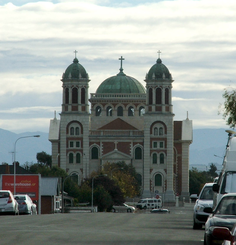
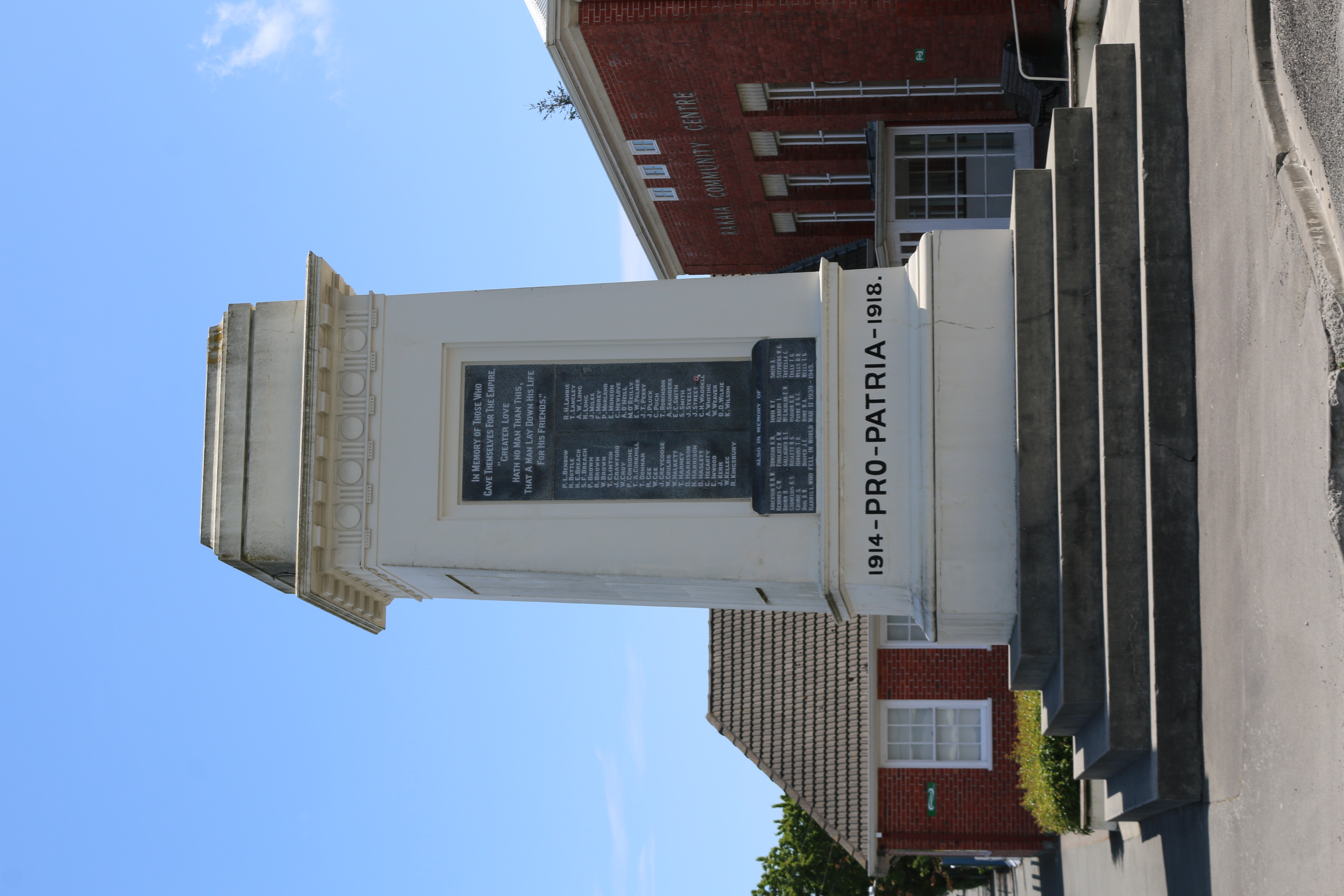
Rakaia is a town seated close to the southern banks of the Rakaia River on the Canterbury Plains in New Zealand's South Island, approximately 57 km south of Christchurch on State Highway 1 and the Main South Line. Immediately north of the township are New Zealand's longest road bridge and longest rail bridge, both of which cross the wide shingle beds of the braided river at this point. Both bridges are approximately 1750 metres in length. Rakaia was also the junction of the Methven Branch, a branch line railway to Methven that operated from 1880 until its closure in 1976. An accident at the railway station in 1899 killed four people. Rakaia's most obvious feature is a large fibreglass salmon. The river from which the town takes its name is known for its salmon fishing and jetboating. The town and river were previously known as ''Cholmondeley'', but the Maori name would eventually prevail over the English one. The rural community of Acton is located south of the Rakaia ... [...More Info...] [...Related Items...] OR: [Wikipedia] [Google] [Baidu] |
Canterbury Plains
The Canterbury Plains () are an area in New Zealand centred in the Mid Canterbury, to the south of the city of Christchurch in the Canterbury region. Their northern extremes are at the foot of the Hundalee Hills in the Hurunui District, and in the south they merge into the plains of North Otago beyond the Waitaki River. The smaller Amuri Plain forms a northern extension of the plains. Geology The Canterbury Plains were formed from Quaternary moraine gravels transported from the Southern Alps and deposited here during glacial periods in the late Pleistocene approximately 3 million to 10,000 years ago. The alluvial gravels were then reworked as shingle fans of several of the larger rivers, notably the Waimakariri, the Rakaia, the Selwyn / Waikirikiri, and the Rangitata. Part of the Canterbury-Otago tussock grasslands, the land is suitable for moderately intensive livestock farming but is prone to droughts, especially when the prevailing wind is from the northwest. At these time ... [...More Info...] [...Related Items...] OR: [Wikipedia] [Google] [Baidu] |
Rolleston, New Zealand
Rolleston ( mi, Roretana, Tauwharekākaho) is the seat and largest town in the Selwyn District, in the Canterbury region of New Zealand's South Island. It is located on the Canterbury Plains south-west of Christchurch, and is part of the wider Christchurch metropolitan area. The town has a population of making it New Zealand's 24th-largest urban area and the third-largest in Canterbury (behind Christchurch and Timaru). It was nicknamed the "Town of the Future" in the 1970s by Prime Minister Norman Kirk. The "Town of the Future" signage has since been removed from the entrances to Rolleston. History Rolleston originated as a railway terminus in 1866, and is named after the Canterbury statesman William Rolleston. Rolleston, who was born in Yorkshire in 1831 and died in 1903, served as Superintendent of the Province of Canterbury from 1868 until 1876 (when central government abolished the New Zealand provinces). He also served as a Member of Parliament, holding various Cabinet ... [...More Info...] [...Related Items...] OR: [Wikipedia] [Google] [Baidu] |
Rail Gauge
In rail transport, track gauge (in American English, alternatively track gage) is the distance between the two rails of a railway track. All vehicles on a rail network must have wheelsets that are compatible with the track gauge. Since many different track gauges exist worldwide, gauge differences often present a barrier to wider operation on railway networks. The term derives from the metal bar, or gauge, that is used to ensure the distance between the rails is correct. Railways also deploy two other gauges to ensure compliance with a required standard. A ''loading gauge'' is a two-dimensional profile that encompasses a cross-section of the track, a rail vehicle and a maximum-sized load: all rail vehicles and their loads must be contained in the corresponding envelope. A ''structure gauge'' specifies the outline into which structures (bridges, platforms, lineside equipment etc.) must not encroach. Uses of the term The most common use of the term "track gauge" refers to the ... [...More Info...] [...Related Items...] OR: [Wikipedia] [Google] [Baidu] |
Broad Gauge
A broad-gauge railway is a railway with a track gauge (the distance between the rails) broader than the used by standard-gauge railways. Broad gauge of , commonly known as Russian gauge, is the dominant track gauge in former Soviet Union (CIS states, Baltic states, Georgia and Ukraine), Mongolia and Finland. Broad gauge of , commonly known as Irish Gauge, is the dominant track gauge in Ireland, and the Australian states of Victoria and Adelaide. Broad gauge of , commonly known as Iberian gauge, is the dominant track gauge in Spain and Portugal. Broad gauge of , commonly known as Indian gauge, is the dominant track gauge in India, Pakistan, Bangladesh, Sri Lanka, Argentina, Chile, and on BART (Bay Area Rapid Transit) in the San Francisco Bay Area. This is the widest gauge in common use anywhere in the world. It is possible for trains on both Iberian gauge and Indian gauge to travel on each other's tracks with no modifications in the vast majority of cases. History In Gr ... [...More Info...] [...Related Items...] OR: [Wikipedia] [Google] [Baidu] |
Ferrymead Railway
The Ferrymead Railway is a New Zealand heritage railway built upon the track formation of New Zealand's first public railway, from Ferrymead to Christchurch, which opened on 1 December 1863. On the opening of the line to Lyttelton on 9 December 1867, the Ferrymead Railway became the Ferrymead Branch and was closed shortly thereafter. In 1964, rail enthusiasts began relaying track on the historic formation and the new narrow gauge. Ferrymead Railway officially reopened in 1977. It now operates steam, diesel and electric trains regularly and is recognised as one of the most significant rail preservation sites in New Zealand. Early history The original line was built with the same gauge as the Canterbury Provincial Railways to suit rolling stock imported from the Melbourne and Essendon Railway Company in the Australian state of Victoria. It serviced ships which docked at the Ferrymead wharf. Construction of the tunnel to the port of Lyttelton was in progress: when this was finishe ... [...More Info...] [...Related Items...] OR: [Wikipedia] [Google] [Baidu] |
Canterbury Province
The Canterbury Province was a Provinces of New Zealand, province of New Zealand from 1853 until the abolition of provincial government in 1876. Its capital was Christchurch. History Canterbury was founded in December 1850 by the Canterbury Association of influential Englishmen associated with the Church of England. (An attempt was initially made to restrict residence in the province to members of the church but this was abandoned.) The ''Charlotte Jane'' and the ''Randolph (ship), Randolph''—the first two of the First Four Ships—arrived in the area on 16 December 1850, later celebrated as the province's #Anniversary Day, Anniversary Day. In 1852, the Parliament of the United Kingdom passed the New Zealand Constitution Act 1852, which amongst other things established Provinces of New Zealand, provincial councils. The Constitution contained specific provisions for the Canterbury Association; the first being that the new General Assembly (New Zealand Parliament) could not amend ... [...More Info...] [...Related Items...] OR: [Wikipedia] [Google] [Baidu] |


.jpg)


