|
Mahoningtown, Pennsylvania
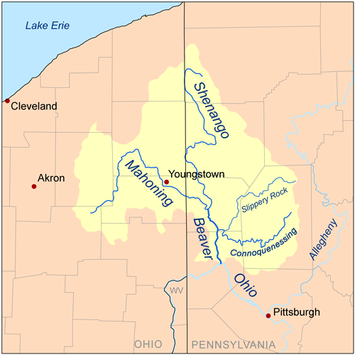
Mahoningtown, also known as "Motown", is a neighborhood in the southwestern part of the city of New Castle, Pennsylvania, United States. Though it is named for the nearby Mahoning River, the city actually sits on the banks of the Shenango River. The two rivers merge and become the Beaver River just south of the city. Mahoningtown is located in Lawrence County at latitude 40.975 and longitude -80.372. Located about two and one-half miles south of New Castle in Taylor township, Mahoningtown was at one time a separate municipality before being annexed by New Castle. Mahoningtown officially became the seventh ward of New Castle, Pennsylvania in 1898. History William Simpson, from Butler County, was the first settler to arrive in Mahoningtown. Arriving in 1836, he is credited with opening Mahoningtown's first store. That same year, Pittsburgh residents Benjamin Darlington and William Hayes laid out the town on five hundred acres of property they owned. In 1844, a general stor ... [...More Info...] [...Related Items...] OR: [Wikipedia] [Google] [Baidu] |
New Castle, Pennsylvania
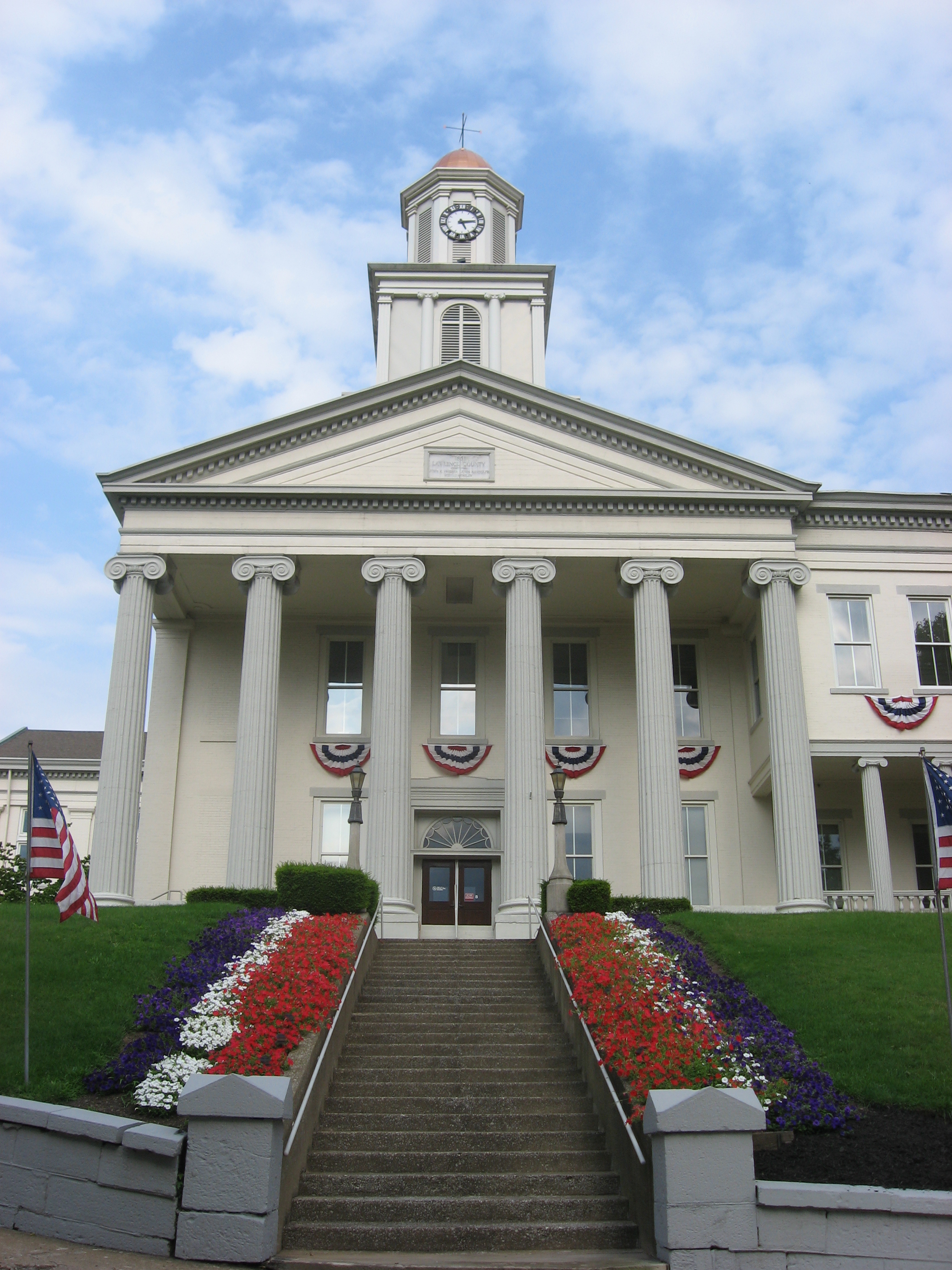
New Castle is a city in Lawrence County, Pennsylvania, United States, and the county seat of Lawrence County. It is northwest of Pittsburgh, and near the Pennsylvania–Ohio border, just southeast of Youngstown, Ohio. As of the 2020 U.S. Census, the city had a population of 21,926. It is the commercial center of a fertile agricultural region, officially the New Castle micropolitan area, which had a population of 86,070 in 2020. New Castle also anchors the northwestern part of the Pittsburgh-New Castle-Weirton combined area. History In 1798, John Carlysle Stewart, a civil engineer, traveled to western Pennsylvania to resurvey the "donation lands", which had been reserved for veterans of the Revolutionary War. He discovered that the original survey had neglected to stake out approximately at the confluence of the Shenango River and Neshannock Creek, at that time a part of Allegheny County. The Indian town of Kuskusky was listed on early maps in this location. Claiming the land ... [...More Info...] [...Related Items...] OR: [Wikipedia] [Google] [Baidu] |
Pennsylvania
Pennsylvania (; ( Pennsylvania Dutch: )), officially the Commonwealth of Pennsylvania, is a state spanning the Mid-Atlantic, Northeastern, Appalachian, and Great Lakes regions of the United States. It borders Delaware to its southeast, Maryland to its south, West Virginia to its southwest, Ohio to its west, Lake Erie and the Canadian province of Ontario to its northwest, New York to its north, and the Delaware River and New Jersey to its east. Pennsylvania is the fifth-most populous state in the nation with over 13 million residents as of 2020. It is the 33rd-largest state by area and ranks ninth among all states in population density. The southeastern Delaware Valley metropolitan area comprises and surrounds Philadelphia, the state's largest and nation's sixth most populous city. Another 2.37 million reside in Greater Pittsburgh in the southwest, centered around Pittsburgh, the state's second-largest and Western Pennsylvania's largest city. The state's su ... [...More Info...] [...Related Items...] OR: [Wikipedia] [Google] [Baidu] |
Mahoning River
The Mahoning River is a river located in northeastern Ohio and a small portion of western Pennsylvania. Flowing primarily through several Ohio counties, it crosses the state line into Pennsylvania before joining with the Shenango River to form the Beaver River. The Mahoning River drops from at the headwaters near Winona to at the outfall near Mahoningtown, Pennsylvania. It is part of the Ohio River watershed. The name is said to derive from either the Lenape or Shawnee languages and mean "Deer Lick," as the area was once known for salt springs, but it's possible the name of the Mahoning and several other similarly named landmarks and places in western Pennsylvania (Manayunk, etc) could come from the Lenape, mënehokink (may-nuh-ho-keeng), meaning "place to get water." Tributaries North Shore * Marshall Run * Grays Run * Dry Run * Little Squaw Creek * Mosquito Creek * Chocolate Run * Eagle Creek * West Branch * Kale Creek * Willow Creek * Deer Creek * Beech Creek * Beaver Ru ... [...More Info...] [...Related Items...] OR: [Wikipedia] [Google] [Baidu] |
Shenango River
The Shenango River is a principal tributary of the Beaver River, approximately 100 mi (160 km) long,Columbia Gazetteer of North America entry for Shenango River in in the . It also briefly flows through small portions of northeastern . |
Beaver River (Pennsylvania)
Beaver River is a tributary of the Ohio River in Western Pennsylvania. It has a length of approximately 21 mi (34 km) and flows through a historically important coal-producing region north of Pittsburgh. Beaver River is formed in Lawrence County by the confluence of the Mahoning and Shenango rivers in the Mahoningtown neighborhood of New Castle. It flows generally south, past West Pittsburg and Homewood. It receives Connoquenessing Creek west of Ellwood City and flows past Beaver Falls and New Brighton. It joins the Ohio at Bridgewater and Rochester (flowing between these two towns) at the downstream end of a sharp bend in the Ohio approximately 20 mi (32 km) northwest of (and downstream from) Pittsburgh. In the lower reaches near the Ohio River, the Beaver cuts through a gorge of underlying sandstone. The river is roughly parallel to the border with the state of Ohio, with both Interstate 376 and Pennsylvania Route 18 running parallel to the river itse ... [...More Info...] [...Related Items...] OR: [Wikipedia] [Google] [Baidu] |
Darlington Park
Darlington is a market town in the Borough of Darlington, County Durham, England. The River Skerne flows through the town; it is a tributary of the River Tees. The Tees itself flows south of the town. In the 19th century, Darlington underwent substantial industrial development, spurred by the establishment there of the world's first permanent steam-locomotive-powered passenger railway: the Stockton and Darlington Railway. Much of the vision (and financing) behind the railway's creation was provided by local Quaker families in the Georgian and Victorian eras. In the 2011 Census, the town had a population of 92,363 (the county's largest settlement by population) which had increased by the 2020 estimate population to 93,417. The borough's population was 105,564 in the census, It is a unitary authority and is a constituent member of the Tees Valley Combined Authority therefore part of the Tees Valley mayoralty. History Darnton Darlington started as an Anglo-Saxon settlement. ... [...More Info...] [...Related Items...] OR: [Wikipedia] [Google] [Baidu] |
Darlington Bell
Darlington is a market town in the Borough of Darlington, County Durham, England. The River Skerne flows through the town; it is a tributary of the River Tees. The Tees itself flows south of the town. In the 19th century, Darlington underwent substantial industrial development, spurred by the establishment there of the world's first permanent steam-locomotive-powered passenger railway: the Stockton and Darlington Railway. Much of the vision (and financing) behind the railway's creation was provided by local Quaker families in the Georgian era, Georgian and Victorian eras. In the 2011 Census, the town had a population of 92,363 (the county's largest settlement by population) which had increased by the 2020 estimate population to 93,417. The borough's population was 105,564 in the census, It is a unitary authority and is a constituent member of the Tees Valley Combined Authority therefore part of the Tees Valley mayoralty. History Darnton Darlington started as an Anglo-Saxon ... [...More Info...] [...Related Items...] OR: [Wikipedia] [Google] [Baidu] |
Butler County, Pennsylvania
Butler County is a county in the Commonwealth of Pennsylvania. It is part of Western Pennsylvania. As of the 2020 census, the population was 193,763. Its county seat is Butler. Butler County was created on March 12, 1800, from part of Allegheny County and named in honor of General Richard Butler, a hero of the American Revolution. Butler County is part of the Pittsburgh, PA Metropolitan Statistical Area. History Some famous inventions and discoveries were made in Butler County. Saxonburg was founded as a Prussian colony by John A. Roebling, a civil engineer, and his brother Carl. After farming for a time, Roebling returned to engineering, and invented his revolutionary "wire rope.", which he first produced at Saxonburg. He moved the operation to Trenton, New Jersey. He is best known for designing his most famous work, the Brooklyn Bridge, but designed and built numerous bridges in Pittsburgh and other cities as well. At what is now known as Oil Creek, Butler County reside ... [...More Info...] [...Related Items...] OR: [Wikipedia] [Google] [Baidu] |
Crawford County, Pennsylvania
Crawford County is a county in the Commonwealth of Pennsylvania. As of the 2020 census, the population was 83,938. Its county seat is Meadville. The county was created on March 12, 1800, from part of Allegheny County and named for Colonel William Crawford. Crawford County comprises the Meadville, PA Micropolitan Statistical Area, which is also included in the Erie-Meadville, PA Combined Statistical Area. Geography According to the U.S. Census Bureau, the county has a total area of , of which is land and (2.4%) is water. It has a warm-summer humid continental climate (''Dfb'') and average monthly temperatures in Meadville range from 24.9 °F in January to 69.5 °F in July, while in Titusville they range from 24.2 °F in January to 68.8 °F in July Adjacent counties * Erie County, Pennsylvania, Erie County (north) *Warren County (east) * Venango County (southeast) * Mercer County (south) *Trumbull County, Ohio (southwest) *Ashtabula County, Ohio (west) ... [...More Info...] [...Related Items...] OR: [Wikipedia] [Google] [Baidu] |
Pennsylvania Route 18
Pennsylvania Route 18 (PA 18) is a major north–south highway in Western Pennsylvania whose southern terminus is at West Virginia Route 69 (WV 69) at the state line in Greene County near the village of Garrison, while the northern terminus is at PA 5 in Lake City. At a length of , PA 18 is the only state route in Pennsylvania — north–south ''or'' east–west — to traverse the entire state. It also has the distinction of being the longest state route in Pennsylvania. Route description Greene County Traveling northward from West Virginia Route 69 at the West Virginia state line, Route 18 winds through rural Greene County, passing through the villages of Garrison, New Freeport, Nettle Hill, White Cottage, Woodruff, and Holbrook, before making its first junction with another state highway, PA Route 21, just west of the village of Rogersville and over from the state line. Here the two routes overlap for nearly , winding east-northeast through Rogersville ... [...More Info...] [...Related Items...] OR: [Wikipedia] [Google] [Baidu] |
Pennsylvania Route 108
Pennsylvania Route 108 (PA 108) is a highway in Western Pennsylvania that runs for from the Ohio state line near SNPJ to PA 8 in Adams Corner. PA 108 intersects Interstate 376 (I-376) near New Castle and U.S. Route 19 (US 19) near Harlansburg. PA 108 also has an interchange with Interstate 79 (I-79) at exit 105. Route description PA 108 begins at the Ohio border in North Beaver Township, Lawrence County, where the road continues southwest into that state as CR 8 in Mahoning County, providing access to Ohio State Route 170 (SR 170) and SR 617. From the state line, the route heads northeast on two-lane undivided Mt. Jackson Road, passing through farmland with some woods and homes. The route skirts the northern border of the borough of S.N.P.J. in three places, curving more to the east-northeast. PA 108 continues through more rural areas of North Beaver Township, coming to an intersection with PA 551. At this point, the route turns north to form a concurren ... [...More Info...] [...Related Items...] OR: [Wikipedia] [Google] [Baidu] |


.jpg)
.jpg)