|
Maha Oya
The Maha Oya is a major stream in the Sabaragamuwa Province of Sri Lanka. It measures approximately in length. It runs across four provinces and five districts. Maha Oya has 14 Water supply networks to serve the need of water and more than 1 million people live by the river. Its catchment area receives approximately 3644 million cubic metres of rain per year, and approximately 34 percent of the water reaches the sea. It has a catchment area of 1,510 square kilometres. See also * List of dams and reservoirs in Sri Lanka * List of rivers of Sri Lanka The following table lists most rivers of Sri Lanka. Since Sri Lanka is a trilingual country, some rivers may have a Sinhala name (i.e. Kalu Ganga), while other have an English name (i.e. Kelani River). In the Sinhala language, Ganga (ගඟ) tr ... References Rivers of Sri Lanka {{SriLanka-river-stub ... [...More Info...] [...Related Items...] OR: [Wikipedia] [Google] [Baidu] |
Nawalapitiya
Nawalapitiya ( si, නාවලපිටිය, ta, நாவலப்பிட்டி, translit=Nāvalappiṭṭi) is a town in Kandy District, Sri Lanka. It is governed by an Urban Council. It is away from Kandy and from Colombo, at a height of above sea level. It is located on the banks of the Mahaweli Ganga. The area was developed during the colonisation of the island by the British, as one of the colony's centres of Coffee Production. Transport Nawalapitiya is located at the junction of Nawalapitya-Ginigathena (B319); Nawalypitia-Kotmale Kotmale ( si, කොත්මලේ, translit=Kotmalē; ta, கொத்மலை, translit=Kotmalai) is a village in Sri Lanka in Central Province. Kotmale forms part of a mountainous region that the Sinhalese kings left forested to generate su ... (B317) and Kandy Roads (AB13). In 1874 the railway line was extended from Kandy to Nawalapitiya, with the Nawalapitiya railway station opening on 21 December. The station serve ... [...More Info...] [...Related Items...] OR: [Wikipedia] [Google] [Baidu] |
Negombo
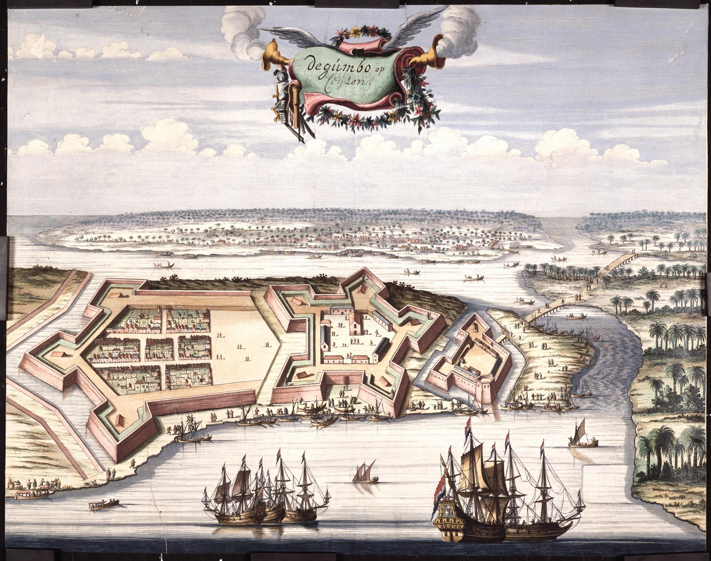
Negombo (, ) is a major city in Sri Lanka, situated on the west coast and at the mouth of the Negombo Lagoon, in Western Province, from Colombo via Colombo - Katunayake Expressway. Negombo is one of the major commercial hubs in the country and the administrative centre of Negombo Division. Negombo has about 142,136 population within its divisional secretariat division. Negombo municipal boundary is fully extended throughout its Divisional Secretariat area. Negombo is known for its long sandy beaches and centuries old fishing industry. Negombo has a large bilingual (Sinhala/Tamil) population with a clear Roman Catholic majority. = Etymology = The name "Negombo" is the Portuguese corrupted name of its Tamil name ''Neerkolombu''. The Sinhala name means from Old-Tamil Naval terminology Meegaman Pattinam. Meegaman denotes Naval Captain, where the local Karava population’s long association of Naval and Fishing connections. Later, "Village of the honeycomb", gaining its name fro ... [...More Info...] [...Related Items...] OR: [Wikipedia] [Google] [Baidu] |
Sea Level
Mean sea level (MSL, often shortened to sea level) is an average surface level of one or more among Earth's coastal bodies of water from which heights such as elevation may be measured. The global MSL is a type of vertical datuma standardised geodetic datumthat is used, for example, as a chart datum in cartography and marine navigation, or, in aviation, as the standard sea level at which atmospheric pressure is measured to calibrate altitude and, consequently, aircraft flight levels. A common and relatively straightforward mean sea-level standard is instead the midpoint between a mean low and mean high tide at a particular location. Sea levels can be affected by many factors and are known to have varied greatly over geological time scales. Current sea level rise is mainly caused by human-induced climate change. When temperatures rise, Glacier, mountain glaciers and the Ice sheet, polar ice caps melt, increasing the amount of water in water bodies. Because most of human settlem ... [...More Info...] [...Related Items...] OR: [Wikipedia] [Google] [Baidu] |
Asupini Ella
Asupini Ella, also sometimes referred to as Ahupini Ella ( si, අසුපිනි ඇල්ල/අහුපිනි ඇල්ල), is a waterfall which is located at Ganga Ihala Koralaya, Rakshawa in Aranayaka, Kegalle of Sabaragamuwa Province. The waterfall was named after a popular ancient fairytale story. It forms part of Maha Oya and it is considered as one of the tourist destination sites in Sri Lanka. History The waterfall was named after the story relating to the story of a king who had many queens, according to the ancient myth and tales. On his return from war, he assured them that he would give all his wives, a sign from the hills about the fate of the war. He said that if his soldiers waved a white flag over the hills, it would mean he was defeated and killed in action and further said that if he waved his own flag bearing his crest, that he was victorious. The king played a foul play on his wives, who were keenly waiting with their horses near the waterfall to se ... [...More Info...] [...Related Items...] OR: [Wikipedia] [Google] [Baidu] |
Mawanella Bridge
Mawanella Bridge ( si, මාවනැල්ල ගඩොල් පාලමේ ඉතිහාසය) is the oldest operational brick bridge in Sri Lanka. The bridge was built in 1833 in Mawanella over the Maha Oya. The arch bridge has four arches, with each arch in length and is constructed entirely from bricks. In 1820 the British commenced construction of the Colombo - Kandy Road, under the orders of the Governor of Ceylon, Sir Robert Wilmot-Horton. The construction of the road was supervised by Captain William Francis Dawson. Five bridges had to be constructed with the road, one being the Arch Bridge over the Maha Oya in Mawanella, the other four were the Ferry Bridge over Kelani River, the Arch Bridge over Hingula Oya in Hingula, the Pilimathalawa Bridge across Nanu Oya and the Satin Bridge over Mahaweli River in Peradeniya Peradeniya ( si, පේරාදෙණිය, translit=Pēradeniya; ta, பேராதனை, translit=Pērātaṉai) is a suburb of the city of ... [...More Info...] [...Related Items...] OR: [Wikipedia] [Google] [Baidu] |
Sabaragamuwa Province
The Sabaragamuwa Province ( si, සබරගමුව පළාත ''Sabaragamuwa Paḷāta'', ta, சபரகமுவ மாகாணம் ''Sabaragamuwa Mākāṇam'') is one of the nine provinces of Sri Lanka, the first level administrative division of the country. The provinces have existed since the 19th century but did not have any legal status until 1987 when the 13th Amendment to the Constitution of Sri Lanka established provincial councils. The Sabaragamuwa Province contains two districts: Ratnapura and Kegalle. It is named after its former indigenous inhabitants, namely the Sabara, an indic term for hunter-gatherer tribes, a term seldom used in ancient Sri Lanka. Sabaragamuwa University is in Belihuloya. Districts Sabaragamuwa is divided into 2 districts: * Kegalle District * Ratnapura District Municipal Council * Ratnapura Urban Council * Balangoda * Embilipitiya * Kegalle Other Towns * Bulathkohupitiya * Belihuloya * Eheliyagoda * Kalawana * Kuruwita * Ma ... [...More Info...] [...Related Items...] OR: [Wikipedia] [Google] [Baidu] |
Sri Lanka
Sri Lanka (, ; si, ශ්රී ලංකා, Śrī Laṅkā, translit-std=ISO (); ta, இலங்கை, Ilaṅkai, translit-std=ISO ()), formerly known as Ceylon and officially the Democratic Socialist Republic of Sri Lanka, is an island country in South Asia. It lies in the Indian Ocean, southwest of the Bay of Bengal, and southeast of the Arabian Sea; it is separated from the Indian subcontinent by the Gulf of Mannar and the Palk Strait. Sri Lanka shares a maritime border with India and Maldives. Sri Jayawardenepura Kotte is its legislative capital, and Colombo is its largest city and financial centre. Sri Lanka has a population of around 22 million (2020) and is a multinational state, home to diverse cultures, languages, and ethnicities. The Sinhalese are the majority of the nation's population. The Tamils, who are a large minority group, have also played an influential role in the island's history. Other long established groups include the Moors, the Burghers ... [...More Info...] [...Related Items...] OR: [Wikipedia] [Google] [Baidu] |
Water Supply Network
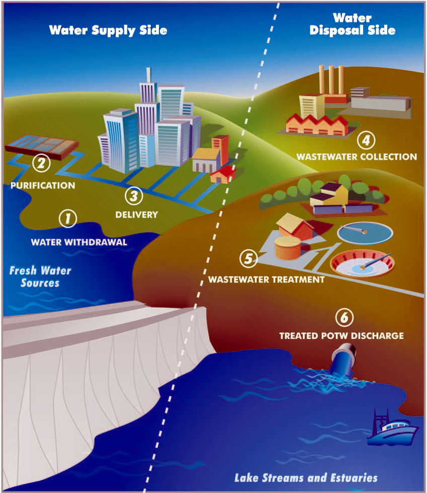
A water supply network or water supply system is a system of engineered hydrologic and hydraulic components that provide water supply. A water supply system typically includes the following: # A drainage basin (see water purification – sources of drinking water) # A raw water collection point (above or below ground) where the water accumulates, such as a lake, a river, or groundwater from an underground aquifer. Raw water may be transferred using uncovered ground-level aqueducts, covered tunnels, or underground water pipes to water purification facilities. # Water purification facilities. Treated water is transferred using water pipes (usually underground). # Water storage facilities such as reservoirs, water tanks, or water towers. Smaller water systems may store the water in cisterns or pressure vessels. Tall buildings may also need to store water locally in pressure vessels in order for the water to reach the upper floors. # Additional water pressurizing components such ... [...More Info...] [...Related Items...] OR: [Wikipedia] [Google] [Baidu] |
Catchment Area
In human geography, a catchment area is the area from which a location, such as a city, service or institution, attracts a population that uses its services and economic opportunities. Catchment areas may be defined based on from where people are naturally drawn to a location (for example, labour catchment area) or as established by governments or organizations for the provision of services. Governments and community service organizations often define catchment areas for planning purposes and public safety such as ensuring universal access to services like fire departments, police departments, ambulance bases and hospitals. In business, a catchment area is used to describe the influence from which a retail location draws its customers. Airport catchment areas can inform efforts to estimate route profitability. Types of catchment areas Catchments can be defined relative to a location and based upon a number of factors, including distance, travel time, geographic boundaries or popu ... [...More Info...] [...Related Items...] OR: [Wikipedia] [Google] [Baidu] |
List Of Dams And Reservoirs In Sri Lanka
The following page lists most dams in Sri Lanka. Most of these dams are governed by the Mahaweli Authority, while the Ceylon Electricity Board operates dams used for hydroelectric power generation. Hydroelectric dams, including small hydros accounts for nearly half of the installed power capacity of Sri Lanka. Sri Lanka is pockmarked with many irrigation dams with its water resource distributed across nearly the entirety of the island for agricultural purposes via artificial canals and streams. Utilization of hydro resources for agricultural production dates back pre-Colonial era, with current crop productions now largely dependent on these water resources. __NOTOC__ Dams in Sri Lanka Irrigation dams with a length and height of more than and are listed, including all the state-run hydroelectric power stations. Privately owned "small-hydro" facilities (which are limited to a maximum nameplate capacity of ), are not included in this list. Nearly all hydroelectric dams are ... [...More Info...] [...Related Items...] OR: [Wikipedia] [Google] [Baidu] |
List Of Rivers Of Sri Lanka
The following table lists most rivers of Sri Lanka. Since Sri Lanka is a trilingual country, some rivers may have a Sinhala name (i.e. Kalu Ganga), while other have an English name (i.e. Kelani River). In the Sinhala language, Ganga (ගඟ) translates to "river", where as Oya (ඔය) translates to "smaller river". At , the Mahaweli River is the longest river in the island, and has drainage basin covering more than one-fifth of the island. List of major rivers (over 100km in length) List of minor rivers (up to 100km in length) Malala oya - Hambanthota District karanda Oya - Potuvil Ampara District Heda Oya - Arugambay (Arunagamthota), Ampare District wil oya - Ampara District Gallery File:Mahaweli River at sunken city of Teldeniya victoria reservoir sri lanka.JPG, Mahaweli River, Teldeniya. File:SL Anuradhapura asv2020-01 img28 Malvathu River.jpg, Malvathu River, Anuradhapura. File:Kelani River.jpg, Kelani River, Kitulgala. File:CastlereighReservoir-SriL ... [...More Info...] [...Related Items...] OR: [Wikipedia] [Google] [Baidu] |


