|
Mynydd Hiraethog
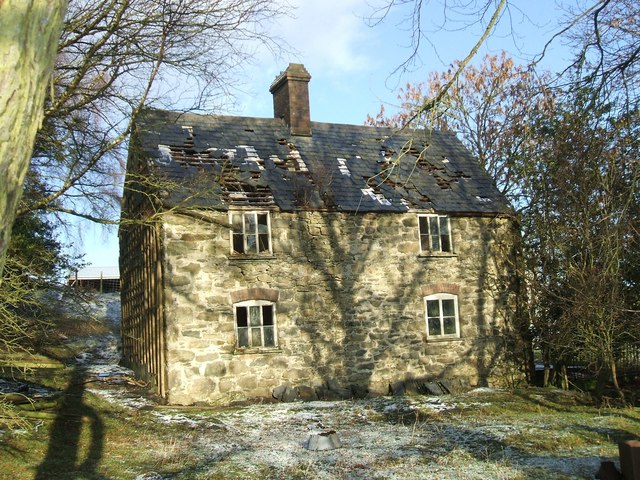
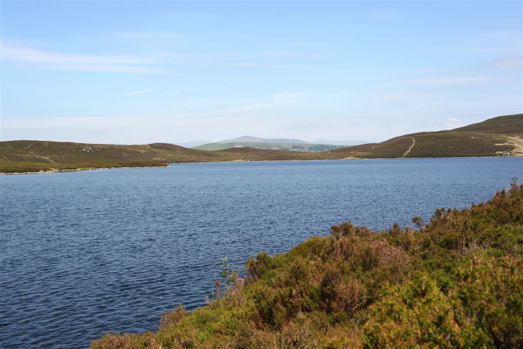
Denbigh Moors ( Welsh: Mynydd Hiraethog) is an upland region in Conwy and Denbighshire in north-east Wales, between Snowdonia and the Clwydian Range. It includes the large reservoirs Llyn Brenig and Llyn Alwen, and the Clocaenog Forest, which has one of Wales's last populations of red squirrels. It also contains the open heath Hafod Elwy Moor National Nature Reserve. Its highest point is Mwdwl-eithin, at above sea level, making it higher than Exmoor. Another summit is Moel Seisiog, at , which is also the source of the River Elwy (). On its western edge, overlooking the Conwy Valley, lies the Moel Maelogan wind farm. Three other summits reach over 500 metres – Craig Bron-banog (502 metres), Gorsedd Bran (518 metres), and Foel Goch (Marial Gwyn) (519 metres). The ruined hunting lodge of Gwylfa Hiraethog (known locally as Plas Pren due to its original timber construction) lies at a height of 498 metres (1633 feet). ... [...More Info...] [...Related Items...] OR: [Wikipedia] [Google] [Baidu] |
Mwdwl-eithin
Mwdwl-eithin () is the highest point on the Denbigh Moors (Welsh: Mynydd Hiraethog) of North Wales. This gently rising mountain lies about east of Betws-y-Coed. On its summit is a trig point and a ruined building which still provides shelter against a storm. A few metres away is a large raised stone cairn. The whole area is underlain by Silurian mudstone which was extensively glaciated during the last British glaciation. The whole area is now very wet moorland dominated by heather (''Calluna'' and ''Erica'' spp.) and rushes. Three of the surrounding valleys and depressions have been used for drinking water storage reservoirs, Llyn Alwen, Llyn Aled and Alwen Reservoir The Alwen Reservoir or Cronfa Alwen is a long reservoir near Pentre-Llyn-Cymmer in Conwy County Borough, Wales. History The reservoir and dam were constructed between 1911 and 1920 bAlexander Binnie, Son and Deacon(Resident Engineer John M. Pa .... Mountains and hills of Conwy County Borough Marilyns of ... [...More Info...] [...Related Items...] OR: [Wikipedia] [Google] [Baidu] |
Mountains And Hills Of Conwy County Borough
A mountain is an elevated portion of the Earth's crust, generally with steep sides that show significant exposed bedrock. Although definitions vary, a mountain may differ from a plateau in having a limited summit area, and is usually higher than a hill, typically rising at least 300 metres (1,000 feet) above the surrounding land. A few mountains are isolated summits, but most occur in mountain ranges. Mountains are formed through tectonic forces, erosion, or volcanism, which act on time scales of up to tens of millions of years. Once mountain building ceases, mountains are slowly leveled through the action of weathering, through slumping and other forms of mass wasting, as well as through erosion by rivers and glaciers. High elevations on mountains produce colder climates than at sea level at similar latitude. These colder climates strongly affect the ecosystems of mountains: different elevations have different plants and animals. Because of the less hospitable terrain and ... [...More Info...] [...Related Items...] OR: [Wikipedia] [Google] [Baidu] |
Moel Seisiog 2 , it means a bare hill.
{{Disambig ...
Moel is a variant spelling for: *Mohel, the person performing the Jewish ritual of circumcision *Saint Mel, a 5th-century Irish religious figure *In Welsh placenames The place-names of Wales derive in most cases from the Welsh language, but have also been influenced by linguistic contact with the Romans, Anglo-Saxons, Vikings, Anglo-Normans and modern English. Toponymy in Wales reveals significant features of ... [...More Info...] [...Related Items...] OR: [Wikipedia] [Google] [Baidu] |
Llyn Aled
Llyn Aled is a lake on Mynydd Hiraethog in the Conwy County Borough. It is situated north of the A543 and to the north-east of the village of Pentrefoelas. It is a natural lake; however, a dam was built at its northern outlet to increase its size. It has an area of and is above sea level. One can reach the lake via the A543. There are a number of varieties of fish in the lake, including pike. The lake was used by the Llyn Aled Sailing Club (Clwb Hwylio Llyn Aled), but the club closed down due to a dwindling membership and the proximity of the much larger Llyn Brenig. The Clwydian Way runs along the north side of the lake. Llyn Aled feeds the Llyn Aled Isaf reservoir. The lake is also the source of the River Aled The River Aled, a small river near Conwy County Borough, flows into River Elwy. The river originates at Llyn Aled on Mynydd Hiraethog to the right of the village Llansannan. It flows through Llyn Aled Isaf and then towards the north through L ..., which flows no ... [...More Info...] [...Related Items...] OR: [Wikipedia] [Google] [Baidu] |
Alwen Reservoir
The Alwen Reservoir or Cronfa Alwen is a long reservoir near Pentre-Llyn-Cymmer in Conwy County Borough, Wales. History The reservoir and dam were constructed between 1911 and 1920 bAlexander Binnie, Son and Deacon(Resident Engineer John M. Parkin Assoc M.Inst. C.E.) for the Corporation of Birkenhead to provide a high quality source of drinking water for the Wirral and parts of Liverpool. The reservoir and dam were built with the authority of an Act of Parliament and although the scheme involved flooding a long valley in central North Wales, the scheme encountered no opposition from local people. An original filter works building enclosing sixteen batteries of six Bell's Patent Filters is now vacant with a modern treatment plant some 100 metres distant. The treatment plant and piped aqueduct continue to supply Birkenhead with water and, despite the proximity of this reservoir to the other River Dee reservoirs, Llyn Celyn, Llyn Brenig and Llyn Tegid, it is not part of the Dee ... [...More Info...] [...Related Items...] OR: [Wikipedia] [Google] [Baidu] |
Hudson Kearley, 1st Viscount Devonport
Hudson Ewbanke Kearley, 1st Viscount Devonport, (1 September 1856 – 5 September 1934), styled Lord Devonport between 1910 and 1917, was a British grocer and politician. He founded the International Tea Company's Stores, became the first chairman of the Port of London Authority, and served as Minister of Food Control during World War I. Early life and business career Devonport was the tenth and youngest child of George Ewbanke Kearley (1814–1876) and his wife, Mary Ann Hudson. He studied at Surrey County School (now Cranleigh School) and joined Tetley & Sons in 1872. In 1876, Devonport founded a tea importing company, known as Kearley and Tonge from 1887, and began retailing his own goods in 1878. In 1890, he had over 200 branches trading as International Stores and in 1895, both companies were combined to form International Tea Company's Stores and shares were offered to the public. Marriage and family Hudson Kearley married Selina Chester in 1888. They had three childre ... [...More Info...] [...Related Items...] OR: [Wikipedia] [Google] [Baidu] |
Moel Maelogan
Moel Maelogan ''(shown on O.S. maps as 'Maelogen', and also sometimes spelled 'Moelogan' and 'Mælogan')'' is a hill (summit height 424m) on the western edge of Mynydd Hiraethog (also known as the Denbigh Moors) in north Wales, and overlooking the Conwy Valley. It is known mostly as the general location of a wind farm. The initial three turbines were erected in 2002, and started generating in January 2003; each turbine is capable of producing 1300 kW. This scheme marked erection of the UK wind industry's 1000th turbine and was initially welcomed, as it had been set up by three local farmers to boost their incomes, under the name of Cwmni Gwynt Teg ("Fair Wind Company"). After commissioning, however, it was opposed by some, not least because, although not located in the Snowdonia National Park itself, the turbines are visible from many parts of it. Of the three turbines, two were owned and operated by the local farming co-operative; the third was owned and operated by Ener ... [...More Info...] [...Related Items...] OR: [Wikipedia] [Google] [Baidu] |
Conwy Valley
, name_etymology = , image = Boats in River Conwy.jpg , image_size = 300 , image_caption = Boats in the river estuary at Conwy , map = , map_size = , map_caption = , pushpin_map = , pushpin_map_size = , pushpin_map_caption= , subdivision_type1 = Country , subdivision_name1 = Wales , subdivision_type2 = , subdivision_name2 = , subdivision_type3 = , subdivision_name3 = , subdivision_type4 = District , subdivision_name4 = County Borough of Conwy , subdivision_type5 = City , subdivision_name5 = Conwy , length = , width_min = , width_avg = , width_max = , depth_min = , depth_avg = , depth_max = , discharge1_location= Cwm Llanerch , discharge1_min = , discharge1_avg = , discharge1_max = , source1 = , source1_location = Migneint moor where a number of small s ... [...More Info...] [...Related Items...] OR: [Wikipedia] [Google] [Baidu] |
River Elwy
The River Elwy (''Afon Elwy'' in Welsh) is a river in Wales forming a tributary to the River Clwyd. The source of the river is sometimes said to be on the northern flank of Moel Seisiog, south-east of Llanrwst, at Ordnance Survey grid reference SH 853593. However the river only receives the name Elwy at the village of Llangernyw, where three rivers, Afon Cledwen, Afon Collen and Afon Gallen, meet to form the Elwy. It flows eastwards through Llanfair Talhaiarn and a few miles downstream from this village it is joined by a tributary, the River Aled (''Afon Aled'') which has its source in Llyn Aled. After passing through Bont-newydd, the river turns northwards again and flows through St. Asaph (''Llanelwy'' or "the church enclosure on the Elwy" in Welsh). It joins the River Clwyd about half way between St. Asaph and Rhuddlan, and the waters of the two rivers can often be seen flowing side by side for several miles. A number of caves along the lower valley of the Elwy are of great a ... [...More Info...] [...Related Items...] OR: [Wikipedia] [Google] [Baidu] |
Exmoor
Exmoor is loosely defined as an area of hilly open moorland in west Somerset and north Devon in South West England. It is named after the River Exe, the source of which is situated in the centre of the area, two miles north-west of Simonsbath. Exmoor is more precisely defined as the area of the former ancient royal hunting forest, also called Exmoor, which was officially surveyed 1815–1818 as in extent. The moor has given its name to a National Park, which includes the Brendon Hills, the East Lyn Valley, the Vale of Porlock and of the Bristol Channel coast. The total area of the Exmoor National Park is , of which 71% is in Somerset and 29% in Devon. The upland area is underlain by sedimentary rocks dating from the Devonian and early Carboniferous periods with Triassic and Jurassic age rocks on lower slopes. Where these reach the coast, cliffs are formed which are cut with ravines and waterfalls. It was recognised as a heritage coast in 1991. The highest point on Exmoor is ... [...More Info...] [...Related Items...] OR: [Wikipedia] [Google] [Baidu] |
Hafod Elwy Moor National Nature Reserve
Hafod Elwy Moor National Nature Reserve, located in the moorland above the town of Denbigh in Denbighshire, North Wales, is part of the Mynydd Hiraethog Site of Special Scientific Interest, formerly managed by the Countryside Council for Wales and now under the jurisdiction of Natural Resources Wales. Established in 1999, it comprises an patch of upland moor lying between the lakes of Llyn Brenig and Llyn Alwen. A conifer forest planted by the Forestry Commission borders the moor to the south and east. With plant life dominated by heather and bilberry, the reserve provides important habitat for ground-nesting birds. Birds found in the area include the Northern wheatear, and some black grouse. The reserve is classified as a Category IV site by the International Union for Conservation of Nature, meaning that the area regularly needs active interventions to support particular species. Conservation efforts focus on increasing black grouse populations. In addition to these ground-nes ... [...More Info...] [...Related Items...] OR: [Wikipedia] [Google] [Baidu] |


