|
Mylor Creek
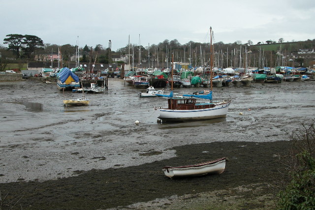
Mylor Creek ( kw, Pol Scathow, meaning ''creek of boats'') is a tidal ria in south Cornwall, United Kingdom. It is a tributary of Carrick Roads, the estuary of the River Fal and is situated approximately six miles (10 km) south of Truro and two miles (3 km) north of Falmouth .Ordnance Survey: Landranger map sheet 204 ''Truro & Falmouth'' Geography The creek is in Mylor civil parish and forms an inland tidal lake. It is approximately at its widest point and just over a mile (1.8 km) long from its tidal limit at Mylor Bridge to its mouth at Mylor Churchtown where it discharges into Carrick Roads. Locations * Normal Tidal Limit (NTL) at Mylor Bridge coordinates * Mouth (Mylor Harbour) coordinates History At the entrance to the creek was the most westerly naval dockyard and victualling station in Britain, which, at high tide, covered of water. During the second half of the 19th-century it was the base for HMS Ganges, a training ship for bo ... [...More Info...] [...Related Items...] OR: [Wikipedia] [Google] [Baidu] |
Mylor Creek At Low Tide - Geograph
Mylor may refer to: * Mylor, Cornwall, a civil parish in Cornwall ** Mylor Bridge, a village in Mylor parish ** Mylor Churchtown, in Mylor parish ** Mylor Creek, a tidal creek in Mylor parish * Mylor, South Australia, a town and locality in Australia * Saint Mylor, correctly known as Saint Melor {{disambig ... [...More Info...] [...Related Items...] OR: [Wikipedia] [Google] [Baidu] |
Mylor Churchtown
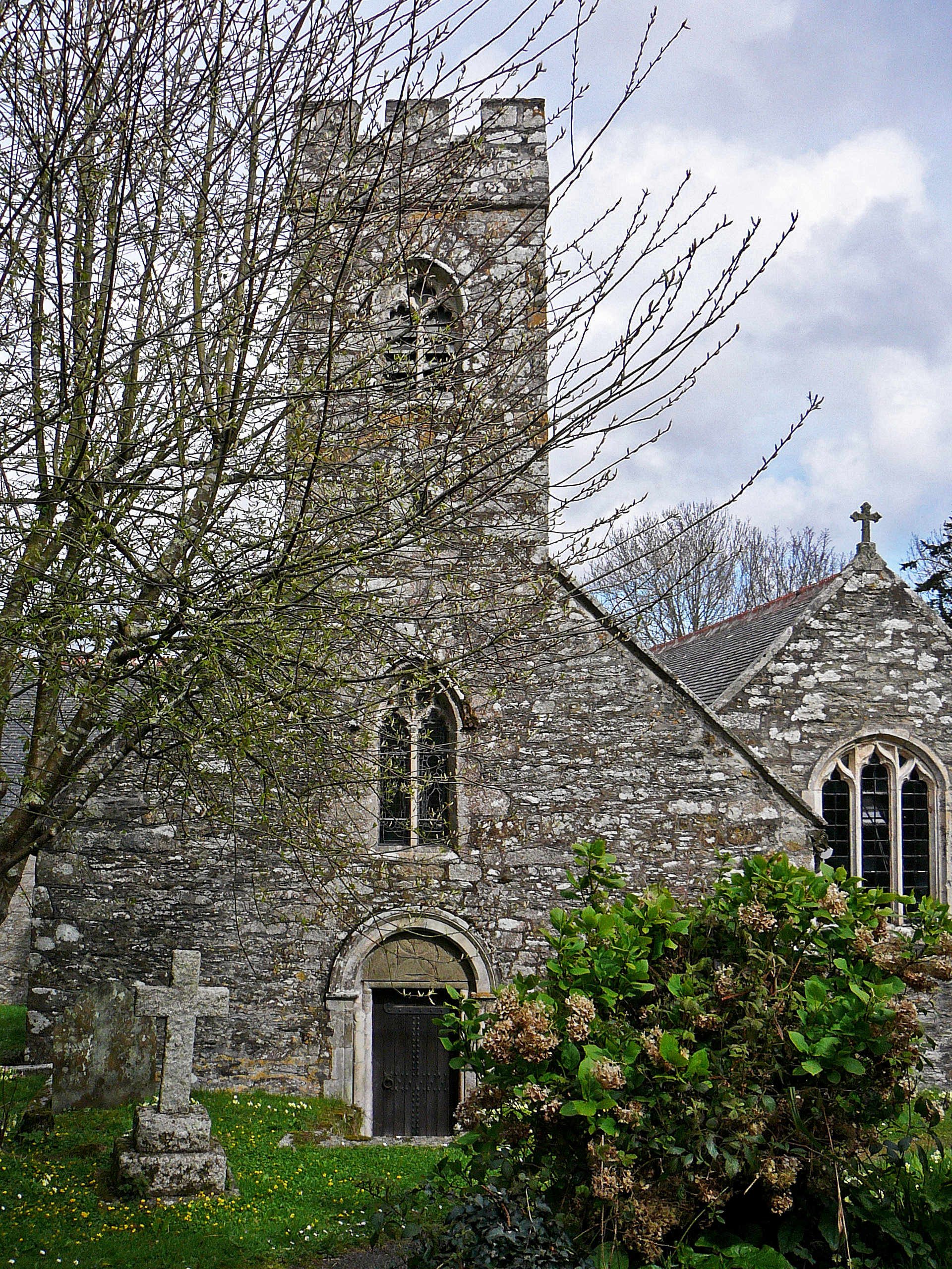
Mylor Churchtown is a coastal village in Cornwall, England. It is the church town of the ecclesiastical parish of Mylor and is situated at the mouth of Mylor Creek, approximately three miles north of Falmouth.Ordnance Survey: Landranger map sheet 204 ''Truro & Falmouth'' Mylor Yacht Harbour is a large yacht marina immediately north of Mylor Churchtown. It has been owned by the Graffy family since 1997. The marina is at the mouth of Mylor Creek at its confluence with Carrick Roads and is the home of Restronguet Sailing Club. Parish church Mylor parish church (Anglican) is in Mylor Churchtown and is dedicated to St Melorus. The church has Norman origins and is built on a cruciform plan, with a south aisle was added in the 15th century. There is a small west tower but the bells (three in number, the earliest dated 1637) are in a detached campanile. One of these bells bears the Latin inscription EGO ME PRECO SE CLAMANDO CONTERIMUS AUDITE VENITE (i.e. ''Ego me, praeco se clama ... [...More Info...] [...Related Items...] OR: [Wikipedia] [Google] [Baidu] |
Populated Coastal Places In Cornwall
Population typically refers to the number of people in a single area, whether it be a city or town, region, country, continent, or the world. Governments typically quantify the size of the resident population within their jurisdiction using a census, a process of collecting, analysing, compiling, and publishing data regarding a population. Perspectives of various disciplines Social sciences In sociology and population geography, population refers to a group of human beings with some predefined criterion in common, such as location, race, ethnicity, nationality, or religion. Demography is a social science which entails the statistical study of populations. Ecology In ecology, a population is a group of organisms of the same species who inhabit the same particular geographical area and are capable of interbreeding. The area of a sexual population is the area where inter-breeding is possible between any pair within the area and more probable than cross-breeding with ind ... [...More Info...] [...Related Items...] OR: [Wikipedia] [Google] [Baidu] |
Mylor Harbour
Mylor Churchtown is a coastal village in Cornwall, England. It is the church town of the ecclesiastical parish of Mylor and is situated at the mouth of Mylor Creek, approximately three miles north of Falmouth.Ordnance Survey: Landranger map sheet 204 ''Truro & Falmouth'' Mylor Yacht Harbour is a large yacht marina immediately north of Mylor Churchtown. It has been owned by the Graffy family since 1997. The marina is at the mouth of Mylor Creek at its confluence with Carrick Roads and is the home of Restronguet Sailing Club. Parish church Mylor parish church (Anglican) is in Mylor Churchtown and is dedicated to St Melorus. The church has Norman origins and is built on a cruciform plan, with a south aisle was added in the 15th century. There is a small west tower but the bells (three in number, the earliest dated 1637) are in a detached campanile. One of these bells bears the Latin inscription EGO ME PRECO SE CLAMANDO CONTERIMUS AUDITE VENITE (i.e. ''Ego me, praeco se clama ... [...More Info...] [...Related Items...] OR: [Wikipedia] [Google] [Baidu] |
Restronguet Creek
Restronguet Creek is a tidal ria in south Cornwall, United Kingdom. It is a tributary of Carrick Roads, the estuary of the River Fal, and is situated approximately four miles (6.5 km) south of Truro and three miles (5 km) north of Falmouth. Ordnance Survey: Landranger map sheet 204 ''Truro & Falmouth'' The creek is approximately two miles (3 km) long from its Normal Tidal Limit (NTL) to its mouth and half-a-mile (800 metres) across at its widest point. It discharges into Carrick Roads at Restronguet Point through a narrow channel known locally as 'the gut'. Restronguet Creek Society website. Retrieved May 2010 Restronguet Creek forms the boundary between the es of [...More Info...] [...Related Items...] OR: [Wikipedia] [Google] [Baidu] |
Dinghy Racing
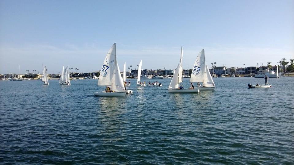
Dinghy racing is a competitive sport using dinghies, which are small boats which may be rowboats, have an outboard motor, or be sailing dinghies. Dinghy racing has affected aspects of the modern sailing dinghy, including hull design, sail materials and sailplan, and techniques such as planing and trapezing. Organization of competitive dinghy sailing Dinghy racing comes under the auspices of World Sailing. Organisations such as the Royal Yachting Association, National School Sailing Association (UK) and Canadian Yachting Association (Canada) organise and regulate the sport at a national level. Sailing dinghies compete on an international, national, state, association, club and class basis, using the ISAF International Racing Rules of Sailing, which are revised every four years. There are several courses used, such as the Olympic triangle. The International Association for Disabled Sailing (IFDS)] is the body authorized by ISAF to be responsible for disabled sailing worldwide. ... [...More Info...] [...Related Items...] OR: [Wikipedia] [Google] [Baidu] |
Yacht
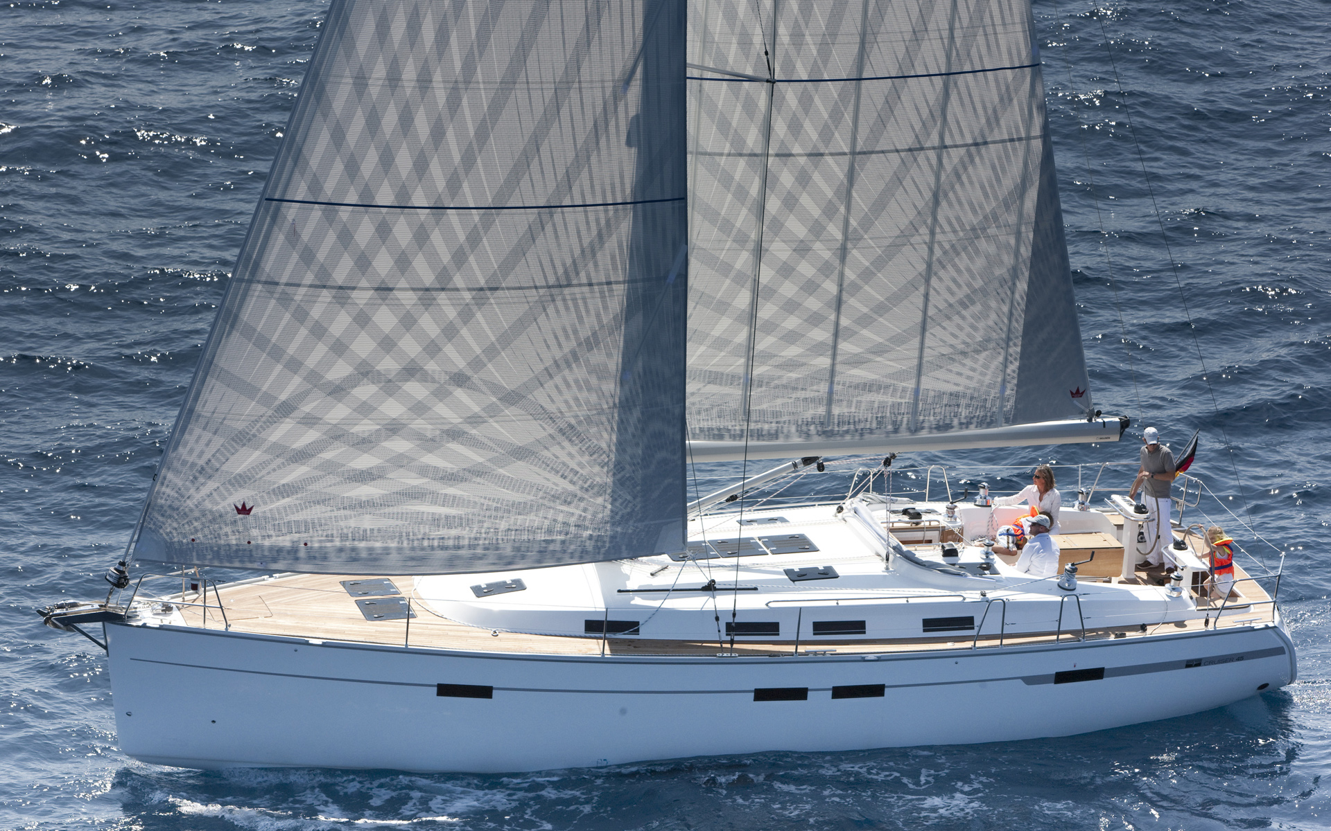
A yacht is a sailing or power vessel used for pleasure, cruising, or racing. There is no standard definition, though the term generally applies to vessels with a cabin intended for overnight use. To be termed a , as opposed to a , such a pleasure vessel is likely to be at least in length and may have been judged to have good aesthetic qualities. The Commercial Yacht Code classifies yachts and over as . Such yachts typically require a hired crew and have higher construction standards. Further classifications for large yachts are: —carrying no more than 12 passengers, —solely for the pleasure of the owner and guests, or by flag, the country under which it is registered. A superyacht (sometimes ) generally refers to any yacht (sail or power) longer than . Racing yachts are designed to emphasize performance over comfort. Charter yachts are run as a business for profit. As of 2020 there were more than 15,000 yachts of sufficient size to require a professional crew. Etymology ... [...More Info...] [...Related Items...] OR: [Wikipedia] [Google] [Baidu] |
English Channel
The English Channel, "The Sleeve"; nrf, la Maunche, "The Sleeve" (Cotentinais) or ( Jèrriais), (Guernésiais), "The Channel"; br, Mor Breizh, "Sea of Brittany"; cy, Môr Udd, "Lord's Sea"; kw, Mor Bretannek, "British Sea"; nl, Het Kanaal, "The Channel"; german: Ärmelkanal, "Sleeve Channel" ( French: ''la Manche;'' also called the British Channel or simply the Channel) is an arm of the Atlantic Ocean that separates Southern England from northern France. It links to the southern part of the North Sea by the Strait of Dover at its northeastern end. It is the busiest shipping area in the world. It is about long and varies in width from at its widest to at its narrowest in the Strait of Dover."English Channel". ''The Columbia Encyclopedia'', 2004. It is the smallest of the shallow seas around the continental shelf of Europe, covering an area of some . The Channel was a key factor in Britain becoming a naval superpower and has been utilised by Britain as a natural def ... [...More Info...] [...Related Items...] OR: [Wikipedia] [Google] [Baidu] |
French Resistance
The French Resistance (french: La Résistance) was a collection of organisations that fought the German occupation of France during World War II, Nazi occupation of France and the Collaborationism, collaborationist Vichy France, Vichy régime during the World War II, Second World War. Resistance Clandestine cell system, cells were small groups of armed men and women (called the Maquis (World War II), Maquis in rural areas) who, in addition to their guerrilla warfare activities, were also publishers of underground newspapers, providers of first-hand intelligence information, and maintainers of escape networks that helped Allies of World War II, Allied soldiers and airmen trapped behind enemy lines. The Resistance's men and women came from all economic levels and political leanings of French society, including émigrés, academics, students, Aristocratic family, aristocrats, conservative Catholic Church, Roman Catholics (including priests and Yvonne Beauvais, nuns), Protestantis ... [...More Info...] [...Related Items...] OR: [Wikipedia] [Google] [Baidu] |
Post Office Packet Service
The Post Office Packet Service dates to Tudor times and ran until 1823, when the Admiralty assumed control of the service. Originally, the Post Office used packet ships to carry mail packets to and from British embassies, colonies and outposts. The vessels generally also carried bullion, private goods and passengers. The ships were usually lightly armed and relied on speed for their security. However, Britain was at war almost continuously during the 18th and early 19th centuries with the result that packet ships did get involved in naval engagements with enemy warships and privateers, and were occasionally captured. Routes Atlantic and Mediterranean *North, Central and South America and the Caribbean Islands, *Spain, Portugal, Gibraltar, Italy, Greece (Corfu was a British Protectorate from 1815 to 1864), Egypt. Northern Europe Routes ran at various times from Dover in Kent and Harwich in Essex to Calais, the Hook of Holland and Heligoland. Ireland The usual packet route was f ... [...More Info...] [...Related Items...] OR: [Wikipedia] [Google] [Baidu] |
HMS Ganges (shore Establishment)
HMS ''Ganges'' was a training ship and later stone frigate of the Royal Navy. She was established as a boys' training establishment in 1865, and was based aboard a number of hulks before moving ashore. She was based alternately in Falmouth, Harwich (from 1899) and Shotley (from 1905). She remained in service at RNTE Shotley until October 1976.Ward, ''Shore establishments'' pp.62–3. HMS ''Ganges'' was also known as Shotley Training Establishment. Foundation and early history The increasing professionalism of the Royal Navy and the reform of practices during the mid-nineteenth century led to the need to establish new training centres at which recruits could be inducted into navy life. The Admiralty decided to set aside five old laid up hulks in different ports around the country, and use them as bases at which volunteers aged between 15 and 17 could spend a year being educated for future service in the navy. The plan called for an annual intake of 3,500 boys. They were to ... [...More Info...] [...Related Items...] OR: [Wikipedia] [Google] [Baidu] |
Mylor Bridge
Mylor Bridge ( kw, Ponsnowyth) is a village in Cornwall, England, United Kingdom. It is in Mylor civil parish at the head of Mylor Creek, about five miles north of Falmouth.Ordnance Survey: Landranger map sheet 204 ''Truro & Falmouth'' Found in Mylor Bridge are a Post Office/Newsagents, grocery store, fishmonger, hairdressers, butcher's shop and a public house called the Lemon Arms. The village also has a primary school. The parish church of Saint Mylor is in the nearby village of Mylor Churchtown. Mylor Bridge lies within the Cornwall Area of Outstanding Natural Beauty (AONB). Governance The village is represented as Penryn East and Mylor on Cornwall Council. It was formerly in the Falmouth and Camborne parliamentary electoral constituency; since 2010 it has been in the Truro and Falmouth constituency. Notably, the former Member for Parliament (MP) for Truro and Falmouth, Sarah Newton Sarah Louise Newton, ( Hick; 19 July 1961) is a British Conservative Party politicia ... [...More Info...] [...Related Items...] OR: [Wikipedia] [Google] [Baidu] |


.jpg)


