|
Mylopotamos, Crete
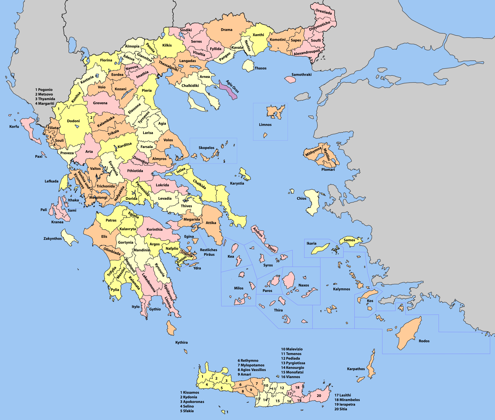
Mylopotamos ( el, Μυλοπόταμος) is a municipality in Rethymno regional unit, on Crete, southern Greece. The seat of the municipality is the village Perama. The municipal unit has an area of ., former municipalities Geropotamos and Kouloukonas and municipal departments Axos and Zoniana from Anogeia. Municipality The municipality Mylopotamos was formed at the 2011 local government reform by the merger of the following 3 former municipalities, which became municipal units: * Geropotamos * Kouloukonas * Zoniana * Anogia Former Province The province of Mylopotamos ( el, Επαρχία Μυλοποτάμου) was one of the provinces of Rethymno Prefecture. Its territory corresponded with that of the current municipalities Mylopotamos and Anogeia. It was abolished in 2006. Ecclesiastical history Modern Lefterna was the seat since 1212 of a Latin Roman Catholic Diocese of Milopotamus, which was suppressed in 1669 and turned into a Latin Titular bishopric of low ... [...More Info...] [...Related Items...] OR: [Wikipedia] [Google] [Baidu] |
Crete
Crete ( el, Κρήτη, translit=, Modern: , Ancient: ) is the largest and most populous of the Greek islands, the 88th largest island in the world and the fifth largest island in the Mediterranean Sea, after Sicily, Sardinia, Cyprus, and Corsica. Crete rests about south of the Greek mainland, and about southwest of Anatolia. Crete has an area of and a coastline of 1,046 km (650 mi). It bounds the southern border of the Aegean Sea, with the Sea of Crete (or North Cretan Sea) to the north and the Libyan Sea (or South Cretan Sea) to the south. Crete and a number of islands and islets that surround it constitute the Region of Crete ( el, Περιφέρεια Κρήτης, links=no), which is the southernmost of the 13 top-level administrative units of Greece, and the fifth most populous of Greece's regions. Its capital and largest city is Heraklion, on the north shore of the island. , the region had a population of 636,504. The Dodecanese are located to the no ... [...More Info...] [...Related Items...] OR: [Wikipedia] [Google] [Baidu] |
Provinces Of Greece
The provinces of Greece ( el, επαρχία, "eparchy") were sub-divisions of some the country's prefectures of Greece, prefectures. From 1887, the provinces were abolished as actual administrative units, but were retained for some state services, especially financial and educational services, as well as for electoral purposes. Before the Second World War, there were 139 provinces, and after the war, with the addition of the Dodecanese, Dodecanese Islands, their number grew to 147. According to the Article 7 of the Code of Prefectural Self-Government (Presidential Decree 30/1996), the provinces constituted a "particular administrative district" within the wider "administrative district" of the prefectures. The provinces were finally abolished after the 2006 Greek local elections, 2006 local elections, in line with Law 2539/1997, as part of the wide-ranging administrative reform known as the "Kapodistrias reform, Kapodistrias Project", and replaced by enlarged Municipalities and ... [...More Info...] [...Related Items...] OR: [Wikipedia] [Google] [Baidu] |
Municipalities Of Crete
A municipality is usually a single administrative division having corporate status and powers of self-government or jurisdiction as granted by national and regional laws to which it is subordinate. The term ''municipality'' may also mean the governing body of a given municipality. A municipality is a general-purpose administrative subdivision, as opposed to a special-purpose district. The term is derived from French and Latin . The English word ''municipality'' derives from the Latin social contract (derived from a word meaning "duty holders"), referring to the Latin communities that supplied Rome with troops in exchange for their own incorporation into the Roman state (granting Roman citizenship to the inhabitants) while permitting the communities to retain their own local governments (a limited autonomy). A municipality can be any political jurisdiction, from a sovereign state such as the Principality of Monaco, to a small village such as West Hampton Dunes, New York. The ... [...More Info...] [...Related Items...] OR: [Wikipedia] [Google] [Baidu] |
Vosakou Monastery
The Vosakou Monastery ( el, Μονή Βωσάκου also misspelled as Βοσάκου) is a 17th-century monastery situated in the Mylopotamos region of the Rethymno regional unit in north-central Crete. The monastery is roughly 50 km east of Rethymno and is built on the north slope of a plateau in the Tallaia mountains.Κώστας Γιαπιτζόγλου. ''Οδοιπορικό: Η μονή Βωσάκου'', Κρητικό Πανόραμα, τεύχος 10, σελ. 86-105, 2005. Its name stands for the ox-fold, composed from the Greek words ''βούς'' (ox) and ''σηκός'' (fold) (''σακός'' in the Doric Greek dialect). History According to various historical sources, the monastery was in continuous use from the early 17th century until 1960, when the last of its monks died. In April 1676, Vossakos became a Patriarchical monastery (i.e. stauropegic), proclaimed by an act (''sigillion'') of Ecumenical Patriarch Parthenius IV. The monastery played an important role ... [...More Info...] [...Related Items...] OR: [Wikipedia] [Google] [Baidu] |
Eleutherna
Eleutherna ( grc-gre, Ἐλεύθερνα), also called Apollonia ( grc-gre, Ἀπολλωνία), was an ancient city-state in Crete, Greece, which lies 25 km southeast of Rethymno in Rethymno regional unit. Archaeologists excavated the site, located on a narrow northern spur of Mount Ida, the highest mountain in Crete. The site is about 1 km south of modern town of Eleftherna, about 8 km north east of Moni Arkadiou, in the current municipality of Rethymno. It flourished from the Dark Ages of Greece’s early history until Byzantine times. History In the systematic Eleutherna project, a team of archaeologists from the University of Crete led by Prof. N. Stampolidis has been in charge since 1984. Surveys and systematic excavations have revealed the city's settlement patterns, sanctuaries and necropoleis in ''Orthi Petra'', even stone quarries in the surroundings of the ''Prines'' hill. The discovery of the remains of four females in Orthi Petra was declared on ... [...More Info...] [...Related Items...] OR: [Wikipedia] [Google] [Baidu] |
Titular Bishopric
A titular see in various churches is an episcopal see of a former diocese that no longer functions, sometimes called a "dead diocese". The ordinary or hierarch of such a see may be styled a "titular metropolitan" (highest rank), "titular archbishop" (intermediary rank) or "titular bishop" (lowest rank), which normally goes by the status conferred on the titular see. Titular sees are dioceses that no longer functionally exist, often because the territory was conquered by Muslims or because it is schismatic. The Greek–Turkish population exchange of 1923 also contributed to titular sees. The see of Maximianoupolis along with the town that shared its name was destroyed by the Bulgarians under Emperor Kaloyan in 1207; the town and the see were under the control of the Latin Empire, which took Constantinople during the Fourth Crusade in 1204. Parthenia, in north Africa, was abandoned and swallowed by desert sand. Catholic Church During the Muslim conquests of the Middle Ea ... [...More Info...] [...Related Items...] OR: [Wikipedia] [Google] [Baidu] |
Roman Catholic Diocese Of Milopotamus
The Roman Catholic Diocese of Milopotamus (also Diocese of Mylopotamus) is a former Latin Catholic bishopric on Crete in southern Greece and present Latin titular bishopric, now under the later assumed name Eleutherna."Diocese of Mylopotamos" ''''. David M. Cheney. Retrieved February 29, 2016"Titular Episcopal See of Eleutherna" ''GCatholic.org''. Gabriel Chow. Retrieved February 29, 2016 Ecclesiastical history Modern Lefterna, in |
Anogeia
Anogeia (Ανώγεια) is a municipality in the Rethymno regional unit, Crete, Greece. The municipality has an area of ., excluding the former municipal departments Axos and Zoniana. Population 2,379 (2011). When exactly Anogeia was founded and by whom, is not accurately known. Many believe that the original settlement was founded by villagers from the village Axos, which is west of Anogia, where the Minoan city Oaxos was. According to a legend, a shepherd from Axos found one day on one of the slopes of Psiloreitis an icon depicting Saint John the Baptist. Pious as he was, he picked it up carefully, wrapped it in a towel, took it to his home and placed it there alongside the other icons. On the following day he was astonished to find out that the icon had disappeared. Terrified, he returned to the place he had found it the previous day, where he was exhilarated to discover the icon in the exact same place. This inexplicable phenomenon was considered to be an order from the hea ... [...More Info...] [...Related Items...] OR: [Wikipedia] [Google] [Baidu] |
Anogia
Anogeia (Ανώγεια) is a municipality in the Rethymno regional unit, Crete, Greece. The municipality has an area of ., excluding the former municipal departments Axos and Zoniana. Population 2,379 (2011). When exactly Anogeia was founded and by whom, is not accurately known. Many believe that the original settlement was founded by villagers from the village Axos, which is west of Anogia, where the Minoan city Oaxos was. According to a legend, a shepherd from Axos found one day on one of the slopes of Psiloreitis an icon depicting Saint John the Baptist. Pious as he was, he picked it up carefully, wrapped it in a towel, took it to his home and placed it there alongside the other icons. On the following day he was astonished to find out that the icon had disappeared. Terrified, he returned to the place he had found it the previous day, where he was exhilarated to discover the icon in the exact same place. This inexplicable phenomenon was considered to be an order from the hea ... [...More Info...] [...Related Items...] OR: [Wikipedia] [Google] [Baidu] |
Rethymno (regional Unit)
Rethymno () is one of the four regional units of Crete, Greece. Its capital is the city of Rethymno. Today its main income is tourism. The countryside is also based economically on agriculture and herding. Administration The regional unit Rethymno is subdivided into 5 municipalities. These are (number as in the map in the infobox): * Agios Vasileios (2) * Amari (3) *Anogeia (4) * Mylopotamos (5) *Rethymno (1) Prefecture The Rethymno prefecture ( el, Νομός Ρεθύμνου or Ρεθύμνης) was created while Crete was still an autonomous state, and was preserved after the island joined Greece in 1913. As a part of the 2011 Kallikratis government reform, the Rethymno regional unit was created out of the former prefecture. The prefecture had the same territory as the present regional unit. At the same time, the municipalities were reorganised, according to the table below. Provinces * Rethymno Province - Rethymno * Agios Vasileios Province - Spili * Amari Province - Am ... [...More Info...] [...Related Items...] OR: [Wikipedia] [Google] [Baidu] |
Zoniana
Zoniana ( el, Ζωνιανά) is a town and a former municipality in the Rethymno regional unit, Crete, Greece Greece,, or , romanized: ', officially the Hellenic Republic, is a country in Southeast Europe. It is situated on the southern tip of the Balkans, and is located at the crossroads of Europe, Asia, and Africa. Greece shares land borders with .... Since the 2011 local government reform it is part of the municipality Mylopotamos, of which it is a municipal unit. The municipal unit has an area of ., formerly municipal department of Anogeia Population 1,117 (2011). References Populated places in Rethymno (regional unit) {{Crete-geo-stub ... [...More Info...] [...Related Items...] OR: [Wikipedia] [Google] [Baidu] |
Kouloukonas
Kouloukonas ( el, Κουλούκωνας) is a former municipality in the Rethymno regional unit, Crete, Greece Greece,, or , romanized: ', officially the Hellenic Republic, is a country in Southeast Europe. It is situated on the southern tip of the Balkans, and is located at the crossroads of Europe, Asia, and Africa. Greece shares land borders with .... Since the 2011 local government reform it is part of the municipality Mylopotamos, of which it is a municipal unit. The municipal unit has an area of ., including former municipal department Axos from Anogeia Population 5,469 (2011). The seat of the municipality was in Garazo. References Populated places in Rethymno (regional unit) Mylopotamos, Crete {{Crete-geo-stub ... [...More Info...] [...Related Items...] OR: [Wikipedia] [Google] [Baidu] |


