|
Munsyari
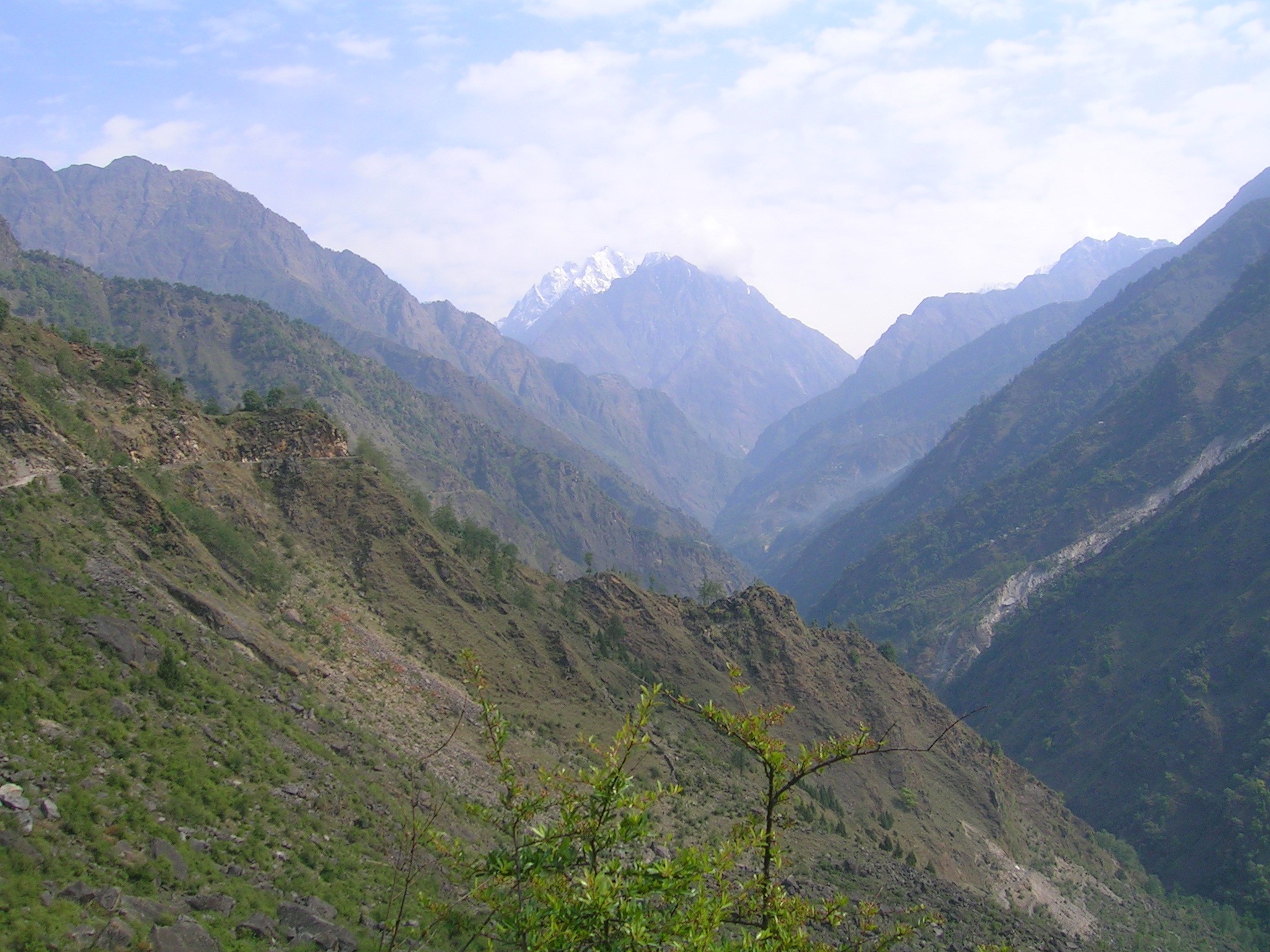
Munsiyari ( Kumaoni: ''Munsyār'') is the name of the sub-division headquarters, a conglomeration of revenue villages and it also refers to the entire region as Munsiyari Tehsil and Sub Division in the Pithoragarh District in the hill-state of Uttarakhand, India. It is a hill station and lies at the base of the great Himalayan mountain range, at an elevation of about ''Garhwal-Himalaya-Ost'', 1:150,000 scale topographic map, prepared in 1992 by Ernst Huber for the Swiss Foundation for Alpine Research, based on maps of the Survey of India, and is a starting point of various treks into the interior of the range. Establishment During a summer festival organized in Munsiyari market in 2013, a proposal for granting Munsiyari the status of ''Nagar Panchayat'' (lower level Municipality) was passed by the locals. Gram Panchayats attached to the Munsiyari market had also given their consent for this. On 28 February 2014, the Uttarakhand Cabinet decided to grant Nagar Panchayat status ... [...More Info...] [...Related Items...] OR: [Wikipedia] [Google] [Baidu] |
Gori River
Gori Ganga ( Kumaoni: ''Gori Gād'') is a river in the Munsiari tehsil of the Pithoragarh District, part of the state of Uttarakhand in northern India. Its principal source is the Milam Glacier, just northeast of Nanda Devi along with the Glaciers of the Ralam River, and the Pyunshani and Uttari & Dakshini Balati Glaciers that lie on the western face of the Panchachuli Peaks. Etymology In the local language "gori" means white or fair. "Gad" and "ganga" both mean river. The water of this river froths and contains white clay/sand, so it looks white most of the time. Course The alpine trans-humant village of Milam is located one kilometer below the snout of the glacier. Here a left-bank stream called ''Gonka'' joins the Gori. The valley provides the approach route for access to peaks such as Nanda Devi East, Hardeol, Trishuli, Panchchuli and Nanda Kot. The Gori is also fed by glaciers and streams flowing from the eastern slopes of the east wall of the Nanda Devi Sanctuary ... [...More Info...] [...Related Items...] OR: [Wikipedia] [Google] [Baidu] |
Pithoragarh District
Pithoragarh district is the easternmost district in the state of Uttarakhand. It is located in the Himalayas and has an area of and a population of 483,439 (as of 2011). The city of Pithoragarh, located in Saur Valley, is its headquarters. The district is within the Kumaon division of Uttarakhand state. The Tibet plateau is situated to the north and Nepal is to the east. The Kali River (Uttarakhand), Kali River which originates from the Kalagiri Mountain flows south, forming the eastern border with Nepal. The Hindu pilgrimage route for Mount Kailash-Lake Manasarovar passes through this district via Lipulekh Pass in the greater Himalayas. The district is administratively divided into six Tehsils: Munsyari; Dharchula; Didihat; Berinag; Gangolihat; and Pithoragarh. Naini Saini Airport is the nearest civil airport, but it does not have a regular scheduled commercial passenger service. The mineral deposits present in the district are magnesium ore, copper ore, limestone, and slate. ... [...More Info...] [...Related Items...] OR: [Wikipedia] [Google] [Baidu] |
Gori Ganga
Gori Ganga ( Kumaoni: ''Gori Gād'') is a river in the Munsiari tehsil of the Pithoragarh District, part of the state of Uttarakhand in northern India. Its principal source is the Milam Glacier, just northeast of Nanda Devi along with the Glaciers of the Ralam River, and the Pyunshani and Uttari & Dakshini Balati Glaciers that lie on the western face of the Panchachuli Peaks. Etymology In the local language "gori" means white or fair. "Gad" and "ganga" both mean river. The water of this river froths and contains white clay/sand, so it looks white most of the time. Course The alpine trans-humant village of Milam is located one kilometer below the snout of the glacier. Here a left-bank stream called ''Gonka'' joins the Gori. The valley provides the approach route for access to peaks such as Nanda Devi East, Hardeol, Trishuli, Panchchuli and Nanda Kot. The Gori is also fed by glaciers and streams flowing from the eastern slopes of the east wall of the Nanda Devi Sanctu ... [...More Info...] [...Related Items...] OR: [Wikipedia] [Google] [Baidu] |
Johar Valley
Johar Valley (also known as ''Milam Valley'' or ''Gori Ganga Valley'') is a valley located in Pithoragarh district of Uttarakhand, India, along the Gori Ganga river. The valley used to be a major trade route with Tibet. The best known villages in the valley are Martoli and Milam. Geography The alpine trans-humant village of Milam is located one kilometer below the snout of the Milam glacier. Here a left-bank stream called ''Gonka'' joins the Gori. The valley provides the approach route for access to peaks such as Nanda Devi East, Hardeol, Trishuli, Panchchuli and Nanda Kot. See also * Shauka - Johar * Kumaon * List of valleys of India The following is a partial list of valleys in India, listed alphabetically. Many of these valleys in India are named after the river that flows through them. {{Geography of India Valleys India India, officially the Republic of ... References External links Valleys of Uttarakhand Geography of Pithoraga ... [...More Info...] [...Related Items...] OR: [Wikipedia] [Google] [Baidu] |
Shauka Tribe
{{Use dmy dates, date=July 2017 The Shauka people are Tibeto-Burman ethnic group living in the Johar Valley of Gori Ganga river in Munsyari, tehsil of the Pithoragarh District in Kumaon, India. See also * Kumaon *Kumauni people Further reading "Zu einer Zeit, als Bäume und Gräser noch sprechen konnten...". Sozioökonomie, Kosmologie und Mythologie der Rang-Shauka im zentralindischen Himalaya (Taschenbuch) von Sabine Leder* ''History of the Origin of Shauka Tribe of Middle Himalayas'', by Negi Girdhar Singh, Dept. of History, Kumaon University Kumaun University is a state university headquartered in Nainital, Uttarakhand, India. In 2017, it hosted the first Kautik Student Film Festival. Campuses The university has two campuses, DSB Campus Nainital Nainital ( Kumaoni: ''Nai ..., Nainital. 2006. Lucknow Journal of Social Sciences. 2006, Volume 3, Issue 2ISSN 0974-8148 References Kumaon division Scheduled Tribes of India People from Pithoragarh Soci ... [...More Info...] [...Related Items...] OR: [Wikipedia] [Google] [Baidu] |
Kshatriya
Kshatriya ( hi, क्षत्रिय) (from Sanskrit ''kṣatra'', "rule, authority") is one of the four varna (social orders) of Hindu society, associated with warrior aristocracy. The Sanskrit term ''kṣatriyaḥ'' is used in the context of later Vedic society wherein members were organised into four classes: ''brahmin'', kshatriya, ''vaishya'' and ''shudra''. History Early Rigvedic tribal monarchy The administrative machinery in the Vedic India was headed by a tribal king called Rajan whose position may or may not have been hereditary. The king may have been elected in a tribal assembly (called Samiti), which included women. The Rajan protected the tribe and cattle; was assisted by a priest; and did not maintain a standing army, though in the later period the rulership appears to have risen as a social class. The concept of the fourfold varna system is not yet recorded. Later Vedic period The hymn '' Purusha Sukta'' to the ''Rigveda'' describes the symbolic creati ... [...More Info...] [...Related Items...] OR: [Wikipedia] [Google] [Baidu] |
Pandit
A Pandit ( sa, पण्डित, paṇḍit; hi, पंडित; also spelled Pundit, pronounced ; abbreviated Pt.) is a man with specialised knowledge or a teacher of any field of knowledge whether it is shashtra (Holy Books) or shastra (Weapons) in Hinduism, particularly the Vedic scriptures, dharma, or Hindu philosophy; in colonial-era literature, the term generally refers to Brahmins specialized in Hindu law. Pandits (Brahmins) is the highest varna or class of sanatan dharma. Brahmins are both martial and preacher community. This community inculdes many surnames like Tyagi, Bhumihar, Mohyal, Chibber etc. Pandits can do agriculture also as they are among the biggest Zamindar (landlord) communities of India. Whereas, today the title is used for experts in other subjects, such as music. Pundit is an English loanword meaning "an expert in a particular subject or field who is frequently called upon to give their opinions to the public". Ustad is the equivalent title for a ... [...More Info...] [...Related Items...] OR: [Wikipedia] [Google] [Baidu] |
Scheduled Castes And Scheduled Tribes
The Scheduled Castes (SCs) and Scheduled Tribes (STs) are officially designated groups of people and among the most disadvantaged socio-economic groups in India. The terms are recognized in the Constitution of India and the groups are designated in one or other of the categories. For much of the period of British rule in the Indian subcontinent, they were known as the Depressed Classes. In modern literature, the ''Scheduled Castes'' are sometimes referred to as Dalit, meaning "broken" or "dispersed", having been popularised by B. R. Ambedkar (1891–1956), a Dalit himself, an economist, reformer, chairman of the Constituent Assembly of India, and Dalit leader during the independence struggle. Ambedkar preferred the term Dalit to Gandhi's term, Harijan, meaning "person of Hari/Vishnu" (or Man of God). In September 2018, the government "issued an advisory to all private satellite channels asking them to 'refrain' from using the nomenclature 'Dalit'", though "rights groups a ... [...More Info...] [...Related Items...] OR: [Wikipedia] [Google] [Baidu] |
Survey Of India
The Survey of India is India's central engineering agency in charge of mapping and surveying.On 250th birthday, Survey of India wants to shed its cloak of secrecy Indian Express. Set up in 1767St. Peter Church Allahabad to help consolidate the territories of the [...More Info...] [...Related Items...] OR: [Wikipedia] [Google] [Baidu] |
Milam Glacier
Milam Glacier is a major glacier of the Kumaon Himalaya. History It is located in the tehsil of Munsiyari, part of the Pithoragarh district of Uttarakhand, India, about northeast of Nanda Devi. It ranges in elevation from about to about at its snout.''Garhwal-Himalaya-Ost'', 1:150,000 scale topographic map, prepared in 1992 by Ernst Huber for the Swiss Foundation for Alpine Research, based on maps of the Survey of India. It covers around and is long. Milam glacier was reopened in the year 1994. It was closed in 1962, so it was inaccessible for trekkers and other visitors. It is a popular destination among trekkers now. ''http://musetheplace.com/milam-glacier/'' The suitable time to visit the glacier is from mid of March to May. Monsoons set in during the month June which herald the menace of landslides and roadblocks.''http://musetheplace.com/milam-glacier/'' The trekking for the Milam glacier commences from Munsiyari.''http://musetheplace.com/milam-glacier/'' Milam Gla ... [...More Info...] [...Related Items...] OR: [Wikipedia] [Google] [Baidu] |
Sikh
Sikhs ( or ; pa, ਸਿੱਖ, ' ) are people who adhere to Sikhism (Sikhi), a monotheistic religion that originated in the late 15th century in the Punjab region of the Indian subcontinent, based on the revelation of Guru Nanak. The term ''Sikh'' has its origin in the word ' (), meaning 'disciple' or 'student'. Male Sikhs generally have ''Singh'' ('lion'/'tiger') as their last name, though not all Singhs are necessarily Sikhs; likewise, female Sikhs have ''Kaur'' ('princess') as their last name. These unique last names were given by the Gurus to allow Sikhs to stand out and also as an act of defiance to India's caste system, which the Gurus were always against. Sikhs strongly believe in the idea of "Sarbat Da Bhala" - "Welfare of all" and are often seen on the frontline to provide humanitarian aid across the world. Sikhs who have undergone the '' Amrit Sanchar'' ('baptism by Khanda'), an initiation ceremony, are from the day of their initiation known as Khalsa, and they mu ... [...More Info...] [...Related Items...] OR: [Wikipedia] [Google] [Baidu] |


.jpg)


