|
Mullaghlea
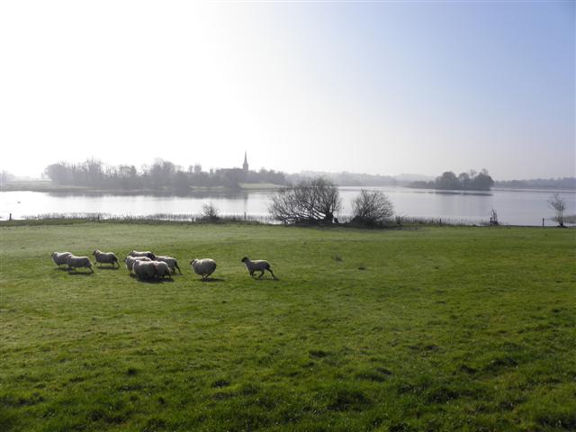
Mullaghlea () is a townland in the civil parish of Templeport, County Cavan, Ireland. It lies in the Roman Catholic parish of Templeport and barony of Tullyhaw. Geography Mullaghlea is bounded on the north by Moherloob and Moherreagh townlands and Finaghoo townland in Swanlinbar parish, on the west by Gortullaghan, Tawnagh and Prospect, Corlough townlands, on the south by Brackley, Templeport townland and on the east by Mullanacre Upper townland in Tomregan parish. Its chief geographical features are Brackley Lough, Polldoo pothole (), sinkholes, forestry plantations, waterfalls, a stream and dug wells. It forms part of the Slieve Rushen Bog Natural Heritage Area. Mullaghlea is traversed by the national secondary N87 road (Ireland), minor roads and rural lanes. The townland covers 529 statute acres. A sub-division of the townland is 'The Baron's Field', named after Baron de Trent who lived in Brackley House in the 1850s. History In medieval times the McGovern barony of Tully ... [...More Info...] [...Related Items...] OR: [Wikipedia] [Google] [Baidu] |
Brackley, Templeport
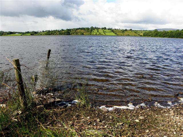
Brackley () is a townland in the civil parish of Templeport, County Cavan, Ireland. It lies in the Roman Catholic parish of Templeport and barony of Tullyhaw. Geography Brackley is bounded on the north by Mullaghlea townland, on the west by Prospect, Corlough parish and Derrymony townlands, on the south by Killyneary, Carrick East and Gortnavreeghan townlands and on the east by Mullanacre Upper townland in Tomregan parish. Its chief geographical features are Slieve Rushen mountain on whose western slope it lies, Brackley Lough, mountain streams, mountain bogs, Brackley Wood, forestry plantations, stone quarries and dug wells. It forms part of the Slieve Rushen Bog Natural Heritage AreAn island in Brackley Lough is called the Baron's Island after a Baron de Trent who lived in Brackley House c.1850 and who built a studio on the island. Brackley is traversed by the regional N87 road (Ireland) and rural lanes. The townland covers 619 statute acres. History In medieval times t ... [...More Info...] [...Related Items...] OR: [Wikipedia] [Google] [Baidu] |
Gortullaghan
Gortullaghan () is a townland in the civil parish of Templeport, County Cavan, Ireland. It lies in the Roman Catholic parish of Templeport and barony of Tullyhaw. Geography Gortullaghan is bounded on the north by Dunglave in Swanlinbar parish and Derrynacreeve townland in Corlough parish, on the west by Tawnagh townland in Corlough parish, on the south by Mullaghlea townland and on the east by Gortmore and Moherloob townlands. Its chief geographical features are a stream, spring wells and dug wells. Gortullaghan is traversed by the national secondary N87 road (Ireland), minor roads and rural lanes. The townland covers 171 statute acres. History In medieval times the McGovern barony of Tullyhaw was divided into economic taxation areas called ballibetoes, from the Irish ''Baile Biataigh'' (Anglicized as 'Ballybetagh'), meaning 'A Provisioner's Town or Settlement'. The original purpose was to enable the farmer, who controlled the baile, to provide hospitality for those who ... [...More Info...] [...Related Items...] OR: [Wikipedia] [Google] [Baidu] |
Templeport
Templeport () is a civil parish in the barony of Tullyhaw, County Cavan, Ireland. The chief towns in the parish are Bawnboy and Ballymagauran. The large Roman Catholic parish of Templeport containing 42,172 statute acres was split up in the 18th & 19th centuries into three new parishes, Templeport, Corlough and Glangevlin. Etymology The name of Templeport parish derives from the old townland of Templeport (which is now shortened to Port) which is the anglicisation of the Gaelic 'Teampall An Phoirt' ("The Church of the Port or Bank or Landing-Place"). The church referred to is the old church on St. Mogue's Island in the middle of Port Lake. This church fell into disuse in medieval times and a new church was built on the opposite shore of the lake. It was forfeited to Queen Elizabeth in 1590 and started use as a Protestant church in about 1610. It is very unlikely that the island church ever served as the parish church because there was only one boat available and it would have ... [...More Info...] [...Related Items...] OR: [Wikipedia] [Google] [Baidu] |
Moherloob
Moherloob () is a small townland in the civil parish of Templeport, County Cavan, Ireland. It is in area and lies in the barony of Tullyhaw. As of the 2011 census, there were no people living in Moherloob. Geography Moherloob is bounded on the north by Gortmore and Moherreagh townlands, on the west by Gortullaghan townland and on the south and east by Mullaghlea townland. Its chief geographical features are a stream, forestry plantations and dug wells. Moherloob is traversed by minor roads and rural lanes. The townland covers 111 statute acres. History In medieval times the McGovern barony of Tullyhaw was divided into economic taxation areas called ballibetoes, from the Irish ''Baile Biataigh'' (Anglicized as 'Ballybetagh'), meaning 'A Provisioner's Town or Settlement'. The original purpose was to enable the farmer, who controlled the baile, to provide hospitality for those who needed it, such as poor people and travellers. The ballybetagh was further divided into townlands f ... [...More Info...] [...Related Items...] OR: [Wikipedia] [Google] [Baidu] |
Moherreagh
Moherreagh () is a townland in the civil parish of Templeport, County Cavan, Ireland. It lies in the Roman Catholic parish of Templeport and barony of Tullyhaw. Geography Moherreagh is bounded on the north by Gub (Kinawley) townland, on the west by Gortmore townland, on the south by Moherloob and Mullaghlea townlands and on the east by Finaghoo townland. Its chief geographical features are 'The Meenymore Formation', in the stream between Finaghoo and Moherreagh townlands, a continuous succession of the highest part of the formation is exposed; forestry plantations; a stream; dug wells and spring wells. Moherreagh is traversed by minor roads and rural lanes. The townland covers 196 statute acres. History In medieval times the McGovern barony of Tullyhaw was divided into economic taxation areas called ballibetoes, from the Irish ''Baile Biataigh'' (Anglicized as 'Ballybetagh'), meaning 'A Provisioner's Town or Settlement'. The original purpose was to enable the farmer, who contr ... [...More Info...] [...Related Items...] OR: [Wikipedia] [Google] [Baidu] |
Finaghoo
Finaghoo (Irish derived place name ''Fionn Achadh'', meaning 'The White Field’) is a townland in the civil parish of Kinawley, barony of Tullyhaw, County Cavan, Ireland. Geography Finaghoo is bounded on the west by Gub (Kinawley) and Moherreagh townlands and on the east by Cullion (Kinawley), Mullaghlea and Mullanacre Upper townlands. It forms part of the Slieve Rushen Bog Natural Heritage Area. Its chief geographical features are Slieve Rushen mountain on whose western slope it lies, reaching a height of 1,238 feet; the Meenymore Formation, in the stream between Finaghoo and Moherreagh townlands a continuous succession of the highest part of the formation is exposed; Polldoo pothole (from Irish: Poll Dubh meaning ‘The Black Hole'). The 1938 Dúchas folklore collection states- ''A noise up in Pullamagulm is a sure sign of lots of rain''; mountain streams; waterfalls; forestry plantations and dug wells. Finaghoo is traversed by minor public roads and rural lanes. The townlan ... [...More Info...] [...Related Items...] OR: [Wikipedia] [Google] [Baidu] |
Mullanacre Upper
Mullanacre Upper is a townland in the Parish of Tomregan, Barony of Tullyhaw, County Cavan, Ireland. Etymology The townland name is an anglicisation of the Gaelic placename "Mullagh an Acre" which means ‘The Acre of the Summit’. In the 17th century it formed part of Carrowmore, County Cavan townland. Geography It is bounded on the north by Legavreagra townland, on the east by Carrowmore, County Cavan townland, on the south by Mullanacre Lower townland and on the west by Clontycarnaghan, Corneen, Gortnavreeghan, Brackley, Templeport, Mullaghlea, Finaghoo, Cullion (Kinawley), Sralahan and Aghakinnigh townlands. Its chief geographical features are Loughan Macmartin mountain lake, Miles’ Lough mountain lake, the Crooked River (Ireland), forestry plantations and Slieve Rushen mountain, on whose southern slope it lies, reaching an altitude of above sea-level. It forms part of the Slieve Rushen Bog Natural Heritage Area. The townland is traversed by minor lanes. The townland ... [...More Info...] [...Related Items...] OR: [Wikipedia] [Google] [Baidu] |
Tawnagh
Tawnagh () is a townland in the civil parish of Templeport, County Cavan, Ireland. It lies in the Roman Catholic parish of Corlough and barony of Tullyhaw. Geography Tawnagh is bounded on the west by Derrynacreeve, Derryvahan and Scrabby, Corlough townlands and on the east by Gortullaghan, Prospect, Corlough and Mullaghlea townlands. Its chief geographical features are small streams, spring wells and dug wells. Tawnagh is traversed by the L5028 public road and rural lanes. The townland covers 150 statute acres. History In medieval times the McGovern barony of Tullyhaw was divided into economic taxation areas called ballibetoes, from the Irish ''Baile Biataigh'' (Anglicized as 'Ballybetagh'), meaning 'A Provisioner's Town or Settlement'. The original purpose was to enable the farmer, who controlled the baile, to provide hospitality for those who needed it, such as poor people and travellers. The ballybetagh was further divided into townlands farmed by individual families who ... [...More Info...] [...Related Items...] OR: [Wikipedia] [Google] [Baidu] |
Prospect, Corlough
Prospect (Modern English name meaning ‘An extensive view of landscape’ because of the fine view it gives over Brackley Lough from Prospect Point at the southern tip of the townland. The old Irish place name was "Renmore or Rinn Mór" meaning the 'Big Promontory or Headland') is a townland in the civil parish of Templeport, County Cavan, Ireland. It lies in the Roman Catholic parish of Corlough and barony of Tullyhaw. Geography Prospect is bounded on the north by Tawnagh townland, on the south by Moneynure and Tirnawannagh townlands, on the west by Derry More and Scrabby, Corlough townlands and on the east by Brackley, Templeport, Mullaghlea and Derrymony townlands. Its chief geographical features are Brackley Lough, small streams, quarries, sinkholes and dug wells. Prospect is traversed by minor public road and rural lanes. The townland covers 227 statute acres. History In medieval times the McGovern barony of Tullyhaw was divided into economic taxation areas calle ... [...More Info...] [...Related Items...] OR: [Wikipedia] [Google] [Baidu] |
Irish Rebellion Of 1641
The Irish Rebellion of 1641 ( ga, Éirí Amach 1641) was an uprising by Irish Catholics in the Kingdom of Ireland, who wanted an end to anti-Catholic discrimination, greater Irish self-governance, and to partially or fully reverse the plantations of Ireland. They also wanted to prevent a possible invasion or takeover by anti-Catholic English Parliamentarians and Scottish Covenanters, who were defying the king, Charles I. It began as an attempted ''coup d'état'' by Catholic gentry and military officers, who tried to seize control of the English administration in Ireland. However, it developed into a widespread rebellion and ethnic conflict with English and Scottish Protestant settlers, leading to Scottish military intervention. The rebels eventually founded the Irish Catholic Confederacy. Led by Felim O'Neill, the rebellion began on 23 October and although they failed to seize Dublin Castle, within days the rebels occupied most of the northern province of Ulster. O'Neill i ... [...More Info...] [...Related Items...] OR: [Wikipedia] [Google] [Baidu] |
Act For The Settlement Of Ireland 1652
The Act for the Setling of Ireland imposed penalties including death and land confiscation against Irish civilians and combatants after the Irish Rebellion of 1641 and subsequent unrest. British historian John Morrill wrote that the Act and associated forced movements represented "perhaps the greatest exercise in ethnic cleansing in early modern Europe." Background The Act was passed on 12 August 1652 by the Rump Parliament of England, which had taken power after the Second English Civil War and had agreed to the Cromwellian conquest of Ireland. The conquest was deemed necessary as Royalist supporters of Charles II of England had allied themselves with the Confederation of Kilkenny (the confederation formed by Irish Catholics during the Irish Confederate Wars) and so were a threat to the newly formed English Commonwealth. The Rump Parliament had a large independent Dissenter membership who strongly empathised with the plight of the settlers of the Ulster Plantation, who ... [...More Info...] [...Related Items...] OR: [Wikipedia] [Google] [Baidu] |
Charles II Of England
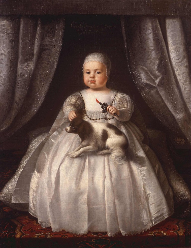
Charles II (29 May 1630 – 6 February 1685) was King of Scotland from 1649 until 1651, and King of England, Scotland and Ireland from the 1660 Restoration of the monarchy until his death in 1685. Charles II was the eldest surviving child of Charles I of England, Scotland and Ireland and Henrietta Maria of France. After Charles I's execution at Whitehall on 30 January 1649, at the climax of the English Civil War, the Parliament of Scotland proclaimed Charles II king on 5 February 1649. But England entered the period known as the English Interregnum or the English Commonwealth, and the country was a de facto republic led by Oliver Cromwell. Cromwell defeated Charles II at the Battle of Worcester on 3 September 1651, and Charles fled to mainland Europe. Cromwell became virtual dictator of England, Scotland and Ireland. Charles spent the next nine years in exile in France, the Dutch Republic and the Spanish Netherlands. The political crisis that followed Cromwell's death in 1 ... [...More Info...] [...Related Items...] OR: [Wikipedia] [Google] [Baidu] |

.jpg)


