|
Mulanthuruthy
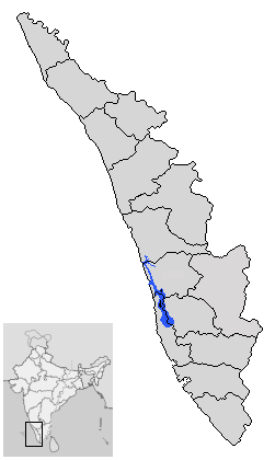
Mulanthuruthy, also spelt Mulamthuruthy, is a south-eastern suburb of the city of Kochi in Kerala, India. The historic Marthoman church is located here. Chottanikkara Temple is situated nearby Mulanthuruthy. Location It is about 15 km south-east of Kochi city centre and around 8 km east of Tripunithura. By road, Mulanthuruthy is accessible from Kanjiramattom (5 km) and from Piravom (13 km), Tripunithura and Ernakulam. Mulanthuruthy is situated on the banks of the Cochin Backwaters part of the Vembanad Lake. A minor distributary of the Muvattupuzha River passes through Mulanthuruthy. Mulanthuruthy Railway Station is the local railhead. Cochin International Airport is the nearest airport. Demographics India census A census is the procedure of systematically acquiring, recording and calculating information about the members of a given population. This term is used mostly in connection with national population and housing censuses; other common cen ... [...More Info...] [...Related Items...] OR: [Wikipedia] [Google] [Baidu] |
Mulanthuruthy Marthoman Church
The Mulanthuruthy Marthoman Orthodox Syrian Cathedral is located at Mulanthuruthy in Ernakulam district in Kerala, India. This Church was founded and established in the 11th Century A.D,the Church was consecrated on 3rd Karkkidakkam (July),in between 1100-1125 A.D. The Church was modified in the 16th Century A.D. The carvings on the main door of the Church, made of granite, on which is inscribed in Syrian script, read as ʹʹthe door of the Mar Thoman Church was re-erected on 9th Thulam 1575 A.D.ʹʹ It is one of the ancient Churches in Kerala. The church is a fine example of Gothic architecture. The carvings, sculptures, symbolic icons and lovely wall paintings, are a blend of Indian, West-Asian and European architecture. The altar of the Church with wooden carvings and paintings of unique design, are reminiscent of the Church at Jerusalem. There is a massive sculptural covering on the eastern side of the main altar, with carvings of faces of cherubins and representations of the ... [...More Info...] [...Related Items...] OR: [Wikipedia] [Google] [Baidu] |
Ernakulam District
Ernakulam, ; ISO: ''Eṟaṇākuḷaṁ'', in Malayalam: എറണാകുളം), is one of the 14 districts in the Indian state of Kerala, that takes its name from the eponymous city division in Kochi. It is situated in the central part of the state, spans an area of about , and is home to over 9% of Kerala's population. Its headquarters are located at Kakkanad. The district includes Kochi, also known as the commercial capital of Kerala, which is famous for its ancient Churches, Hindu temples, synagogues and mosques. The district includes the largest metropolitan region of the state: Greater Cochin. Ernakulam is the district that yields the most revenue and the largest number of industries in the state. Ernakulam is the third most populous district in Kerala, after Malappuram and Thiruvananthapuram (out of 14 districts). The district also hosts the highest number of international and domestic tourists in Kerala state. The most commonly spoken language in Ernakulam is ... [...More Info...] [...Related Items...] OR: [Wikipedia] [Google] [Baidu] |
Piravom
Piravom is a municipality in Ernakulam district and a suburb of Kochi in the Indian state of Kerala. It is located with in 31 km southeast of Kochi city center, at the boundary of the Ernakulam and Kottayam districts. Piravom is famous for its Hindu temples and Christian churches. Piravom has a river-front, verdant hills, and paddy fields. History Piravom was owned by the Vadakkumkoor Kingdom until it was captured by Travancore kingdom, and is now part of the Indian state of Kerala. Piravom was reverted to panchayat status in 1992 after two years as a municipality because of skepticism that its classification as a municipality would attract higher tax rates and building regulation. However, as modern municipal councils now have the authority to fix the tax rate and new building rule provisions are now applicable to special grade panchayats, the economic incentive for Piravom remaining a panchayat has disappeared. The local government of Piravom passed a unanimous resolut ... [...More Info...] [...Related Items...] OR: [Wikipedia] [Google] [Baidu] |
Tripunithura
Thrippunithura or Tripunithura (), is a prominent historical and residential region in the City of Kochi in Kerala, India. Located about 7 km (4 mi) from the city centre, Tripunithura was the capital of the erstwhile Kingdom of Cochin. The descendants of the Cochin royal family still live in the palaces here. The Hill Palace situated in Tripunithura was the palace of Maharaja of Cochin, the ruler of Kingdom of Cochin. Tripunithura is also well known for its historical cultures and worldwide famous because of Sree Poornathrayeesa Temple and the annual festival ''Vrishchikoltsawam'' that takes place at the temple. In local administration, it is a municipality named Tripunithura Municipality. In the state administrative structure, Tripunithura is part of the Ernakulam District in the state of Kerala. Etymology Some latter day Sanskrit enthusiasts describe the origin of the name to "pūrṇa vēda puri" — the town of Vedas in its entirety. Another possible o ... [...More Info...] [...Related Items...] OR: [Wikipedia] [Google] [Baidu] |
Chottanikkara Temple
The Chottanikkara (correction of ''Jyotiannakkara'') Devi Temple is a temple dedicated to the Hindu mother goddess Bhagavati, also seen as a form of Mahalakshmi.She is believed to be residing in Chottanikkara along with her husband Maha Vishnu. The temple is located at Chottanikkara, a southern suburb of the city of Kochi in Ernakulam district, in the state of Kerala, India and is one of the most popular temples in the state. The temple is also known for conducting exorcism. In terms of temple architecture, the Chottanikkara temple stands out to be an ultimate testimonial to the ancient vishwakarma sthapathis (wooden sculpture) along with Sabarimala temple. Sree Mahamaya Bhagavati (Adi Parashakti), the goddess of Saraswathi, Lakshmi, and Parvati is one of the most popular deities in Kerala and the supreme mother goddess in Hinduism. Chottanikkara Devi (Melekavu Bhagavathi) is worshipped at the temple, in three different forms: as Mahasaraswati in the morning, draped in white; ... [...More Info...] [...Related Items...] OR: [Wikipedia] [Google] [Baidu] |
CIAL
Cochin International Airport is an International airport serving the city of Kochi, in the state of Kerala, India. Located at Nedumbassery, about northeast of the city centre, Cochin International Airport is first of its kind which is developed under a public-private partnership (PPP) model in India. This project was funded by nearly 10,000 non-resident Indians from 32 countries. It is the busiest and largest airport in the state of Kerala and 4th biggest airport in South India. , the Cochin International Airport caters to 61.8% of the total air passenger movement in Kerala. It is the third busiest airport in India in terms of international traffic and also ninth busiest overall. In fiscal year 2018–19, the airport handled more than 10.2 million passengers with a total of 71,871 aircraft movements. The airport operates three passenger terminals and one cargo terminal with a total area of over . In 2015, Cochin International Airport became the world's first fully sol ... [...More Info...] [...Related Items...] OR: [Wikipedia] [Google] [Baidu] |
Muvattupuzha
Muvattupuzha () is a town in the midlands directly to the east of Kochi in Ernakulam district, Kerala, India. It is located about from downtown Kochi, and is a growing urban centre in central Kerala. The town is also the starting point of the Muvattupuzhayar (Muvattupuzha river), which is a confluence formed by three rivers: the Thodupuzhayar, Kaliyar, and Kothayar. Muvattupuzha is bordered by the Kottayam district on the southern side and the Idukki district on the eastern side. Muvattupuzha lies on the intersection between MC Road and National Highway 49, about from the district capital Ernakulam. Muvattupuzha is located from Thodupuzha, from Koothattukulam, and away from Arakuzha. It is the second biggest commercial center of the district and one of the biggest in the central part of the state. There are two major malls: Canton Mall & Grand Central Mall. Etymology The town is named after the Muvattupuzha river that flows through it. The name is made up of ... [...More Info...] [...Related Items...] OR: [Wikipedia] [Google] [Baidu] |
Vembanad Lake
Vembanad is the longest lake in India, as well as the largest lake in the state of Kerala. The lake has an area of 230 square kilometers and a maximum length of 96.5 km. Spanning several districts in the state of Kerala, it is known as Vembanadu Lake in Kottayam, Vaikom, Changanassery, Punnamada Lake in Alappuzha, Punnappra, Kuttanadu and Kochi Lake in Kochi. Several groups of small islands including Vypin, Mulavukad, Maradu, Udayamperoor, Vallarpadam, Willingdon Island are located in the Kochi Lake portion. Kochi Port is built around the Willingdon Island and the Vallarpadam island. Kuttanad, also known as ''The Rice Bowl of Kerala'', has the lowest altitude in India, and is also one of the few places in world where cultivation takes place below sea level. Kuttanad lies on the southern portion of Vembanad. The Nehru Trophy Boat Race is conducted in a portion of the lake. High levels of pollution have been noticed at certain hotspots of the Vembanad backwat ... [...More Info...] [...Related Items...] OR: [Wikipedia] [Google] [Baidu] |
Kerala Backwaters
The Kerala backwaters are a network of brackish lagoons and canals lying parallel to the Arabian Sea of the Malabar coast of Kerala state in south-western India. It also includes interconnected lakes, rivers, and inlets, a labyrinthine system formed by more than of waterways, and sometimes compared to bayous. The network includes five large lakes linked by canals, both man made and natural, fed by 38 rivers, and extending virtually half the length of Kerala state. The backwaters were formed by the action of waves and shore currents creating low barrier islands across the mouths of the many rivers flowing down from the Western Ghats range. In the midst of this landscape there are a number of towns and cities, which serve as the starting and end points of backwater cruises. There are 34 backwaters in Kerala. Out of it, 27 are located either closer to Arabian Sea or parallel to the sea. The remaining 7 are inland navigation routes. The backwaters have a unique ecosystem: freshw ... [...More Info...] [...Related Items...] OR: [Wikipedia] [Google] [Baidu] |
Kanjiramattom
Kanjiramattom in Ernakulam District, Kerala, India is a suburban area of the City of Kochi lying approximately 25 km southeast to the City of Kochi. The place is known for the Sheikh Fariddudin Mosque and its proximity to the famous Arayankavu Temple. The Mosque is famous for Kodikuthu which is celebrated on 13-14 January every year. It is one of the most important religious festivals of Kerala and is very colorfulArayankavu Templehosts the famous festival consisting of Garudan Thookkam. Pooram is the most famous celebration. Kanjiramattom Kodikuthu The annual festival of Kanjiramattom Kodikuthu is held at the Kanjiramattom Mosque, built as a memorial to Sheikh Fariduddin. The Chandanakkudam (Sandalwood Pot) ritual is the main event of the Kanjiramattom Kodikuthu and is conducted at night, when the pilgrims carry Pots covered with Sandalwood paste and proceed in a procession to the Mosque. The six caparisoned and ornamented elephants and folk performances add color to t ... [...More Info...] [...Related Items...] OR: [Wikipedia] [Google] [Baidu] |
States And Territories Of India
India is a federal union comprising 28 states and 8 union territories, with a total of 36 entities. The states and union territories are further subdivided into districts and smaller administrative divisions. History Pre-independence The Indian subcontinent has been ruled by many different ethnic groups throughout its history, each instituting their own policies of administrative division in the region. The British Raj The British Raj (; from Hindi language, Hindi ''rāj'': kingdom, realm, state, or empire) was the rule of the British The Crown, Crown on the Indian subcontinent; * * it is also called Crown rule in India, * * * * or Direct rule in India, * Q ... mostly retained the administrative structure of the preceding Mughal Empire. India was divided into provinces (also called Presidencies), directly governed by the British, and princely states, which were nominally controlled by a local prince or raja loyal to the British Empire, which held ''de f ... [...More Info...] [...Related Items...] OR: [Wikipedia] [Google] [Baidu] |
Kerala
Kerala ( ; ) is a state on the Malabar Coast of India. It was formed on 1 November 1956, following the passage of the States Reorganisation Act, by combining Malayalam-speaking regions of the erstwhile regions of Cochin, Malabar, South Canara, and Thiruvithamkoor. Spread over , Kerala is the 21st largest Indian state by area. It is bordered by Karnataka to the north and northeast, Tamil Nadu to the east and south, and the Lakshadweep Sea to the west. With 33 million inhabitants as per the 2011 census, Kerala is the 13th-largest Indian state by population. It is divided into 14 districts with the capital being Thiruvananthapuram. Malayalam is the most widely spoken language and is also the official language of the state. The Chera dynasty was the first prominent kingdom based in Kerala. The Ay kingdom in the deep south and the Ezhimala kingdom in the north formed the other kingdoms in the early years of the Common Era (CE). The region had been a prominent spice exp ... [...More Info...] [...Related Items...] OR: [Wikipedia] [Google] [Baidu] |


