|
Mugu Lagoon
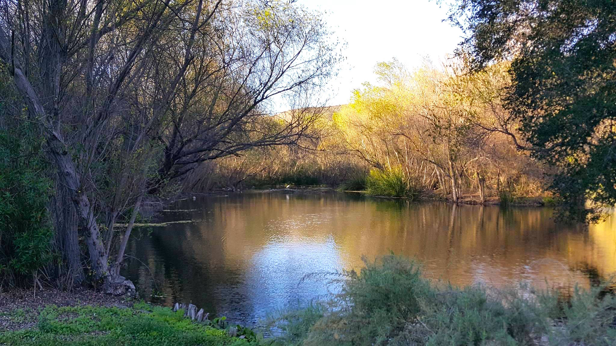
Mugu Lagoon (; Chumash: ''Muwu'', meaning "Beach") is a salt marsh located within the Naval Base Ventura County at the foot of the Santa Monica Mountains in Ventura County, California. The lagoon extends for 4.3 miles parallel to a narrow barrier beach. The first European to come ashore here was Juan Rodríguez Cabrillo on October 10, 1542. Cabrillo was the first European to visit present-day California, and he named it ''Muwu'', which is Chumash meaning "beach" or "seashore". When the Europeans first discovered the lagoon, it functioned as the capital village of the Chumash Indians settled around Point Mugu. Geography The Calleguas Creek, and its tributaries such as Arroyo Conejo and Arroyo Simi, discharges into the Pacific Ocean at its estuary in Mugu Lagoon. Historically, Calleguas Creek flood flows spread across the floodplain and the deposited sediment created the rich agricultural lands of the Oxnard Plain The Oxnard Plain is a large coastal plain in southwest Ventura Co ... [...More Info...] [...Related Items...] OR: [Wikipedia] [Google] [Baidu] |
Mugu Lagoon From The Mugu Peak Trail
{{disambiguation ...
Mugu may refer to: * Mugu District, one of the seventy-seven districts of Nepal * Point Mugu, California ** Point Mugu State Park ** Naval Air Station Point Mugu * A nickname for Spanish-Venezuelan professional tennis player Garbiñe Muguruza Garbiñe Muguruza Blanco (; born 8 October 1993) is a Spanish-Venezuelan professional tennis player. She has a career-high singles ranking of world No. 1 by the Women's Tennis Association (WTA), and a career-high doubles ranking of world No. ... [...More Info...] [...Related Items...] OR: [Wikipedia] [Google] [Baidu] |
Point Mugu
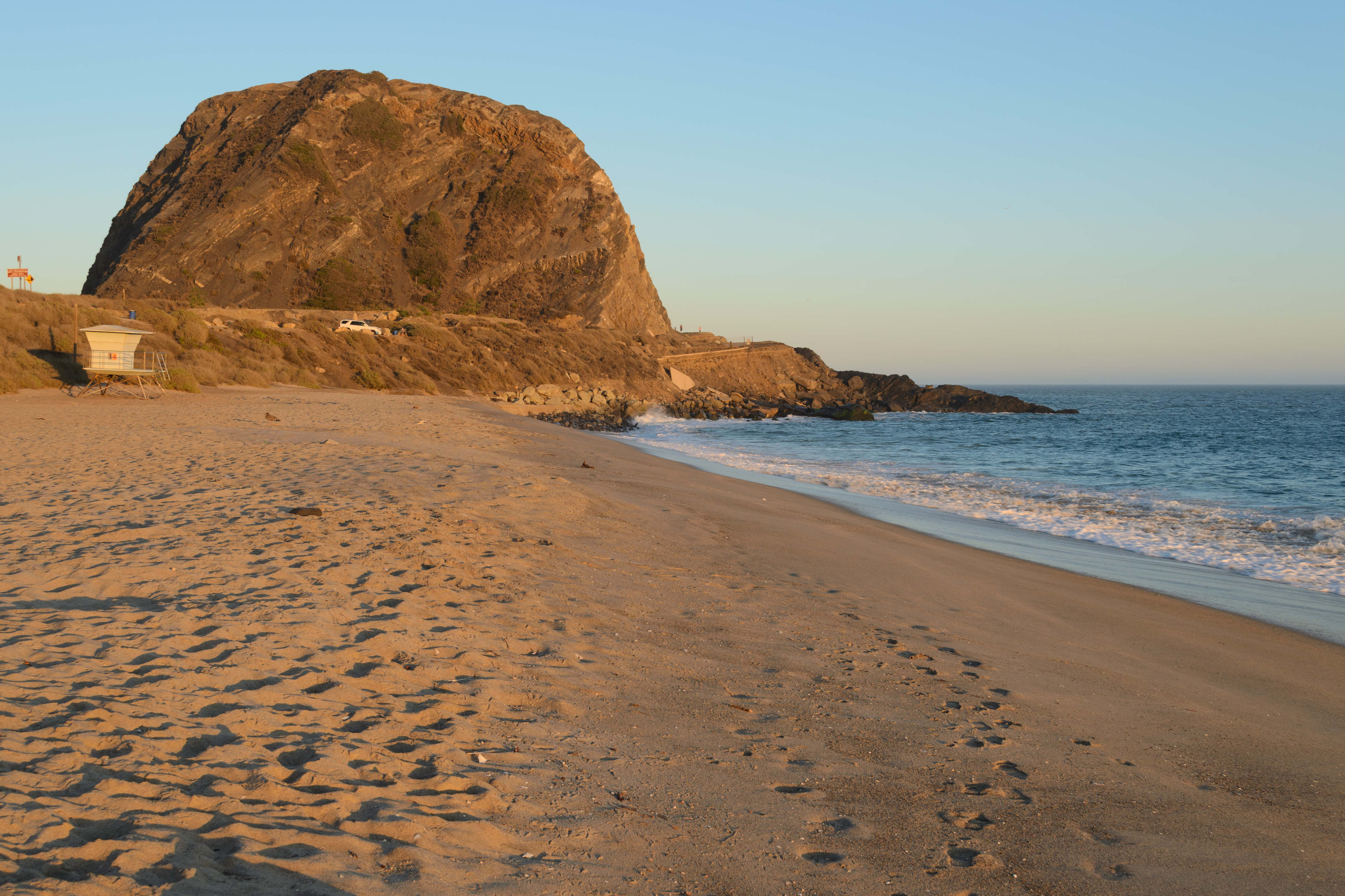
Point Mugu (, Chumash: ''Muwu'') is a cape or promontory within Point Mugu State Park on the Pacific Coast in Ventura County, near the city of Port Hueneme and the city of Oxnard. The name is believed to be derived from the Chumash Indian term "Muwu", meaning "beach", which was first mentioned by Cabrillo in his journals in 1542. Mugu Lagoon is a salt marsh just upcoast from the promontory within the Naval Base Ventura County formerly called the Naval Air Station Point Mugu. History The name derives from Muwu ( Ventureño: "Beach"), which was the name of a Chumash village at Point Mugu during pre-colonial times. The village of Muwu (CA-VEN-11) had the highest population of any coastal Chumash settlements along the Santa Monica Mountains. Muwu was a ceremonial center and the ancient capital of Lulapin, a major political unit of Chumash territory which stretched from modern day Los Angeles County to Santa Barbara in the north. The territory stretched for along the coast, and at ... [...More Info...] [...Related Items...] OR: [Wikipedia] [Google] [Baidu] |
Bodies Of Water Of Ventura County, California
Bodies may refer to: * The plural of body * ''Bodies'' (2004 TV series), BBC television programme * Bodies (upcoming TV series), an upcoming British crime thriller limited series * "Bodies" (''Law & Order''), 2003 episode of ''Law & Order'' * Bodies: The Exhibition, exhibit showcasing dissected human bodies in cities across the globe * ''Bodies'' (novel), 2002 novel by Jed Mercurio * ''Bodies'', 1977 play by James Saunders (playwright) * ''Bodies'', 2009 book by British psychoanalyst Susie Orbach Music * ''Bodies'' (album), a 2021 album by AFI * ''Bodies'' (EP), a 2014 EP by Celia Pavey * "Bodies" (Drowning Pool song), 2001 hard rock song by Drowning Pool * "Bodies" (Sex Pistols song), 1977 punk rock song by the Sex Pistols * "Bodies" (Little Birdy song), 2007 indie rock song by Little Birdy * "Bodies" (Robbie Williams song), 2009 pop song by Robbie Williams * "Bodies", a song by Megadeth from ''Endgame'' * "Bodies", a song by The Smashing Pumpkins from ''Mellon Collie an ... [...More Info...] [...Related Items...] OR: [Wikipedia] [Google] [Baidu] |
Estuaries Of California
An estuary is a partially enclosed coastal body of brackish water with one or more rivers or streams flowing into it, and with a free connection to the open sea. Estuaries form a transition zone between river environments and maritime environments and are an example of an ecotone. Estuaries are subject both to marine influences such as tides, waves, and the influx of saline water, and to fluvial influences such as flows of freshwater and sediment. The mixing of seawater and freshwater provides high levels of nutrients both in the water column and in sediment, making estuaries among the most productive natural habitats in the world. Most existing estuaries formed during the Holocene epoch with the flooding of river-eroded or glacially scoured valleys when the sea level began to rise about 10,000–12,000 years ago. Estuaries are typically classified according to their geomorphological features or to water-circulation patterns. They can have many different names, such as bays, ... [...More Info...] [...Related Items...] OR: [Wikipedia] [Google] [Baidu] |
Lagoons Of California
A lagoon is a shallow body of water separated from a larger body of water by a narrow landform, such as reefs, barrier islands, barrier peninsulas, or isthmuses. Lagoons are commonly divided into ''coastal lagoons'' (or ''barrier lagoons'') and ''atoll lagoons''. They have also been identified as occurring on mixed-sand and gravel coastlines. There is an overlap between bodies of water classified as coastal lagoons and bodies of water classified as estuaries. Lagoons are common coastal features around many parts of the world. Definition and terminology Lagoons are shallow, often elongated bodies of water separated from a larger body of water by a shallow or exposed shoal, coral reef, or similar feature. Some authorities include fresh water bodies in the definition of "lagoon", while others explicitly restrict "lagoon" to bodies of water with some degree of salinity. The distinction between "lagoon" and "estuary" also varies between authorities. Richard A. Davis Jr. restrict ... [...More Info...] [...Related Items...] OR: [Wikipedia] [Google] [Baidu] |
County Of Ventura
Ventura County () is a county in the southern part of the U.S. state of California. As of the 2020 census, the population was 843,843. The largest city is Oxnard, and the county seat is the city of Ventura. Ventura County comprises the Oxnard–Thousand Oaks–Ventura, CA Metropolitan Statistical Area, which is part of the Greater Los Angeles area (Los Angeles-Long Beach, CA Combined Statistical Area). It is also considered the southernmost county along the California Central Coast. Two of the Channel Islands are part of the county: Anacapa Island, which is the most visited island in Channel Islands National Park, and San Nicolas Island. History Pre-colonial period Ventura County was historically inhabited by the Chumash people, who also settled much of Santa Barbara and San Luis Obispo Counties, with their presence dating back 10,000–12,000 years. The Chumash were hunter-gatherers, fishermen, and also traders with the Mojave, Yokuts, and Tongva Indians. The Chumash are ... [...More Info...] [...Related Items...] OR: [Wikipedia] [Google] [Baidu] |
Oxnard Plain
The Oxnard Plain is a large coastal plain in southwest Ventura County, California, United States surrounded by the mountains of the Transverse ranges. The cities of Oxnard, Camarillo, Port Hueneme and much of Ventura as well as the unincorporated communities of Hollywood Beach, El Rio, Saticoy, Silver Strand Beach, and Somis lie within the over . The population within the plain comprises a majority of the western half of the Oxnard-Thousand Oaks-Ventura Metro Area and includes the largest city along the Central Coast of California. The is among the longest stretches of continuous, linear beaches in the state. The high quality soils, adequate water supply, favorable climate, long growing season, and level topography are characteristic of the Oxnard Plain where the top cash crops are strawberries, raspberries, nursery stock and celery. Ventura County is one of the principal agricultural counties in the state and it is a significant component of the economy with a total ann ... [...More Info...] [...Related Items...] OR: [Wikipedia] [Google] [Baidu] |
Los Angeles Times
The ''Los Angeles Times'' (abbreviated as ''LA Times'') is a daily newspaper that started publishing in Los Angeles in 1881. Based in the LA-adjacent suburb of El Segundo since 2018, it is the sixth-largest newspaper by circulation in the United States. The publication has won more than 40 Pulitzer Prizes. It is owned by Patrick Soon-Shiong and published by the Times Mirror Company. The newspaper’s coverage emphasizes California and especially Southern California stories. In the 19th century, the paper developed a reputation for civic boosterism and opposition to labor unions, the latter of which led to the bombing of its headquarters in 1910. The paper's profile grew substantially in the 1960s under publisher Otis Chandler, who adopted a more national focus. In recent decades the paper's readership has declined, and it has been beset by a series of ownership changes, staff reductions, and other controversies. In January 2018, the paper's staff voted to unionize and final ... [...More Info...] [...Related Items...] OR: [Wikipedia] [Google] [Baidu] |
Arroyo Simi
The Arroyo Simi (Spanish language, Spanish for "Small Stream of Simi", sometimes also referred to as Simi Creek)Appleton, Bill (2009). ''Santa Susana''. Arcadia Publishing. Page 27. . is a westwards-running Arroyo (creek), creek, located in California, United States, running from the city of Simi Valley, California, Simi Valley and crosses the Simi Valley, valley from east to west, before entering the city of Moorpark, California, Moorpark. It originates at Corriganville Movie Ranch, Corriganville Park by the Santa Susana Pass, and streams westwards into Moorpark where it merges with Arroyo Las Posas by Hitch Road. It extends for through the Simi Valley, and leaves the city limits by Oak Park, Simi Valley, Oak Park at the western end Simi Valley, and continues for seven miles in Moorpark. It is a tributary to the Calleguas Creek, which enters the Pacific Ocean by its estuary at Mugu Lagoon by Naval Air Station Point Mugu. Besides an Arroyo (creek), arroyo, it has been described as ... [...More Info...] [...Related Items...] OR: [Wikipedia] [Google] [Baidu] |
Arroyo Conejo
Arroyo Conejo (Spanish for “Rabbit Creek”) is the longest creek in the Conejo Valley, sprawling over the cities of Thousand Oaks and Camarillo, and the communities of Newbury Park, Casa Conejo and Santa Rosa Valley. Arroyo Conejo is the primary drainage for the City of Thousand Oaks. Its watershed covers of which are in the Conejo Valley and in the Santa Rosa Valley. It is an ancient creek, which, historically, was a seasonal-running creek. The arroyo is today perennial due to urban runoff from irrigation. Its north fork carved Wildwood Canyon out of bedrock over several millennia. Paradise Falls in Wildwood Regional Park has been described as perhaps the "most visual representation" of the arroyo today. The south fork originates in the Conejo Hills above Newbury Park. It also follows Thousand Oaks Boulevard, where it runs directly along and below the boulevard. In certain areas, the creek runs through concrete culverts and runs underneath the street. Past Newbury Park ... [...More Info...] [...Related Items...] OR: [Wikipedia] [Google] [Baidu] |
Calleguas Creek
Calleguas Creek (; Chumash: ''Kayïwïsh'', meaning "the head") is the terminus of a river system in Ventura County, California. It drains the Calleguas Creek Watershed, an area 30 miles long and 14 miles wide (343 square miles), which includes Simi Valley, Moorpark, Camarillo and a large portion of Thousand Oaks. Tributaries include Arroyo Simi, Arroyo Santa Rosa, Revolon Slough and Arroyo Conejo. It discharges into the Pacific Ocean, the Santa Barbara Channel, at Mugu Lagoon on Naval Base Ventura County, just north of Point Mugu, where the Santa Monica Mountains meet the ocean, marking the southern/eastern boundary of the Oxnard Plain The Oxnard Plain is a large coastal plain in southwest Ventura County, California, United States surrounded by the mountains of the Transverse ranges. The cities of Oxnard, Camarillo, Port Hueneme and much of Ventura as well as the unincorpora .... In 2009, Calleguas Creek was named the most polluted body of water in the jurisdiction of the ... [...More Info...] [...Related Items...] OR: [Wikipedia] [Google] [Baidu] |
Chumash Indians
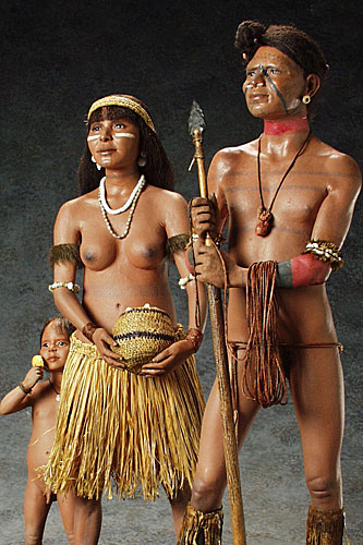
The Chumash are a Native American people of the central and southern coastal regions of California, in portions of what is now San Luis Obispo, Santa Barbara, Ventura and Los Angeles counties, extending from Morro Bay in the north to Malibu in the south. Their territory included three of the Channel Islands: Santa Cruz, Santa Rosa, and San Miguel; the smaller island of Anacapa was likely inhabited seasonally due to the lack of a consistent water source. Modern place names with Chumash origins include Malibu, Nipomo, Lompoc, Ojai, Pismo Beach, Point Mugu, Port Hueneme, Piru, Lake Castaic, Saticoy, Simi Valley and Somis. Archaeological research demonstrates that the Chumash people have deep roots in the Santa Barbara Channel area and lived along the southern California coast for millennia. History Prior to European contact (pre-1542) Indigenous peoples have lived along the California coast for at least 11,000 years. Sites of the Millingstone Horizon date from 7000 ... [...More Info...] [...Related Items...] OR: [Wikipedia] [Google] [Baidu] |


.jpg)


