|
Mountain View Corridor
The Mountain View Corridor is a freeway under construction in northern Utah that will run along the western periphery of Salt Lake County and south into northwest Utah County. Except for the last several miles on its southern end the Mountain View Corridor is numerically designated as State Route 85 (SR-85) in the Utah state highway system. The entire Mountain View Corridor will be maintained by the Utah Department of Transportation (UDOT). Route description Mountain View Corridor is an arterial road with a distance of one to two miles parallel on the west to Bangerter Highway (SR-154), built to meet the demand of the growing cities in Salt Lake County. It starts at SR-73 in Saratoga Springs and runs north to a junction with a spur of the roadway that runs east to Interstate 15 in Lehi. The spur, designated as 2100 North, also carries the SR-85 designation. From the junction at 2100 North, the Mountain View Corridor will continue north through Camp Williams into Salt Lake Cou ... [...More Info...] [...Related Items...] OR: [Wikipedia] [Google] [Baidu] |
Saratoga Springs, Utah
Saratoga Springs is a city in Utah County, Utah, United States. The elevation is 4,505 feet. It is part of the Provo–Orem, Utah Metropolitan Statistical Area. The city is a relatively new development along the northwestern shores of Utah Lake. It was incorporated on December 31, 1997 and has been growing rapidly since then. The population was 37,696 at the 2020 Census. Saratoga Springs became a city in 2001. Geography According to the United States Census Bureau, the city has a total area of 16.61 square miles (26.8 km2), of which 16.51 square miles (26.4 km2) is land and 0.1 square mile (0.3 km2) (1.26%) is water. (This water is mostly Utah lake.) History The natural hot springs near the source of the Jordan River inspired early European-American settlers to create a resort known as Beck's Saratoga Springs, named after the original New York resort and owner John Beck. The Beck family opened their resort in 1884 and used it as their reside ... [...More Info...] [...Related Items...] OR: [Wikipedia] [Google] [Baidu] |
Bluffdale, Utah
Bluffdale is a city in Salt Lake and Utah counties in the U.S. state of Utah, located about south of Salt Lake City. As of the 2020 census, the city population was 17,014. From 2011 to 2013, the National Security Agency's (NSA) data storage center, the Utah Data Center, was constructed at Camp Williams in Bluffdale. It is approximately 1 million square feet in size. History Bluffdale, named for its geography of bluffs and dales, was first settled in 1848–1849, when the area was originally part of West Jordan. On July 29, 1858, Orrin Porter Rockwell paid five- hundred dollars to Evan M. Green for sixteen acres of land near the Crystal Hot Lakes (adjacent to the present Utah State Prison). This land included Hot Springs Hotel and Brewery with dining facilities, a stable brewery, and a pony express station. As the community expanded, the Bluffdale area became part of South Jordan, then Riverton. In 1883 the Bluffdale School Precinct was formed from parts of Herriman, South J ... [...More Info...] [...Related Items...] OR: [Wikipedia] [Google] [Baidu] |
Utah State Route 68
State Route 68 (SR-68) is a state highway in the U.S. state of Utah. It is a major thoroughfare throughout the Wasatch Front as it runs north–south for , linking US-6 near Elberta to US-89 in Woods Cross. The route intersects several major freeways and highways in the Salt Lake City metropolitan area including I-215, I-80, and I-15. The route is more commonly referred to as Redwood Road, after the street it is routed along throughout Salt Lake County. The highway is also routed for a short distance along 500 South and 200 West in Bountiful and Camp Williams Road in Utah County. The route is a surface street for its entire length. SR-68 became a state highway in 1931, at which time the route ran from then–US-40 (North Temple Street) in Salt Lake City to present-day US-89 in Lehi. In 1933, the route was extended north to US-89 at Beck's Hot Springs. SR-68 was routed onto Redwood Road in 1943, taking over what had been designated SR-153. In 1960, SR-68 switched ... [...More Info...] [...Related Items...] OR: [Wikipedia] [Google] [Baidu] |
Santaquin, Utah
Santaquin ( ) is a city in Utah and Juab counties in the U.S. state of Utah. It is part of the Provo–Orem metropolitan area. The population was 13,725 at the 2020 census. Geography Santaquin lies southeast of Utah Lake in southern Utah County, with a small portion extending south into Juab County. It is bordered to the northwest by Genola and to the north by unincorporated Spring Lake. Interstate 15 passes through the city, with access from Exits 242 and 244. I-15 leads north to Provo and south to Nephi. U.S. Route 6 passes through Santaquin as Main Street and leads west to Silver City. Utah State Route 198 leads north from I-15 to Payson. According to the United States Census Bureau, Santaquin has a total area of , of which , or 0.01%, are water. Climate This climatic region is typified by large seasonal temperature differences, with hot summers and cold (sometimes severely cold) winters. According to the Köppen Climate Classification system, Santaquin has a humi ... [...More Info...] [...Related Items...] OR: [Wikipedia] [Google] [Baidu] |
Frontage Road
A frontage road (also known as an access road, outer road, service road, feeder road, or parallel road) is a local road running parallel to a higher-speed, limited-access road. A frontage road is often used to provide access to private driveways, shops, houses, industries or farms. Where parallel high-speed roads are provided as part of a major highway, these are also known as local-express lanes. A frontage lane is a paved path that is used for the transportation and travel from one street to another. Frontage lanes, closely related to a frontage road, are common in metropolitan areas and in small rural towns. Frontage lanes are technically not classified as roads due to their purpose as a bridge from one road to another, and due to the architectural standards that they are not as wide as a standard road, or used as commonly as a standard road, street, or avenue. Overview Frontage roads provide access to homes and businesses which would otherwise be cut off by a limited ... [...More Info...] [...Related Items...] OR: [Wikipedia] [Google] [Baidu] |
High-occupancy Toll
A high-occupancy toll lane (or HOT lane) is a type of traffic lane or roadway that is available to high-occupancy vehicles and other exempt vehicles without charge; other vehicles are required to pay a variable fee that is adjusted in response to demand. Unlike toll roads, drivers have an option to use general purpose lanes, on which a fee is not charged. Express toll lanes, which are less common, operate along similar lines, but do not exempt high-occupancy vehicles. History The HOT concept developed from high-occupancy vehicle lane (HOV) systems in order to increase use of the available capacity, as it was found that HOV lanes were underutilized compared to general purpose lanes. Most implementations are currently in the United States. The first practical implementation was California's formerly private toll 91 Express Lanes, in Orange County, California, in 1995, followed in 1996 by Interstate 15 in northern San Diego. According to the Texas A&M Transportation Institute, th ... [...More Info...] [...Related Items...] OR: [Wikipedia] [Google] [Baidu] |
Salt Lake City International Airport
Salt Lake City International Airport is a civil-military airport located about west of Downtown Salt Lake City, Utah, in the United States. The airport is the closest commercial airport for more than 2.5 million people and is within a 30-minute drive of nearly 1.3 million jobs. The airport serves as a hub for Delta Air Lines and is a major gateway to the Intermountain West and West Coast. The airport sees 343 scheduled nonstop airline departures per day to 93 cities in North America and Europe. Salt Lake City International Airport continues to rank high for on-time departures/arrivals and fewest flight cancellations among major US airports. The airport ranked first for on time departures and arrivals and first for percentage of cancellations as of April 2017. The airport is owned by the City of Salt Lake and is administered by the Salt Lake City Department of Airports. History 1900 to 1940 In 1911, a site for an air field was chosen on Basque Flats, named for Spanish-French ... [...More Info...] [...Related Items...] OR: [Wikipedia] [Google] [Baidu] |
Interstate 80 In Utah
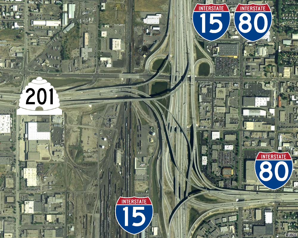
Interstate 80 (I-80) is a part of the Interstate Highway System that runs from San Francisco, California, to Teaneck, New Jersey. The portion of the highway in the US state of Utah is long through the northern part of the state. From west to east, I-80 crosses the state line from Nevada in Tooele County and traverses the Bonneville Salt Flats—which are a part of the larger Great Salt Lake Desert. It continues alongside the Wendover Cut-off—the corridor of the former Victory Highway— US Route 40 (US-40) and the Western Pacific Railroad Feather River Route. After passing the Oquirrh Mountains, I-80 enters the Salt Lake Valley and Salt Lake County. A short portion of the freeway is concurrent with I-15 through Downtown Salt Lake City. At the Spaghetti Bowl, I-80 turns east again into the mouth of Parleys Canyon and Summit County, travels through the mountain range, and intersects the eastern end of I-84 near Echo Reservoir before turning northeast toward the Wyo ... [...More Info...] [...Related Items...] OR: [Wikipedia] [Google] [Baidu] |
Utah State Route 201
State Route 201 (SR-201) is an east–west expressway and freeway located in Salt Lake County in the U.S. state of Utah. Colloquially known by some as the ''21st South Freeway'', the route serves as an alternative to Interstate 80 (I-80) through Salt Lake City. From the western terminus of the route west of Magna, the highway heads east through Kennecott Copper property as an expressway before running through the western suburbs of Salt Lake City as a freeway. Shortly after the route returns on a surface route, SR-201 terminates on its eastern end at State Street (U.S. Route 89). The history of the route predates the invention of the automobile; the Donner Party, California Trail and Pony Express all followed the present-day path of the highway. During the 1910s, the route was designated a state highway and, in 1939, State Route 201 was officially written into law, running from Magna east to the mouth of Parley's Canyon. At one point, the highway carried US-50 Alternate w ... [...More Info...] [...Related Items...] OR: [Wikipedia] [Google] [Baidu] |
Utah State Route 171
State Route 171 (SR-171) is a state highway in the Salt Lake City metropolitan area in northern Utah that runs from SR-111 in Magna in the west side of the city to Interstate 215 in the city of Millcreek in the eastern part valley. In its sixteen-mile span, the route is named 3500 South and 3300 South. Route description From SR-111 in Magna, the highway (known as 3500 South) runs due east with between one and four general-purpose lanes in each direction until its junction with Redwood Road ( SR-68), where it veers to the northeast before again straightening out to the east. Other than the west end, this portion is entirely within West Valley City. The route passes through the former towns (now neighborhoods) of Hunter and Granger as well as West Valley City's modern downtown area near I-215 (which overlaps with historic Granger). The intersection with Bangerter Highway ( SR-154) was the first continuous flow intersection built in Utah. At the intersection with 2700 West just ... [...More Info...] [...Related Items...] OR: [Wikipedia] [Google] [Baidu] |
Utah State Route 173
State Route 173 is a major east–west thoroughfare completely within Salt Lake County in northern Utah. From its western terminus at SR-111 it passes through the growing west side of Salt Lake County, eventually reaching US-89 in Murray. Route description Starting at its western terminus in West Valley City, SR-173 (which is routed on 5400 South) heads east through West Valley City, passing by the USANA Amphitheatre. Continuing east, the route enters Kearns, passing by the Utah Olympic Oval and Kearns High School before entering Taylorsville and crossing the Bangerter Highway. Shortly thereafter, the route crosses under I-215 and passes Taylorsville High School at the Redwood Road ( SR-68) continuous flow intersection. The route continues eastward, crossing a canal before descending a steep hill to the Jordan River as it enters Murray and shifts slightly to the north (taking the name 5300 South). East of its single-point urban interchange with I-15, the route passe ... [...More Info...] [...Related Items...] OR: [Wikipedia] [Google] [Baidu] |
West Jordan
West Jordan is a city in Salt Lake County, Utah, United States. It is a suburb of Salt Lake City and has a mixed economy. According to the 2020 Census, the city had a population of 116,961, placing it as the third most populous in the state. The city occupies the southwest end of the Salt Lake Valley at an elevation of 4,330 feet (1,320 m). Named after the nearby Jordan River, the limits of the city begin on the river's western bank and end in the eastern foothills of the Oquirrh Mountains, where Kennecott Copper Mine, the world's largest man-made excavation, is located. Settled in the mid-19th century, the city has developed into its own regional center. , the city has four major retail centers; with Jordan Landing being one of the largest mixed-use planned developments in the Intermountain West. Companies headquartered in West Jordan include Mountain America Credit Union, Lynco Sales & Service, SME Steel, and Cyprus Credit Union. The city has one major hospital, Jordan V ... [...More Info...] [...Related Items...] OR: [Wikipedia] [Google] [Baidu] |


