|
Mount Wire
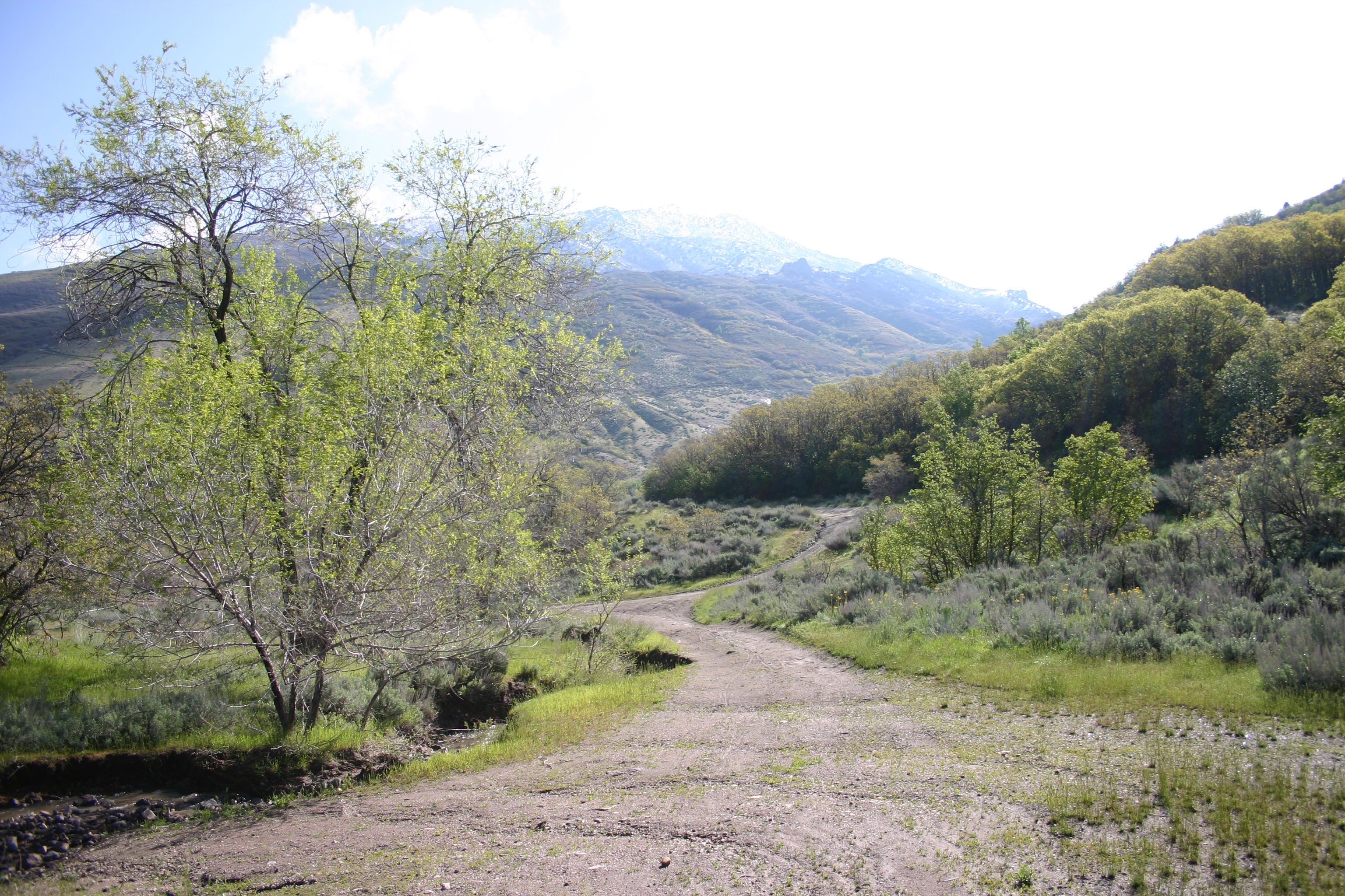
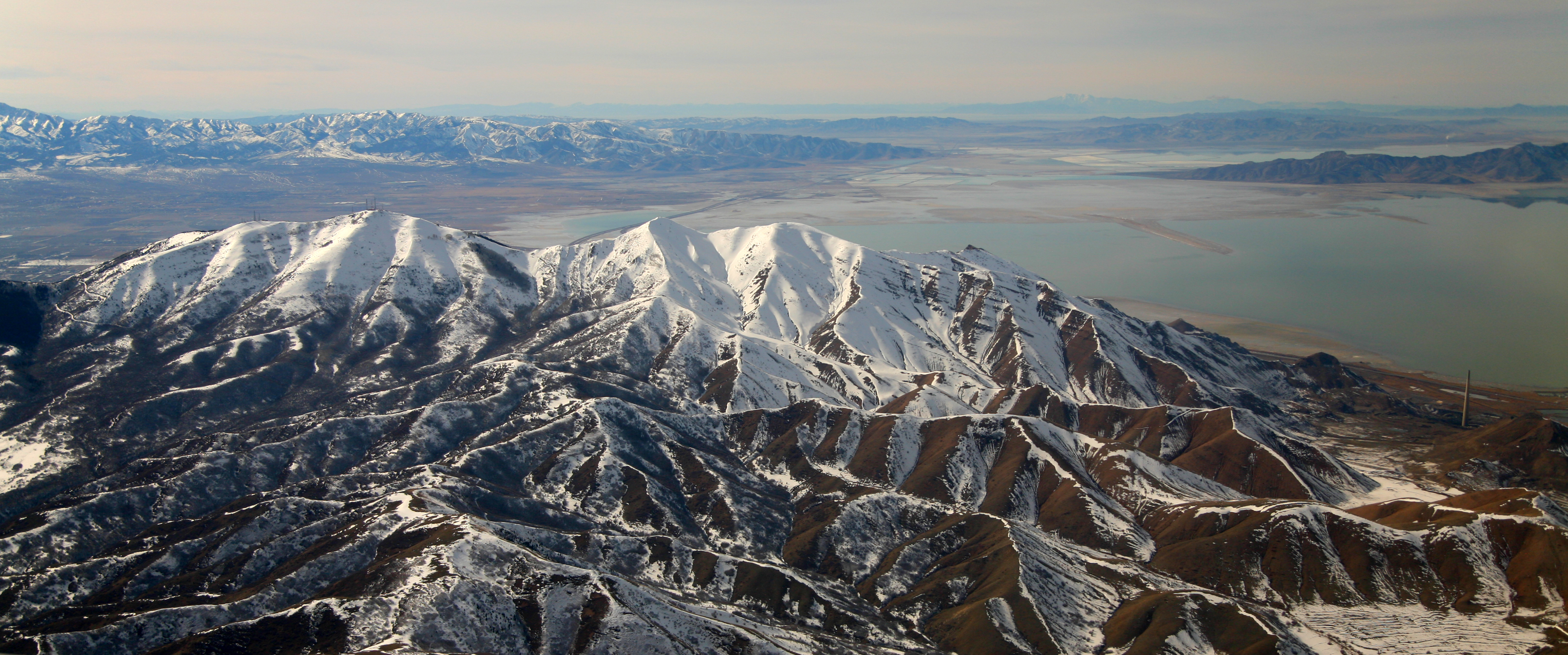
Mount Wire (also known as Wire Mountain or Big Beacon) is a mountain located on the east side of Salt Lake City, Utah with an elevation of . The mountain is named after Lester Wire, an American policeman of Salt Lake City, Utah, who in 1912 developed the first red-green electric traffic light. Mount Wire is a common spot for adventurous hikers and has many access trails, some created by nearby Red Butte Gardens. The east side of the University of Utah offers direct access to trails to the summit. Mount Wire formerly could be identified from other nearby mountains by its two passive microwave repeaters near the summit. These billboard like structures were used to bounce microwave signals over the mountain to the north-eastern parts of Utah. Mount Wire also houses an old airway beacon directly on the summit. An interesting man-made rock outcropping about halfway up the mountain looks like several lawn chairs in a row, and is a common rest stop for hikers. This stop offers views of ... [...More Info...] [...Related Items...] OR: [Wikipedia] [Google] [Baidu] |
Lester Wire
Lester Farnsworth Wire (September 3, 1887 – April 14, 1958) was credited with the invention of the electric traffic light in 1912, in Salt Lake City. Wire worked as a detective for the Salt Lake City police force. The original traffic light, based on a semaphore system, had been invented in London in 1868 by John Peake Knight, but had not been a success. The earliest known patent for a traffic light in the United States was U.S.Patent # 1,251,666, issued January 1, 1918, to J.B. Hoge of Cleveland, Ohio. Biography Lester Wire attended Salt Lake High School. In high school, Wire was a football star and expert marksman and also helped create the first men's and women's basketball games. He later received appointment to West Point Military Academy by Senator, Reed E. Smoot, but was unable to attend. In 1909, he was enrolled in the University of Utah as a law student, which he found too expensive and quit to join the Salt Lake City Police in 1910. In 1912, he was appointed to head th ... [...More Info...] [...Related Items...] OR: [Wikipedia] [Google] [Baidu] |
Draper, Utah
Draper is a city in Salt Lake and Utah counties in the U.S. state of Utah, about south of Salt Lake City along the Wasatch Front. As of the 2020 census, the population is 51,017, up from 7,143 in 1990. Draper is part of two metropolitan areas; the Salt Lake County portion is in the Salt Lake City metropolitan area, while the Utah County portion is in the Provo-Orem metropolitan area. The Utah State Prison is in Draper, near Point of the Mountain, alongside Interstate 15. Gary Gilmore's execution occurred on 17 January 1977. The Utah Legislature voted to relocate the state prison to Draper in 2014 and in 2015 approved the Salt Lake City location the prison relocation commission recommended. The Draper Prison will close in 2022. Inmates will be moved to a new prison facility in Salt Lake City; the new prison is slated for completion in mid-2022. Draper has two UTA TRAX stations (Draper Town Center, 12300/12400 South and Kimball's Lane 11800 South) as well as one on the border w ... [...More Info...] [...Related Items...] OR: [Wikipedia] [Google] [Baidu] |
United States National Forest
In the United States, national forest is a classification of protected area, protected and managed federal lands. National forests are largely forest and woodland areas owned collectively by the American people through the Federal government of the United States, federal government, and managed by the United States Forest Service, a division of the United States Department of Agriculture. The U.S. Forest Service is also a forestry research organization who provides financial assistance to state and local forestry industry. As of 2020, there are List of U.S. National Forests, 154 national forests in the United States. History The National Forest System (NFS) was created by the Land Revision Act of 1891, which was enacted during the presidency of Benjamin Harrison. This act took land to form United States National Park, national parks in the West, including 15 reserves containing more than 13 million acres of land. At first one would be called a Forest Reserve; a later one w ... [...More Info...] [...Related Items...] OR: [Wikipedia] [Google] [Baidu] |
Four-wheel Drive
Four-wheel drive, also called 4×4 ("four by four") or 4WD, refers to a two-axled vehicle drivetrain capable of providing torque to all of its wheels simultaneously. It may be full-time or on-demand, and is typically linked via a transfer case providing an additional output drive shaft and, in many instances, additional gear ranges. A four-wheel drive vehicle with torque supplied to both axles is described as "all-wheel drive" (AWD). However, "four-wheel drive" typically refers to a set of specific components and functions, and intended off-road application, which generally complies with modern use of the terminology. Definitions Four-wheel-drive systems were developed in many different markets and used in many different vehicle platforms. There is no universally accepted set of terminology that describes the various architectures and functions. The terms used by various manufacturers often reflect marketing rather than engineering considerations or significant technical diff ... [...More Info...] [...Related Items...] OR: [Wikipedia] [Google] [Baidu] |
All-terrain Vehicle
An all-terrain vehicle (ATV), also known as a light utility vehicle (LUV), a quad bike, or simply a quad, as defined by the American National Standards Institute (ANSI); is a vehicle that travels on low-pressure tires, with a seat that is straddled by the operator, along with handlebars for steering control. As the name implies, it is designed to handle a wider variety of terrain than most other vehicles. Although it is a street-legal vehicle in some countries, it is not street-legal within most states, territories and provinces of Australia, the United States or Canada. By the current ANSI definition, ATVs are intended for use by a single operator, although some companies have developed ATVs intended for use by the operator and one passenger. These ATVs are referred to as tandem ATVs. The rider sits on and operates these vehicles like a motorcycle, but the extra wheels give more stability at slower speeds. Although most are equipped with three or four wheels, six-wheel mode ... [...More Info...] [...Related Items...] OR: [Wikipedia] [Google] [Baidu] |
Airway Beacon
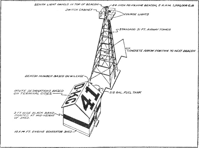
An airway beacon (US) or aerial lighthouse (UK and Europe) was a rotating light assembly mounted atop a tower. These were once used extensively in the United States for visual navigation by airplane pilots along a specified airway corridor. In Europe, they were used to guide aircraft with lighted beacons at night. UK and Europe United Kingdom A network of aerial lighthouses was established in the United Kingdom and Europe during the 1920s and 1930s. Use of the lighthouses has declined with the advent of radio navigation aids such as NDB (non-directional beacon), VOR (VHF omnidirectional ranging) and DME (distance measuring equipment). The last operational aerial lighthouse in the United Kingdom is on top of the cupola over the RAF College main hall at RAF Cranwell. Netherlands In the Netherlands, gas holders were painted with an arrow pointing north and two letters identifying their location. United States Approximately 1,500 airway beacons were constructed to guide ... [...More Info...] [...Related Items...] OR: [Wikipedia] [Google] [Baidu] |
Wasatch Range
The Wasatch Range ( ) or Wasatch Mountains is a mountain range in the western United States that runs about from the Utah-Idaho border south to central Utah. It is the western edge of the greater Rocky Mountains, and the eastern edge of the Great Basin region.''Hiking the Wasatch'', John Veranth, 1988, Salt Lake City, The northern extension of the Wasatch Range, the Bear River Mountains, extends just into Idaho, constituting all of the Wasatch Range in that state. In the language of the native Ute people, Wasatch means "mountain pass" or "low pass over high range." According to William Bright, the mountains were named for a Shoshoni leader who was named with the Shoshoni term ''wasattsi'', meaning "blue heron". In 1926, Cecil Alter quoted Henry Gannett from 1902, who said that the word meant "land of many waters," then posited, "the word is a common one among the Shoshones, and is given to a berry basket" carried by women. Overview Since the earliest days of European sett ... [...More Info...] [...Related Items...] OR: [Wikipedia] [Google] [Baidu] |
Emigration Canyon, Utah
Emigration Canyon is a metro township and canyon in Salt Lake County, Utah, United States, located east of Salt Lake City in the Wasatch Range. Beginning at the southern end of the University of Utah, the canyon itself heads east and northeast between Salt Lake City and Morgan County. The boundaries of the metro township do not extend to the county line, nor do they encompass all of Emigration Canyon, as parts of it are within Salt Lake City. As of the 2010 census, the population was 1,568. A portion of Emigration Canyon, located in This Is the Place Heritage Park, was declared a National Historic Landmark in 1961 for the canyon's significance in the Mormon migration of the 19th century. Demographics History Emigration Canyon was significant in early Utah history as the original route used by pioneers entering the area. It was part of the Hastings Cutoff route used by the Donner Party in 1846 and where the Mormon Pioneers entered the Salt Lake Valley in 1847. As Brigham Y ... [...More Info...] [...Related Items...] OR: [Wikipedia] [Google] [Baidu] |
Oquirrh Mountains
The Oquirrh Mountains is a mountain range that runs north-south for approximately 30 miles (50 km) to form the west side of Utah's Salt Lake Valley, separating it from Tooele Valley. The range runs from northwestern Utah County–central & eastern Tooele County, to the south shore of the Great Salt Lake. The highest elevation is Flat Top Mountain at 10,620 ft (3,237 m). The name Oquirrh was taken from the Goshute word meaning "wood sitting."William Bright, ed. ''Native American Placenames of the United States'' (2004, University of Oklahoma Press) The Oquirrh Mountains have been mined for gold, silver, lead, and most famously for copper, as home of the porphyry copper deposit at Bingham Canyon Mine The Bingham Canyon Mine, more commonly known as Kennecott Copper Mine among locals, is an open-pit mining operation extracting a large porphyry copper deposit southwest of Salt Lake City, Utah, in the Oquirrh Mountains. The mine is the largest m ..., one of the worl ... [...More Info...] [...Related Items...] OR: [Wikipedia] [Google] [Baidu] |
Mount Van Cott
Mount Van Cott is a mountain located in the Wasatch Mountain Range immediately east of the University of Utah with an elevation of . The mountain is a common spot for hikers as well as mountain bikers and has many access trails. The east side of the University of Utah offers direct access to trails to the summit. Most trails to the summit branch off of the Bonneville Shoreline Trail. The most obvious of these trails is a scar on the mountain that is located on its southwestern flank. The mountain is named after Lucy May Van Cott, the first dean of women (1907–1931) at the University of Utah and daughter of John Van Cott. Hiking Like the adjacent mountains, hiking to the summit can be moderately difficult as the terrain is fairly unforgiving. Trails are not marked, but are in good condition, depending on which side a hiker climbs. Access from the west side of the mountain is often the easiest, as the trails are clearer. The summit Once on the summit, the entire Salt Lake Valley ... [...More Info...] [...Related Items...] OR: [Wikipedia] [Google] [Baidu] |
Antelope Island
Antelope Island, with an area of 42 square miles (109 km2), is the largest of ten islands located within the Great Salt Lake in the US state of Utah. The island lies in the southeastern portion of the lake, near Salt Lake City and Davis County, and becomes a peninsula when the lake is at extremely low levels. It is protected as Antelope Island State Park. The first known non-natives to visit the island were John C. Frémont and Kit Carson during exploration of the Great Salt Lake in 1845, who "rode on horseback over salt from the thickness of a wafer to twelve inches" and "were informed by the Indians that there was an abundance of fresh water on it and plenty of antelope". It is said they shot a pronghorn antelope on the island and in gratitude for the meat they named it Antelope Island. Antelope Island has natural scenic beauty and holds populations of pronghorn, bighorn sheep, American bison, porcupine, badger, coyote, bobcat, mule deer, and millions of waterfowl. The bis ... [...More Info...] [...Related Items...] OR: [Wikipedia] [Google] [Baidu] |
North Salt Lake
North Salt Lake is a city in Davis County, Utah, United States. It is part of the Ogden– Clearfield, Utah Metropolitan Statistical Area. The population was 16,322 at the 2010 census, which had risen to an estimated 20,948 as of 2019. The city is often casually known as North Salt Lake City as it shares a municipal boundary with Salt Lake City to the south, though the city's actual corporate name is "The City of North Salt Lake". The error also has been solidified with the Federal Communications Commission, which has radio station KALL (700) officially licensed to "North Salt Lake City", though for all intents and purposes that station serves the Salt Lake City market in general. Demographics According to estimates from the U.S. Census Bureau, as of 2016, there were 20,301 people in North Salt Lake. The racial makeup of the county was 75.4% non-Hispanic White, 0.3% Black, 0.8% Native American, 3.1% Asian, and 5.0% from two or more races. 13.5% of the population were His ... [...More Info...] [...Related Items...] OR: [Wikipedia] [Google] [Baidu] |


