|
Mount Kaba (Ibaraki)
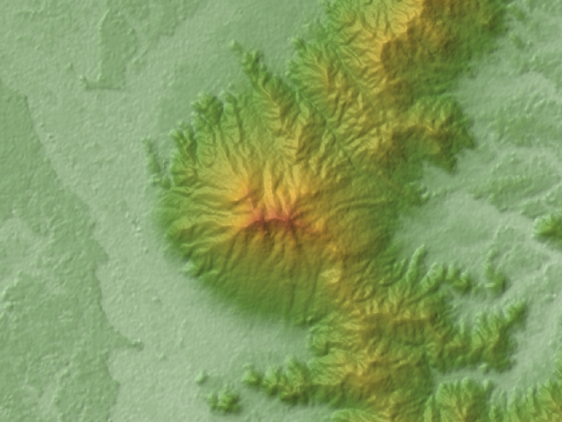
is a [] mountain located within the borders of Suigo-Tsukuba Quasi-National Park, Japan. Location Mount Kaba is located in the southern part of Ibaraki Prefecture, bordering the cities of Sakuragawa and Ishioka, and north of Mount Tsukuba. The mountain is located in the northwestern part of Suigo-Tsukuba Quasi-National Park and of it. The mountain is part of the Tsukuba range (筑波山地), which includes Maruyama (丸山) of Sakuragawa, Ontakesan (御嶽山), Amabikiyama (雨引山), Enzan (燕山), Kabasan (加波山), Maruyama (丸山) of Sakuragawa and Ishioka, Ashiozan (足尾山), Kinokayama (きのこ山), Bentensan (弁天山) Tsukubasan (筑波山), Hōkyōsan (宝篋山), among others. Satellite view: Attractions The mountain is granite. There are stone quarries, in the center of the western part of Kabasan, Sakuragawa city (old town, Makabe). It is nationally known as a center of stone carvings. At the summit of the mountain, there is the ''Haiden'' of ... [...More Info...] [...Related Items...] OR: [Wikipedia] [Google] [Baidu] |
Sakuragawa, Ibaraki
260px, Cherry Blossoms of Sakuragawa is a city located in Ibaraki Prefecture, Japan. , the city had an estimated population of 39,072 in 13,721 households and a population density of 217 persons per km². The percentage of the population aged over 65 was 34.3%. The total area of the city is . Geography Located in central-western Ibaraki Prefecture, Sakuragawa is bordered by Tochigi Prefecture to the north. The city is lined by mountains along its east side, named Tomiya, Amabiki, Kaba and Ashio, from north to south. Mt. Tsukuba dominates the southern side, although it is not located within the borders of the city. The eponymous Sakuragawa River has its source in the Iwase area of the city. Surrounding municipalities Ibaraki Prefecture * Kasama * Ishioka * Tsukuba * Chikusei Tochigi Prefecture * Mashiko * Mooka * Motegi Climate Sakuragawa has a Humid continental climate (Köppen ''Cfa'') characterized by warm summers and cool winters with light snowfall. The average annual t ... [...More Info...] [...Related Items...] OR: [Wikipedia] [Google] [Baidu] |
Ishioka, Ibaraki
260px, Ishioka City Hall is a city located in Ibaraki Prefecture, Japan. , the city had an estimated population of 72,351 in 28,291 households and a population density of 336 persons per km². The percentage of the population aged over 65 was 33.5%. The total area of the city is . Geography Ishioka is located in central Ibaraki Prefecture, approximately 70 kilometers north of central Tokyo. It is bordered by Lake Kasumigaura to the south and by mountains on all other sides. The urban area of the city is in the east. Surrounding municipalities Ibaraki Prefecture * Tsuchiura * Tsukuba * Kasumigaura * Kasama * Sakuragawa * Omitama Climate Ishioka has a Humid continental climate (Köppen ''Cfa'') characterized by warm summers and cool winters with light snowfall. The average annual temperature in Ishioka is 13.8 °C. The average annual rainfall is 1331 mm with September as the wettest month. The temperatures are highest on average in August, at around 25.8 °C, a ... [...More Info...] [...Related Items...] OR: [Wikipedia] [Google] [Baidu] |
Ibaraki Prefecture
is a Prefectures of Japan, prefecture of Japan located in the Kantō region of Honshu. Ibaraki Prefecture has a population of 2,871,199 (1 June 2019) and has a geographic area of . Ibaraki Prefecture borders Fukushima Prefecture to the north, Tochigi Prefecture to the northwest, Saitama Prefecture to the southwest, Chiba Prefecture to the south, and the Pacific Ocean to the east. Mito, Ibaraki, Mito, the capital, is the largest city in Ibaraki Prefecture. Other major cities include Tsukuba, Ibaraki, Tsukuba, Hitachi, Ibaraki, Hitachi, and Hitachinaka, Ibaraki, Hitachinaka. Ibaraki Prefecture is located on Japan's eastern Pacific coast to the northeast of Tokyo, and is part of the Greater Tokyo Area, the most populous metropolitan area in the world. Ibaraki Prefecture features Lake Kasumigaura, the second-largest lake in Japan; the Tone River, Japan's second-longest river and largest drainage basin; and Mount Tsukuba, one of the most famous mountains in Japan. Ibaraki Prefectur ... [...More Info...] [...Related Items...] OR: [Wikipedia] [Google] [Baidu] |
Japan
Japan ( ja, 日本, or , and formally , ''Nihonkoku'') is an island country in East Asia. It is situated in the northwest Pacific Ocean, and is bordered on the west by the Sea of Japan, while extending from the Sea of Okhotsk in the north toward the East China Sea, Philippine Sea, and Taiwan in the south. Japan is a part of the Ring of Fire, and spans Japanese archipelago, an archipelago of List of islands of Japan, 6852 islands covering ; the five main islands are Hokkaido, Honshu (the "mainland"), Shikoku, Kyushu, and Okinawa Island, Okinawa. Tokyo is the Capital of Japan, nation's capital and largest city, followed by Yokohama, Osaka, Nagoya, Sapporo, Fukuoka, Kobe, and Kyoto. Japan is the List of countries and dependencies by population, eleventh most populous country in the world, as well as one of the List of countries and dependencies by population density, most densely populated and Urbanization by country, urbanized. About three-fourths of Geography of Japan, the c ... [...More Info...] [...Related Items...] OR: [Wikipedia] [Google] [Baidu] |
Granite
Granite () is a coarse-grained (phaneritic) intrusive igneous rock composed mostly of quartz, alkali feldspar, and plagioclase. It forms from magma with a high content of silica and alkali metal oxides that slowly cools and solidifies underground. It is common in the continental crust of Earth, where it is found in igneous intrusions. These range in size from dikes only a few centimeters across to batholiths exposed over hundreds of square kilometers. Granite is typical of a larger family of ''granitic rocks'', or ''granitoids'', that are composed mostly of coarse-grained quartz and feldspars in varying proportions. These rocks are classified by the relative percentages of quartz, alkali feldspar, and plagioclase (the QAPF classification), with true granite representing granitic rocks rich in quartz and alkali feldspar. Most granitic rocks also contain mica or amphibole minerals, though a few (known as leucogranites) contain almost no dark minerals. Granite is nearly alway ... [...More Info...] [...Related Items...] OR: [Wikipedia] [Google] [Baidu] |
Mount Tsukuba
is an mountain located at the northern-end of Tsukuba, Japan. It is one of the most famous mountains in Japan, particularly well known for its double peaks, and . Many people climb the so-called "purple mountain" every year for the panoramic view of the Kantō plain from the summit. On clear days the Tōkyō skyline, Lake Kasumigaura and even Mount Fuji are visible from the summit. Japanese mountains are mostly volcanic, but Mount Tsukuba is non-volcanic granite and gabbro in origin. Renowned beautiful granites are produced in the northern quarries even today. Etymology The , a national geography completed in 721 AD, says Mount Tsukuba was named after a noble called . According to this account, the area around Mount Tsukuba was once called . Under the reign of (Emperor Sujin), Tsukuha no Mikoto from the was appointed as its governor. He had a strong desire to leave his name in history, so he renamed the area "Tsukuha", which is now pronounced Tsukuba. History As leg ... [...More Info...] [...Related Items...] OR: [Wikipedia] [Google] [Baidu] |
Haiden (Shinto)
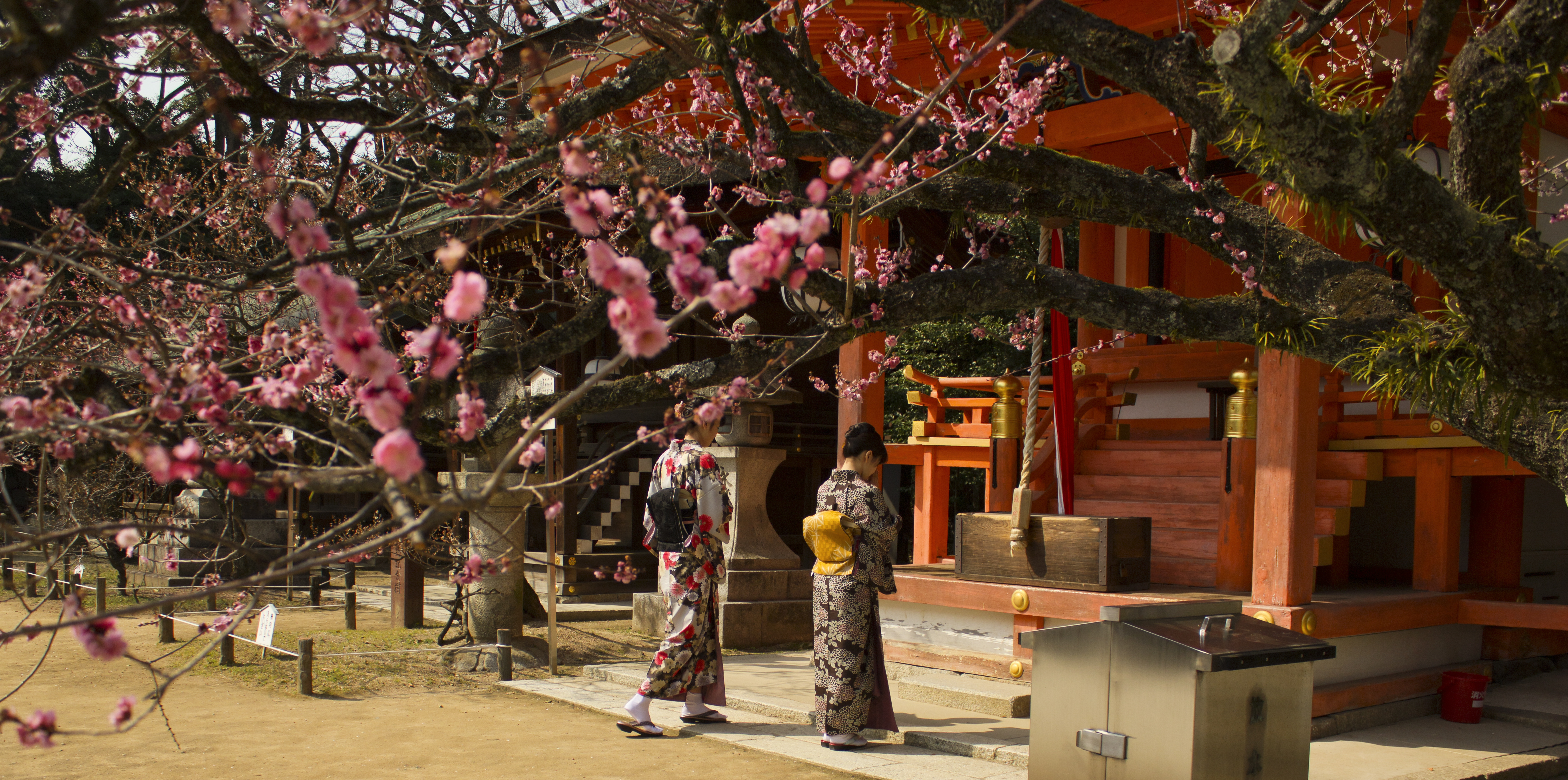
In Shinto shrine architecture, the is the hall of worship or oratory. It is generally placed in front of the shrine's main sanctuary ('' honden'') and often built on a larger scale than the latter. The ''haiden'' is often connected to the ''honden'' by a '' heiden'', or hall of offerings. While the ''honden'' is the place for the enshrined ''kami'' and off-limits to the general public, the ''haiden'' provides a space for ceremonies and for worshiping the ''kami''. In some cases, for example at Nara's Ōmiwa Shrine , also known as , is a Shinto shrine located in Sakurai, Nara Prefecture, Japan. The shrine is noted because it contains no sacred images or objects because it is believed to serve Mount Miwa, the mountain on which it stands. For the same re ..., the ''honden'' can be missing and be replaced by a patch of sacred ground. In that case, the ''haiden'' is the most important building of the complex. References Shinto architecture {{Shinto-stub ja:拝殿< ... [...More Info...] [...Related Items...] OR: [Wikipedia] [Google] [Baidu] |
Shinto Shrine
A is a structure whose main purpose is to house ("enshrine") one or more ''kami'', the deities of the Shinto religion. Overview Structurally, a Shinto shrine typically comprises several buildings. The '' honden''Also called (本殿, meaning: "main hall") is where a shrine's patron ''kami'' is/are enshrined.Iwanami Japanese dictionary The ''honden'' may be absent in cases where a shrine stands on or near a sacred mountain, tree, or other object which can be worshipped directly or in cases where a shrine possesses either an altar-like structure, called a ''himorogi,'' or an object believed to be capable of attracting spirits, called a ''yorishiro,'' which can also serve as direct bonds to a ''kami''. There may be a and other structures as well. Although only one word ("shrine") is used in English, in Japanese, Shinto shrines may carry any one of many different, non-equivalent names like ''gongen'', ''-gū'', ''jinja'', ''jingū'', ''mori'', ''myōjin'', ''-sha'', ''taisha ... [...More Info...] [...Related Items...] OR: [Wikipedia] [Google] [Baidu] |


