|
Mount Eagle (Ireland)
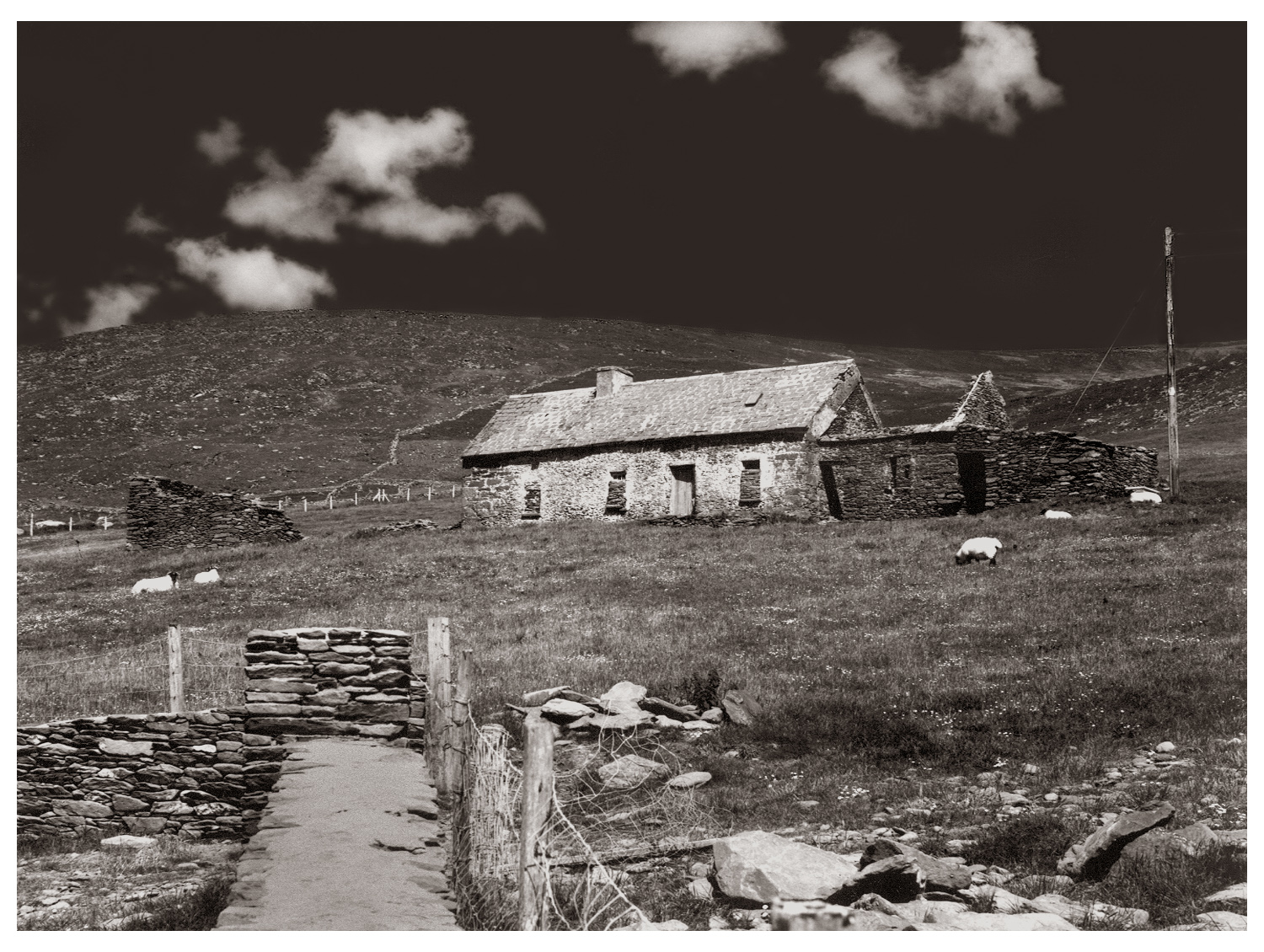
Mount Eagle () is a mountain in County Kerry, Ireland. Geography The mountain is part of Mountains of the Central Dingle Peninsula and is the 419th highest in Ireland. Mount Eagle is located not faraway from Slea Head (Ceann Sléibhe), the most south-westerly point of the peninsula, and is connected with mount Brandon by a ridge of lower hills. On the mountain's top stands a trig point. History The mountain summit was the first European bit of land seen by Charles Lindbergh after his 1927 plane voyage across the Atlantic Ocean. Access to the summit Mount Eagle summit can be reached with a medium walk from Ventry Harbour. From the top of the mountain there is a good view of the neighbouring coast and the Blasket Islands. See also *List of mountains in Ireland In these lists of mountains in Ireland, those within Northern Ireland, or on the Republic of Ireland – United Kingdom border, are marked with an asterisk, while the rest are within the Republic of Ireland ... [...More Info...] [...Related Items...] OR: [Wikipedia] [Google] [Baidu] |
Ordnance Survey Ireland
Ordnance Survey Ireland (OSI; ga, Suirbhéireacht Ordanáis Éireann) is the national mapping agency of Ireland. It was established on 4 March 2002 as a body corporate. It is the successor to the former Ordnance Survey of Ireland. It and the Ordnance Survey of Northern Ireland (OSNI) are the ultimate successors to the Irish operations of the British Ordnance Survey. OSI is part of the Irish public service. OSI has made modern and historic maps of the state free to view on its website. OSI is headquartered at Mountjoy House in the Phoenix Park in Dublin. Mountjoy House was also the headquarters, until 1922, of the Irish section of the British Ordnance Survey. Organisation Under the Ordnance Survey Ireland Act 2001, the Ordnance Survey of Ireland was dissolved and a new corporate body called Ordnance Survey Ireland was established in its place. OSI is now an autonomous corporate body, with a remit to cover its costs of operation from its sales of data and derived products, wh ... [...More Info...] [...Related Items...] OR: [Wikipedia] [Google] [Baidu] |
Marilyn (hill)
This is a list of Marilyn hills and mountains in the United Kingdom, Isle of Man and Republic of Ireland, Ireland by height. Lists of mountains and hills in the British Isles#Marilyns, Marilyns are defined as peaks with a topographic prominence, prominence of or more, regardless of height or any other merit (e.g. topographic isolation, as used in Lists of mountains and hills in the British Isles#Munros, Munros). Thus, Marilyns can be mountains, with a height above , or relatively small hills. there were 2,011 recorded Marilyns. Definition The Marilyn classification was created by Alan Dawson in his 1992 book ''The Relative Hills of Britain''. The name Marilyn was coined by Dawson as a punning contrast to the ''Munro'' classification of Scottish mountains above , but which has no explicit prominence threshold, being homophonous with (Marilyn) ''Marilyn Monroe, Monroe''. The list of Marilyns was extended to Ireland by Clem Clements. Marilyn was the first of several subsequen ... [...More Info...] [...Related Items...] OR: [Wikipedia] [Google] [Baidu] |
County Kerry
County Kerry ( gle, Contae Chiarraí) is a county in Ireland. It is located in the South-West Region and forms part of the province of Munster. It is named after the Ciarraige who lived in part of the present county. The population of the county was 155,258 at the 2022 census, A popular tourist destination, Kerry's geography is defined by the MacGillycuddy's Reeks mountains, the Dingle, Iveragh and Beara peninsulas, and the Blasket and Skellig islands. It is bordered by County Limerick to the north-east and Cork County to the south and south-east. Geography and subdivisions Kerry is the fifth-largest of Ireland's 32 traditional counties by area and the 16th-largest by population. It is the second-largest of Munster's six counties by area, and the fourth-largest by population. Uniquely, it is bordered by only two other counties: County Limerick to the east and County Cork to the south-east. The county town is Tralee although the Catholic diocesan seat is Killarney, whi ... [...More Info...] [...Related Items...] OR: [Wikipedia] [Google] [Baidu] |
Mountains Of The Central Dingle Peninsula
The Mountains of the Central Dingle Peninsula are the generic name given to the mountains that lie on the Dingle Peninsula between the Brandon Group of mountains in the west, and the Slieve Mish Mountains at the eastern end of the peninsula. Geology Like many of the mountain ranges in Kerry, such as the MacGillycuddy Reeks, the mountains of the Central Dingle peninsula are composed predominantly of Devonian period Old Red Sandstone, with a band of Ordovician period metasediments. The rocks date from the Upper Devonian period (310–450 million years ago) when Ireland was in a hot equatorial setting. During this 60 million year period, Ireland was the site of a major basin, known as the Munster basin, and Cork and Kerry were effectively a large alluvial floodplain. Chemical oxidation stained the material with a purple–reddish colour (and green in places from chlorination), still visible today. There are virtually no fossils in Old Red Sandstone. The composition of Old ... [...More Info...] [...Related Items...] OR: [Wikipedia] [Google] [Baidu] |
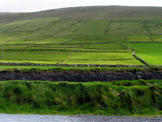
Pasture Along The Dingle Way And Slopes Of Mount Eagle - Geograph
Pasture (from the Latin ''pastus'', past participle of ''pascere'', "to feed") is land used for grazing. Pasture lands in the narrow sense are enclosed tracts of farmland, grazed by domesticated livestock, such as horses, cattle, sheep, or swine. The vegetation of tended pasture, forage, consists mainly of grasses, with an interspersion of legumes and other forbs (non-grass herbaceous plants). Pasture is typically grazed throughout the summer, in contrast to meadow which is ungrazed or used for grazing only after being mown to make hay for animal fodder. Pasture in a wider sense additionally includes rangelands, other unenclosed pastoral systems, and land types used by wild animals for grazing or browsing. Pasture lands in the narrow sense are distinguished from rangelands by being managed through more intensive agricultural practices of seeding, irrigation, and the use of fertilizers, while rangelands grow primarily native vegetation, managed with extensive practices like c ... [...More Info...] [...Related Items...] OR: [Wikipedia] [Google] [Baidu] |
Dublin City University
Dublin City University (abbreviated as DCU) ( ga, Ollscoil Chathair Bhaile Átha Cliath) is a university based on the Northside of Dublin, Ireland. Created as the ''National Institute for Higher Education, Dublin'' in 1975, it enrolled its first students in 1980, and was elevated to university status (along with the NIHE Limerick, now the University of Limerick) in September 1989 by statute. In September 2016, DCU completed the process of incorporating four other Dublin-based educational institutions: the Church of Ireland College of Education, All Hallows College, Mater Dei Institute of Education and St Patrick's College. As of 2020, the university has 17,400 students and over 80,000 alumni. In addition the university has around 1,200 online distance education students studying through DCU Connected. There were 1,690 staff in 2019. Notable members of the academic staff include former Taoiseach, John Bruton and "thinking" Guru Edward De Bono. Bruton accepted a position as ... [...More Info...] [...Related Items...] OR: [Wikipedia] [Google] [Baidu] |
Slea Head
Slea Head (Irish: ''Ceann Sléibhe'') is a promontory in the westernmost part of the Dingle Peninsula, located in the barony of Corca Dhuibhne in southwest County Kerry, Ireland. It belongs to the province of Munster and the county of Kerry and is served by the R559 road; the nearest villages are Ballyickeen and Coumeenoole. The headland itself, together with the larger part of Mount Eagle's southern slopes is formed from steeply dipping beds of the pebbly sandstones and conglomerates of the Slea Head Formation, dating from the Devonian period and traditionally referred to as the Old Red Sandstone. Just to the northwest of Slea Head is Dunmore Head, the westernmost point of Ireland. Slea Head is a well known and recognised landmark and also a very scenic viewpoint, with a dramatic view of the Blasket Islands. On 11 March 1982, the Spanish container ship, Ranga, was wrecked at Dunmore Head, close to Slea Head after losing power in a storm. The Slea Head Drive The S ... [...More Info...] [...Related Items...] OR: [Wikipedia] [Google] [Baidu] |
Mount Brandon
Mount Brandon or Brandon (), at , is one of the ten highest peaks in Ireland, being the 8th–highest peak in Ireland on the Arderin list, and the 9th–highest on the Vandeleur-Lynam list. Brandon is the highest Irish mountain outside the MacGillycuddy's Reeks range and has the greatest prominence of any Irish peak except Carrauntoohil, Ireland's highest mountain. Mount Brandon is at the centre of a long high ridge called the Brandon Group range of mountains in the Dingle Peninsula in Kerry. The ridge contains seven other major peaks (i.e. above 2,000 ft in height); one is the similarly named Brandon Peak (840 metres). The positioning and dimensions of the Brandon Group ridge have made it the scene of several air accidents over the years. The mountain, and range, is named after Saint Brendan, and is the end of a Christian pilgrimage trail known as ''Cosán na Naomh''. It is also well regarded for hill walking with routes such as the 4–5-hour ''Faha Route'' (also called ''Th ... [...More Info...] [...Related Items...] OR: [Wikipedia] [Google] [Baidu] |
Trig Point
A triangulation station, also known as a trigonometrical point, and sometimes informally as a trig, is a fixed surveying station, used in geodetic surveying and other surveying projects in its vicinity. The nomenclature varies regionally: they are generally known as trigonometrical stations or triangulation stations in North America, trig points in the United Kingdom, trig pillars in Ireland, trig stations or trig points in Australia and New Zealand, and trig beacons in South Africa. Use The station is usually set up by a government with known coordinates and elevation published. Many stations are located on hilltops for the purposes of visibility. A graven metal plate on the top of a pillar may provide a mounting point for a theodolite or reflector, often using some form of kinematic coupling to ensure reproducible positioning. Trigonometrical stations are grouped together to form a network of triangulation. Positions of all land boundaries, roads, railways, bridges and other ... [...More Info...] [...Related Items...] OR: [Wikipedia] [Google] [Baidu] |
Charles Lindbergh
Charles Augustus Lindbergh (February 4, 1902 – August 26, 1974) was an American aviator, military officer, author, inventor, and activist. On May 20–21, 1927, Lindbergh made the first nonstop flight from New York City to Paris, a distance of , flying alone for 33.5 hours. His aircraft, the ''Spirit of St. Louis'', was designed and built by the Ryan Airline Company specifically to compete for the Raymond Orteig#Orteig Prize, Orteig Prize for the first flight between the two cities. Although not the Transatlantic flight of Alcock and Brown, first transatlantic flight, it was the first solo transatlantic flight, the first nonstop transatlantic flight between two major city hubs, and the longest by over . It is known as one of the most consequential flights in history and ushered in a new era of air transportation between parts of the globe. Lindbergh was raised mostly in Little Falls, Minnesota and Washington, D.C., the son of prominent U.S. Congressman from Minnesota, Charles ... [...More Info...] [...Related Items...] OR: [Wikipedia] [Google] [Baidu] |
Ventry
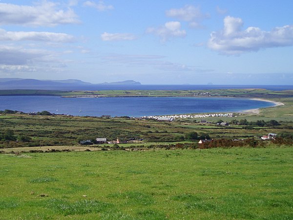
Ventry (), officially ''Ceann Trá'', Placenames Database of Ireland. is a Gaeltacht village in County Kerry, Republic of Ireland, Ireland, on the Dingle Peninsula, 7 kilometres west of Dingle. Due to its long sandy beach, Ventry is a popular tourism, tourist destination. The town is connected to Dingle via the R559 road (Ireland), R559 regional road. Six kilometres west of Ventry are the ruins of Dunbeg Fort, Dunbeg (''An Dún Beag''), an Iron Age promontory fort on the edge of a steep cliff. Near Dunbeg is Kilvickadownig, home to other archeological ruins, including examples of the beehive house and the grave of Caol or Cháil Mic Crimthainn, the last to die in the Battle of Ventry from the well-known Fenian Cycle myths. A site of interest in Ventry parish is Rahinnane Castle, which was the residence of the Knight of Kerry. The Knight of ... [...More Info...] [...Related Items...] OR: [Wikipedia] [Google] [Baidu] |
Blasket Islands
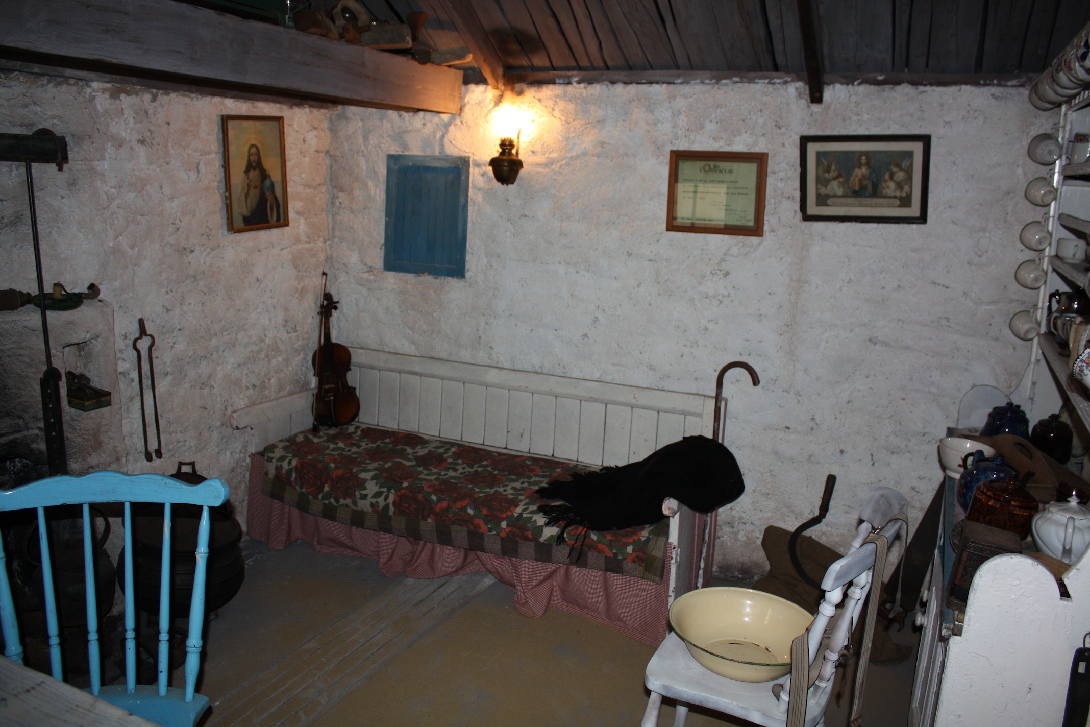
The Blasket Islands ( ga, Na Blascaodaí) are an uninhabited group of islands off the west coast of the Dingle Peninsula in County Kerry, Ireland. The last island to hold a significant population, Great Blasket Island, was abandoned in 1954 due to population decline and is best known for a number of gifted Irish language writers who vividly described their way of life and who kept alive old Irish folk tales of the land. History The islands were inhabited until 1954 by a completely Irish-speaking population and today are part of the Gaeltacht. At its peak, the islands had 175 residents. The population declined to 22 by 1953. The government evacuated most of the remaining residents to the mainland on 17 November 1953 because of increasingly extreme winter weather that left the island's ageing population cut off from emergency services.Stagles, Joan and Ray, ''The Blasket Islands: Next Parish America''. Dublin: O'Brien Press, 1980 (new edn. 1998). The evacuation was seen as neces ... [...More Info...] [...Related Items...] OR: [Wikipedia] [Google] [Baidu] |


_2.jpg)


