|
Mount Dubois
Mount Dubois () is in the White Mountains in the U.S. state of California. Mount Dubois is in the White Mountains Wilderness of Inyo National Forest Inyo National Forest is a United States National Forest covering parts of the eastern Sierra Nevada of California and the White Mountains of California and Nevada. The forest hosts several superlatives, including Mount Whitney, the highest po .... References Mountains of Mono County, California Inyo National Forest {{MonoCountyCA-geo-stub ... [...More Info...] [...Related Items...] OR: [Wikipedia] [Google] [Baidu] |
Mono County, California
Mono County ( ) is a county located in the east central portion of the U.S. state of California. As of the 2020 census, the population was 13,195, making it the fourth-least populous county in California. The county seat is Bridgeport. The county is located east of the Sierra Nevada between Yosemite National Park and Nevada. The only incorporated town in the county is Mammoth Lakes, which is located at the foot of Mammoth Mountain. Other locations, such as June Lake, are also famous as skiing and fishing resorts. Located in the middle of the county is Mono Lake, a vital habitat for millions of migratory and nesting birds. The lake is located in a wild natural setting, with pinnacles of tufa arising out of the salty and alkaline lake. Also located in Mono County is Bodie, the official state gold rush ghost town, which is now a California State Historic Park. History Mono County was formed in 1861 from parts of Calaveras, Fresno and Mariposa counties. A portion of norther ... [...More Info...] [...Related Items...] OR: [Wikipedia] [Google] [Baidu] |
White Mountains (California)
The White Mountains of California and Nevada are a triangular fault-block mountain range facing the Sierra Nevada across the upper Owens Valley. They extend for approximately as a greatly elevated plateau about wide on the south, narrowing to a point at the north, with elevations generally increasing south to north. The range's broad southern end is near the community of Big Pine, where Westgard Pass and Deep Springs Valley separate it from the Inyo Mountains. The narrow northern end is at Montgomery Pass, where U.S. Route 6 crosses. The Fish Lake Valley lies east of the range; the southeast part of the mountains are separated from the Silver Peak Range by block faulting across the Furnace Creek Fault Zone, forming a feeder valley to Fish Lake Valley. The range lies within the eastern section of the Inyo National Forest. Ecology Ecologically, the White Mountains are like the other ranges in the Basin and Range Province; they are dry, but the upper slopes from hold open suba ... [...More Info...] [...Related Items...] OR: [Wikipedia] [Google] [Baidu] |
United States Geological Survey
The United States Geological Survey (USGS), formerly simply known as the Geological Survey, is a scientific agency of the United States government. The scientists of the USGS study the landscape of the United States, its natural resources, and the natural hazards that threaten it. The organization's work spans the disciplines of biology, geography, geology, and hydrology. The USGS is a fact-finding research organization with no regulatory responsibility. The agency was founded on March 3, 1879. The USGS is a bureau of the United States Department of the Interior; it is that department's sole scientific agency. The USGS employs approximately 8,670 people and is headquartered in Reston, Virginia. The USGS also has major offices near Lakewood, Colorado, at the Denver Federal Center, and Menlo Park, California. The current motto of the USGS, in use since August 1997, is "science for a changing world". The agency's previous slogan, adopted on the occasion of its hundredt ... [...More Info...] [...Related Items...] OR: [Wikipedia] [Google] [Baidu] |
List Of Highest Mountain Peaks Of California
This article comprises three sortable tables of major mountain peaksThis article defines a significant summit as a summit with at least of topographic prominence, and a major summit as a summit with at least of topographic prominence. All summits in this article have at least 500 meters of topographic prominence. An ultra-prominent summit is a summit with at least of topographic prominence. of the U.S. State of California. The summit of a mountain or hill may be measured in three principal ways: #The topographic elevation of a summit measures the height of the summit above a geodetic sea level.All elevations in this article include an elevation adjustment from the National Geodetic Vertical Datum of 1929 (NGVD 29) to the North American Vertical Datum of 1988 (NAVD 88). For further information, please see this United States National Geodetic Surveybr>noteIf the elevation or prominence of a summit is calculated as a range of values, the arithmetic mean is shown. The ... [...More Info...] [...Related Items...] OR: [Wikipedia] [Google] [Baidu] |
California
California is a U.S. state, state in the Western United States, located along the West Coast of the United States, Pacific Coast. With nearly 39.2million residents across a total area of approximately , it is the List of states and territories of the United States by population, most populous U.S. state and the List of U.S. states and territories by area, 3rd largest by area. It is also the most populated Administrative division, subnational entity in North America and the 34th most populous in the world. The Greater Los Angeles area and the San Francisco Bay Area are the nation's second and fifth most populous Statistical area (United States), urban regions respectively, with the former having more than 18.7million residents and the latter having over 9.6million. Sacramento, California, Sacramento is the state's capital, while Los Angeles is the List of largest California cities by population, most populous city in the state and the List of United States cities by population, ... [...More Info...] [...Related Items...] OR: [Wikipedia] [Google] [Baidu] |
White Mountains Wilderness
The White Mountains Wilderness is a wilderness area in the White Mountains of California, United States. It was established by Congress in 2009 with a total of . The wilderness is largely managed by the Inyo National Forest, with managed by the Bureau of Land Management. The wilderness covers the White Mountains along the eastern boundary of California, from Boundary Peak in the north, south almost to Bishop. The wilderness includes White Mountain Peak White Mountain Peak (or simply White Mountain), at , is the highest peak in the White Mountains of California, the highest peak in Mono County, and the third highest peak in the state after Mount Whitney and Mount Williamson. It is the fo ..., but excludes the roads to the south of the peak. Signs placed at the entrance of the wilderness near the trail to White Mountain Peak were initially misspelled "White Mountain Wilderness", the name of another wilderness area in New Mexico. References {{Protected Areas of Cal ... [...More Info...] [...Related Items...] OR: [Wikipedia] [Google] [Baidu] |
Inyo National Forest
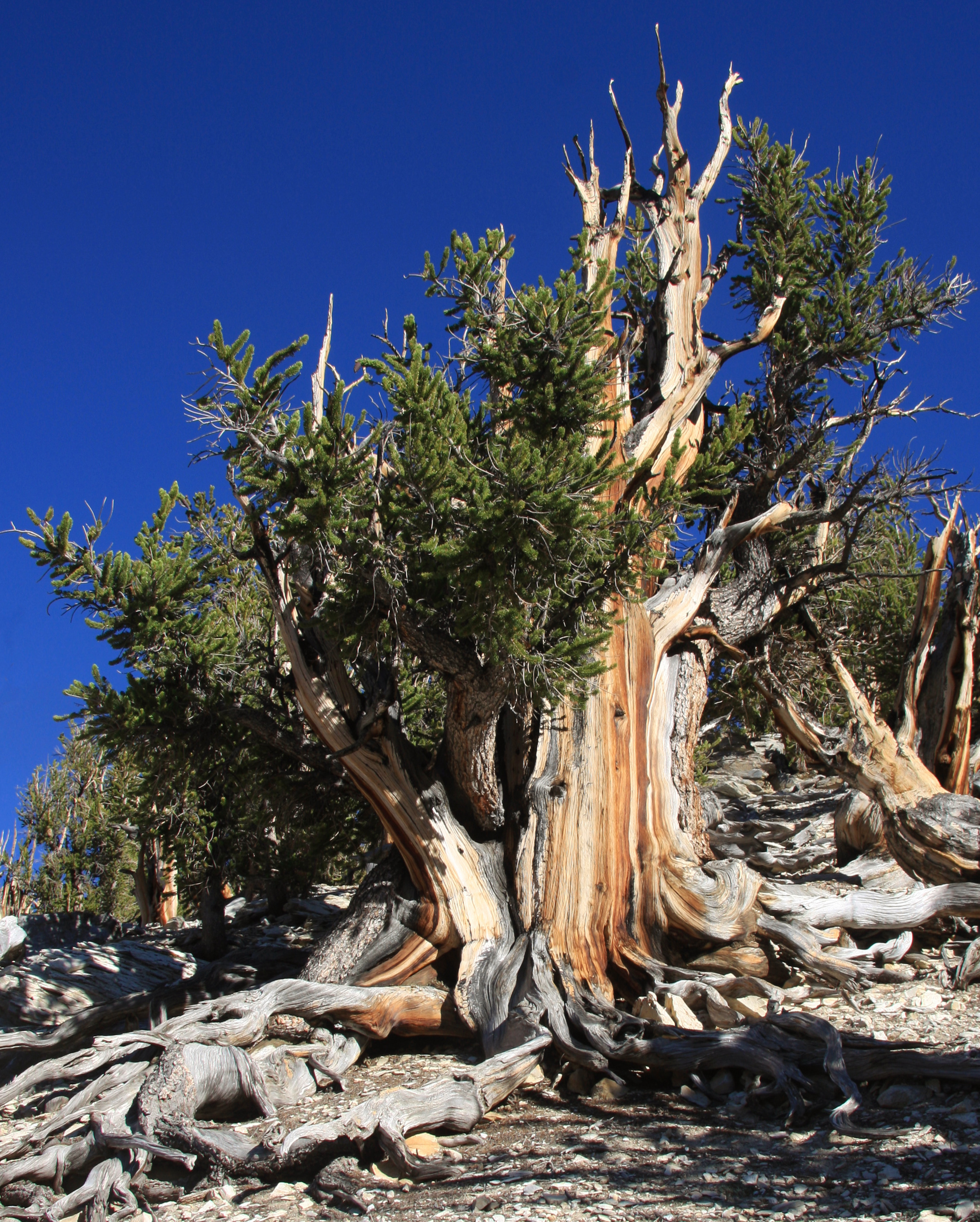
Inyo National Forest is a United States National Forest covering parts of the eastern Sierra Nevada of California and the White Mountains of California and Nevada. The forest hosts several superlatives, including Mount Whitney, the highest point in the contiguous United States; Boundary Peak, the highest point in Nevada; and the Ancient Bristlecone Pine Forest, which protects the oldest living trees in the world. The forest, encompassing much of the Owens Valley, was established by Theodore Roosevelt as a way of sectioning off land to accommodate the Los Angeles Aqueduct project in 1907, making the Inyo National Forest one of the least wooded forests in the U.S. National Forest system. Geography The forest covers and includes nine designated wilderness areas which protect over . Most of the forest is in California, but it includes about in western Nevada. It stretches from the eastern side of Yosemite to south of Sequoia National Park. Geographically it is split in two, one ... [...More Info...] [...Related Items...] OR: [Wikipedia] [Google] [Baidu] |
Mountains Of Mono County, California
A mountain is an elevated portion of the Earth's crust, generally with steep sides that show significant exposed bedrock. Although definitions vary, a mountain may differ from a plateau in having a limited Summit (topography), summit area, and is usually higher than a hill, typically rising at least 300 metres (1,000 feet) above the surrounding land. A few mountains are Monadnock, isolated summits, but most occur in mountain ranges. Mountain formation, Mountains are formed through Tectonic plate, tectonic forces, erosion, or volcanism, which act on time scales of up to tens of millions of years. Once mountain building ceases, mountains are slowly leveled through the action of weathering, through Slump (geology), slumping and other forms of mass wasting, as well as through erosion by rivers and glaciers. High elevations on mountains produce Alpine climate, colder climates than at sea level at similar latitude. These colder climates strongly affect the Montane ecosystems, ecosys ... [...More Info...] [...Related Items...] OR: [Wikipedia] [Google] [Baidu] |


