|
Mount Cavendish
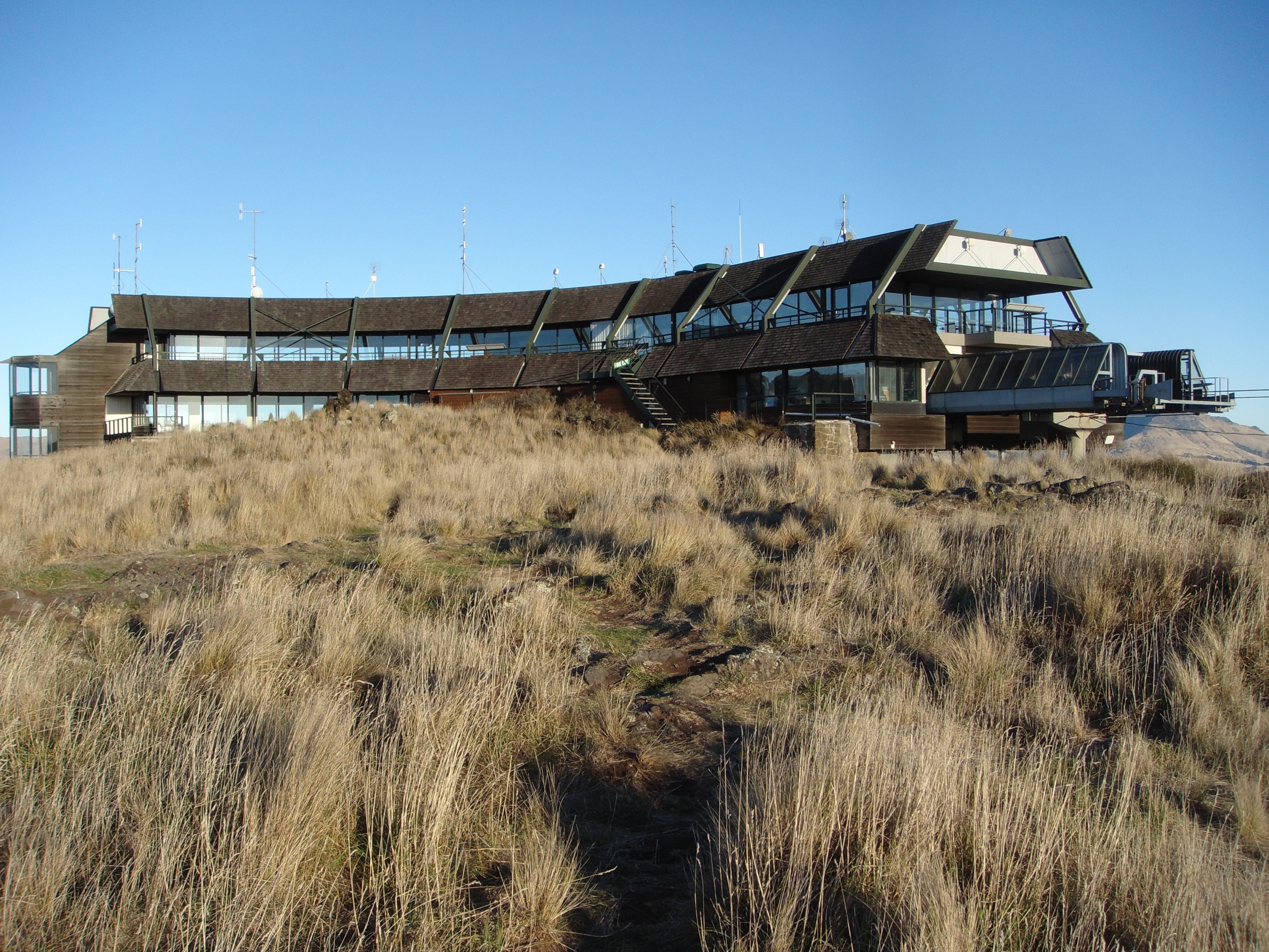
Mount Cavendish is located in the Port Hills, with views over Christchurch, New Zealand and Lyttelton. It is part of the crater wall of the extinct volcano that formed Lyttelton Harbour. The Mount Cavendish Reserve displays some of the best examples of lava flow to be seen on the Port Hills. History Mount Cavendish was first transferred to the Crown for a Scenic Reserve in 1910, by the Morten Brothers. The mountain was first named Hill Morten in 1912 by Harry Ell, in recognition of the Morten family's gifts of land for the Summit Road and scenic reserves. The name Mount Cavendish was first given to nearby Mount Pleasant (after which a suburb is now named) in 1848, but did not stick and the peak of Hill Morten was named Mount Cavendish after the Hon. Richard Cavendish of the Canterbury Association. Description It is 448 metres (1,470 feet) high and falls within the Mount Cavendish Scenic Reserve, which sits at the top of the Heathcote Valley, close to the northern entran ... [...More Info...] [...Related Items...] OR: [Wikipedia] [Google] [Baidu] |
Christchurch
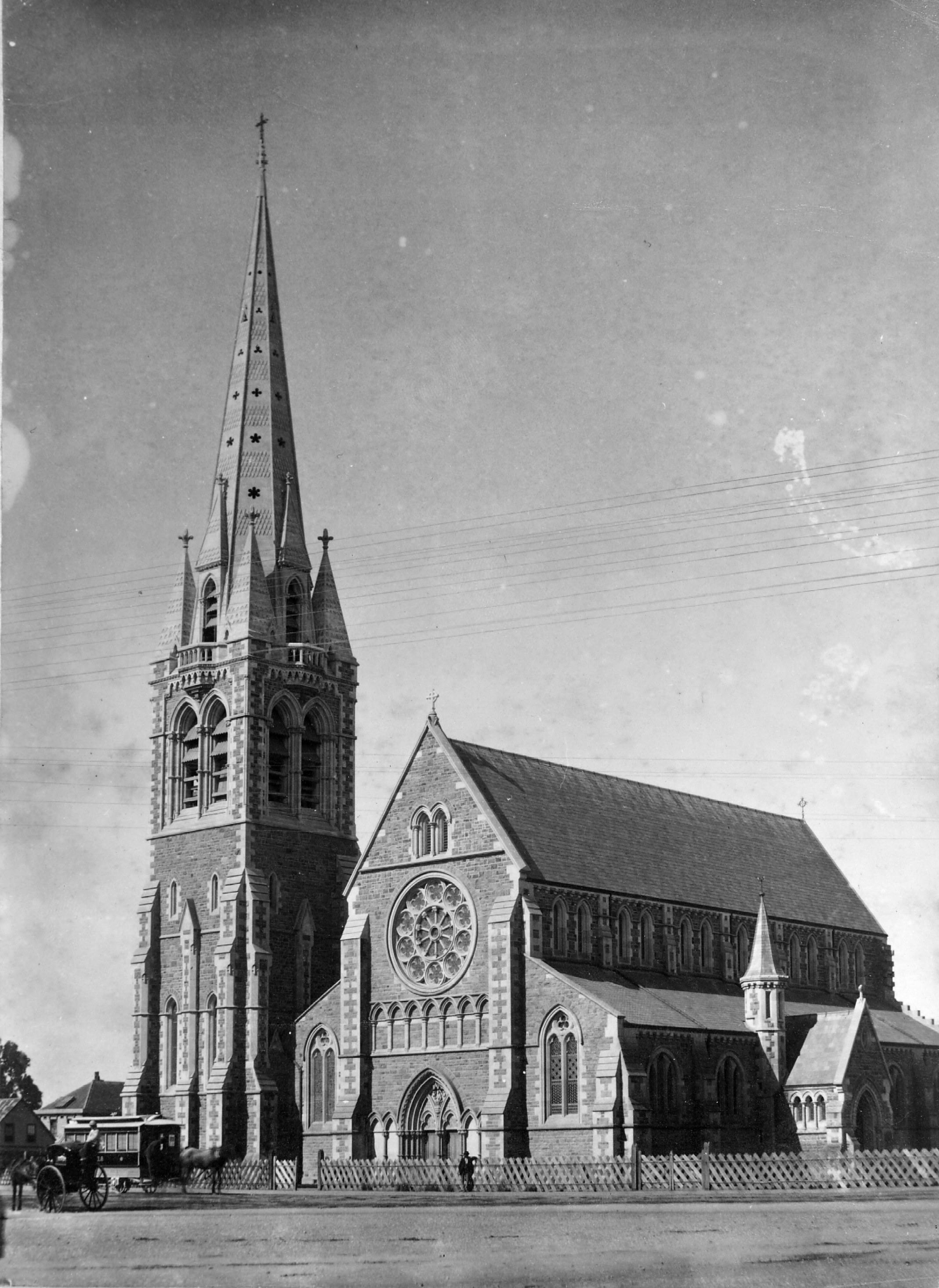
Christchurch ( ; mi, Ōtautahi) is the largest city in the South Island of New Zealand and the seat of the Canterbury Region. Christchurch lies on the South Island's east coast, just north of Banks Peninsula on Pegasus Bay. The Avon River / Ōtākaro flows through the centre of the city, with an urban park along its banks. The city's territorial authority population is people, and includes a number of smaller urban areas as well as rural areas. The population of the urban area is people. Christchurch is the second-largest city by urban area population in New Zealand, after Auckland. It is the major urban area of an emerging sub-region known informally as Greater Christchurch. Notable smaller urban areas within this sub-region include Rangiora and Kaiapoi in Waimakariri District, north of the Waimakariri River, and Rolleston and Lincoln in Selwyn District to the south. The first inhabitants migrated to the area sometime between 1000 and 1250 AD. They hunted moa, which led ... [...More Info...] [...Related Items...] OR: [Wikipedia] [Google] [Baidu] |
Port Hills
The Port Hills are a range of hills in Canterbury Region, so named because they lie between the city of Christchurch and its port at Lyttelton. They are an eroded remnant of the Lyttelton volcano, which erupted millions of years ago. The hills start at Godley Head, run approximately east–west along the northern side of Lyttelton Harbour, and continue running to the south, dividing the city from the harbour. The range terminates near Gebbies Pass above the head of the harbour. The range includes a number of summits between 300 and 500 metres above sea level. The range is of significant geological, environmental and scenic importance. History The volcano is one of two from which Banks Peninsula was originally formed 12 million years ago. The area was first populated by Māori during the 14th century. During early European settlement some 500 years later the Port Hills presented a challenging barrier between the harbour and the planned settlement of Christchurch, their st ... [...More Info...] [...Related Items...] OR: [Wikipedia] [Google] [Baidu] |
New Zealand
New Zealand ( mi, Aotearoa ) is an island country in the southwestern Pacific Ocean. It consists of two main landmasses—the North Island () and the South Island ()—and over 700 smaller islands. It is the sixth-largest island country by area, covering . New Zealand is about east of Australia across the Tasman Sea and south of the islands of New Caledonia, Fiji, and Tonga. The country's varied topography and sharp mountain peaks, including the Southern Alps, owe much to tectonic uplift and volcanic eruptions. New Zealand's capital city is Wellington, and its most populous city is Auckland. The islands of New Zealand were the last large habitable land to be settled by humans. Between about 1280 and 1350, Polynesians began to settle in the islands and then developed a distinctive Māori culture. In 1642, the Dutch explorer Abel Tasman became the first European to sight and record New Zealand. In 1840, representatives of the United Kingdom and Māori chiefs ... [...More Info...] [...Related Items...] OR: [Wikipedia] [Google] [Baidu] |
Lyttelton, New Zealand
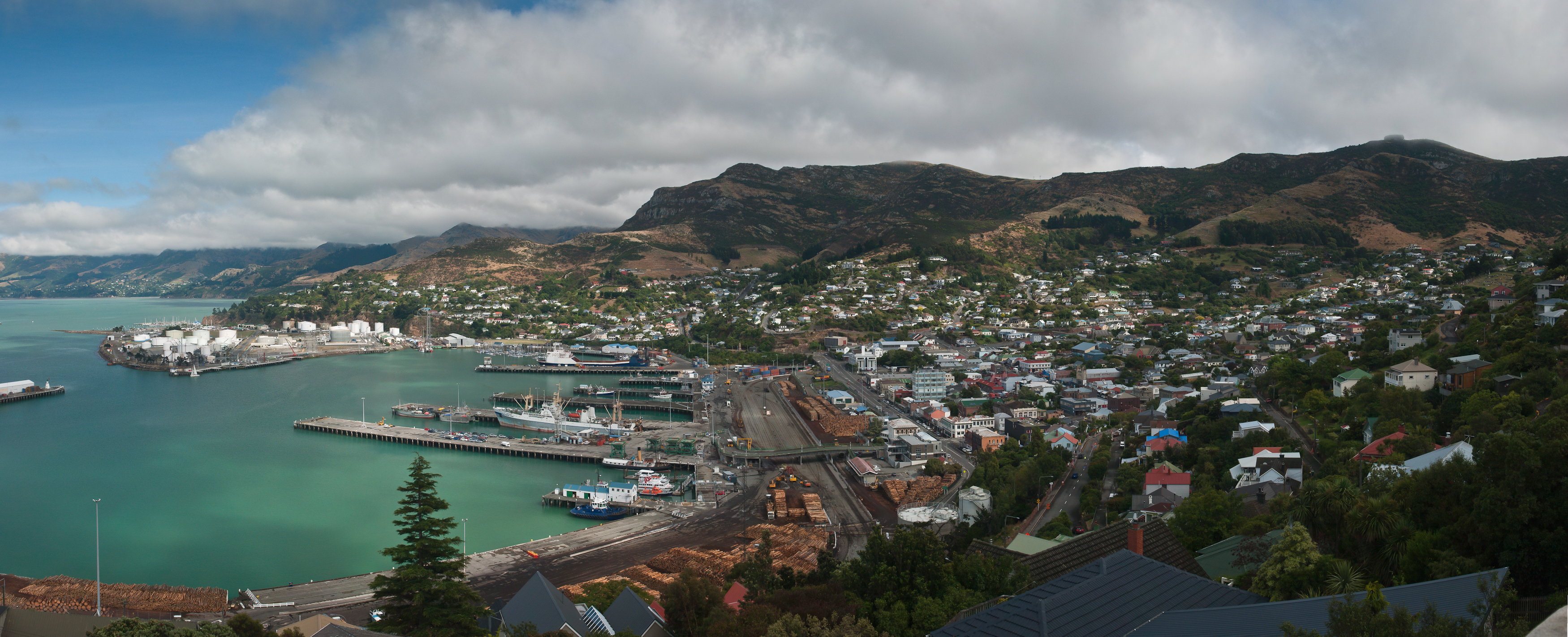
Lyttelton (Māori: ''Ōhinehou'') is a port town on the north shore of Lyttelton Harbour / Whakaraupō, at the northwestern end of Banks Peninsula and close to Christchurch, on the eastern coast of the South Island of New Zealand. As a landing point for Christchurch-bound seafarers, Lyttelton has historically been regarded as the "Gateway to Canterbury" for colonial settlers. Until the 2020 coronavirus pandemic, the port has been a regular destination for cruise ships. It is the South Island's principal goods-transport terminal, handling 34% of exports and 61% of imports by value. In 2009 Lyttelton was awarded Category I Historic Area status by the Historic Places Trust (NZHPT) defined as "an area of special or outstanding historical or cultural heritage significance or value", not long before much of the historic fabric was destroyed in the 2011 Christchurch earthquake. Location Lyttelton is the largest settlement on Lyttelton Harbour / Whakaraupō, an inlet on the northwe ... [...More Info...] [...Related Items...] OR: [Wikipedia] [Google] [Baidu] |
Volcano
A volcano is a rupture in the crust of a planetary-mass object, such as Earth, that allows hot lava, volcanic ash, and gases to escape from a magma chamber below the surface. On Earth, volcanoes are most often found where tectonic plates are diverging or converging, and most are found underwater. For example, a mid-ocean ridge, such as the Mid-Atlantic Ridge, has volcanoes caused by divergent tectonic plates whereas the Pacific Ring of Fire has volcanoes caused by convergent tectonic plates. Volcanoes can also form where there is stretching and thinning of the crust's plates, such as in the East African Rift and the Wells Gray-Clearwater volcanic field and Rio Grande rift in North America. Volcanism away from plate boundaries has been postulated to arise from upwelling diapirs from the core–mantle boundary, deep in the Earth. This results in hotspot volcanism, of which the Hawaiian hotspot is an example. Volcanoes are usually not created where two tectonic plates slide ... [...More Info...] [...Related Items...] OR: [Wikipedia] [Google] [Baidu] |
Lyttelton Harbour
Lyttelton Harbour / Whakaraupō is one of two major inlets in Banks Peninsula, on the coast of Canterbury, New Zealand; the other is Akaroa Harbour on the southern coast. It enters from the northern coast of the peninsula, heading in a predominantly westerly direction for approximately from its mouth to the aptly-named Head of the Bay near Teddington. The harbour sits in an eroded caldera of the ancient Banks Peninsula Volcano, the steep sides of which form the Port Hills on its northern shore. The harbour's main population centre is Lyttelton, which serves the main port to the nearby city of Christchurch, linked with Christchurch by the single-track Lyttelton rail tunnel (opened 1867), a two lane road tunnel (opened 1964) and two roads over the Port Hills. Diamond Harbour lies to the south and the Māori village of Rāpaki to the west. At the head of the harbour is the settlement of Governors Bay. The reserve of Otamahua / Quail Island is near the harbour head and Ripap ... [...More Info...] [...Related Items...] OR: [Wikipedia] [Google] [Baidu] |
Christchurch Gondola 02
Christchurch ( ; mi, Ōtautahi) is the largest city in the South Island of New Zealand and the seat of the Canterbury Region. Christchurch lies on the South Island's east coast, just north of Banks Peninsula on Pegasus Bay. The Avon River / Ōtākaro flows through the centre of the city, with an urban park along its banks. The city's territorial authority population is people, and includes a number of smaller urban areas as well as rural areas. The population of the urban area is people. Christchurch is the second-largest city by urban area population in New Zealand, after Auckland. It is the major urban area of an emerging sub-region known informally as Greater Christchurch. Notable smaller urban areas within this sub-region include Rangiora and Kaiapoi in Waimakariri District, north of the Waimakariri River, and Rolleston, New Zealand, Rolleston and Lincoln, New Zealand, Lincoln in Selwyn District to the south. The first inhabitants migrated to the area sometime between 1 ... [...More Info...] [...Related Items...] OR: [Wikipedia] [Google] [Baidu] |
Harry Ell
Henry George Ell (probably 24 September 1862 – 27 June 1934), commonly known as Harry Ell, was a Christchurch City Council, Christchurch City councillor and a New Zealand Member of parliament, Member of Parliament. He is famous for his conservation work around Christchurch's Port Hills, his advocacy for the Summit Road, and his construction of the Sign of the Takahe and other road houses along the Summit Road. Early years Ell was born in Christchurch, New Zealand, and grew up on his father's farm in Halswell. As a teenager he worked at the Canterbury Museum, then as a farm hand. Between 1881 and 1884 he was a member of the Armed Constabulary in Taranaki, where he participated in the destruction of Parihaka. This experience turned him into a stern critic of the race-relations policies of the time. Ell was a Christchurch City councillor in 1903 and then again between 1917 and 1919. He was a member of the Knights of Labour and the Canterbury Liberal Association. Member of Parli ... [...More Info...] [...Related Items...] OR: [Wikipedia] [Google] [Baidu] |
Mount Pleasant, New Zealand
Mount Pleasant (Tauhinukorokio) is a coastal suburb of Christchurch, New Zealand. The suburb is located on the northern flank of the mountain Tauhinukorokio/Mount Pleasant in the Port Hills. It takes its name from the English version of the mountain's name. The area was originally administered by the borough of Sumner. A petition in September 1920, by 57 of the suburb's 66 ratepayers, asked for it to be included as a riding of the Heathcote County. At the time of the petition, the area was mostly farmland, with 21 dwelling houses and an estimated population of 80. Whilst the mayor of Sumner, John Barr, submitted against the petition, it was granted and took effect on 1 April 1921. As a result of the 1989 local government reforms, Heathcote County was amalgamated with and became part of Christchurch City Council. The suburb and its houses were extensively damaged in the 2011 Christchurch earthquake. Demographics Mount Pleasant covers . It had an estimated population of ... [...More Info...] [...Related Items...] OR: [Wikipedia] [Google] [Baidu] |
Richard Cavendish (1794–1876)
The Honourable, The Hon. Richard Cavendish (23 December 1794 – 18 March 1876) was an English nobleman, politician, Member of parliament, Member of Parliament, and a member of the Canterbury Association. Biography Cavendish was born in Waterpark, County Cork, Ireland, in 1794. He was the second son of Richard Cavendish, 2nd Baron Waterpark and Juliana Cooper. Sir Henry Cavendish, 2nd Baronet, was his grandfather. His elder brother Henry Cavendish, 3rd Baron Waterpark succeeded their father in the family titles. His sister Sarah Georgiana Cavendish married Sir George Philips, 2nd Baronet. His sister Catherine Cavendish married Bishop Thomas Musgrave (bishop), Thomas Musgrave. On 22 July 1841, he married Elizabeth Maria Margaret Hart at Uttoxeter. He went into civil service in 1811 for the East India Company. In the 1820s, he was a Member of parliament, Member of Parliament. By 1831, he lived in Gwalior, India. He was an Envoy (title), envoy in Nagpur by 1835. He became a dire ... [...More Info...] [...Related Items...] OR: [Wikipedia] [Google] [Baidu] |
Canterbury Association
The Canterbury Association was formed in 1848 in England by members of parliament, peers, and Anglican church leaders, to establish a colony in New Zealand. The settlement was to be called Canterbury, with its capital to be known as Christchurch. Organised emigration started in 1850 and the colony was established in the South Island, with the First Four Ships bringing out settlers steeped in the region's history. The Association was not a financial success for the founding members and the organisation was wound up in 1855. Formation of the Association The Association, founded in London on 27 March 1848, was incorporated by Royal Charter on 13 November 1849. The prime movers were Edward Gibbon Wakefield and John Robert Godley. Wakefield was heavily involved in the New Zealand Company, which by that time had already established four other colonies in New Zealand (Wellington, Nelson, Petre and Otago). Wakefield approached Godley to help him establish a colony sponsored by the Chu ... [...More Info...] [...Related Items...] OR: [Wikipedia] [Google] [Baidu] |
Heathcote Valley
Heathcote Valley is a suburb of Christchurch, New Zealand. It is named after Sir William Heathcote, who was secretary of the Canterbury Association. Location Nestled at the foot of the steep volcanic crags that form the northern edge of the hills, some southeast of the city centre the Heathcote Valley is dominated by the approaches to the Lyttelton road tunnel, a major arterial that passes through the Port Hills. The road is part of the State Highway 74 network. The Main South Railway line also passes through the suburb, before entering the Lyttelton rail tunnel that connects with the port of Lyttelton. Heathcote Valley is the lower terminus of the Christchurch Gondola, which goes up to Mount Cavendish on the Port Hills, and also for the Bridle Path walking track over the northern rim of the Lyttelton volcano to the port of Lyttelton. History In the past the Heathcote Valley was known for its orchards, brickworks and maltworks. The distinctive towers of the Canterbury Ma ... [...More Info...] [...Related Items...] OR: [Wikipedia] [Google] [Baidu] |


