|
Motorways In Albania
The motorways in Albania () are the controlled-access highway system in Albania predominantly under the supervision of the Ministry of Infrastructure and Energy. The motorways are characterised as roads with at least two lanes in each driving direction including an emergency lane and a maximum allowed speed limit of not less than . The longest motorway in Albania constitute the A1 motorway which connects Durrës in Albania to Pristina in Kosovo. There is also a motorway from Fier to Vlorë, the A2 motorway, as well as the A3 motorway from Tirana to Elbasan. The majority of the motorways are still under construction or in various stages of development such as the bypasses of Fier, and Tirana and the planned sections between Thumana and Kashar, and between Milot and Balldren. In some ways, Albanian motorway road signs bears some similarity to those of Italy. Motorways Completed }) is mostly a four traffic lane toll motorway spanning . The motorway connects the Albania ... [...More Info...] [...Related Items...] OR: [Wikipedia] [Google] [Baidu] |
Motorway
A controlled-access highway is a type of highway that has been designed for high-speed vehicular traffic, with all traffic flow—ingress and egress—regulated. Common English terms are freeway, motorway and expressway. Other similar terms include '' throughway'' and '' parkway''. Some of these may be limited-access highways, although this term can also refer to a class of highways with somewhat less isolation from other traffic. In countries following the Vienna convention, the motorway qualification implies that walking and parking are forbidden. A fully controlled-access highway provides an unhindered flow of traffic, with no traffic signals, intersections or property access. They are free of any at-grade crossings with other roads, railways, or pedestrian paths, which are instead carried by overpasses and underpasses. Entrances and exits to the highway are provided at interchanges by slip roads (ramps), which allow for speed changes between the highway and arteri ... [...More Info...] [...Related Items...] OR: [Wikipedia] [Google] [Baidu] |
Bypass (road)
A bypass is a road or highway that avoids or "bypasses" a built-up area, town, or village, to let through traffic flow without interference from local traffic, to reduce congestion in the built-up area, and to improve road safety. A bypass specifically designated for trucks may be called a truck route. If there are no strong land use controls, buildings are often built in town along a bypass, converting it into an ordinary town road, and the bypass may eventually become as congested as the local streets it was intended to avoid. Petrol station A filling station, also known as a gas station () or petrol station (), is a facility that sells fuel and engine lubricants for motor vehicles. The most common fuels sold in the 2010s were gasoline (or petrol) and diesel fuel. Gaso ...s, shopping centres and some other businesses are often built there for ease of access, while homes are often avoided for noise and pollution reasons. Bypass routes are often controversial, ... [...More Info...] [...Related Items...] OR: [Wikipedia] [Google] [Baidu] |
Albanian Alps
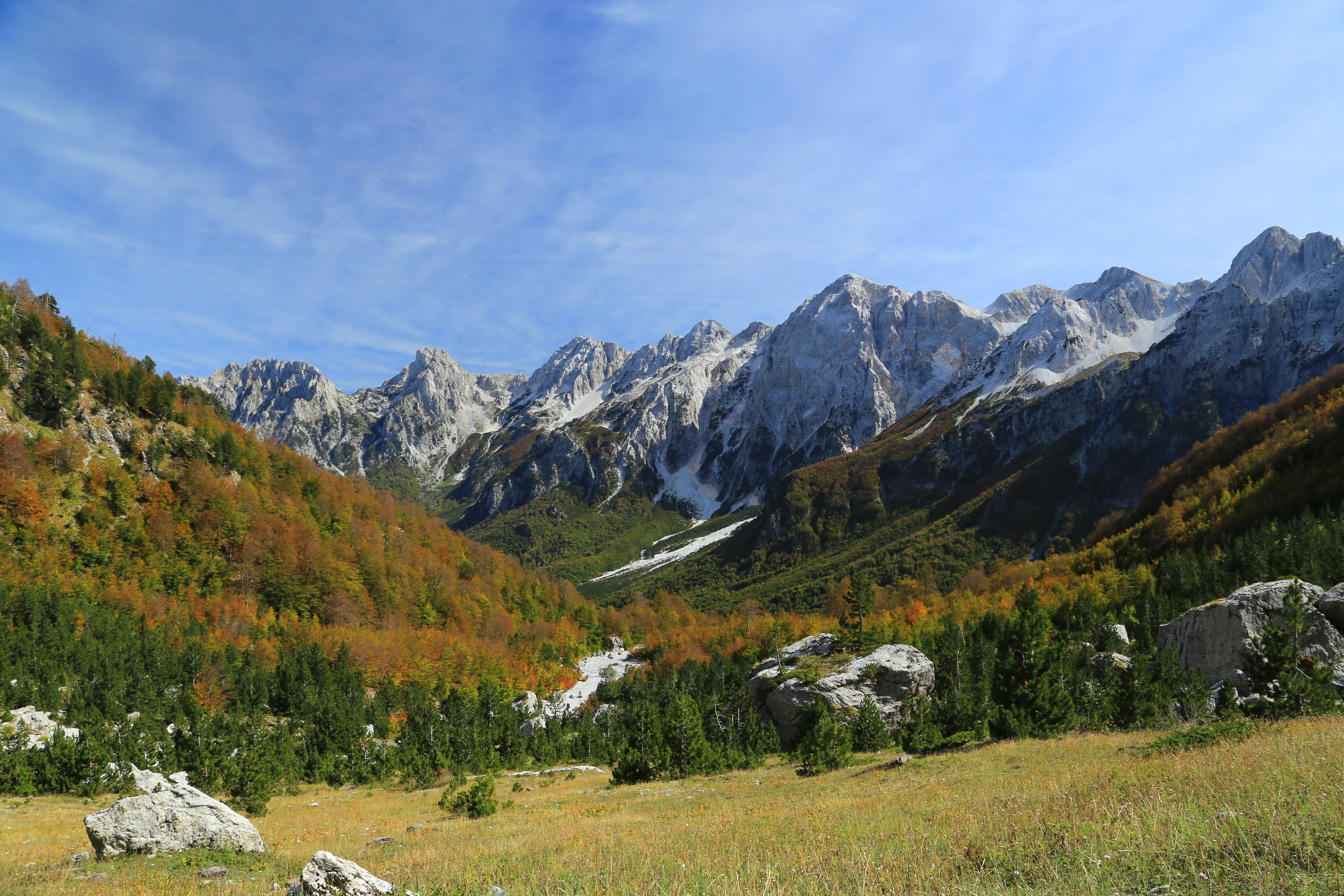
The Accursed Mountains ( sq, Bjeshkët e Nemuna; sh-Cyrl-Latn, Проклетије, Prokletije, ; both translated as "Cursed Mountains"), also known as the Albanian Alps ( sq, Alpet Shqiptare), are a mountain group in the western part of the Balkans. It is the southernmost subrange of the Dinaric Alps range (Dinarides), extending from northern Albania to southern Kosovo and northeastern Montenegro. Maja Jezercë, standing at , is the highest point of the Accursed Mountains and of all Dinaric Alps, and the fifth highest peak in Albania. The highest peak in Montenegro, Zla Kolata at and the second-highest in Kosovo, Gjeravica at are also part of the range. One of the southernmost glacial masses in Europe was discovered in the Albanian part of the range in 2009. Name Ptolemy mentioned , which has been connected to the Accursed Mountains. Bertiscus lives on artificially in the form ''bertiscae'' in the scientific names for endemic species that have their ''locus classicus'' ... [...More Info...] [...Related Items...] OR: [Wikipedia] [Google] [Baidu] |
Albanian Adriatic Sea Coast
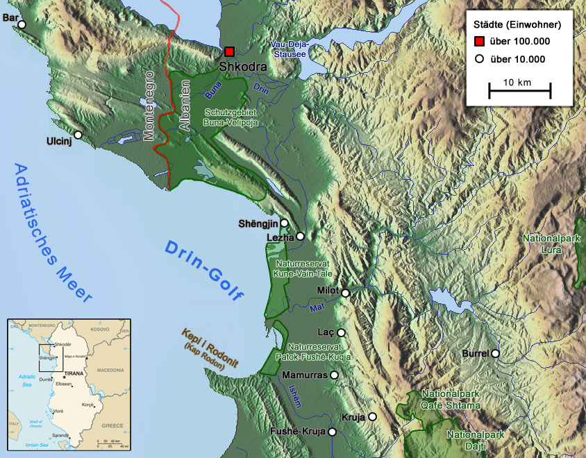
The Albanian Adriatic Sea Coast ( — ) stretches in the Southeastern Adriatic Sea beginning at the Gulf of Drin in the north, across the port cities of Shëngjin, Durrës and Vlorë, to the Bay of Vlorë in the south, where the Albanian Riviera as well as the Albanian Ionian Sea Coast begins. Albania is geographically located in South and Southeast Europe within the Balkan Peninsula. It borders on Montenegro to the northwest, Kosovo to the northeast, North Macedonia to the east, Greece to the south and the Mediterranean Sea to the west. The total length of the coastline is approximately , of which are taken up by white sandy beaches and the remaining by different landforms. The Adriatic Sea is the northernmost arm of the Mediterranean Sea extending all the way from the Strait of Otranto in the south up to the Po Valley in the north. The sea is apportioned into two major basins, wherein Albania is entirely located within the deepest and southernmost one. The coastline i ... [...More Info...] [...Related Items...] OR: [Wikipedia] [Google] [Baidu] |
Traffic Lane
In road transport, a lane is part of a roadway that is designated to be used by a single line of vehicles to control and guide drivers and reduce traffic conflicts. Most public roads (highways) have at least two lanes, one for traffic in each direction, separated by lane markings. On multilane roadways and busier two-lane roads, lanes are designated with road surface markings. Major highways often have two multi-lane roadways separated by a median. Some roads and bridges that carry very low volumes of traffic are less than wide, and are only a single lane wide. Vehicles travelling in opposite directions must slow or stop to pass each other. In rural areas, these are often called country lanes. In urban areas, alleys are often only one lane wide. Urban and suburban one lane roads are often designated for one-way traffic. History For much of human history, roads did not need lane markings because most people walked or rode horses at relatively slow speeds. However, when auto ... [...More Info...] [...Related Items...] OR: [Wikipedia] [Google] [Baidu] |
Kukës
Kukës ( sq-definite, Kukësi) is a city in the Republic of Albania. The city is the capital of the surrounding municipality of Kukës and county of Kukës, one of 12 constituent counties of the republic. It spans and had a total population of 16,719 people as of 2011. Geologically, the terrain of the surrounding area is dominated by mountainous and high terrain. The city sprawls across the Luma Plain within the Albanian Alps between the banks of Lake Fierza and the hills of the northernmost Korab Mountains and westernmost Shar Mountains. At the confluence of the Black and White Drin, the Drin River originates close to the city's territory. History Early Development Kukës traces its history back over a thousand years. The region that nowadays corresponds to the city territory was inhabited by several ancient Illyrian tribes, as most of Albania. Numerous tombs from the Illyrians have been identified at Këneta and Kolsh nearby the city. The residential estate served as a ... [...More Info...] [...Related Items...] OR: [Wikipedia] [Google] [Baidu] |
Rrëshen
Rrëshen ( sq-definite, Rrësheni) is a small town and a former municipality in Lezhë County, in northern Albania. History At the 2015 local government reform, Rrëshen became a subdivision and the seat of the municipality Mirditë. It was the administrative seat of the former Mirditë District. The population at the 2011 census was 8,803.2011 census results The City As an administrative seat, the town has schools and a hospital. After the Communist era, new facilities such as a , a restaurant, and a cultural centre appeared in ...[...More Info...] [...Related Items...] OR: [Wikipedia] [Google] [Baidu] |
Lezhë
Lezhë (, sq-definite, Lezha) is a city in the Republic of Albania and seat of Lezhë County and Lezhë Municipality. One of the main strongholds of the Labeatai, the earliest of the fortification walls of Lezhë are of typical Illyrian construction and are dated to the late 4th century BC. Lezhë was one of the main centres of the Illyrian kingdom. During the conflicts with Macedon, it was captured by Philip V becoming the Macedonian outlet to the Adriatic Sea. The city was later recovered by the Illyrians. It was subjected to Rome after the Roman-Illyrian wars and the fall of Gentius' realm. Lezhë was the site of the League of Lezhë where Skanderbeg united the Albanian lords in the fight against the Ottoman Empire. Name The city is mentioned in ancient sources as ''Lissós'' (Ancient Greek: Λισσός) and ''Lissus'' (Latin: ''Lissus'', ''Lissum''). It is also attested in numismatic material. The ''ethnicon'' ΛΙΣΣΙΤΑΝ /LISSITAN/ is found on coin inscriptions ... [...More Info...] [...Related Items...] OR: [Wikipedia] [Google] [Baidu] |
Laç
Laç (; sq-definite, Laçi) is a town and a former municipality in Lezhë County, northwestern Albania. At the 2015 local government reform it became a subdivision and the seat of the municipality Kurbin. It was the administrative center of the former Kurbin District. The population at the 2011 census was 17,086.2011 census results Its associated club is . Laç is served by . Name La� ...[...More Info...] [...Related Items...] OR: [Wikipedia] [Google] [Baidu] |
Kukës County
Kukës County (; sq, Qarku i Kukësit) is a landlocked county in northeastern Albania, with the capital in Kukës. The county spans and had a total population of 74,388 people as of 2021. The county borders on the counties of Dibër, Lezhë and Shkodër and the countries of Montenegro, Kosovo and North Macedonia. It is divided into three municipalities: Has, Kukës and Tropojë. The municipalities are further subdivided into 290 towns and villages in total. The human presence in the lands of modern Kukës County can be traced back to the Bronze Ages, when ancient Illyrians, Dardanians and Romans established settlements in the region. Several Illyrian tombs were discovered in the villages of Këneta and Kolsh close to Kukës. Kukës is predominantly mountainous and framed by mountain ranges including the Albanian Alps in the northwest which is typified by karst topography. The northeast is dominated by the mountains of Gjallica, Koritnik and Pashtrik, while the southeaste ... [...More Info...] [...Related Items...] OR: [Wikipedia] [Google] [Baidu] |
Lezhë County
Lezhë County ( sq, Qarku i Lezhës) is one of the 12 counties of Albania. The population as of 2021 was 120,678, in an area of 1620 km².2011 census results Its capital is the city . Administrative divisions Until 2000, Lezhë County was subdivided into three districts: , , and . Since the ...[...More Info...] [...Related Items...] OR: [Wikipedia] [Google] [Baidu] |
Tirana County
Tirana County ( sq, Qarku Tiranë, italic=unset), officially the County of Tirana ( sq, Qarku i Tiranës, italic=unset), is a Counties of Albania, county in the Central Albania, Central Region of the Republic of Albania. It is the tenth largest by area and the List of counties of Albania by population, most populous of the twelve counties, with more than 912,000 people within an area of . The county borders on the Adriatic Sea to the west, the counties of Durrës County, Durrës to the northwest, Dibër County, Dibër to the northeast, Elbasan County, Elbasan to the east and Fier County, Fier to the southwest. It is divided into five Municipalities of Albania, municipalities, Tirana, Kamëz, Kavajë, Rrogozhinë and Vorë, with all of whom incorporate twenty-nine Villages of Tirana County, administrative units. Geography of Albania, Geographically, Tirana extends from the high and rugged Skanderbeg Mountains in the east to the flat shores of the Albanian Adriatic Sea Coast along th ... [...More Info...] [...Related Items...] OR: [Wikipedia] [Google] [Baidu] |


