|
Morden Colliery Historic Provincial Park
Morden Colliery Historic Provincial Park is a historic provincial park near the east coast of southern Vancouver Island, British Columbia. The location off BC Highway 19 is about by road northwest of Victoria, and south of Nanaimo. Railway In 1909, the Pacific Coast Coal Mining Co. (PCCM) opened a standard-gauge railway line from Fiddick's Junction on the E&N Railway line to Boat Harbour for loading coal into the holds of vessels. The next year, the line extended westward to the Fiddick Colliery. In early 1915, 19 men drowned in the Fiddick mine disaster. Late the next year, all production ceased, and all workers transferred southeast to the PCCM Morden Colliery. Morden Colliery On the existing PCCM Fiddick railway line, work commenced on the Morden mine shafts (nos. 3 and 4) in 1912, but the coal seam was not reached until a year later. A yearlong strike in 1913–1914 allowed the new shafts to flood. At this time, the high concrete headframe was constructed. During 19 ... [...More Info...] [...Related Items...] OR: [Wikipedia] [Google] [Baidu] |
British Columbia
British Columbia (commonly abbreviated as BC) is the westernmost province of Canada, situated between the Pacific Ocean and the Rocky Mountains. It has a diverse geography, with rugged landscapes that include rocky coastlines, sandy beaches, forests, lakes, mountains, inland deserts and grassy plains, and borders the province of Alberta to the east and the Yukon and Northwest Territories to the north. With an estimated population of 5.3million as of 2022, it is Canada's third-most populous province. The capital of British Columbia is Victoria and its largest city is Vancouver. Vancouver is the third-largest metropolitan area in Canada; the 2021 census recorded 2.6million people in Metro Vancouver. The first known human inhabitants of the area settled in British Columbia at least 10,000 years ago. Such groups include the Coast Salish, Tsilhqotʼin, and Haida peoples, among many others. One of the earliest British settlements in the area was Fort Victoria, established ... [...More Info...] [...Related Items...] OR: [Wikipedia] [Google] [Baidu] |
Tipple
A tipple is a structure used at a mine to load the extracted product (e.g., coal, ores) for transport, typically into railroad hopper cars. In the United States, tipples have been frequently associated with coal mines, but they have also been used for hard rock mining. Operation Basic coal tipples simply load coal into railroad cars. Many tipples had simple screening equipment to sort coal pieces by size before loading. Today, a coal mine facility usually includes a coal preparation plant which washes coal of soil and rock, before loading it for transport to market. The term "tipple" may be used interchangeably with coal prep plant. Tipples were initially used with minecarts, also called ''tubs'' or ''tram cars'', or ''mine cars'' in the U.S. These were small hopper cars that carried the product on a mine railway out of the mine. When a mine car entered the upper level of the tipple, its contents were dumped through a chute leading to a railroad hopper car positioned on a track r ... [...More Info...] [...Related Items...] OR: [Wikipedia] [Google] [Baidu] |
Mining In British Columbia
British Columbia ( B.C.) is the third largest Canadian province by population and fourth largest provincial economy. Like other provinces in the Canadian federation, B.C. consists of both private and public institutions. However, as Canada's westernmost province, located between the Pacific Ocean and the Rocky Mountains, B.C. has unique economic characteristics that distinguish it from much of the rest of Canada. Economic Geography Geography has played a significant role in the province's economic development. B.C.’s location on Canada's west coast puts it at the commercial crossroads of the Asia-Pacific region and North America. B.C. is geographically characterized by mountainous topography along with substantial areas of lowlands and plateaus. Though less than 5% of B.C.’s land is arable due to mostly mountainous terrain, the province is agriculturally rich. This can be attributed to relatively mild weather along the Pacific Northwestern coast and in various sheltered ... [...More Info...] [...Related Items...] OR: [Wikipedia] [Google] [Baidu] |
Provincial Parks Of British Columbia
Provincial may refer to: Government & Administration * Provincial capitals, an administrative sub-national capital of a country * Provincial city (other) * Provincial minister (other) * Provincial Secretary, a position in Canadian government * Member of Provincial Parliament (other), a title for legislators in Ontario, Canada as well as Eastern Cape Province, South Africa. * Provincial council (other), various meanings * Sub-provincial city in the People's Republic of China Companies * The Provincial sector of British Rail, which was later renamed Regional Railways * Provincial Airlines, a Canadian airline * Provincial Insurance Company, a former insurance company in the United Kingdom Other Uses * Provincial Osorno, a football club from Chile * Provincial examinations, a school-leaving exam in British Columbia, Canada * A provincial superior of a religious order * Provincial park, the equivalent of national parks in the Canadian province ... [...More Info...] [...Related Items...] OR: [Wikipedia] [Google] [Baidu] |
Hemer Provincial Park
Hemer Provincial Park is a provincial park in British Columbia, Canada. It is located south of Nanaimo Nanaimo ( ) is a city on the east coast of Vancouver Island, in British Columbia, Canada. As of the Canada 2021 Census, 2021 census, it had a population of 99,863, and it is known as "The Harbour City." The city was previously known as the "H .... References Regional District of Nanaimo Provincial parks of British Columbia 1981 establishments in British Columbia Protected areas established in 1981 {{BritishColumbia-park-stub ... [...More Info...] [...Related Items...] OR: [Wikipedia] [Google] [Baidu] |
Nanaimo River
The Nanaimo River is a river on Vancouver Island, British Columbia, Canada, located near the city of Nanaimo on the island's east coast. Its headwaters are in the Vancouver Island Ranges of central Vancouver Island and its mouth, the Nanaimo River estuary, is at the south end of Nanaimo Harbour in the Strait of Georgia. The estuary is part of the Pacific Estuary Conservation Program. The river and its drainage basin contain a wide range of industrial and recreational activities. Logging and coal mining were a couple of the earliest industrial operations. While coal mining ceased in the first half of the 20th century, logging continues to be important. Morden Colliery Historic Provincial Park is one of the few places left near the river that links to the region's coal mining history. Due to the lack of arable land, agriculture never became an important industry. In 1931, South Fork Dam was built upstream on the South Nanaimo River to supply water to the city of Nanaimo. In 1974 ... [...More Info...] [...Related Items...] OR: [Wikipedia] [Google] [Baidu] |
Muddy, Illinois
Muddy is a small incorporated village located in the Harrisburg Township in Saline County, Illinois, United States. The population was 78 at the 2000 census. History During the 19th century, the site of Muddy was home to a small settlement known as Robinson's Ford, which was among the communities considered for the seat of Saline County after the county's creation in the 1840s. The modern village of Muddy had its start as a mining settlement established by the Harrisburg Big Muddy Coal Company, for which it was named, in 1903. The mine was sold to the larger O'Gara Coal Company in 1906. The disused St. Ioasaph Orthodox Church in Muddy, built in 1913, is dedicated to Ioasaph of Belgorod. The church is located on South St. at . This church was attended by eastern European immigrants, including Russians, Slovaks, Poles, and Rusyns, Geography Muddy is located at (37.764086, -88.514469). The village lies along U.S. Route 45 northeast of Harrisburg and southwest of Eldorado. Th ... [...More Info...] [...Related Items...] OR: [Wikipedia] [Google] [Baidu] |
2011 Christchurch Earthquake
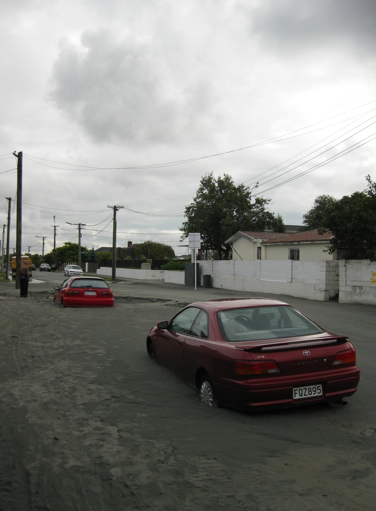
A major earthquake occurred in Christchurch on Tuesday 22 February 2011 at 12:51 p.m. local time (23:51 UTC, 21 February). The () earthquake struck the entire of the Canterbury region in the South Island, centred south-east of the central business district. It caused widespread damage across Christchurch, killing 185 people, in New Zealand's fifth-deadliest disaster. Christchurch's central city and eastern suburbs were badly affected, with damage to buildings and infrastructure already weakened by the magnitude 7.1 Canterbury earthquake of 4 September 2010 and its aftershocks. Significant liquefaction affected the eastern suburbs, producing around 400,000 tonnes of silt. The earthquake was felt across the South Island and parts of the lower and central North Island. While the initial quake only lasted for approximately 10 seconds, the damage was severe because of the location and shallowness of the earthquake's focus in relation to Christchurch as well as ... [...More Info...] [...Related Items...] OR: [Wikipedia] [Google] [Baidu] |
Gondola (rail)
In US railroad terminology, a gondola is an open-topped rail vehicle used for transporting loose bulk materials. Because of their low side walls, gondolas are also suitable for the carriage of such high-density cargos as steel plates or coils, or of bulky items such as prefabricated sections of rail track. Gondolas are distinct from hopper cars in that they do not have doors on their floor to empty cargo. In Australia these wagons are called ''open wagons''. History The first gondola cars in North America were developed in the 1830s, and used primarily to carry coal. Early gondolas were little more than flatcars with wooden sides added, and were typically small – or less in length, and or less in weight. These cars were not widely used at first, as they could only be unloaded by workers shoveling out their cargo by hand, a slow and labor-intensive process. A solution for this problem was developed around the 1860s with the drop-bottom gondola, which had hatches installed ... [...More Info...] [...Related Items...] OR: [Wikipedia] [Google] [Baidu] |
Headframe
A headframe (also known as a gallows frame, winding tower, hoist frame,Ernst, Dr.-Ing. Richard (1989). ''Wörterbuch der Industriellen Technik'' (5th ed.). Wiesbaden: Oscar Brandstetter, 1989. pit frame, shafthead frame, headgear, headstock or poppethead) is the structural frame above an underground mine shaft so as to enable the hoisting of machinery, personnel, or materials. Design Modern headframes are built out of steel, concrete or a combination of both. Timber headframes are no longer used in industrialized countries, but are still used in developing nations. Conventionally steel headframes are used when a drum hoist is employed, and concrete headframes are built for friction hoists; however a steel headframe can be used with a friction hoist for shafts with a smaller capacity and depth. Steel headframes A steel headframe is less expensive than a concrete headframe; the tallest steel headframe measures 87 m. Steel headframes are more adaptable to modifications (mak ... [...More Info...] [...Related Items...] OR: [Wikipedia] [Google] [Baidu] |
Regional District Of Nanaimo
The Regional District of Nanaimo is a regional district located on the eastern coast of Vancouver Island, British Columbia, Canada. It is bordered to the south by the Cowichan Valley Regional District, to the west by the Alberni-Clayoquot Regional District, and to the northwest by the Comox Valley Regional District. Its administration offices are located in Nanaimo. During the 2016 census, its population was established at 155,698. The Regional District of Nanaimo was incorporated on August 24, 1967. It has members that are cities, towns, districts, and seven electoral areas that contain unincorporated communities. The region owns and operates the Nanaimo Regional Transit System, which provides conventional local bus routes and special needs paratransit services. Incorporated municipalities Electoral areas Electoral areas have no administrative or governmental function, and are used only to select rural representatives to the Regional District board. Area A (Cassidy/Ced ... [...More Info...] [...Related Items...] OR: [Wikipedia] [Google] [Baidu] |


