|
Moorooka State School
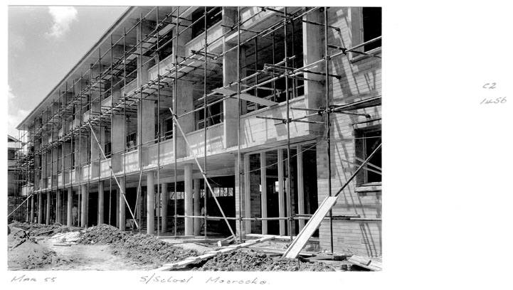
Moorooka State School is a heritage-listed state school at Sherley Street, Moorooka, Queensland, Moorooka, City of Brisbane, Queensland, Australia. The buildings were designed by Department of Public Works (Queensland) and Frederick George Kirkegard with the first buildings being constructed from 1928 to 1929. It was added to the Queensland Heritage Register on 28 August 2015. History Moorooka State School opened in January 1929 to accommodate the growing population of a previously rural district on the southern outskirts of Brisbane. The first Sectional School building was extended in 1933 and 1946 with further Sectional School buildings to its northeast and northwest corners. In 1956 a three-storey brick and concrete classroom block in a modernist style was added, as post-war housing construction in Moorooka continued to increase the local population. The standard and purpose-built school buildings are set amongst terraced, landscaped grounds with mature trees. Apart from a ... [...More Info...] [...Related Items...] OR: [Wikipedia] [Google] [Baidu] |
Moorooka, Queensland
Moorooka is a southern suburb in the City of Brisbane, Queensland, Australia. In the , Moorooka had a population of 10,368 people. Geography Moorooka is by road south of Brisbane's central business district. Ipswich Road enters the suburb from the north ( Annerley) and exits to the south-west (Rocklea). Beaudesert Road splits from Ipswich Road within the suburb and exits to the south (Rocklea). The Gold Coast railway line passes along part of the western boundary of the suburb, which is serviced by the Moorooka railway station (). The neighbourhood of Moorvale is located around the intersection of Beaudesert Road and Mayfield Road (. The suburb has mixed uses - large areas, particularly in the elevated eastern side of the suburb are residential. The lower, western side of the suburb is dominated by retail, particularly motor vehicle dealerships along Ipswich Road, known popularly throughout Brisbane as the "Magic Mile", light industry and warehouses. Many of the houses ... [...More Info...] [...Related Items...] OR: [Wikipedia] [Google] [Baidu] |

