|
Moordrecht
Moordrecht () is a town and a former municipality in the province of South Holland, the Netherlands, situated along the river Hollandse IJssel. In September 2006, 93% of the population of Moordrecht chose by referendum to pursue a merger with the neighboring municipalities Nieuwerkerk aan den IJssel and Zevenhuizen-Moerkapelle. Only 7% chose to merge with Gouda. Based on this result, the town council decided to form the new municipality Zuidplas Zuidplas () is a municipality in the Netherlands located in the province of South Holland. It was established on 1 January 2010 by the joining of Moordrecht, Nieuwerkerk aan den IJssel, and Zevenhuizen-Moerkapelle. It had a population of 41,753 ... in 2010 with Nieuwerkerk aan den IJssel and Zevenhuizen-Moerkapelle. International footballer Memphis Depay was born there. References External links Official website Municipalities of the Netherlands disestablished in 2010 Former municipalities of South Holland Populated places ... [...More Info...] [...Related Items...] OR: [Wikipedia] [Google] [Baidu] |
Memphis Depay
Memphis Depay (; born 13 February 1994), also known simply as Memphis, is a Dutch professional footballer who plays as a forward for La Liga club Barcelona and the Netherlands national team. Memphis began his professional career with PSV Eindhoven, where, under the influence of manager Phillip Cocu, he became an integral part of the team, scoring 49 goals in 124 games across all competitions. During the 2014–15 season, he was the Eredivisie's top scorer with 22 goals in 30 games, and helped the team win the Eredivisie title for the first time since 2008. He also won the Dutch Footballer of the Year for his performances during the season. His performances also led him to be named the "Best Young Player" in the world in 2015 by ''France Football''. Memphis joined English side Manchester United in June 2015 for a reported fee of £25 million. After a disappointing spell there, he joined French club Lyon in January 2017. After five seasons there, he joined Barcelona in 2021 on ... [...More Info...] [...Related Items...] OR: [Wikipedia] [Google] [Baidu] |
Nieuwerkerk Aan Den IJssel
Nieuwerkerk aan den IJssel (; population: 22,344 in 2004) is a town and former municipality in the western Netherlands, in the province of South Holland. Since 2010 it is part of the new municipality of Zuidplas. It is situated along the Hollandsche IJssel river, across from the town Ouderkerk aan den IJssel. Within the boundaries of this municipality lies the lowest point of the Netherlands: 6.76 m (22.2 ft) below Amsterdam Ordnance Datum (mean summer sea level in Amsterdam). It is the hometown of Miss Universe 1989, Angela Visser. History Nieuwerkerk was probably first formed circa 1250. The first reference to "''Nuwekerke''" is from 1282 when Count Floris V loaned the land between Kralingen and Gouda to a certain Traveys of Moordrecht. Another reference is from 22 January 1317 when Count William III of Holland sold the fiefdoms Capelle and Nieuwerkerk to John III van de Werve, Lord of Hovorst for 325 Dutch Pounds. The original old village formed on a mount ... [...More Info...] [...Related Items...] OR: [Wikipedia] [Google] [Baidu] |
Zuidplas
Zuidplas () is a municipality in the Netherlands located in the province of South Holland. It was established on 1 January 2010 by the joining of Moordrecht, Nieuwerkerk aan den IJssel, and Zevenhuizen-Moerkapelle. It had a population of 41,753 as of August 2017. Topography ''Dutch Topographic map of the municipality of Zuidplas, September 2014'' Notable people * Claes Michielsz Bontenbal (1575–1623) Secretary of Zevenhuizen and conspirator * Lia van Rhijn (born 1953) ceramist and sculptor * Arie Slob (born 1961) politician and history teacher * Angela Visser (born 1966) actress, model and beauty queen, Miss Universe 1989 retrieved 2 May 2019 * Hans Spekman (born 1966) politician * |
Netherlands
) , anthem = ( en, "William of Nassau") , image_map = , map_caption = , subdivision_type = Sovereign state , subdivision_name = Kingdom of the Netherlands , established_title = Before independence , established_date = Spanish Netherlands , established_title2 = Act of Abjuration , established_date2 = 26 July 1581 , established_title3 = Peace of Münster , established_date3 = 30 January 1648 , established_title4 = Kingdom established , established_date4 = 16 March 1815 , established_title5 = Liberation Day , established_date5 = 5 May 1945 , established_title6 = Kingdom Charter , established_date6 = 15 December 1954 , established_title7 = Caribbean reorganisation , established_date7 = 10 October 2010 , official_languages = Dutch , languages_type = Regional languages , languages_sub = yes , languages = , languages2_type = Recognised languages , languages2_sub = yes , languages2 = , demonym = Dutch , capital = Amsterdam , largest_city = capital , ... [...More Info...] [...Related Items...] OR: [Wikipedia] [Google] [Baidu] |
South Holland
South Holland ( nl, Zuid-Holland ) is a province of the Netherlands with a population of over 3.7 million as of October 2021 and a population density of about , making it the country's most populous province and one of the world's most densely populated areas. Situated on the North Sea in the west of the Netherlands, South Holland covers an area of , of which is water. It borders North Holland to the north, Utrecht and Gelderland to the east, and North Brabant and Zeeland to the south. The provincial capital is the Dutch seat of government The Hague, while its largest city is Rotterdam. The Rhine-Meuse-Scheldt delta drains through South Holland into the North Sea. Europe's busiest seaport, the Port of Rotterdam, is located in South Holland. History Early history Archaeological discoveries in Hardinxveld-Giessendam indicate that the area of South Holland has been inhabited since at least c. 7,500 years before present, probably by nomadic hunter-gatherers. Agriculture and per ... [...More Info...] [...Related Items...] OR: [Wikipedia] [Google] [Baidu] |
Statistics Netherlands
Statistics Netherlands, founded in 1899, is a Dutch governmental institution that gathers statistical information about the Netherlands. In Dutch it is known as the Centraal Bureau voor de Statistiek (''Central Agency for Statistics''), often abbreviated to CBS. It is located in The Hague and Heerlen. Since 3 January 2004, Statistics Netherlands has been a self-standing organisation, or quango. Its independent status in law guarantees the reliable collection and dissemination of information supporting public debate, policy development and decision-making. The CBS collects statistical information about, amongst others: * Count of the population * Consumer pricing * Economic growth * Income of persons and households * Unemployment * Religion The CBS carries out a program that needs to be ratified by the Central Commission for Statistics. This commission was replaced in 2016 by an Advisory Board. This independent board must guard the impartiality, independence, quality, rele ... [...More Info...] [...Related Items...] OR: [Wikipedia] [Google] [Baidu] |
Central European Time
Central European Time (CET) is a standard time which is 1 hour ahead of Coordinated Universal Time (UTC). The time offset from UTC can be written as UTC+01:00. It is used in most parts of Europe and in a few North African countries. CET is also known as Middle European Time (MET, German: MEZ) and by colloquial names such as Amsterdam Time, Berlin Time, Brussels Time, Madrid Time, Paris Time, Rome Time, Warsaw Time or even Romance Standard Time (RST). The 15th meridian east is the central axis for UTC+01:00 in the world system of time zones. As of 2011, all member states of the European Union observe summer time ( daylight saving time), from the last Sunday in March to the last Sunday in October. States within the CET area switch to Central European Summer Time (CEST, UTC+02:00) for the summer. In Africa, UTC+01:00 is called West Africa Time (WAT), where it is used by several countries, year round. Algeria, Morocco, and Tunisia also refer to it as ''Central Euro ... [...More Info...] [...Related Items...] OR: [Wikipedia] [Google] [Baidu] |
Central European Summer Time
Central European Summer Time (CEST), sometimes referred to as Central European Daylight Time (CEDT), is the standard clock time observed during the period of summer daylight-saving in those European countries which observe Central European Time (CET; UTC+01:00) during the other part of the year. It corresponds to UTC+02:00, which makes it the same as Eastern European Time, Central Africa Time, South African Standard Time, Egypt Standard Time and Kaliningrad Time in Russia. Names Other names which have been applied to Central European Summer Time are Middle European Summer Time (MEST), Central European Daylight Saving Time (CEDT), and Bravo Time (after the second letter of the NATO phonetic alphabet). Period of observation Since 1996, European Summer Time has been observed between 01:00 UTC (02:00 CET and 03:00 CEST) on the last Sunday of March, and 01:00 UTC on the last Sunday of October; previously the rules were not uniform across the European Union. There were pr ... [...More Info...] [...Related Items...] OR: [Wikipedia] [Google] [Baidu] |
Hollandse IJssel
The Hollandse (or Hollandsche) IJssel (; "Holland IJssel", as opposed to the 'regular' or Gelderland IJssel) is a branch of the Rhine delta that flows westward from Nieuwegein on river Lek through IJsselstein, Gouda and Capelle aan den IJssel to Krimpen aan den IJssel, where it ends in the Nieuwe Maas. Another branch called Enge IJssel ("Narrow IJssel") flows southwest from Nieuwegein. The name IJssel is thought to derive from the Germanic ''i sala'', meaning "dark water". Originally, the Hollandse IJssel forked off from river Lek at Nieuwegein, but the connection was cut off with the Hollandse IJssel nowadays only draining the surrounding pastures. If the North Sea floods, the Hollandse IJssel allows water through the Rotterdam Waterway to flood low-lying land east of Rotterdam. The Delta Works included a steel barrier that can be lowered within minutes to block the waterway. The sea protection constructions were built at the mouth of the Hollandse IJssel in 1957. See ... [...More Info...] [...Related Items...] OR: [Wikipedia] [Google] [Baidu] |
Zevenhuizen-Moerkapelle
Zevenhuizen-Moerkapelle () is a former municipality in the western Netherlands, in the province of South Holland. The municipality was formed on January 1, 1991, through the merger of Moerkapelle and Zevenhuizen. It was initially called Moerhuizen before being renamed to Zevenhuizen-Moerkapelle on February 1, 1992. The municipality joined the new municipality of Zuidplas on January 1, 2010. It consisted of the population centres of Moerkapelle, Oud Verlaat , image=File:oud2.jpg , image_capt=Syrian oud made by Abdo Nahat in 1921 , background= , classification= *String instruments * Necked bowl lutes , hornbostel_sachs=321.321-6 , hornbostel_sachs_desc=Composite chordophone sounded with a plectrum , ..., and Zevenhuizen. References External links Official Website ... [...More Info...] [...Related Items...] OR: [Wikipedia] [Google] [Baidu] |
Gouda, South Holland
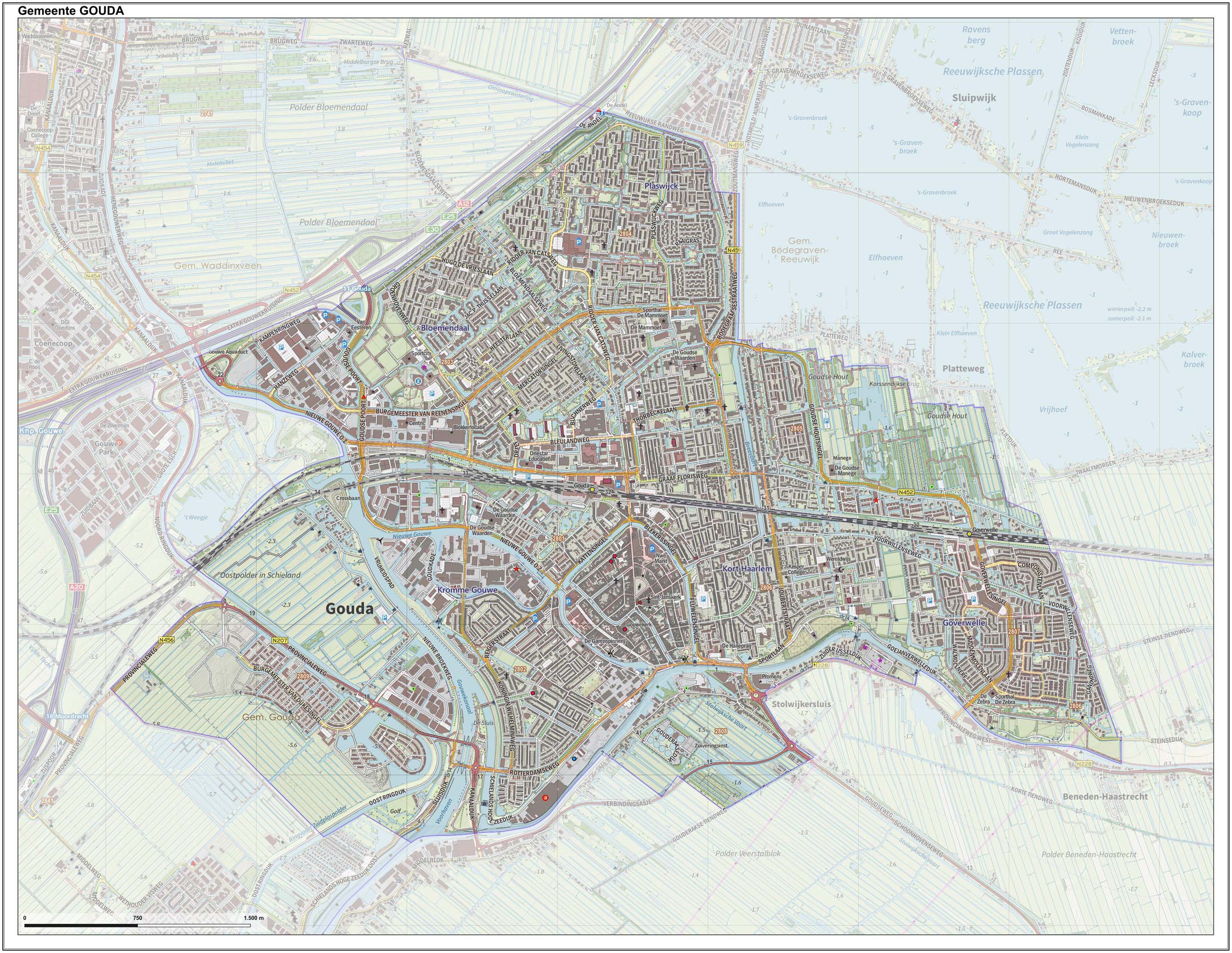
Gouda () is a city and municipality in the west of the Netherlands, between Rotterdam and Utrecht, in the province of South Holland. Gouda has a population of 75,000 and is famous for its Gouda cheese, stroopwafels, many grachten, smoking pipes, and its 15th-century city hall. Its array of historic churches and other buildings makes it a very popular day trip destination. In the Middle Ages, a settlement was founded at the location of the current city by the Van der Goude family, who built a fortified castle alongside the banks of the Gouwe River, from which the family and the city took its name. The area, originally marshland, developed over the course of two centuries. By 1225, a canal was linked to the Gouwe and its estuary was transformed into a harbour. City rights were granted in 1272. History Around the year 1100, the area where Gouda now is located was swampy and covered with a peat forest, crossed by small creeks such as the Gouwe. Along the shores of t ... [...More Info...] [...Related Items...] OR: [Wikipedia] [Google] [Baidu] |


.jpg)


