|
Montgomery County, Georgia
Montgomery County is a county located in the central portion of the U.S. state of Georgia. As of the 2020 census, the population was 8,610. The county seat is Mount Vernon. Montgomery County is part of the Vidalia, GA Micropolitan Statistical Area. History Montgomery County is named in honor of Richard Montgomery, an American Revolutionary War general killed in 1775 while attempting to capture Quebec City, Canada. It was created on December 19, 1793, from a southern portion of Washington County, Georgia. Arthur Lott's Plantation was designated the first county seat in 1797. In 1801, Tattnall County, Georgia was formed from the southern part of Montgomery County. The dividing line between Tatnall and Montgomery ran from the mouth of Limestone Creek on the Oconee River, just below modern Mount Vernon, Georgia, to the mouth of Wolf Creek on the Canoochee River below Metter, Georgia. The Great Revision On December 11, 1811, the county lines between Washington County, Montgom ... [...More Info...] [...Related Items...] OR: [Wikipedia] [Google] [Baidu] |
Richard Montgomery
Richard Montgomery (2 December 1738 – 31 December 1775) was an Irish soldier who first served in the British Army. He later became a major general in the Continental Army during the American Revolutionary War, and he is most famous for leading the unsuccessful 1775 invasion of Quebec. Montgomery was born and raised in Ireland. In 1754, he enrolled at Trinity College, Dublin, and two years later joined the British Army to fight in the French and Indian War. He steadily rose through the ranks, serving in North America and then the Caribbean. After the war he was stationed at Fort Detroit during Pontiac's War, following which he returned to Britain for health reasons. In 1773, Montgomery returned to the Thirteen Colonies, married Janet Livingston, and began farming. When the American Revolutionary War broke out, Montgomery took up the Patriot cause, and was elected to the New York Provincial Congress in May 1775. In June 1775, he was commissioned as a brigadier ... [...More Info...] [...Related Items...] OR: [Wikipedia] [Google] [Baidu] |
Canoochee River
The Canoochee River (pronounced ''kuh-NOO-chee'') is a U.S. Geological Survey. National Hydrography Dataset high-resolution flowline dataThe National Map, accessed April 26, 2011 river in southeastern Georgia in the United States. It is a tributary of the Ogeechee River, which flows to the Atlantic Ocean. In 1738 the Trustees of the colony mentioned the proposed house and ferry boat over the 'Cooanoochi River'. Course The Canoochee River is formed about southeast of Swainsboro in southwestern Emanuel County by the confluence of Canoochee Creek and Little Canoochee Creek, and flows generally southeastwardly through or along the boundaries of Candler, Evans, Bryan, and Liberty counties, through Fort Stewart. It joins the Ogeechee River from the west in Bryan County, south-southwest of Savannah. Name origin "Canoochee" may be a name derived from the Muscogee language, meaning "little ground". The United States Board on Geographic Names settled on "Canoochee River" as the stre ... [...More Info...] [...Related Items...] OR: [Wikipedia] [Google] [Baidu] |
Gum Swamp Creek
Gum Swamp Creek is a tributary of the Little Ocmulgee River in the U.S. state of Georgia. Via the Little Ocmulgee and Ocmulgee rivers, it is part of the Altamaha River basin draining to the Atlantic Ocean The Atlantic Ocean is the second-largest of the world's five oceans, with an area of about . It covers approximately 20% of Earth#Surface, Earth's surface and about 29% of its water surface area. It is known to separate the "Old World" of Afr .... See also * List of rivers of Georgia References * *USGS Hydrologic Unit Map - State of Georgia (1974) Rivers of Georgia (U.S. state) {{GeorgiaUS-river-stub ... [...More Info...] [...Related Items...] OR: [Wikipedia] [Google] [Baidu] |
Ordinance Of Secession
An Ordinance of Secession was the name given to multiple resolutions drafted and ratified in 1860 and 1861, at or near the beginning of the Civil War, by which each seceding Southern state or territory formally declared secession from the United States of America. South Carolina, Mississippi, Georgia, and Texas also issued separate documents purporting to justify secession. Adherents of the Union side in the Civil War regarded secession as illegal by any means and President Abraham Lincoln, drawing in part on the legacy of President Andrew Jackson, regarded it as his job to preserve the Union by force if necessary. However, President James Buchanan, in his State of the Union Address of December 3, 1860, stated that the Union rested only upon public opinion and that conciliation was its only legitimate means of preservation; President Thomas Jefferson also had suggested in 1816, after his presidency but in official correspondence, that secession of some states might be desirable ... [...More Info...] [...Related Items...] OR: [Wikipedia] [Google] [Baidu] |
Free People Of Color
In the context of the history of slavery in the Americas, free people of color (French: ''gens de couleur libres''; Spanish: ''gente de color libre'') were primarily people of mixed African, European, and Native American descent who were not enslaved. However, the term also applied to people born free who were primarily of black African descent with little mixture. They were a distinct group of free people of color in the French colonies, including Louisiana and in settlements on Caribbean islands, such as Saint-Domingue (Haiti), St. Lucia, Dominica, Guadeloupe, and Martinique. In these territories and major cities, particularly New Orleans, and those cities held by the Spanish, a substantial third class of primarily mixed-race, free people developed. These colonial societies classified mixed-race people in a variety of ways, generally related to visible features and to the proportion of African ancestry. Racial classifications were numerous in Latin America. A freed ... [...More Info...] [...Related Items...] OR: [Wikipedia] [Google] [Baidu] |
McRae, Georgia
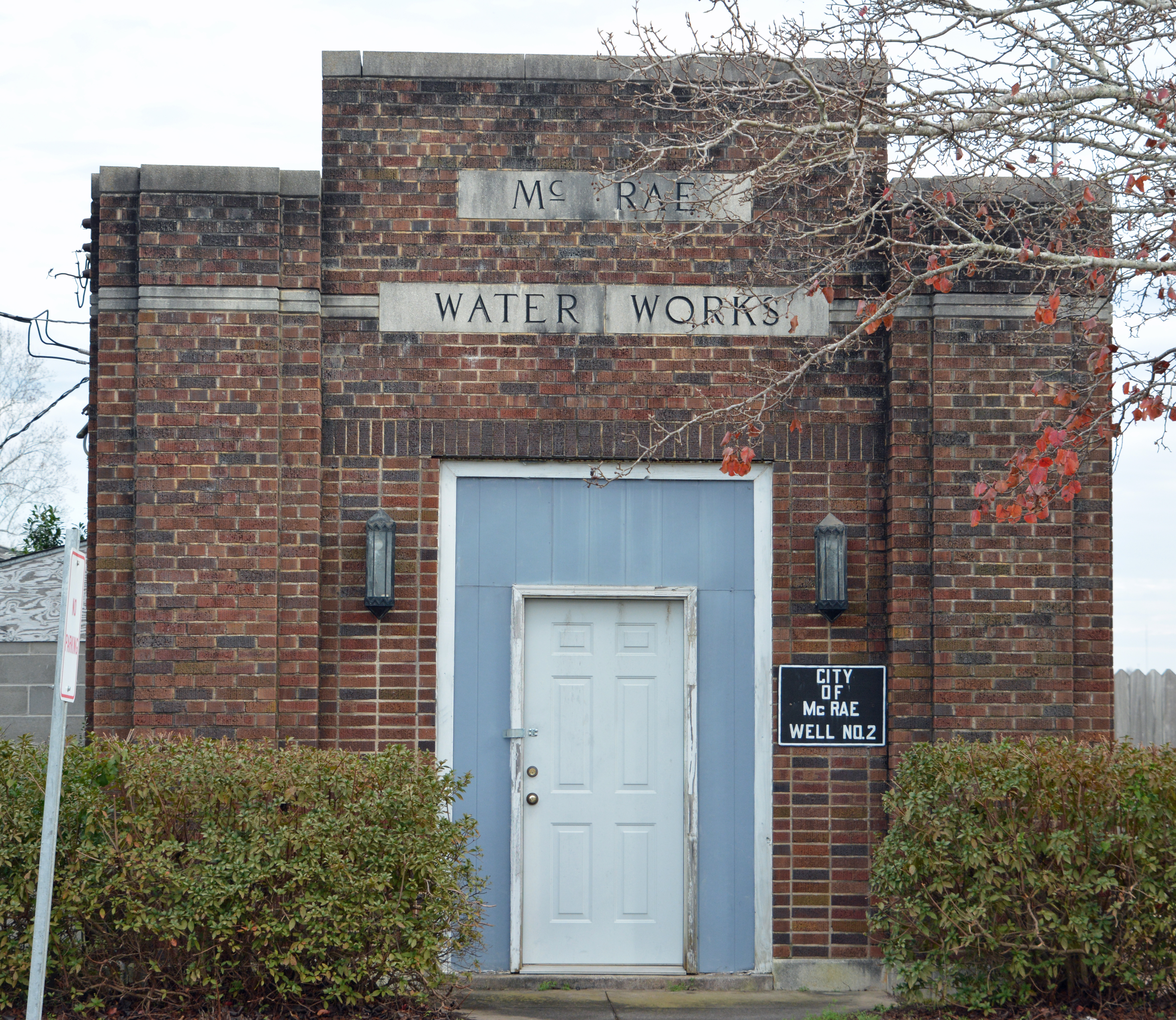
McRae was a city in and the county seat of Telfair County, Georgia, United States. It was designated as the seat in 1871, after being established the previous year as a station on the Macon and Brunswick Railroad. Upon the city's merger with adjacent Helena in 2015, the new county seat is the combined city of McRae-Helena. As of the 2010 census, McRae had a population of 5,740, up from 2,682 at the 2000 census, due largely to expansion of the city limits to incorporate the area and prison population of the McRae Correctional Institution, a privately owned and operated prison under contract to the federal government. The prison is a low-security facility holding adult males; it is owned and operated by CoreCivic. History McRae was founded in 1870 as station number eleven on the Macon and Brunswick Railroad. In 1871, the seat of Telfair County was transferred to McRae from Jacksonville. McRae was incorporated on March 3, 1874, and was named for a pioneering Scottish family. ... [...More Info...] [...Related Items...] OR: [Wikipedia] [Google] [Baidu] |
Pulaski County, Georgia
Pulaski County is a county located in the central portion of the U.S. state of Georgia. As of the 2010 census, the population was 12,010. The county seat is Hawkinsville. History Pulaski County was created by an act of the Georgia General Assembly on December 13, 1808, from a portion of Laurens County. In the antebellum years, it was developed for cotton cultivation and is part of the Black Belt of Georgia, an arc of highly fertile soil. In 1870, Dodge County was partially created from a section of Pulaski County by another legislative act. In 1912, the northwestern half of Pulaski County was used to create Bleckley County via a constitutional amendment approved by Georgia voters. The county was named for Count Kazimierz Pułaski of Poland who fought and died for United States independence in the American Revolutionary War. The county population fell by more than half from 1910 to 1930, as residents moved to cities. African Americans especially joined the Great Migrat ... [...More Info...] [...Related Items...] OR: [Wikipedia] [Google] [Baidu] |
Ocmulgee River
The Ocmulgee River () is a western tributary of the Altamaha River, approximately 255 mi (410 km) long, in the U.S. state of Georgia. It is the westernmost major tributary of the Altamaha.Ocmulgee River '' New Georgia Encyclopedia'' (August 9, 2004). It was formerly known by its Hitchiti name of Ocheese Creek, from which the (Muscogee) people derived their name. The Ocmulgee River and its tributaries provide |
Chauncey, Georgia
Chauncey is a city in Dodge County, Georgia, United States. The population was 342 at the 2010 census. It was formed around station number twelve on the Macon and Brunswick Railroad. History The Georgia General Assembly incorporated the "Town of Chauncey" in 1883. The community was named after William Chauncey, a businessperson in the local lumber industry. Geography Chauncey is located in southeastern Dodge County at (32.104972, -83.065991). U.S. Routes 23 and 341 pass concurrently through the center of town, leading northwest to Eastman, the county seat, and east to McRae. Sugar Creek runs along the southwest border of the city. According to the United States Census Bureau, Chauncey has a total area of , all of it land. Demographics 2020 census As of the 2020 United States census, there were 289 people, 143 households, and 89 families residing in the city. 2000 census As of the census of 2000, there were 295 people, 111 households, and 85 families residing in the ... [...More Info...] [...Related Items...] OR: [Wikipedia] [Google] [Baidu] |
Little Ocmulgee River
The Little Ocmulgee River is a U.S. Geological Survey. National Hydrography Dataset high-resolution flowline dataThe National Map, accessed April 21, 2011 tributary of the Ocmulgee River in the U.S. state of Georgia Georgia most commonly refers to: * Georgia (country), a country in the Caucasus region of Eurasia * Georgia (U.S. state), a state in the Southeast United States Georgia may also refer to: Places Historical states and entities * Related to t .... See also * List of rivers of Georgia References * *USGS Hydrologic Unit Map - State of Georgia (1974) Rivers of Georgia (U.S. state) {{GeorgiaUS-river-stub ... [...More Info...] [...Related Items...] OR: [Wikipedia] [Google] [Baidu] |
Telfair County, Georgia
Telfair County is a county located in the central portion of the U.S. state of Georgia. As of the 2010 census, the population was 16,500. The largest city and county seat is McRae-Helena. In 2009, researchers from the Fernbank Museum of Natural History announced having found artifacts they associated with the 1541 Hernando de Soto Expedition at a private site near the Ocmulgee River, the first such find between Tallahassee, Florida and western North Carolina. De Soto's expedition was well recorded, but researchers have had difficulties finding artifacts from sites where he stopped. This site was an indigenous village occupied by the historic Creek people from the early 15th century into the 16th century. It was located further southeast than de Soto's expedition was thought to go in Georgia. History Archaeologists associated with Atlanta's Fernbank Museum of Natural History have excavated a plot near McRae-Helena and approximately a mile from the Ocmulgee River, beginnin ... [...More Info...] [...Related Items...] OR: [Wikipedia] [Google] [Baidu] |
Laurens County, Georgia
Laurens County is a county located in the central part of the U.S. state of Georgia. As of the 2020 census, the population was 49,570, up from 48,434 in 2010. The county seat is Dublin. The county was founded on December 10, 1807, and named after Lieutenant Colonel John Laurens, an American soldier and statesman from South Carolina during the American Revolutionary War. Laurens County is part of the Dublin, Georgia Micropolitan Statistical Area. History Laurens County was formed on December 10, 1807, from portions of Wilkinson and Washington Counties. During the Red Summer of 1919 there was increased racial tension in the area and in August there was the Laurens County, Georgia race riot of 1919. Geography According to the U.S. Census Bureau, the county has a total area of , of which is land and (1.4%) is water. It is the third-largest county in Georgia by land area and fourth-largest by total area. The majority of Laurens County is located in the Lower Oconee River sub-b ... [...More Info...] [...Related Items...] OR: [Wikipedia] [Google] [Baidu] |


