|
Mokhotlong District
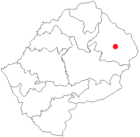
Mokhotlong district (in Sesotho language "the place of the bald ibis") is a district of Lesotho. It includes the highest terrain in the Maloti Mountains and the source of the Senqu River, Lesotho's primary watershed. Mokhotlong is the capital or camptown, and only town in the district. Mokhotlong borders on the KwaZulu-Natal Province of South Africa, with its north point bordering the Free State Province. Domestically, it borders on Butha-Buthe District in northwest, Leribe District in west, and Thaba-Tseka District in the south. As of 2006, the district had a population of 97,713 which was 5.21 per cent of the total population of the country. The total area of the district was 4,075 which was 13.42 per cent of the total area of the country. The density of population in the district was 24.00 per km2. The total area planted in crops in 2009 was 16,420 hectares, which formed 4.07 per cent of the total area planted in crops in the country. The total agricultural production wa ... [...More Info...] [...Related Items...] OR: [Wikipedia] [Google] [Baidu] |
Districts Of Lesotho
The Kingdom of Lesotho is divided into ten districts, each headed by a district administrator. Each district has a capital known as a camptown. The districts are further subdivided into 80 constituencies, which consist of 129 local community councils. Most of the districts are named after their capitals. Hlotse, the capital of Leribe District is also known as Leribe. Conversely, the Berea District is sometimes called Teyateyaneng, based on its capital. See also *List of districts of Lesotho by Human Development Index This is a list of districts of Lesotho by Human Development Index as of 2019. References {{Subnational entities by Human Development Index Lesotho Human Development Index The Human Development Index (HDI) is a statistic composit ... * ISO 3166-2:LS References Further readingCensus data by administrative division Subdivisions of Lesotho Lesotho, Districts Lesotho 1 Districts, Lesotho Lesotho geography-related lists {{Lesotho- ... [...More Info...] [...Related Items...] OR: [Wikipedia] [Google] [Baidu] |
Leribe District
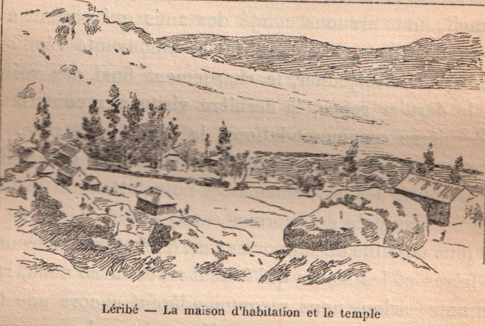
Leribè is a district of Lesotho. It has an area of 2,828 km2 and a population in 2016 of approximately 337,500. Hlotse is the capital or camptown of the district. The district has one additional town, namely Maputsoe. In the west, Leribe borders on the Free State Province of South Africa. Domestically, it borders Butha-Buthe District in the north, Mokhotlong District in the east, Thaba-Tseka District in southeast and Berea District in southwest. As of 2006, the district had a population of 293,369 which was 15.63 per cent of the total population of the country. As of 2008, 48% of the population in the district were economically active. There were 191,052 employed people out of a total of 401,258 people in the district above 15 years of age. Demographics As of 2006, the district had a population of 293,369, 15.63 per cent of the population of the country. The area of the district is 2,828 km2, 9.32% of the total area of the country. The population density in the district w ... [...More Info...] [...Related Items...] OR: [Wikipedia] [Google] [Baidu] |
Mokhotlong Urban Council
Mokhotlong is a city and seat of Mokhotlong District in the mountainous northeastern part of Lesotho. It is the first major city with an airport along the road from South Africa across the Sani Pass, near the Maloti (Drakensberg in South Africa) Mountains. The name of the city is a word in Sesotho, the language of the people of Lesotho, meaning "Place of the Bald Ibis." Thabana Ntlenyana, the highest point in southern Africa, is found in Mokhotlong. History Mokhotlong's role as a police post first brought people to this part of Lesotho in 1905. It developed into a trading center for the people of the Highlands region. However, it was preserved from major development by its separation from the rest of the country. Not until 1947 was radio contact established with Maseru, the capital city. In the next few years an air strip was built and a road cleared through town to link Mokhotlong to the rest of Lesotho. Even so, Mokhotlong continued to be outfitted with provisions and suppli ... [...More Info...] [...Related Items...] OR: [Wikipedia] [Google] [Baidu] |
Mokhotlong Par La Route
Mokhotlong is a city and seat of Mokhotlong District in the mountainous northeastern part of Lesotho. It is the first major city with an airport along the road from South Africa across the Sani Pass, near the Maloti (Drakensberg in South Africa) Mountains. The name of the city is a word in Sesotho, the language of the people of Lesotho, meaning "Place of the Bald Ibis." Thabana Ntlenyana, the highest point in southern Africa, is found in Mokhotlong. History Mokhotlong's role as a police post first brought people to this part of Lesotho in 1905. It developed into a trading center for the people of the Highlands region. However, it was preserved from major development by its separation from the rest of the country. Not until 1947 was radio contact established with Maseru, the capital city. In the next few years an air strip was built and a road cleared through town to link Mokhotlong to the rest of Lesotho. Even so, Mokhotlong continued to be outfitted with provisions and suppli ... [...More Info...] [...Related Items...] OR: [Wikipedia] [Google] [Baidu] |
HIV/AIDS
Human immunodeficiency virus infection and acquired immunodeficiency syndrome (HIV/AIDS) is a spectrum of conditions caused by infection with the human immunodeficiency virus (HIV), a retrovirus. Following initial infection an individual may not notice any symptoms, or may experience a brief period of influenza-like illness. Typically, this is followed by a prolonged incubation period with no symptoms. If the infection progresses, it interferes more with the immune system, increasing the risk of developing common infections such as tuberculosis, as well as other opportunistic infections, and tumors which are rare in people who have normal immune function. These late symptoms of infection are referred to as acquired immunodeficiency syndrome (AIDS). This stage is often also associated with unintended weight loss. HIV is spread primarily by unprotected sex (including anal and vaginal sex), contaminated blood transfusions, hypodermic needles, and from mother to ch ... [...More Info...] [...Related Items...] OR: [Wikipedia] [Google] [Baidu] |


