|
Moerbrugge
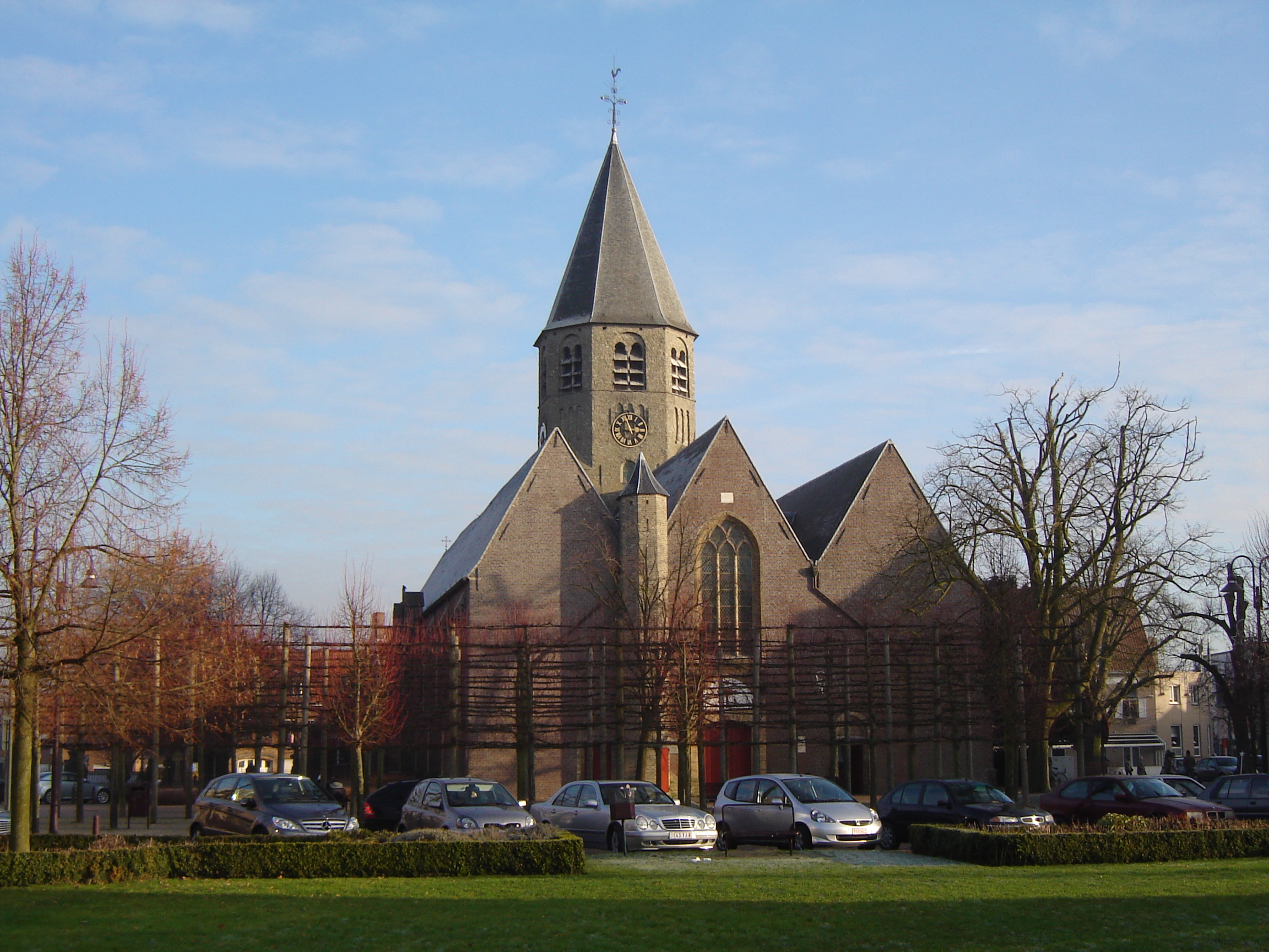
Moerbrugge is a village in the Belgian province of West Flanders, in the municipality of Oostkamp. It was the site of a bridgehead that the Canadian 4th Armoured Division used to cross the Ghent-Bruges Canal during the Battle of the Scheldt on 10 September 1944. See also *Battle of Moerbrugge The Battle of Moerbrugge was a three-day battle during the Liberation of Belgium. The 10th Canadian Infantry Brigade was tasked to cross the Ghent Canal about five kilometers south of Bruges at the small village of Oostkamp in early Septemb ... Populated places in West Flanders {{WestFlanders-geo-stub ... [...More Info...] [...Related Items...] OR: [Wikipedia] [Google] [Baidu] |
Battle Of Moerbrugge
The Battle of Moerbrugge was a three-day battle during the Liberation of Belgium. The 10th Canadian Infantry Brigade was tasked to cross the Ghent Canal about five kilometers south of Bruges at the small village of Oostkamp in early September 1944. Directly across the canal from Oostkamp was another small village named Moerbrugge. The canal is about 20 metres wide and very deep. Opposition was not expected so only one battalion was chosen for the crossing: the Argyll and Sutherland Highlanders of Canada ( Princess Louise's), the Argylls. Two batteries of the 15th Field Regiment, RCA were placed in support but due to the rapid advance of the allied armies, supply lines were hundreds of miles long and not much ammunition was available for the guns. As a result, no preparatory fire was laid on. Fire would be provided on an "as required" basis. The South Alberta Regiment (SARs) would place its tanks on the friendly side of the canal at either side of the crossing point and hol ... [...More Info...] [...Related Items...] OR: [Wikipedia] [Google] [Baidu] |
Canadian 4th Armoured Division
The 4th Canadian Division is a formation of the Canadian Army. The division was first created as a formation of the Canadian Corps during the First World War. During the Second World War the division was reactivated as the 4th Canadian Infantry Division in 1941 and then converted to armour and redesignated as the 4th Canadian (Armoured) Division. Beginning in 1916 the division adopted a distinctive green-coloured formation patch as its insignia. In 2013 it was announced that Land Force Central Area would be redesignated 4th Canadian Division. It is currently responsible for Canadian Army operations in the Canadian province of Ontario and is headquartered at Denison Armoury in Toronto. First World War The 4th Canadian Division was formed in Britain in April 1916 from several existing units and others scheduled to arrive shortly thereafter. Under the command of Major-general David Watson, the Division embarked for France in August of that year where they served both in the We ... [...More Info...] [...Related Items...] OR: [Wikipedia] [Google] [Baidu] |
Battle Of The Scheldt
The Battle of the Scheldt in World War II was a series of military operations led by the First Canadian Army, with Polish and British units attached, to open up the shipping route to Antwerp so that its port could be used to supply the Allies in north-west Europe. Under acting command of the First Canadian's Lieutenant-General Guy Simonds, the battle took place in northern Belgium and southwestern Netherlands from 2 October to 8 November 1944. The Canadians had been delayed, and pressure on the Scheldt left wanting, by Allied decisions to focus on Arnhem ( Operation Market Garden), Boulogne (Operation Wellhit), Calais (Operation Undergo) and Dunkirk. By the time the Canadians were sent into the Battle of the Scheldt, the Wehrmacht defenders had been reinforced. The Germans staged an effective delaying action, during which they flooded land areas in the Scheldt estuary, slowing the Allied advance. After five weeks of difficult fighting, the Canadian First Army, at a cost of 12, ... [...More Info...] [...Related Items...] OR: [Wikipedia] [Google] [Baidu] |
Oostkamp
Oostkamp (; vls, Ôostkamp) is a municipality located in the Belgian province of West Flanders. The municipality comprises the villages of Hertsberge, Oostkamp proper, Ruddervoorde and Waardamme. On January 1, 2019, Oostkamp had a total population o23,698 The total area is 79.65 km² which gives a population density of 289 inhabitants per km². History The name Oostkamp comes from the Medieval name "Orscamp", meaning place of the horses. The old word ''ors'' is a cognate of the English word ''horse''. Oostkamp during World War II The Canadian 4th Armoured Division liberated the village on 8 September 1944 (World War II) during the Battle of Moerbrugge. A monument was erected by the Ghent-Bruges Canal to honour the 53 Canadian casualties. Fusion of 1977 With the Belgian Unity Law the four villages of Oostkamp proper, Hertsberge, Ruddervoorde and Waardamme became the municipality of Greater Oostkamp. Landmarks and Monuments Churches *Sint Pieters-in-de-Bandenkerk, a hall ... [...More Info...] [...Related Items...] OR: [Wikipedia] [Google] [Baidu] |
Winter In The Assebroekse Meersen (Oostkamp)
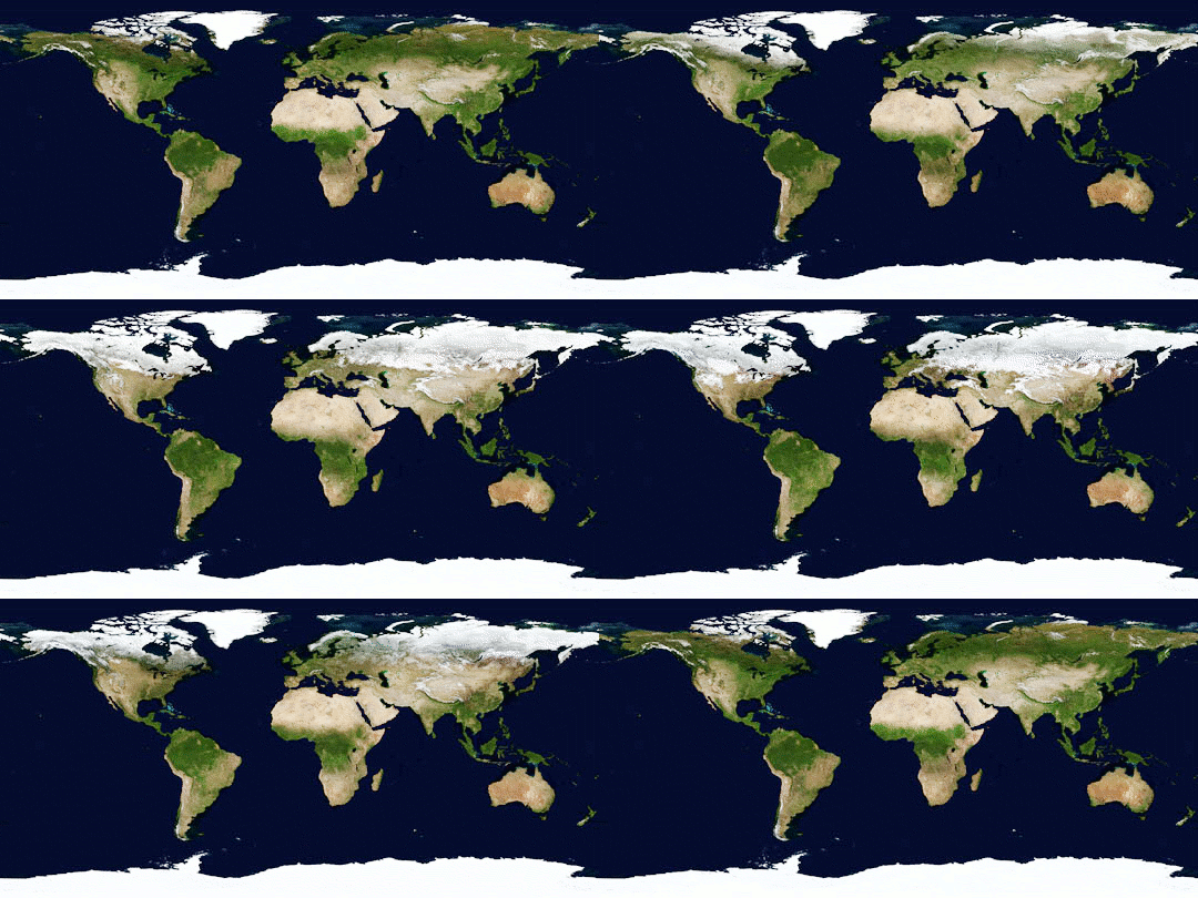
Winter is the coldest season of the year in polar and temperate climates. It occurs after autumn and before spring. The tilt of Earth's axis causes seasons; winter occurs when a hemisphere is oriented away from the Sun. Different cultures define different dates as the start of winter, and some use a definition based on weather. When it is winter in the Northern Hemisphere, it is summer in the Southern Hemisphere, and vice versa. In many regions, winter brings snow and freezing temperatures. The moment of winter solstice is when the Sun's elevation with respect to the North or South Pole is at its most negative value; that is, the Sun is at its farthest below the horizon as measured from the pole. The day on which this occurs has the shortest day and the longest night, with day length increasing and night length decreasing as the season progresses after the solstice. The earliest sunset and latest sunrise dates outside the polar regions differ from the date of the winter s ... [...More Info...] [...Related Items...] OR: [Wikipedia] [Google] [Baidu] |
Belgium
Belgium, ; french: Belgique ; german: Belgien officially the Kingdom of Belgium, is a country in Northwestern Europe. The country is bordered by the Netherlands to the north, Germany to the east, Luxembourg to the southeast, France to the southwest, and the North Sea to the northwest. It covers an area of and has a population of more than 11.5 million, making it the 22nd most densely populated country in the world and the 6th most densely populated country in Europe, with a density of . Belgium is part of an area known as the Low Countries, historically a somewhat larger region than the Benelux group of states, as it also included parts of northern France. The capital and largest city is Brussels; other major cities are Antwerp, Ghent, Charleroi, Liège, Bruges, Namur, and Leuven. Belgium is a sovereign state and a federal constitutional monarchy with a parliamentary system. Its institutional organization is complex and is structured on both regional ... [...More Info...] [...Related Items...] OR: [Wikipedia] [Google] [Baidu] |
West Flanders
) , settlement_type = Province of Belgium , image_flag = Flag of West Flanders.svg , flag_size = , image_shield = Wapen van West-Vlaanderen.svg , shield_size = , image_map = Provincie West-Vlaanderen in Belgium.svg , coordinates = , subdivision_type = Country , subdivision_name = , subdivision_type1 = Region , subdivision_name1 = , seat_type = Capital , seat = Bruges , leader_title = Governor , leader_name = Carl Decaluwé , area_total_km2 = 3197 , area_footnotes = , population_footnotes = , population_total = 1195796 , population_as_of = 1 January 2019 , population_density_km2 = auto , blank_name_sec2 = HDI (2019) , blank_info_sec2 = 0.935 · 5th of 11 , website = West Flanders ( nl, West-Vlaanderen ; vls, West Vlo ... [...More Info...] [...Related Items...] OR: [Wikipedia] [Google] [Baidu] |
Bridgehead
In military strategy, a bridgehead (or bridge-head) is the strategically important area of ground around the end of a bridge or other place of possible crossing over a body of water which at time of conflict is sought to be defended or taken over by the belligerent forces. Bridgeheads typically exist for only a few days, the invading forces either being thrown back or expanding the bridgehead to create a secure defensive lodgement area, before breaking out into enemy territory, such as when the U.S. 9th Armored Division seized the Ludendorff Bridge at Remagen in 1945 during World War II. In some cases a bridgehead may exist for months. Etymology ''Bridgehead'' ( French ''tête de pont'') is a High Middle Ages military term, which before the invention of cannons meant the military fortification that protects the end of a bridge. Like many older terms, the meaning of the word drifted with the passage of time, becoming used for something not exactly true to its initial usage. Wit ... [...More Info...] [...Related Items...] OR: [Wikipedia] [Google] [Baidu] |


