|
Modjeska Peak
Modjeska Peak is the northern mountain of the Saddleback landform in Orange County California. It is the second-highest peak of the Santa Ana Mountains, after Santiago Peak, whose summit is less than to the northwest. Modjeska lies within Cleveland National Forest and, despite being shorter than Santiago, has a smaller peak without manmade structures to obstruct views of the Pacific Ocean and San Gabriel Mountains. The peak is named after the Shakespearean actress Helena Modjeska, who lived in Modjeska Canyon (on the western foot of the mountain) near the end of her life. History The peak, which was formerly unnamed and generally lumped in with Santiago Peak, was dubbed Modjeska Peak following the death of Helena Modjeska. The Ebell Society of Santa Ana campaigned in June of 1909 for the new name to honor Modjeska and the change was made sometime thereafter. Aside from United States Forest Service rangers, the first recorded people to hike the new trail from Modjeska Canyon t ... [...More Info...] [...Related Items...] OR: [Wikipedia] [Google] [Baidu] |
Santiago Peak
Santiago Peak is the southern mountain of the Saddleback landform in Orange County, California. It is the highest and most prominent peak of both the Santa Ana Mountains and Orange County; it also marks a border point with Riverside County. The peak is named for Santiago Creek, which begins on its southwestern slope. During some winters, snow has fallen on the peak. A telecommunication antenna farm with microwave antennas sits atop the peak. The Acjachemen referred to the peak as ''Kalawpa'', with the nearby village of Alume meaning "to raise the head in looking upward," in reference to the mountain. Hiking More than one trail leads to the top of Santiago Peak, but the most popular among hikers is the Holy Jim trail. The Holy Jim trail gains about in elevation and is a round trip. It is a moderate to strenuous hike and is most enjoyable during spring and winter due to the large number of insects during warmer times of the year. From the summit of Santiago Peak, one can ... [...More Info...] [...Related Items...] OR: [Wikipedia] [Google] [Baidu] |
Ebell Society
The Ebell Society was a woman's club with its first chapter in Oakland, California. It was founded in 1876 and was originally called the International Academy for the Advancement of Women. The club's purpose was the advancement of women in cultural, industrial and intellectual pursuits. After feminist Adrian John Ebell's early death in 1877 at age 37 the International Academy for the Advancement of Women renamed their club to honor him. Other chapters formed in California. From 1907 to 1959 the Oakland chapter had a club house built in the Tudor Revival style located at 1440 Harrison Street. That building was destroyed by fire in 1959. The original Oakland chapter disbanded in 2011. Gallery File:Ebell Oakland California.png, Ebell Society original 1896 Club House Oakland, California File:Ebell Society of Santa Ana Valley.jpg, Ebell Society of Santa Ana, California File:Ebell of Los Angeles, Los Angeles.JPG, Ebell of Los Angeles, California File:Ebell Building, Highland Park.jp ... [...More Info...] [...Related Items...] OR: [Wikipedia] [Google] [Baidu] |
Mudflow
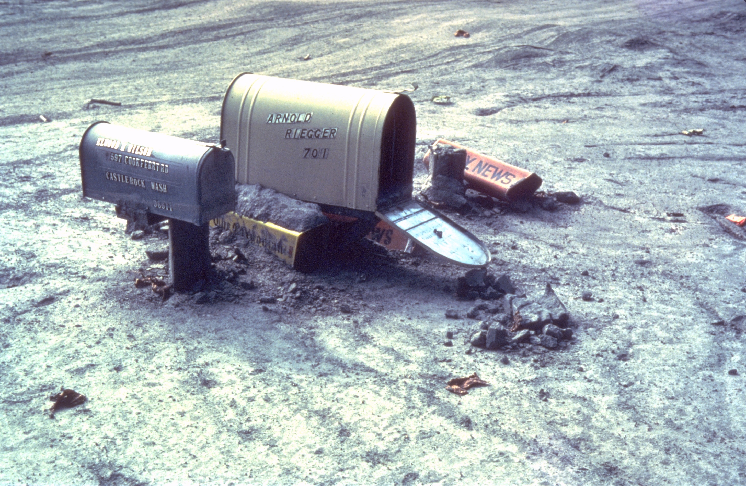
A mudflow or mud flow is a form of mass wasting involving fast-moving flow of debris that has become liquified by the addition of water. Such flows can move at speeds ranging from 3 meters/minute to 5 meters/second. Mudflows contain a significant proportion of clay, which makes them more fluid than debris flows, allowing them to travel farther and across lower slope angles. Both types of flow are generally mixtures of particles with a wide range of sizes, which typically become sorted by size upon deposition. Mudflows are often called mudslides, a term applied indiscriminately by the mass media to a variety of mass wasting events. Mudflows often start as slides, becoming flows as water is entrained along the flow path; such events are often called flow slides. Other types of mudflows include lahars (involving fine-grained pyroclastic deposits on the flanks of volcanoes) and jökulhlaups (outbursts from under glaciers or icecaps). A statutory definition of "flood-related muds ... [...More Info...] [...Related Items...] OR: [Wikipedia] [Google] [Baidu] |
Precipitation
In meteorology, precipitation is any product of the condensation of atmospheric water vapor that falls under gravitational pull from clouds. The main forms of precipitation include drizzle, rain, sleet, snow, ice pellets, graupel and hail. Precipitation occurs when a portion of the atmosphere becomes saturated with water vapor (reaching 100% relative humidity), so that the water condenses and "precipitates" or falls. Thus, fog and mist are not precipitation but colloids, because the water vapor does not condense sufficiently to precipitate. Two processes, possibly acting together, can lead to air becoming saturated: cooling the air or adding water vapor to the air. Precipitation forms as smaller droplets coalesce via collision with other rain drops or ice crystals within a cloud. Short, intense periods of rain in scattered locations are called showers. Moisture that is lifted or otherwise forced to rise over a layer of sub-freezing air at the surface may be condensed into ... [...More Info...] [...Related Items...] OR: [Wikipedia] [Google] [Baidu] |
Corona, California
Corona (Spanish for "Crown") is a city in Riverside County, California, United States. At the 2020 census, the city had a population of 157,136, up from 152,374 at the 2010 census. The cities of Norco and Riverside lie to the north and northeast, Chino Hills and Yorba Linda to the northwest, Anaheim to the west, Cleveland National Forest and the Santa Ana Mountains to the southwest, and unincorporated Riverside County along the rest of the city's borders. Downtown Corona is approximately southeast of Downtown Los Angeles and north-northwest of San Diego. Corona, located along the western edge of Southern California's Inland Empire region, is known as the "Circle City" due to Grand Boulevard's circular layout. It is one of the most residential cities in the Inland Empire, but also has a large industrial portion on the northern half, being the headquarters of companies such as Fender Musical Instruments Corporation, Monster Beverage Corporation, and supercar manufacturer ... [...More Info...] [...Related Items...] OR: [Wikipedia] [Google] [Baidu] |
Pacific Bell
The Pacific Bell Telephone Company (Pacific Bell or Pac Bell) is a telephone company that provides telephone service in California. The company is owned by AT&T through AT&T Teleholdings, and, though separate, is now marketed as “AT&T”. The company has been known by a number of names during which its service area has changed. The formal name of the company from the 1910s through the 1984 Bell System divestiture was The Pacific Telephone and Telegraph Company. As of 2002, the name “Pacific Bell” is no longer used in marketing, Pacific Bell is still the holder of record for the infrastructure of cables and fiber through much of California. History The Pacific Telephone and Telegraph Company, or "PacTel" for short, managed the Bell System's telephone operations in California. It grew by acquiring smaller telephone companies along the Pacific coast. It built and occupied San Francisco's Pacific Telephone Building on New Montgomery Street which has been described as a " ... [...More Info...] [...Related Items...] OR: [Wikipedia] [Google] [Baidu] |
Newport Beach, California
Newport Beach is a coastal city in South Orange County, California. Newport Beach is known for swimming and sandy beaches. Newport Harbor once supported maritime industries however today, it is used mostly for recreation. Balboa Island, Newport Beach, Balboa Island draws visitors with a waterfront path and easy access from the ferry to the shops and restaurants. History The Upper Bay of Newport is a canyon carved by a stream in the Pleistocene period. The Lower Bay of Newport was formed much later by sand brought along by ocean currents, which constructed the offshore beach now recognized as the Balboa Peninsula of Newport Beach. For thousands of years, the Tongva people lived on the land in an extensive, thriving community. The Tongva villages of Genga, California, Genga and Moyongna were located in Newport Beach. Throughout the 1800s, Europeans colonized the land and forcibly removed and assimilated the Tongva. Present-day Newport Beach exists upon the unceded homelands of ... [...More Info...] [...Related Items...] OR: [Wikipedia] [Google] [Baidu] |
Palm Springs, California
Palm Springs (Cahuilla: ''Séc-he'') is a desert resort city in Riverside County, California, United States, within the Colorado Desert's Coachella Valley. The city covers approximately , making it the largest city in Riverside County by land area. With multiple plots in checkerboard pattern, more than 10% of the city is part of the Agua Caliente Band of Cahuilla Indians reservation land and is the administrative capital of the most populated reservation in California. The population of Palm Springs was 44,575 as of the 2020 census, but because Palm Springs is a retirement location and a winter snowbird destination, the city's population triples between November and March. The city is noted for its mid-century modern architecture, design elements, arts and cultural scene, and recreational activities. History Founding Pre-colonial history The first humans to settle in the area were the Cahuilla people, who arrived 2,000 years ago.Baker, Christopher P. (2008). ''E ... [...More Info...] [...Related Items...] OR: [Wikipedia] [Google] [Baidu] |
Mountain Biking
Mountain biking is a sport of riding bicycles off-road, often over rough terrain, usually using specially designed mountain bikes. Mountain bikes share similarities with other bikes but incorporate features designed to enhance durability and performance in rough terrain, such as air or coil-sprung shocks used as suspension, larger and wider wheels and tires, stronger frame materials, and mechanically or hydraulically actuated disc brakes. Mountain biking can generally be broken down into five distinct categories: cross country, trail riding, all mountain (also referred to as "Enduro"), downhill, and freeride. This sport requires endurance, core strength and balance, bike handling skills, and self-reliance. Advanced riders pursue both steep technical descents and high incline climbs. In the case of freeride, downhill, and dirt jumping, aerial maneuvers are performed off both natural features and specially constructed jumps and ramps. Mountain bikers ride on off-road trails su ... [...More Info...] [...Related Items...] OR: [Wikipedia] [Google] [Baidu] |
Santa Ana Line
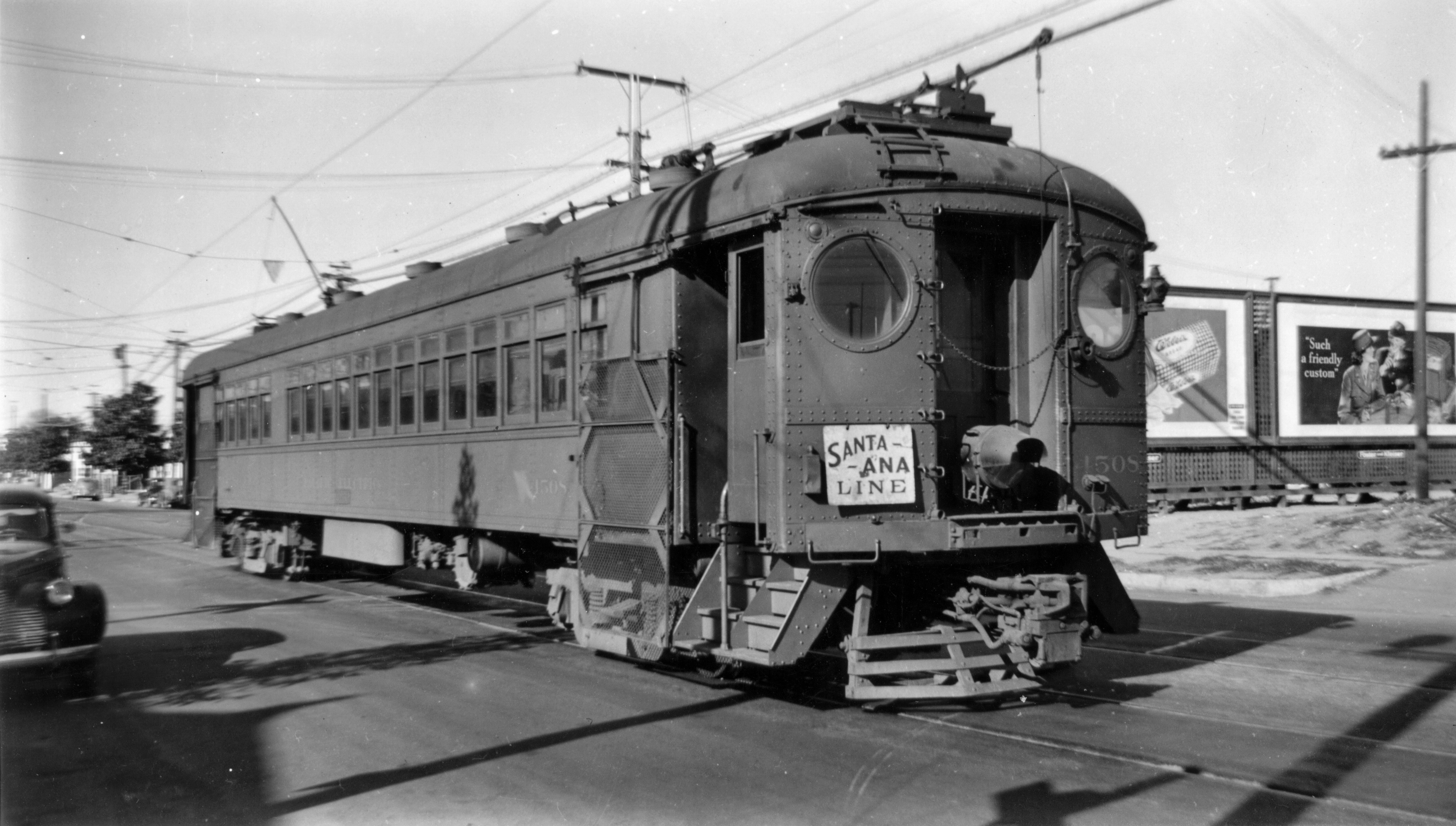
The Santa Ana Line was an interurban railway route connecting Los Angeles and Santa Ana in Orange County. It ran between 1905 and 1958 (with the southern end truncated to Bellflower in 1950) and was predominantly operated by the Pacific Electric Railway for its history. History The route began operation on November 6, 1905 under the Los Angeles Inter-Urban Electric Railway; Pacific Electric leased the line starting in 1908 and fully acquired it in 1911 under terms of the Great Merger. The Santa Ana Line was designated as route number 11 during most of its operational life. Santa Ana's status as the county seat and largest city in Orange County at the time allowed for high ridership. The railway built a new station in the city in late 1927, and cars were rerouted to serve it. Cars ceased running to the Santa Ana Southern Pacific Depot in November 1945. By 1950, service had halved from its peak only five years earlier and the line was cut back to a minor station in Bellflo ... [...More Info...] [...Related Items...] OR: [Wikipedia] [Google] [Baidu] |
Pacific Electric
The Pacific Electric Railway Company, nicknamed the Red Cars, was a privately owned mass transit system in Southern California consisting of electrically powered streetcars, interurban cars, and buses and was the largest electric railway system in the world in the 1920s. Organized around the city centers of Los Angeles and San Bernardino, it connected cities in Los Angeles County, Orange County, San Bernardino County and Riverside County. The system shared dual gauge track with the narrow gauge Los Angeles Railway, "Yellow Car," or "LARy" system on Main Street in downtown Los Angeles (directly in front of the 6th and Main terminal), on 4th Street, and along Hawthorne Boulevard south of downtown Los Angeles toward the cities of Hawthorne, Gardena, and Torrance. Districts The system had four districts: * Northern District: San Gabriel Valley, including Pasadena, Mount Lowe, South Pasadena, Alhambra, El Monte, Covina, Duarte, Glendora, Azusa, Sierra Madre, and Monrovia. * ... [...More Info...] [...Related Items...] OR: [Wikipedia] [Google] [Baidu] |


