|
Ming Prefecture (Zhejiang)
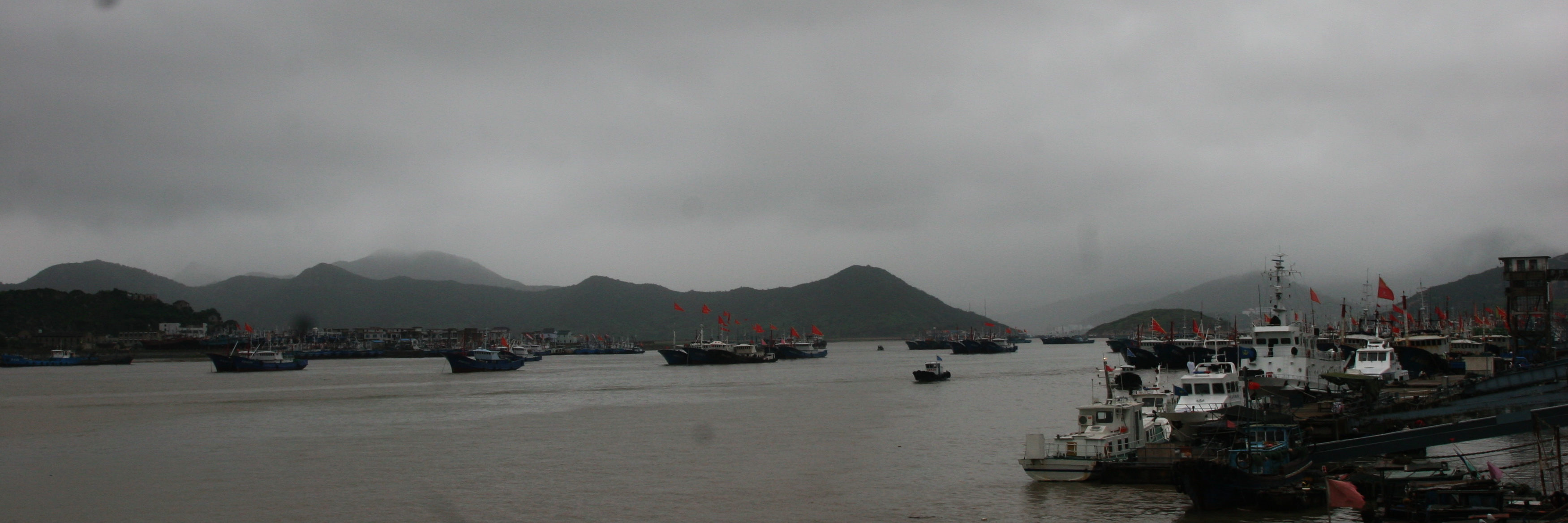
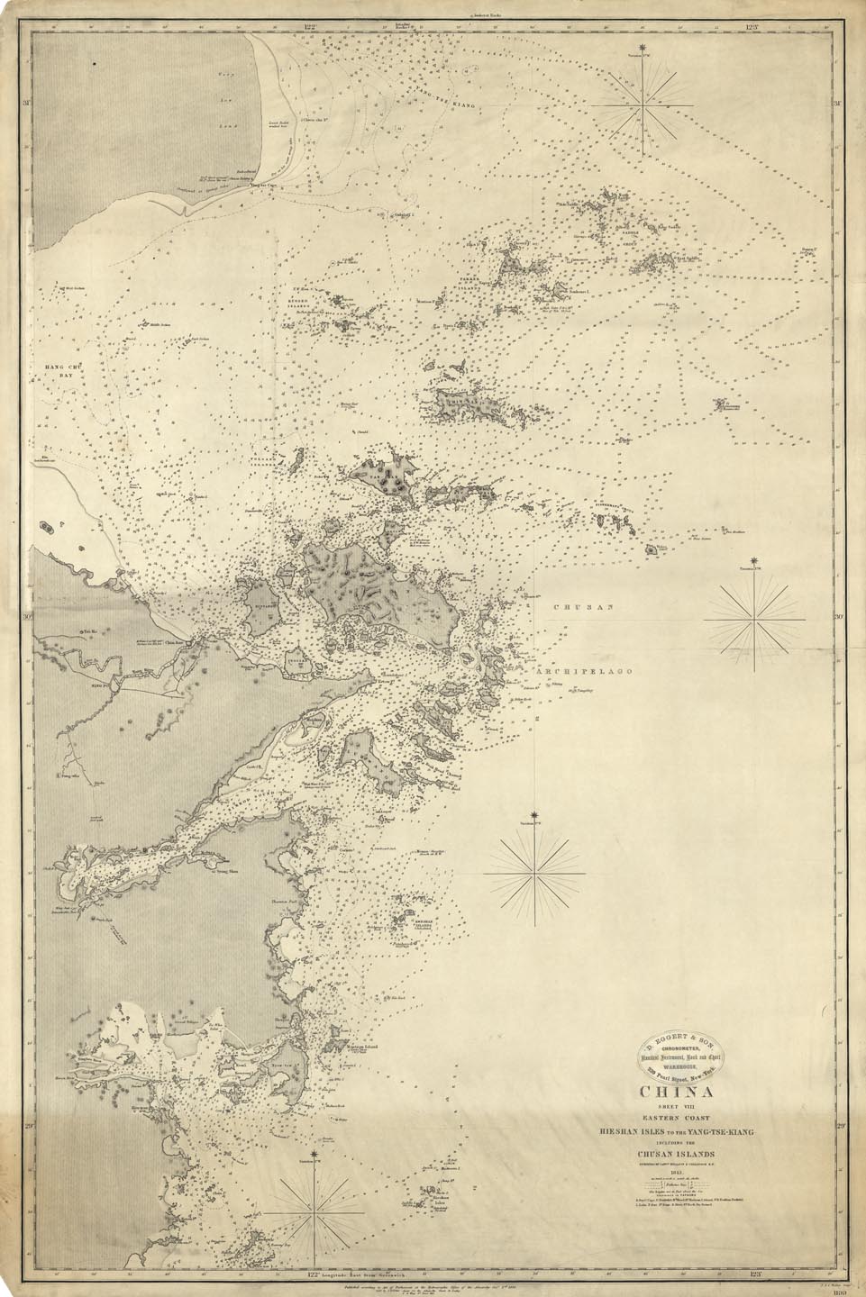
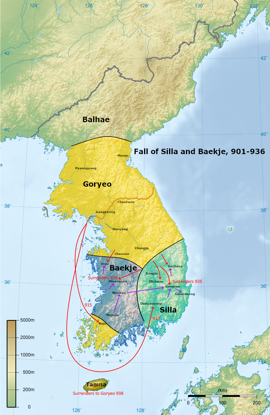
Mingzhou or Ming Prefecture (738–1194) was a '' zhou'' (prefecture) in imperial China located in modern northeastern Zhejiang, China, around modern Ningbo. The prefecture was called Yuyao Commandery from 742 to 758. Located on the coast of the East China Sea and the southern bank of Hangzhou Bay (which connects it to Hang Prefecture and the Grand Canal), Ming Prefecture was one of the most important international ports during the Tang (618–907), Wuyue (907–978) and Song (960–1279) dynasties. Cargo ships to and from Japan, Silla (57 BC – 935 AD), Goryeo (918–1392), and Liao (907–1125) frequented this prefecture. Ming Prefecture also administered Zhoushan, an island archipelago off the Zhejiang coast, including Zhoushan Island. Counties For most of its history, Ming Prefecture administered the following 4–6 counties (縣): Before 764, Xiangshan (which is separated from the prefectural seat by Xiangshan Harbor) was under the administration of Tai Prefecture. Histo ... [...More Info...] [...Related Items...] OR: [Wikipedia] [Google] [Baidu] |
Zhou (country Subdivision)
''Zhou'' () were historical administrative and political divisions of China. Formally established during the Han dynasty, ''zhou'' existed continuously in 1912—a period of over 2000 years. ''Zhou'' were also previously used in Korea (, ''ju''), Vietnam ( vi, châu), and . Overview ''Zhou'' is typically rendered by several terms in the English language: * The large ''zhou'' before the Tang dynasty and in countries other than China are called "provinces" * The smaller ''zhou'' during and after the Tang dynasty are called "prefectures" * The ''zhou'' of the Qing dynasty are also called either "independent" or "dependent departments", depending on their level. The Tang dynasty also established '' fǔ'' (, "prefectures"), ''zhou'' of special importance such as capitals and other major cities. By the Ming and Qing, became predominant divisions within Chinese provinces. In Ming and Qing, the word ''fǔ'' () was typically attached to the name of each prefecture's capital cit ... [...More Info...] [...Related Items...] OR: [Wikipedia] [Google] [Baidu] |
Hangzhou Bay
Hangzhou Bay, or the Bay of Hangzhou (), is a funnel-shaped inlet of the East China Sea, bordered by the province of Zhejiang and the municipality of Shanghai, which lies north of the Bay. The Bay extends from the East China Sea to its head at the city of Hangzhou, from which its name is derived. At Hangzhou, the Qiantang River flows into this Bay, providing freshwater from the West while seawater comes in from the East. Thus, Hangzhou Bay, especially its western end, is sometimes called in the scientific literature as the Qiantang River Estuary. At the southeast end of Hangzhou Bay, off Ningbo, are many small islands that are collectively called the Zhoushan Islands. This archipelago of islands is urbanized with the administrative status of a prefecture-level city in Zhejiang Province. At less than 15 meters in depth, the entire Bay is relatively shallow. Consequently, the main port in the Bay area is the one in Ningbo and Zhoushan, at the southeast end of the Bay on the ... [...More Info...] [...Related Items...] OR: [Wikipedia] [Google] [Baidu] |
Tai Prefecture (Zhejiang)
Tai or TAI may refer to: Arts and entertainment *Tai (comics) a fictional Marvel Comics supervillain *Tai Fraiser, a fictional character in the 1995 film ''Clueless'' *Tai Kamiya, a fictional character in ''Digimon'' Businesses and organisations * Avianca El Salvador, an airline, ICAO code TAI * The Australia Institute, a left-wing think tank * Transports Aériens Intercontinentaux (TAI), a defunct French airline * Turkish Aerospace Industries (TAI) Ethnic groups and languages *Tai peoples *Tai languages *Tai language (New Guinea) People *Tai (given name), including a list of people with the name *Tai (surname), including a list of people with the name *Dai (surname), a Chinese surname also spelled Tai, including a list of people with the name *Tai, the artist name of poet and painter Kambara Yasushi (1899–1997) Places *Tai (city), a former settlement in China during the Xia dynasty *Tai, Ardabil, Iran *Tai, Lorestan, Iran *Tai, Rivers, Nigeria *Taï, Ivory Coast *Lake Tai, i ... [...More Info...] [...Related Items...] OR: [Wikipedia] [Google] [Baidu] |
Xiangshan Harbor
Xiangshan may refer to: Mainland China *Xiangshan County, Guangdong, former county *Xiangshan County, Zhejiang (象山县), a coastal county in Ningbo, Zhejiang *Xiangshan District, Guilin (象山区), in Guilin, Guangxi *Xiangshan District, Huaibei (相山区), in Huaibei, Anhui *Fragrant Hills Park or Xiangshan Park (香山公园), in Haidian District, Beijing * Xiangshan Subdistrict, Beijing, in Haidian District, Beijing * Xiangshan, Zhangjiagang (香山), mountain in Jiangsu *Zhongshan, city in Guangdong whose former name was Xiangshan *Longmen Grottoes, area in Luoyang with a mountain named Xiangshan * Xiangshan, Ma'anshan (向山镇), town in Yushan District, Ma'anshan, Anhui * Xiangshan, Chongren County (相山镇), town in Jiangxi * Xiangshan, Xinjian District (象山镇), town in Xinjian District, Nanchang, Jiangxi * Xiangshan, Sichuan (象山镇), town in Daying County * Xiangshan Subdistrict, Guilin (象山街道), in Xiangshan District, Guilin, Guangxi Taiwan * Xiangsh ... [...More Info...] [...Related Items...] OR: [Wikipedia] [Google] [Baidu] |
Xiangshan County, Zhejiang
County () is a county in the east of Zhejiang province, China. It is under the administration of the city of Ningbo. Administrative divisions Subdistricts: * Dandong Subdistrict (丹东街道), Danxi Subdistrict (丹西街道), Juexi Subdistrict (爵溪街道) Towns: * Dingtang (定塘镇), Daxu (大徐镇), Hepu (鹤浦镇), Qiangtou (墙头镇), Shipu (石浦镇), Sizhoutou (泗洲头镇), Tuci (涂茨镇), Xinqiao (新桥镇), Xianyang Xianyang () is a prefecture-level city in central Shaanxi province, situated on the Wei River a few kilometers upstream (west) from the provincial capital of Xi'an. Once the capital of the Qin dynasty, it is now integrated into the Xi'an metrop ... (贤庠镇), Xizhou (西周镇) Townships: * Dongchen Township (东陈乡), Gaotangdao Township (高塘岛乡), Huangbi'ao Township (黄避岙乡), Maoyang Township (茅洋乡), Xiaotang Township (晓塘乡) References County-level divisions of Zhejiang Geography of Ni ... [...More Info...] [...Related Items...] OR: [Wikipedia] [Google] [Baidu] |
Cixi, Zhejiang
Cixi (), alternately romanized as Tzeki, is a county-level city under the jurisdiction of the sub-provincial city of Ningbo, in the north of Zhejiang province, China. As of the 2020 census, its population was 1,829,488. Its urban agglomeration built-up (or metro) area, largely contiguous with Cixi plus the county-level city of Yuyao, had 3,083,520 inhabitants. History Cixi is a city with a rich culture and a long history. It was part of the state of Yue in the Spring and Autumn period (770-476 B.C.). The county was set up in the Qin Dynasty. At first it was called “Gouzhang” and has been using the name of “Cixi” since the Kaiyuan reign of the Tang Dynasty (738 A.D.). Geography Cixi City is located on the south of the economic circle of Yangtze River Delta, and is from Ningbo in the east, from Shanghai in the north and from Hangzhou in the west. Administrative divisions Subdistricts: * Baisha Road Subdistrict (白沙路街道), Gutang Subdistrict (古塘街道), H ... [...More Info...] [...Related Items...] OR: [Wikipedia] [Google] [Baidu] |
Fenghua District
Fenghua (; ) is a district of the city of Ningbo, Zhejiang Province, China. The district and its administrative hinterlands has a population of over 480,000. Fenghua is most famous for being the hometown of former Presidents Chiang Kai-shek and Chiang Ching-kuo. Geographically, it is dominated by the Tiantai and Siming mountain ranges. History Fenghua was established as a county in the Tang dynasty, in the territory of Mingzhou. Its name means "Accepting Reform" and adopted during imperial times. During the Song dynasty, immigration from the north increased exponentially, peaking during the loss of northern China to the Jurchen Jin dynasty during the Jin–Song wars. In 1129, Fenghua was raided by Jurchen cavalry in pursuit of Emperor Gaozong. Local militia at Xiaowangmiao () fought off the invaders. In late imperial times, Fenghua established itself as a meeting point for trade between the agrarian communities to the north, in Yinxian (), and the mountain-based communi ... [...More Info...] [...Related Items...] OR: [Wikipedia] [Google] [Baidu] |
Zhenhai District
Zhenhai is a district and former county of the sub-provincial city of Ningbo in Zhejiang Province in eastern China. It has a population of 200,000. History The town of Zhenhai grew up at the foot of Zhaobao Hill on a tongue of land at the mouth of the Yong River about north-east of central Ningbo. Under the Qing, the city walls covered a circuit of and rose to . The British captured Zhenhai on 10 October 1841 during the First Opium War, dismantling its former citadel. The Zhenhai Coastal Battery was the site of the 1885 Battle of Zhenhai during the Sino-French War. In the later 19th century, Zhenhai was protected from the sea by a dike about long, made of large blocks of hewn granite. Zhenhai has suffered severe long-term air pollution mainly emanating from the Ningbo Petro-Chemical Economic and Technical Development Zone built on its eastern coast. The zone is home to nearly 200 chemical plants including Zhenhai Refining and Chemical Corporation (ZRCC), a subsidiary ... [...More Info...] [...Related Items...] OR: [Wikipedia] [Google] [Baidu] |
Zhoushan Island
Zhoushan Island is the principal and namesake island in the Zhoushan Islands, formerly romanized as the ChusanIslands, an archipelago administered by Zhoushan Prefecture in Zhejiang Province in the People's Republic of China. It is the province's largest island and 3rd-largest in mainland China after Hainan and Chongming. The island is the district seats of both Dinghai and Putuo. The island was the site of the first and second capture of Chusan during the First Opium War. When referred to as a port, the Port of Zhoushan (舟山市) refers to the prefecture-level "city" consisting of Zhoushan island as well as the other nearby outlying islands, in Zhejiang. The former name of Zhoushan was Dinghai (Chinese: 定海). The Port of Zhoushan is a popular port for bulk carriers. Name The name ''Zhoushan'' means "Boat" and refers to the shape of the island on a map. Geography At 30° N. 122° E., it lies northwest to southeast, and has a coastline, at its longest point at i ... [...More Info...] [...Related Items...] OR: [Wikipedia] [Google] [Baidu] |
Zhoushan
Zhoushan , formerly romanized as Chusan, is an urbanized archipelago with the administrative status of a prefecture-level city in the eastern Chinese province of Zhejiang. It consists of an archipelago of islands at the southern mouth of Hangzhou Bay, off Ningbo. The prefecture's city proper is Dinghai on Zhoushan Island, now administered as the prefecture's Dinghai District. During the 2020 census, Zhoushan Prefecture's population was 1,157,817, out of whom 882,932 lived in the built-up (or metro) area made of two urban districts of Dinghai and Putuo. On 8 July 2011 the central government approved Zhoushan as Zhoushan Archipelago New Area, a state-level new area. History The archipelago was inhabited 6,000 years ago during the Neolithic by people of the Hemudu culture. During the Spring and Autumn period, Zhoushan was called Yongdong, referring to its location east of the Yong River. At the time, it belonged to the state of Yue. The fishermen and sailors who inhab ... [...More Info...] [...Related Items...] OR: [Wikipedia] [Google] [Baidu] |
Liao Dynasty
The Liao dynasty (; Khitan: ''Mos Jælud''; ), also known as the Khitan Empire (Khitan: ''Mos diau-d kitai huldʒi gur''), officially the Great Liao (), was an imperial dynasty of China that existed between 916 and 1125, ruled by the Yelü clan of the Khitan people. Founded around the time of the collapse of the Tang dynasty, at its greatest extent it ruled over Northeast China, the Mongolian Plateau, the northern part of the Korean Peninsula, southern portions of the Russian Far East, and the northern tip of the North China Plain. The dynasty had a history of territorial expansion. The most important early gains was the Sixteen Prefectures (including present-day Beijing and part of Hebei) by fueling a proxy war that led to the collapse of the Later Tang dynasty (923–936). In 1004, the Liao dynasty launched an imperial expedition against the Northern Song dynasty. After heavy fighting and large casualties between the two empires, both sides worked out the Chanyuan Trea ... [...More Info...] [...Related Items...] OR: [Wikipedia] [Google] [Baidu] |
Goryeo
Goryeo (; ) was a Korean kingdom founded in 918, during a time of national division called the Later Three Kingdoms period, that unified and ruled the Korean Peninsula until 1392. Goryeo achieved what has been called a "true national unification" by Korean historians as it not only unified the Later Three Kingdoms but also incorporated much of the ruling class of the northern kingdom of Balhae, who had origins in Goguryeo of the earlier Three Kingdoms of Korea. The name "Korea" is derived from the name of Goryeo, also spelled Koryŏ, which was first used in the early 5th century by Goguryeo. According to Korean historians, it was during the Goryeo period that the individual identities of Goguryeo, Baekje, and Silla were successfully merged into a single entity that became the basis of modern-day 'Korean' identity. Throughout its existence, Goryeo, alongside Unified Silla, was known to be the "Golden Age of Buddhism" in Korea. As the state religion, Buddhism achieved its highes ... [...More Info...] [...Related Items...] OR: [Wikipedia] [Google] [Baidu] |


