|
Mimili
Mimili is an Aboriginal community in the Anangu Pitjantjatjara Yankunytjatjara Lands in South Australia, comprising one of the six main communities on "The Lands" (the others being Amata, Pukatja, Kaltjiti, Indulkana and Pipalyatjara). At the 2016 Australian census, Mimili had a population of 243. After European settlement in the 19th century, there was a cattle station on the land, which was named Everard Park. The station was purchased by the South Australian government in 1972 before transferring it to the traditional owners. Time zone Due to its links with the Northern Territory and proximity to the border, the APY Lands do not observe daylight savings unlike the rest of South Australia. The time zone observed throughout the year is Australian Central Standard Time ( UTC+9:30), in line with Darwin rather than Adelaide. Geography Mimili is situated in South Australia, within the APY, about west of the Stuart Highway and south of Alice Springs. History and significa ... [...More Info...] [...Related Items...] OR: [Wikipedia] [Google] [Baidu] |
Aṉangu Pitjantjatjara Yankunytjatjara
Aṉangu Pitjantjatjara Yankunytjatjara, also known as APY, APY Lands or ''the Lands'', is a large, sparsely populated Local government in Australia, local government area (LGA) for Aboriginal Australians, Aboriginal people, located in the remote north west of South Australia. Some of the Aṉangu (people) of the Western Desert cultural bloc, in particular Pitjantjatjara people, Pitjantjatjara, Yankunytjatjara and Ngaanyatjarra peoples, inhabit the Lands. Governance of the area is determined by the ''Anangu Pitjantjatjara Yankunytjatjara Land Rights Act 1981'' (or APYLRA), whereby an elected executive board reports to the Premier of South Australia. The APY's administration centre is located at Umuwa. A large portion of the APY Lands was formerly the North-West Aboriginal Reserve. Time zone Due to its links with the Northern Territory and proximity to the border, the APY Lands do not observe daylight savings unlike the rest of South Australia. The time zone observed througho ... [...More Info...] [...Related Items...] OR: [Wikipedia] [Google] [Baidu] |
Pukatja, South Australia
Pukatja (formerly Ernabella, ) is an Aboriginal community in the Anangu Pitjantjatjara Yankunytjatjara Lands in South Australia, comprising one of the six main communities on "The Lands" (the others being Amata, Pipalyatjara, Fregon/ Kaltjiti, Indulkana and Mimili). Established as a Presbyterian mission in 1937 with enlightened practices which maintained the Pitjantjatjara language at the school and church services, Ernabella was handed over to the community in 1974 and was later named Pukatja. Ernabella Arts is Australia's oldest continuously running Indigenous art centre. Time zone Due to its links with the Northern Territory and proximity to the border, the APY Lands do not observe daylight savings unlike the rest of South Australia. The time zone observed throughout the year is Australian Central Standard Time ( UTC+9:30), in line with Darwin rather than Adelaide. Geography Pukatja is in the eastern Musgrave Ranges, west of the Stuart Highway, about south of th ... [...More Info...] [...Related Items...] OR: [Wikipedia] [Google] [Baidu] |
Indulkana, South Australia
Indulkana (also known as Iwantja, from Iwantja Creek) is an Aboriginal community in the Anangu Pitjantjatjara Yankunytjatjara Lands in South Australia, comprising one of the six main communities on "The Lands" (the others being Pukatja, Amata, Kaltjiti, Mimili and Pipalyatjara). At the 2016 Australian census, Indulkana had a population of 256. Time zone Due to its links with the Northern Territory and proximity to the border, the APY Lands do not observe daylight savings unlike the rest of South Australia. The time zone observed throughout the year is Australian Central Standard Time ( UTC+9:30), in line with Darwin rather than Adelaide. Geography Indulkana (Iwantja) is situated about west of the Stuart Highway and south of Alice Springs. By road it is (approx.11.5 hours) north-west of Adelaide GPO. Climate Based upon the climate records of the nearest weather station at Marla Police Station, Indulkana experiences summer maximum temperatures of an average of 37.1 ... [...More Info...] [...Related Items...] OR: [Wikipedia] [Google] [Baidu] |
Kaltjiti, South Australia
Kaltjiti (formerly Fregon) is an Aboriginal community in Anangu Pitjantjatjara Yankunytjatjara (APY lands) in South Australia, comprising one of the six main communities on "The Lands" (the others being Amata, Pukatja, Pipalyatjara, Indulkana and Mimili). Time zone Due to its links with the Northern Territory and proximity to the border, the APY Lands do not observe daylight savings unlike the rest of South Australia. The time zone observed throughout the year is Australian Central Standard Time ( UTC+9:30), in line with Darwin rather than Adelaide. Geography Kaltjiti () is situated approximately south of the Musgrave Ranges and lies west of the Everard Ranges. Kaltjiti is also situated approximately from the Stuart Highway. Kaltjiti lies directly south of Umuwa and Ernabella/Pukatja. The community straddles the Officer Creek, which in turn flows from South Australia's highest mountain, Ngarutjaranya. The creek is usually a dry sandy bed and only flows at times of ... [...More Info...] [...Related Items...] OR: [Wikipedia] [Google] [Baidu] |
Amata, South Australia
Amata (formerly Musgrave Park) is an Aboriginal community in the Anangu Pitjantjatjara Yankunytjatjara Lands in South Australia, comprising one of the six main communities on "The Lands" (the others being Pukatja, Kaltjiti, Indulkana, Mimili and Pipalyatjara). Amata is part of the Amata – Tjurma electorate. The people of the Tjurma Homelands regard themselves as a separate community. Time zone Due to its proximity to the border of the Northern Territory, Amata does not observe daylight saving time unlike the rest of South Australia. The time zone observed throughout the year is Australian Central Standard Time ( UTC+9:30), in line with Darwin rather than Adelaide. Geography and governance Amata lies about due south of Uluru and south-west of Alice Springs, in the north-west of South Australia, within the Anangu Pitjantjatjara lands. It is located at the western end of the Musgrave Ranges, about south of the border with the Northern Territory. Being above sea le ... [...More Info...] [...Related Items...] OR: [Wikipedia] [Google] [Baidu] |
Electoral District Of Giles
Giles is a single-member electoral district for the South Australian House of Assembly. Named after explorer Ernest Giles, it is the largest electorate in the state by area, covering of South Australian outback. Its main population centre is the industrial city of Whyalla on the far south-east border of the seat which represents half of the electorate's voters. The electorate covers significant areas of pastoral leases and Pitjantjatjara Aboriginal land stretching to the Western Australian and Northern Territory borders, taking in the remote towns of Andamooka, Coober Pedy, Ernabella, Fregon, Marla, Mimili, Mintabie, Oodnadatta, and Tarcoola. Giles also has a far north mobile booth. Giles was created at the 1991 electoral redistribution to replace the abolished electoral district of Whyalla. It covered an area that had traditionally been one of the few country areas where Labor consistently did well. Support for the party was particularly strong in the city of Whya ... [...More Info...] [...Related Items...] OR: [Wikipedia] [Google] [Baidu] |
Pipalyatjara, South Australia
Pipalyatjara (formerly Mount Davies) is an Aboriginal community in the Anangu Pitjantjatjara Yankunytjatjara Lands in South Australia, comprising one of the six main communities on "The Lands" (the others being Amata, Pukatja, Kaltjiti, Indulkana, and Mimili). Other smaller communities include Nyapari, Kanpi, Kalka and Yunyarinyi. The residents are mainly Anangu who speak Pitjantjatjara as their first language.The closest community is Kalka to the west. Time zone Due to its links with the Northern Territory and proximity to the border, the APY Lands do not observe daylight savings unlike the rest of South Australia. The time zone observed throughout the year is Australian Central Standard Time ( UTC+9:30), in line with Darwin rather than Adelaide. Geography Pipalyatjara is situated approximately south-west of Alice Springs on the Gunbarrel Highway, an unsealed road. Pipalyatjara is approximately from the junction of the South Australian, Western Australi ... [...More Info...] [...Related Items...] OR: [Wikipedia] [Google] [Baidu] |
Witchetty Grub
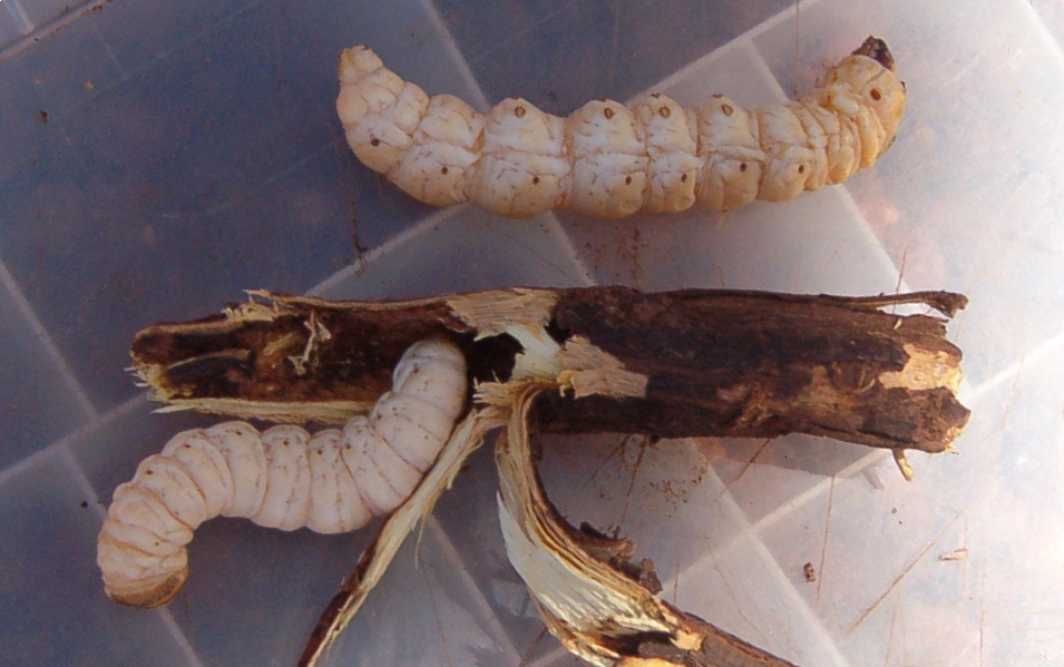
The witchetty grub (also spelled witchety grub or witjuti grub) is a term used in Australia for the large, white, wood-eating larvae of several moths. In particular, it applies to the larvae of the Cossidae, cossid moth ''Endoxyla leucomochla'', which feeds on the roots of the Acacia kempeana, witchetty bush (after which the grubs are named) that is widespread throughout the Northern Territory and also typically found in parts of Western Australia and South Australia, although it is also found elsewhere throughout Australia. The term can also apply to larvae of other cossid moths, ghost moths (Hepialidae), and longhorn beetles (Cerambycidae). The term is used mainly when the larvae are being considered as food. The grub is the most important Entomophagy, insect food of the desert and has historically been a staple in the diets of Aboriginal Australians. Terminology The Arabana language, Arabana term for the grub is (with emphasis on initial syllables); means grub, and refer ... [...More Info...] [...Related Items...] OR: [Wikipedia] [Google] [Baidu] |
Outstation (Aboriginal Community)
An outstation, homeland or homeland community is a very small, often remote, permanent community of Aboriginal Australian people connected by kinship, on land that often, but not always, has social, cultural or economic significance to them, as traditional land. The outstation movement or homeland movement refers to the voluntary relocation of Aboriginal people from towns to these locations. Within the Australian Indigenous context, outstation refers to remote and small groups of First Nations people who relocated for resistance, in the face of assimilation. This occurred predominantly in the 1970s – 1980s and was aimed at providing autonomy for Indigenous people opposing conformance. Oftentimes, these relocations were supported by government and overall wellbeing improvements for those who had relocated were able to be seen, demonstrating the importance of self-autonomy and a cultural connection to country. What started as a few small breakaway groups lead into much larger out ... [...More Info...] [...Related Items...] OR: [Wikipedia] [Google] [Baidu] |
Everard Ranges
The Everard Ranges, officially known as The Everard Ranges, is a range of low rounded granite hills located in the Australian state of South Australia in the Aṉangu Pitjantjatjara Yankunytjatjara lands about west of Mintabie. It is of Palaeocene origin between 20 and 60 million years ago, in Central Australia . Rising into domes above a Cenozoic peneplain, which is here about above sea level, they were named by Ernest Giles in 1873 after SA Commissioner of Crown Lands William Everard, and consist of monoliths or bornhardts, rich in caves and overhangs with Aboriginal rock painting galleries. The ranges are similar to Uluru and Kata Tjuta. Giles described them in his book, ''Australia Twice Traversed'' as follows: ''"Arriving at the first hills of the Everard, I found they were all very peculiar, bare, red, granite mounds, being the most extraordinary ranges one could possibly imagine, if indeed any one could imagine such a scene. They have thousands of acre ... [...More Info...] [...Related Items...] OR: [Wikipedia] [Google] [Baidu] |
Aboriginal Australians
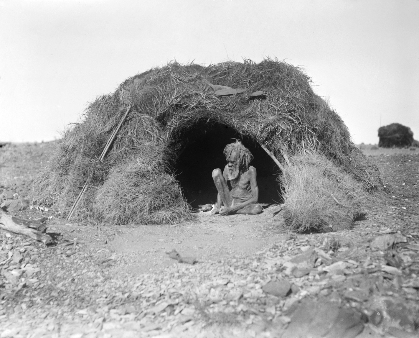
Aboriginal Australians are the various indigenous peoples of the Mainland Australia, Australian mainland and many of its islands, excluding the ethnically distinct people of the Torres Strait Islands. Humans first migrated to Australia (continent), Australia 50,000 to 65,000 years ago, and over time formed as many as 500 List of Aboriginal Australian group names, language-based groups. In the past, Aboriginal people lived over large sections of the continental shelf. They were isolated on many of the smaller offshore islands and Tasmania when the land was inundated at the start of the Holocene Interglacial, inter-glacial period, about 11,700 years ago. Despite this, Aboriginal people maintained extensive networks within the continent and certain groups maintained relationships with Torres Strait Islanders and the Makassar people, Makassar people of modern-day Indonesia. Over the millennia, Aboriginal people developed complex trade networks, inter-cultural relationships, law ... [...More Info...] [...Related Items...] OR: [Wikipedia] [Google] [Baidu] |
Torres Strait Islanders
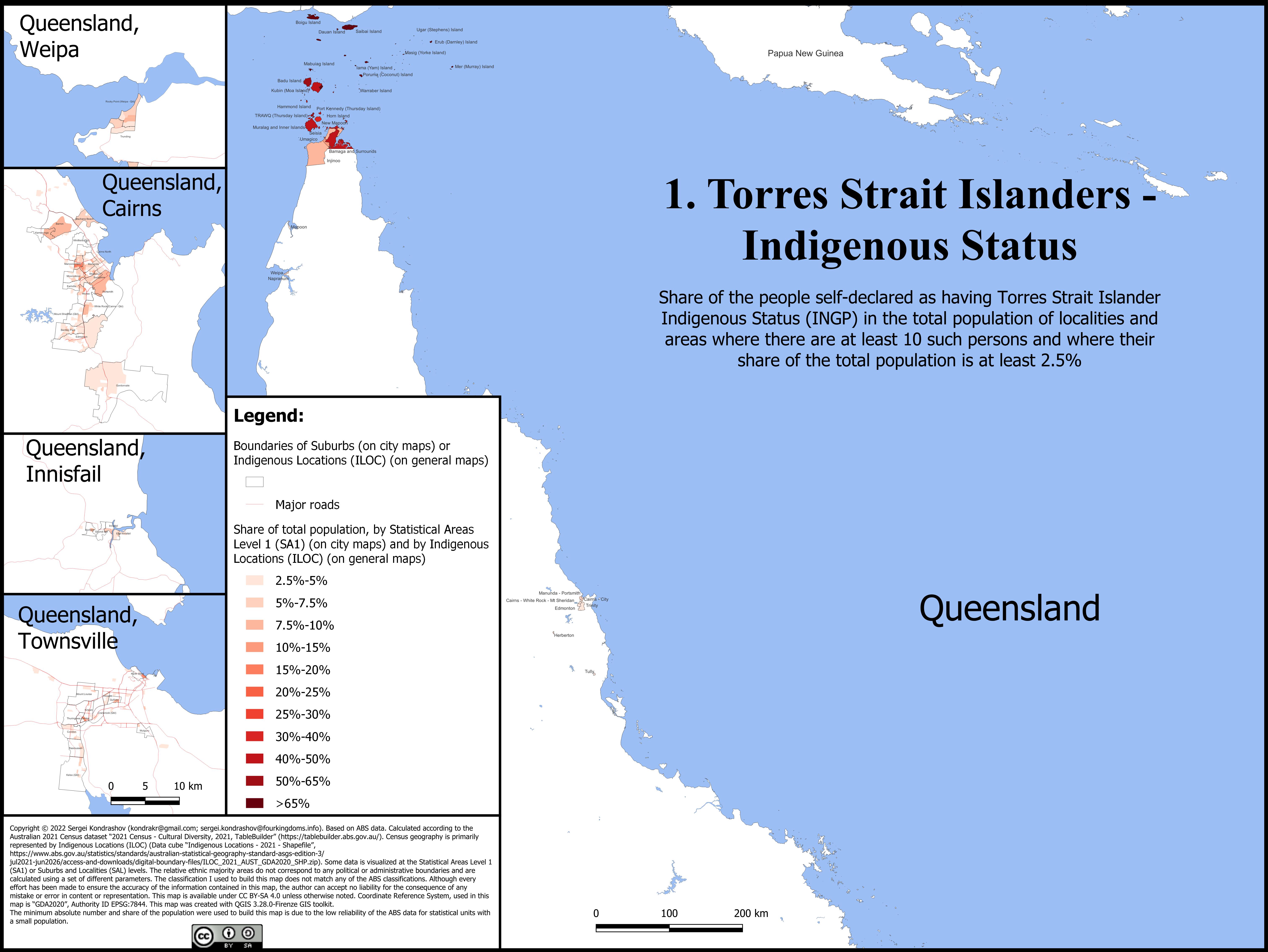
Torres Strait Islanders ( ) are the Indigenous Melanesians, Melanesian people of the Torres Strait Islands, which are part of the state of Queensland, Australia. Ethnically distinct from the Aboriginal Australians, Aboriginal peoples of the rest of Australia, they are often grouped with them as Indigenous Australians. Today, many more Torres Strait Islander people live in mainland Australia than on the Islands. Five distinct peoples exist within the broader designation of Torres Strait Islander people, based partly on geographical and cultural divisions. Kalaw Lagaw Ya and Meriam Mir comprise the two main Indigenous language groups; Torres Strait Creole is also widely spoken as a language of trade and commerce. The core of Island culture is Indigenous people of New Guinea, Papuan, and the people are traditionally a seafaring nation. The Torres Islanders exhibit a strong artistic culture, particularly in sculpture, printmaking, and mask-making. Demographics Of the 133 islands ... [...More Info...] [...Related Items...] OR: [Wikipedia] [Google] [Baidu] |


