|
Middle Fork American River
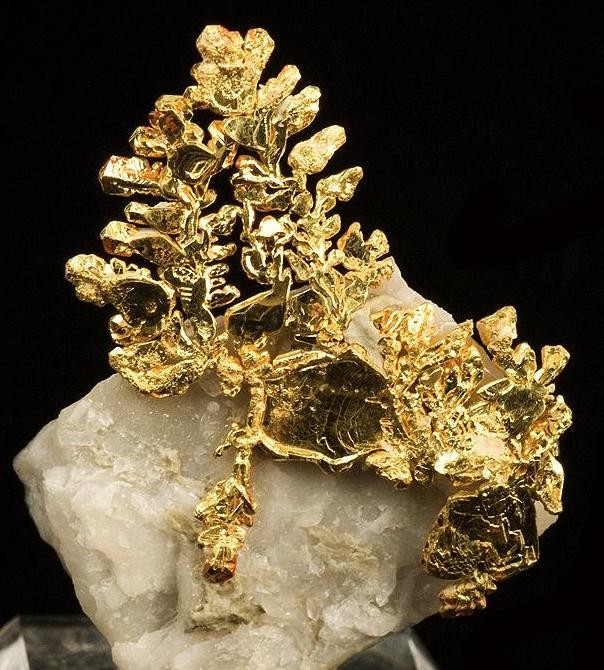
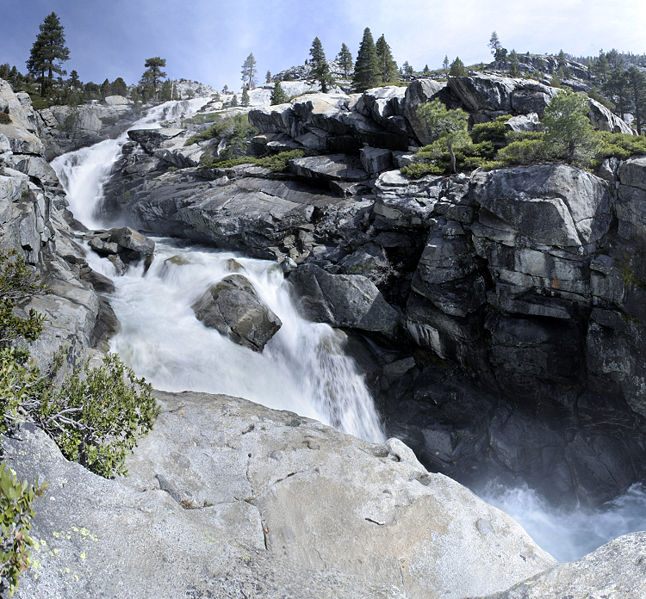
The Middle Fork American River is one of three forks that form the American River in Northern California. It drains a large watershed in the high Sierra Nevada west of Lake Tahoe and northeast of Sacramento in Placer and El Dorado Counties, between the watersheds of the North Fork American River and South Fork American River. The Middle Fork joins with the North Fork near Auburn and they continue downstream to Folsom Lake as the North Fork, even though the Middle Fork carries a larger volume of water. The Middle Fork was one of the richest gold mining areas during the California Gold Rush of the 1850s, and is still recreationally mined today. The river is dammed extensively to produce hydroelectricity and provide domestic water supply. Although long stretches of the Middle Fork have been dewatered by diversions, the portion of the river and canyon in the Auburn State Recreation Area is one of the state's most popular whitewater runs. Professional whitewater rafting companies off ... [...More Info...] [...Related Items...] OR: [Wikipedia] [Google] [Baidu] |
Auburn State Recreation Area
Auburn State Recreation Area is a state park unit of California, along of the North and Middle Forks of the American River. The state recreation area (SRA) is situated on the border of Placer and El Dorado Counties in the heart of historic Gold Country. The largest city with close proximity is the city of Auburn. Once teeming with gold mining activity, the area now offers a wide variety of outdoor recreational opportunities. Major recreational uses include trail running, hiking, swimming, boating, fishing, camping, mountain biking, gold panning, horseback riding, road bicycling, and off-highway motorcycle riding. Whitewater recreation is also very popular on both forks of the river, with Class II, III and IV runs. Auburn SRA is also known as the location of a number of endurance races that are hosted throughout the year. History Auburn SRA comprises lands set aside for the proposed Auburn Dam. However a large earthquake at Oroville nearby was found to have been caused by the O ... [...More Info...] [...Related Items...] OR: [Wikipedia] [Google] [Baidu] |
Folsom Lake
Folsom Lake is a reservoir on the American River in the Sierra Nevada foothills of California, United States. It is located within Placer, El Dorado, and Sacramento Counties. It is about northeast of Sacramento. The lake surface area is , its elevation is , and it has of undulated shoreline. Folsom Lake with its surrounding Folsom Lake State Recreation Area is one of the most visited parks in the California park system. The California Office of Environmental Health Hazard Assessment has developed a safe eatinadvisoryfor Folsom Lake based on levels of mercury found in fish caught here. History The Folsom Lake reservoir is formed by Folsom Dam, built in 1955 to control and retain the American River. The dam and reservoir are part of the Folsom Project, which also includes the Nimbus afterbay reservoir and dam facilities. The Folsom Project, operated by the United States Bureau of Reclamation, is part of the Central Valley Project, a multipurpose project that provides flood co ... [...More Info...] [...Related Items...] OR: [Wikipedia] [Google] [Baidu] |
Foresthill Bridge
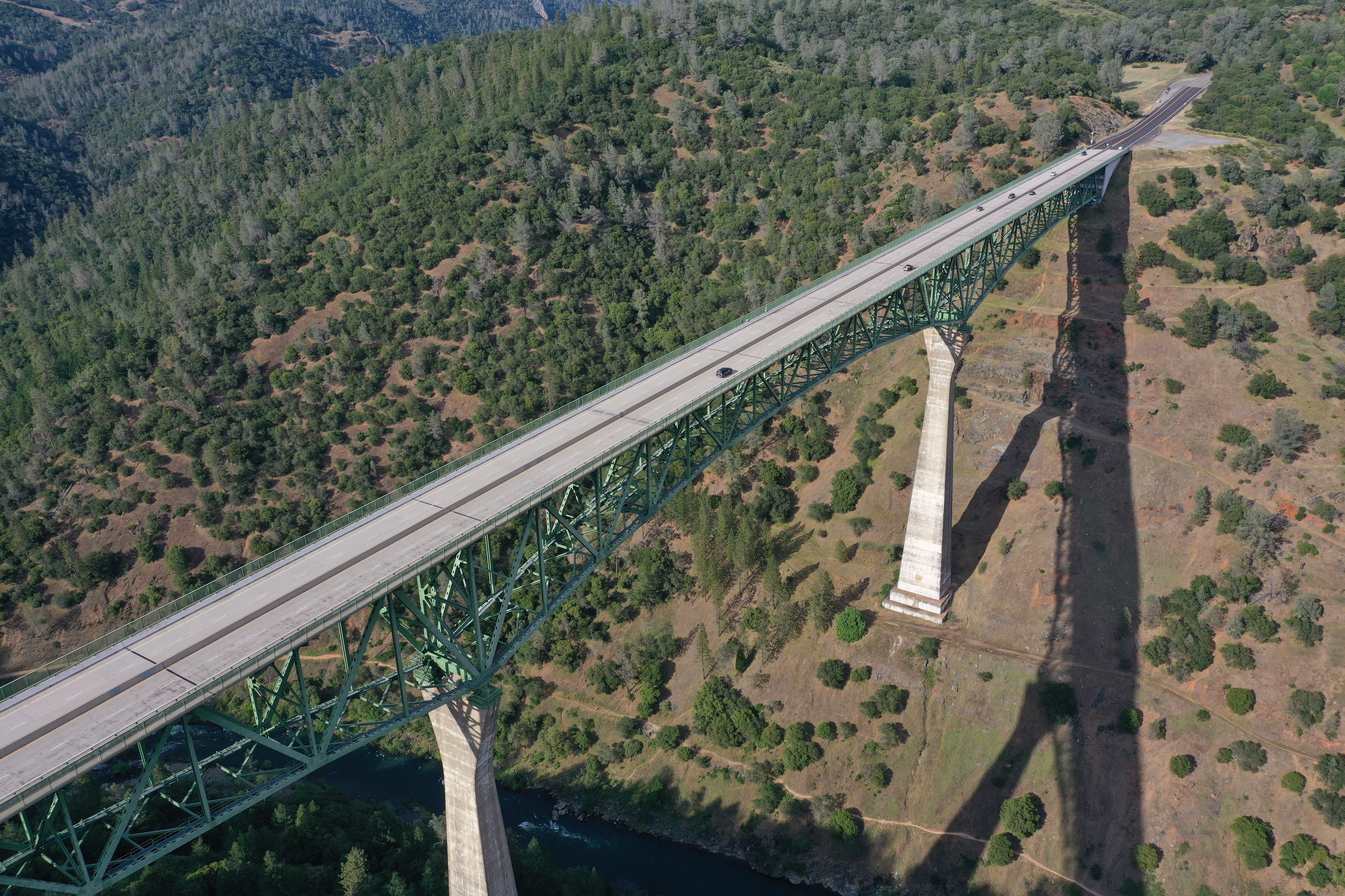
The Foresthill Bridge, also referred to as the Auburn-Foresthill Bridge or the Auburn Bridge, is a road bridge crossing over the North Fork American River in Placer County and the Sierra Nevada foothills, in eastern California. It is the highest bridge by deck height in California, the fourth highest in the United States, and among the seventy highest in the world at above the river. History Originally constructed to replace a river-level crossing of the American River that would have been flooded by the reservoir that would have been created by the unbuilt Auburn Dam, the deck of the steel cantilever bridge stands above the river. It was fabricated in 1971 by Kawasaki Heavy Industries in Japan, built by Willamette Western Contractors, and opened in 1973. The bridge spans the North Fork of the American River in Placer County between the city of Auburn and the town of Foresthill in the Sierra Nevada foothills. Pedestrians can walk the length of the bridge in both directions. The ... [...More Info...] [...Related Items...] OR: [Wikipedia] [Google] [Baidu] |
California State Route 49
State Route 49 (SR 49) is a north–south state highway in the U.S. state of California that passes through many historic mining communities of the 1849 California gold rush. Highway 49 is numbered after the "49ers", the waves of immigrants who swept into the area looking for gold, and it is known as the Golden Chain Highway. This roadway begins at Oakhurst, California, Oakhurst, Madera County, California, Madera County, in the Sierra Nevada (U.S.), Sierra Nevada, where it diverges from State Route 41. It continues in a generally northwest direction, weaving through the communities of Goldside and Ahwahnee, before crossing into Mariposa County, California, Mariposa County. State Route 49 then continues northward through the counties of Tuolumne County, California, Tuolumne, Calaveras County, California, Calaveras, Amador County, California, Amador, El Dorado County, California, El Dorado, Placer County, California, Placer, Nevada County, California, Nevada, Yuba County, Califo ... [...More Info...] [...Related Items...] OR: [Wikipedia] [Google] [Baidu] |
Greenwood, El Dorado County, California
Greenwood (formerly, Long Valley, Green Valley, Lewisville, and Louisville) is an unincorporated community in El Dorado County, California. It is located west of Georgetown, at an elevation of 1608 feet (490 m). The place was originally called Long Valley, then Green Valley, then Lewisville, and finally Greenwood, in honor of John Greenwood who set up a trading post there in 1848. The Louisville post office operated from 1852 to 1852, when it was moved and renamed to Greenwood. Lewisville and Louisville were names in honor of Lewis B. Meyer, father of the first child born there. The community is now registered as California Historical Landmark A California Historical Landmark (CHL) is a building, structure, site, or place in California that has been determined to have statewide historical landmark significance. Criteria Historical significance is determined by meeting at least one of ... #521. References {{authority control Unincorporated communities in Californi ... [...More Info...] [...Related Items...] OR: [Wikipedia] [Google] [Baidu] |
Georgetown, California
Georgetown (formerly Growlersburg) is a census-designated place (CDP) in El Dorado County, California. It is the northeasternmost town in the California Mother Lode. The population was 2,367 at the 2010 census, up from 962 in 2000. The town is registered as California Historical Landmark #484. History Founded August 7, 1849, by George Phipps and party, Georgetown was nicknamed "Growlersburg" due to the heavy, gold-laden quartz rocks that "growled" in the miners' pants as they walked around town. Georgetown is named for George Phipps. The first post office was established in 1851. After a disastrous fire in 1852, the old town was moved from the canyon in lower Main Street to its present site, and, unique in early-day planning, Main Street was laid out wide, with side streets . After this new reconstruction, the residents of the city proclaimed their town as the "Pride of the Mountains". The hub of an immensely rich gold mining area, Georgetown had a population of about three thous ... [...More Info...] [...Related Items...] OR: [Wikipedia] [Google] [Baidu] |
Foresthill, California
Foresthill is a census-designated place (CDP) in Placer County, California, United States. It is part of the Sacramento–Arden-Arcade– Roseville Metropolitan Statistical Area. The population was 1,483 at the 2010 census, down from 1,791 at the 2000 census. History Foresthill is located on a broad ridge between the North and Middle Forks of the American River on the gold-bearing gravel bed of an ancient river. In the spring of 1850, miners came to the Forest Hill Divide in large numbers. There was one route from Auburn through Yankee Jim's and one from Coloma. At the junction of these trails, the Forest House hotel and trading post was built. The height of mining activity in Foresthill began in 1853 after a winter landslide at the head of Jenny Lind Canyon exposed numerous nuggets of gold. The Jenny Lind mine produced about $2,500 of gold a day for a while, up to a total output over $1 million by 1880. The combined production of all the mines in the Forest Hill area wa ... [...More Info...] [...Related Items...] OR: [Wikipedia] [Google] [Baidu] |
Desolation Wilderness
The Desolation Wilderness is a federally protected wilderness area in the Eldorado National Forest and Lake Tahoe Basin Management Unit, in El Dorado County, California. The crest of the Sierra Nevada runs through it, just west of Lake Tahoe. History Before European settlement in the mid-19th century, there is evidence this area was used by the Washoe. After, it was known at times as "Devil's Valley," and most often used for cattle grazing. By the end of that century, the first formal step to limiting its development when it was made a Forest Reserve, managed first by the General Land Office, and later, by the US Forest Service. It was set aside as the Desolation Valley Primitive Area in 1931 with an area of . In 1969, it became the Desolation Wilderness after the passage of the Wilderness Act of 1964.Godfrey, Anthony. ''The Ever-Changing View-A History of the National Forests in California''. USDA Forest Service Publishers, 2005. p. 445. Access Desolation is a popular ba ... [...More Info...] [...Related Items...] OR: [Wikipedia] [Google] [Baidu] |
Balderson Station, California
Balderson Station (also, Bolderston Station) is an unincorporated community in El Dorado County, California California is a state in the Western United States, located along the Pacific Coast. With nearly 39.2million residents across a total area of approximately , it is the most populous U.S. state and the 3rd largest by area. It is also the m .... It is located east-northeast of Georgetown, at an elevation of 3294 feet (1004 m). References Unincorporated communities in California Unincorporated communities in El Dorado County, California {{ElDoradoCountyCA-geo-stub ... [...More Info...] [...Related Items...] OR: [Wikipedia] [Google] [Baidu] |
Eldorado National Forest
Eldorado National Forest is a U.S. National Forest located in the central Sierra Nevada mountain range, in eastern California. Geography Most of the forest (72.8%) lies in El Dorado County. In descending order of land area the others counties are: Amador, Alpine, and Placer counties in California; and Douglas County in Nevada with . The forest is bordered on the north by the Tahoe National Forest, on the east by the Lake Tahoe Basin Management Unit, on the southeast by the Humboldt–Toiyabe National Forest, and to the south by the Stanislaus National Forest. Eldorado National Forest headquarters are located in Placerville, California. There are local ranger district offices in Camino, Georgetown, Pioneer, and Pollock Pines. Land ownership A complicated ownership pattern exists. The parcels of other ownership (private or other agency land) are mostly isolated and surrounded on all sides by government land. An opposite pattern occurs outside of the forest boundary, wher ... [...More Info...] [...Related Items...] OR: [Wikipedia] [Google] [Baidu] |
French Meadows Reservoir
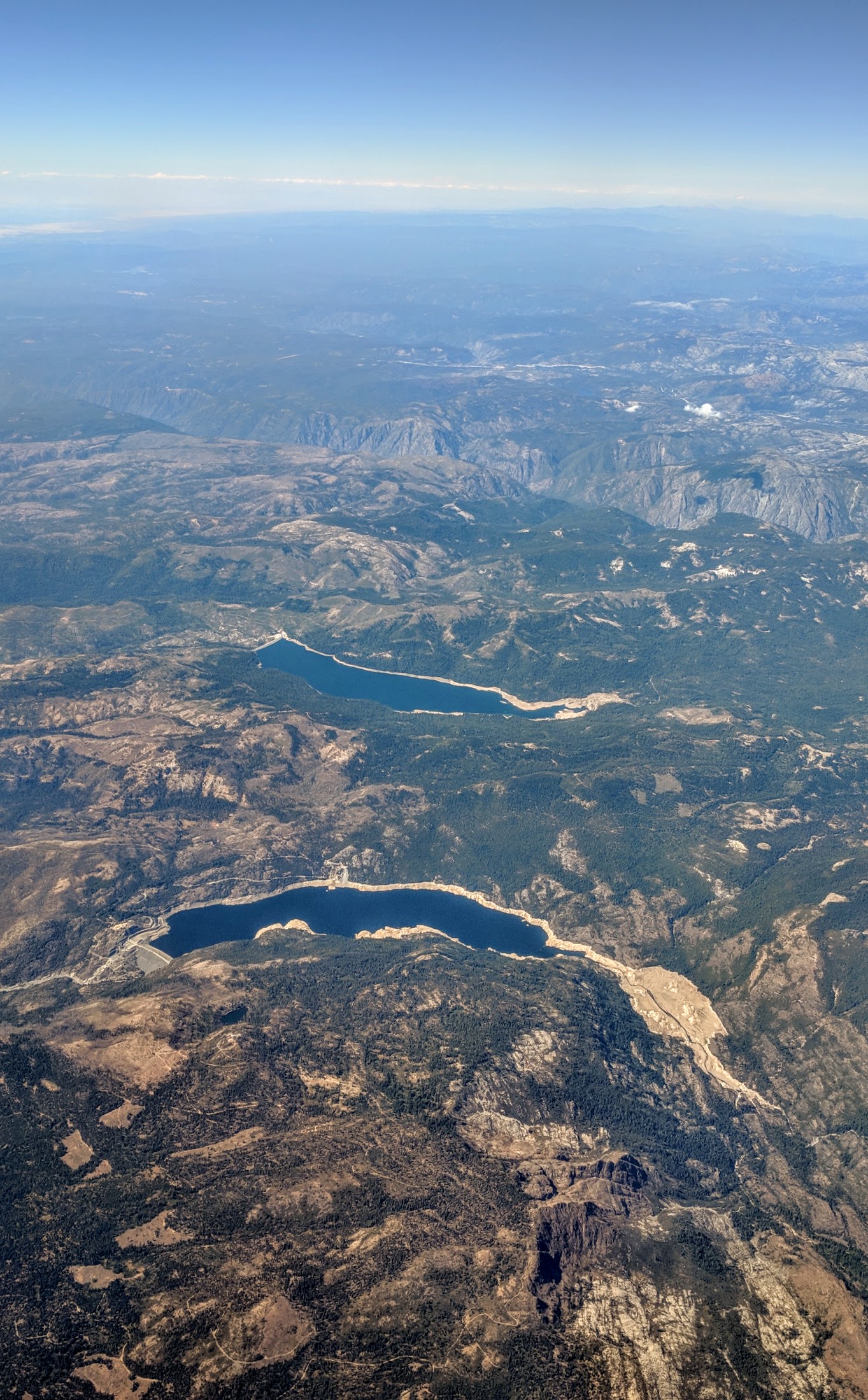
French Meadows Reservoir is a manmade lake northeast of Foresthill, California, United States on the Middle Fork of the American River. The reservoir is long, wide, with of shoreline. Tahoe National Forest manages the recreational facilities which include five campgrounds, two group campgrounds and two paved boat launch ramps. Activities at the lake include powerboating, kayaking, canoeing, fishing, picnicking and hiking. The reservoir is entirely within a state game refuge so no firearms, pellet guns or archery weapons are allowed. The elevation of the lake is , and it is nine miles (14 km) from the crest of the Sierra Nevada Mountain Range. The California Office of Environmental Health Hazard Assessment (OEHHA) has developed a safe eatinadvisoryfor French Meadows Reservoir based on levels of mercury found in fish caught here. History The reservoir was built in with the construction on the Middle Fork of the American River of the L.L. Anderson Dam. The dam i ... [...More Info...] [...Related Items...] OR: [Wikipedia] [Google] [Baidu] |
United States Geological Survey
The United States Geological Survey (USGS), formerly simply known as the Geological Survey, is a scientific agency of the United States government. The scientists of the USGS study the landscape of the United States, its natural resources, and the natural hazards that threaten it. The organization's work spans the disciplines of biology, geography, geology, and hydrology. The USGS is a fact-finding research organization with no regulatory responsibility. The agency was founded on March 3, 1879. The USGS is a bureau of the United States Department of the Interior; it is that department's sole scientific agency. The USGS employs approximately 8,670 people and is headquartered in Reston, Virginia. The USGS also has major offices near Lakewood, Colorado, at the Denver Federal Center, and Menlo Park, California. The current motto of the USGS, in use since August 1997, is "science for a changing world". The agency's previous slogan, adopted on the occasion of its hundredt ... [...More Info...] [...Related Items...] OR: [Wikipedia] [Google] [Baidu] |


