|
Middle Cove, New South Wales
Middle Cove is a suburb on the Lower North Shore of Sydney, in the state of New South Wales, Australia 9 kilometres north of the Sydney central business district, in the local government area of the City of Willoughby. Middle Cove is bounded to the north, east and south by Middle Harbour and to the west by Eastern Valley Way. Middle Cove shares its postcode, 2068, with the surrounding suburbs of Castlecrag and Willoughby North. In 2016 Middle Cove was ranked in the top 30 of Sydney's most liveable suburbs. History Middle Cove takes its name from its location between two coves, Castle Cove and Crag Cove. The suburb was undeveloped bushland until 1957 when Dick Dusseldorp bought most of the land from the NSW government and subdivided Middle Cove as we know it today. Dusseldorp was the founder and the largest share holder of Lend Lease, GPT and MLC. The Dusseldorps lived in Middle Cove until the patriarch death in 2000, the house which Dusseldorp built in Middle Cove is one of t ... [...More Info...] [...Related Items...] OR: [Wikipedia] [Google] [Baidu] |
Electoral District Of Willoughby
Willoughby is an electoral district of the Legislative Assembly in the Australian state of New South Wales. It was previously represented by Gladys Berejiklian of the Liberal Party, who announced on 1 October 2021 that she would resign from the Legislative Assembly and as Premier of New South Wales. She was replaced at the 2022 Willoughby state by-election on 12 February 2022 by Liberal Tim James. History Willoughby was an electoral district of the New South Wales Legislative Assembly, first created in 1894 with the abolition of multi-member electoral districts from part of St Leonards, and named after and including the Sydney suburb of Willoughby. It was abolished in 1904 and re-established in 1913. In 1920 with the introduction of proportional representation, it was absorbed into the multi-member electorate of Ryde along with Burwood and Gordon. It was recreated in 1927 with the return to single-member electorates. It was abolished in 1988, with most of its territory be ... [...More Info...] [...Related Items...] OR: [Wikipedia] [Google] [Baidu] |
City Of Willoughby
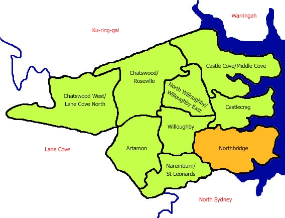
The City of Willoughby is a local government area on the Lower North Shore of Northern Sydney, in the state of New South Wales, Australia. It is located north of the Sydney central business district. It was first proclaimed in October 1865 as the ''Municipality of North Willoughby''. The main commercial centre of the City of Willoughby is Chatswood, home to one of Sydney's suburban skyscraper clusters. Other commercial centres are the suburbs of Willoughby, St Leonards and Artarmon. Willoughby is situated on an elevated plateau, and all of Sydney's television stations broadcast from towers in the area. Within the City of Willoughby is the Royal North Shore Hospital, located at St Leonards, one of Sydney's major hospitals. Suburbs in the local government area Suburbs and Localities in the City of Willoughby are: Heritage listings The City of Willoughby has a number of heritage-listed sites, including: * Artarmon, 559 Pacific Highway: Chatswood Reservoirs No. 1 and No. 2 ... [...More Info...] [...Related Items...] OR: [Wikipedia] [Google] [Baidu] |
Queen Victoria Building
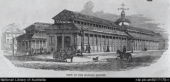
The Queen Victoria Building (abbreviated as the QVB) is a heritage-listed late-nineteenth-century building designed by the architect George McRae located at 429–481 George Street in the Sydney central business district, in the Australian state of New South Wales. The Romanesque Revival building was constructed between 1893 and 1898 and is wide by long. The domes were built by Ritchie Brothers, a steel and metal company that also built trains, trams and farm equipment. The building fills a city block bounded by George, Market, York, and Druitt Streets. Designed as a marketplace, it was used for a variety of other purposes, underwent remodelling, and suffered decay until its restoration and return to its original use in the late twentieth century. The property is owned by the City of Sydney and was added to the New South Wales State Heritage Register on 5 March 2010. History Site and precursors The site has been under the control of the council of the City of Sydney since ... [...More Info...] [...Related Items...] OR: [Wikipedia] [Google] [Baidu] |
North Shore Railway Line
The North Shore Line is a railway line serving the North Shore in Sydney, New South Wales, Australia. The North Shore Line extends from Sydney Central station through the western limb of the City Circle, across the Sydney Harbour Bridge and through the North Shore area to Hornsby where it joins the Main North Line. Services on the line are primarily provided by the T1 North Shore & Western Line and T9 Northern Line, with some services to Wyong during peak hours. History As early as 1874, people dreamed of a railway in the North Shore. In that year, a petition was made for a line from Pearce's Corner (Wahroonga) to Sydney Harbour. When one local was approached, he said: "If I live to be as old as Methuselah, I will never see a railway". In 1875, a committee was formed at the Greengate Hotel (Killara). The Public Works Department was opposed, saying "either then or now, the line would run from nowhere to nowhere". In 1879, surveyors proved that a line between Pearce's Corn ... [...More Info...] [...Related Items...] OR: [Wikipedia] [Google] [Baidu] |
Chatswood Railway Station
Chatswood is a railway station located in the Sydney suburb of Chatswood. It is served by Sydney Trains services; the T1 North Shore & Western Line and the T9 Northern Line, and the Sydney Metro's North West Line. History Chatswood station opened on 1 January 1890 when the North Shore line opened from Hornsby to St Leonards. An island platform was built on 23 May 1900 and a third dock platform brought into use on 12 July 1919. There was a small goods yard, similar to the one at St Leonards, on the western side of the station, beyond the northern end of the platforms. The dock platform on the eastern side of the station was used for electric parcel-van traffic and also for terminating some services from the city, until these were rescheduled to terminate further along the North Shore line from January 1992. It was removed in October 1994. Until 1958 there was a tram terminus in Victoria Avenue beside the station. The station entrance was later integrated with a shopping c ... [...More Info...] [...Related Items...] OR: [Wikipedia] [Google] [Baidu] |
Milsons Point, New South Wales
Milsons Point is a suburb on the lower North Shore of Sydney, in the state of New South Wales, Australia. The suburb is located 3 kilometres north of the Sydney central business district in the local government area of North Sydney Council. Milsons Point is also the geographical feature that juts into Sydney Harbour from the northern side, directly opposite Sydney Cove, the spot where the first European settlement was established in 1788. Milsons Point was named after James Milson (1783–1872), one of the earliest settlers. History Milsons Point was named after James Milson (1783–1872), a free settler originally from Lincolnshire. Milson settled in the area near Milsons Point and established a profitable business supplying ships with stone ballast, fresh water, and the produce of his dairy, orchard, and vegetable gardens. In the early 1820s Milson settled in the vicinity of Jeffrey Street, Kirribilli, on 120 acres of land he leased from Robert Campbell (1769–1846). In ... [...More Info...] [...Related Items...] OR: [Wikipedia] [Google] [Baidu] |
Cammeray
Cammeray is a residential suburb located five kilometres north of the Sydney Central Business District (CBD) and is part of the North Sydney Council local government area. Cammeray is part of the Lower North Shore region of Northern Sydney. History Aboriginal culture Cammeray takes its name from the Cammeraygal people, an Aboriginal clan who once occupied the Lower North Shore. Radiometric dating (carbon dating) indicates that indigenous peoples lived in the Cammeray area at least 5,800 years ago and Aboriginal shell middens have been discovered at Folly Point and cave paintings in Primrose Park. European settlement Prior to the 1920s, the suburb was known as Suspension Bridge reflecting the now Long Gully Bridge that joined Northbridge to Cammeray. Cammeray was slow to develop mainly due to its steep topography and remoteness from transport. Despite the land boom of the 1880s and plans for a suspension bridge across Flat Rock Creek, development in the Cammeray area was mos ... [...More Info...] [...Related Items...] OR: [Wikipedia] [Google] [Baidu] |
Northbridge, New South Wales
Northbridge is a suburb on the Lower North Shore of Sydney, New South Wales, Australia. It is located 6 kilometres north of the Sydney Central Business District, in the local government area of the City of Willoughby. The Suspension Bridge, linking the suburb to Cammeray, has become a recognised symbol of Northbridge, completed in January 1892 and purchased by the state government in 1912. The suburb celebrated its centenary in 2013. History Northbridge took its name from its location, north of a sandstone suspension bridge built in 1892. The bridge was constructed by a team of land developers at a cost of A£42,000 and originally known as North Sydney Bridge. The engineer responsible for the construction was J. E. Coyle and the style was Federation Gothic, with medieval motifs as "unexpected embellishments". It has been known as the Northbridge and Cammeray Suspension Bridge but is now called the Long Gully Bridge. The land where the suspension bridge was built belonged to W ... [...More Info...] [...Related Items...] OR: [Wikipedia] [Google] [Baidu] |
Forest Coach Lines
Forest Coach Lines is an Australian bus and coach operator. Founded in 1930 in the Northern Suburbs of Sydney, since 2016 it has expanded with purchases in the Mid North Coast and North West Slopes regions in New South Wales. It is a subsidiary of ComfortDelGro Australia. History In March 1930, Eric and Trevor Royle trading as Royle Brothers, purchased routes 56 Chatswood station to Roseville Chase and 201 Roseville station to Roseville Chase from E Jones with three buses. In October 1941 the first service operated across the Roseville Bridge to Terrey Hills.History Forest Coach Lines In March 1947, route 52 Chatswood to Artarmon was purchased but quickly sold in November of that y ... [...More Info...] [...Related Items...] OR: [Wikipedia] [Google] [Baidu] |
Busways
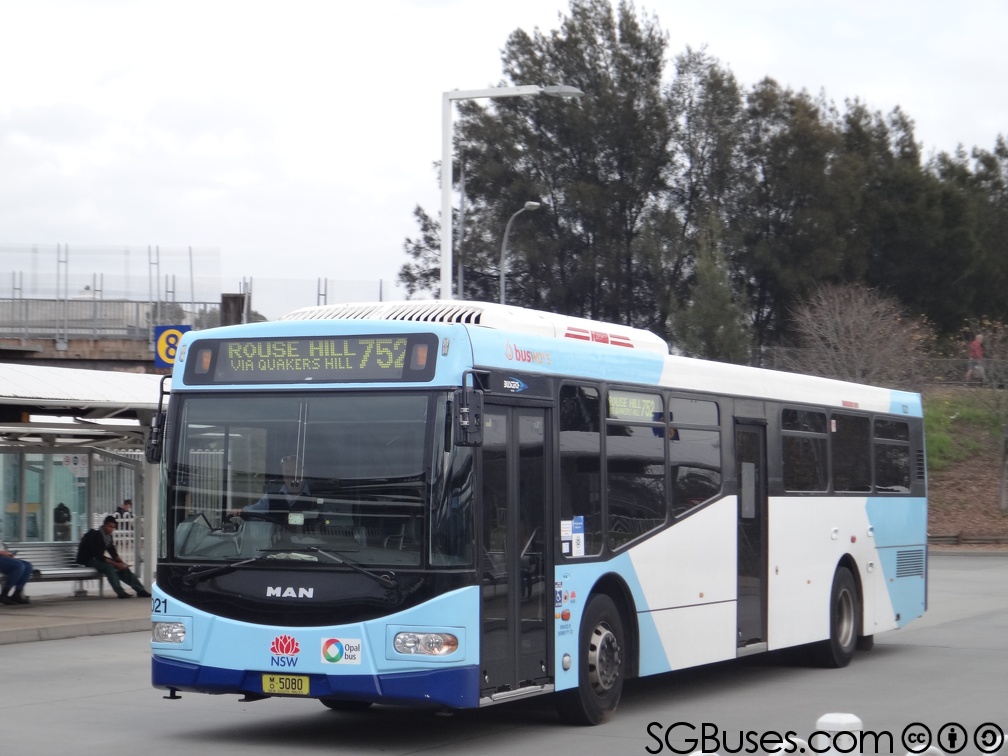
Busways is an Australian bus company operating services in Sydney Sydney ( ) is the capital city of the state of New South Wales, and the most populous city in both Australia and Oceania. Located on Australia's east coast, the metropolis surrounds Sydney Harbour and extends about towards the Blue Mountain ..., and in the Central Coast (New South Wales), Central Coast, Great Lakes Council, Great Lakes, Mid North Coast regions of New South Wales and Adelaide. It is the largest privately owned bus operator in Australia. History The origins of Busways can be traced to 1942 when Dick Rowe commenced a hire car service from Rooty Hill, New South Wales, Rooty Hill to Plumpton, New South Wales, Plumpton. In 1946 Rowe purchased his first bus and further expansion saw a depot established in Plumpton in 1958. [...More Info...] [...Related Items...] OR: [Wikipedia] [Google] [Baidu] |
Cammeray, New South Wales
Cammeray is a residential suburb located five kilometres north of the Sydney Central Business District (CBD) and is part of the North Sydney Council local government area. Cammeray is part of the Lower North Shore region of Northern Sydney. History Aboriginal culture Cammeray takes its name from the Cammeraygal people, an Aboriginal clan who once occupied the Lower North Shore. Radiometric dating (carbon dating) indicates that indigenous peoples lived in the Cammeray area at least 5,800 years ago and Aboriginal shell middens have been discovered at Folly Point and cave paintings in Primrose Park. European settlement Prior to the 1920s, the suburb was known as Suspension Bridge reflecting the now Long Gully Bridge that joined Northbridge to Cammeray. Cammeray was slow to develop mainly due to its steep topography and remoteness from transport. Despite the land boom of the 1880s and plans for a suspension bridge across Flat Rock Creek, development in the Cammeray area was m ... [...More Info...] [...Related Items...] OR: [Wikipedia] [Google] [Baidu] |
Cammeraygal
The Cammeraygal, variously spelled as Cam-mer-ray-gal, Gamaraigal, Kameraigal, Cameragal and several other variations, are one clan of the 29 Darug tribes who are united by a common language, strong ties of kinship and survived as skilled hunter–fisher–gatherers in family groups or clans that inhabited the Lower North Shore of Sydney, New South Wales, Australia. Traditional lands The traditional lands of the Cammeraygal people are now contained within much of the North Sydney, Willoughby, Mosman, Manly and Warringah local government areas. The Cammeraygal people lived in the area until the 1820s and are recorded as being in the northern parts of the Sydney region for approximately 5,800 years. Legacy The name Cammeraygal is ensigned on the North Sydney Municipal emblem. The North Sydney suburb of Cammeray and the Cammeraygal High School located in the North Sydney suburb of Crows Nest are named after the Cammeraygal people. In 1999, the North Sydney Council erect ... [...More Info...] [...Related Items...] OR: [Wikipedia] [Google] [Baidu] |


.jpg)

Tarella.jpg)
