|
Metropolitan Adelaide Transport Study
The Metropolitan Adelaide Transport Study, or "MATS Plan" as it became known, was a comprehensive transport plan released in 1968 proposing a number of road and rail transport projects for the metropolitan area of Adelaide, South Australia. It recommended the construction of 98 kilometres of freeways, 34 kilometres of expressway and the widening of 386 kilometres of existing arterial roads. It also featured new arterial roads and a new bridge over the Port River. For public transport, it proposed the closure of the Glenelg tram line, 20 rail grade separations and 14 kilometres of new train line, including a subway under King William Street. The estimated cost of land acquisition and construction was $436.5 million in 1968, which equates to approximately $4,580 million in 2010 with inflation. Very few of the plan's recommendations were ultimately brought to fruition in their original form due to political and public opposition. History Like other states of Australia, there w ... [...More Info...] [...Related Items...] OR: [Wikipedia] [Google] [Baidu] |
Urban Planning
Urban planning, also known as town planning, city planning, regional planning, or rural planning, is a technical and political process that is focused on the development and design of land use and the built environment, including air, water, and the infrastructure passing into and out of urban areas, such as transportation, communications, and distribution networks and their accessibility. Traditionally, urban planning followed a top-down approach in master planning the physical layout of human settlements. The primary concern was the public welfare, which included considerations of efficiency, sanitation, protection and use of the environment, as well as effects of the master plans on the social and economic activities. Over time, urban planning has adopted a focus on the social and environmental bottom-lines that focus on planning as a tool to improve the health and well-being of people while maintaining sustainability standards. Sustainable development was added as one ... [...More Info...] [...Related Items...] OR: [Wikipedia] [Google] [Baidu] |
Holdfast Bay Railway Line
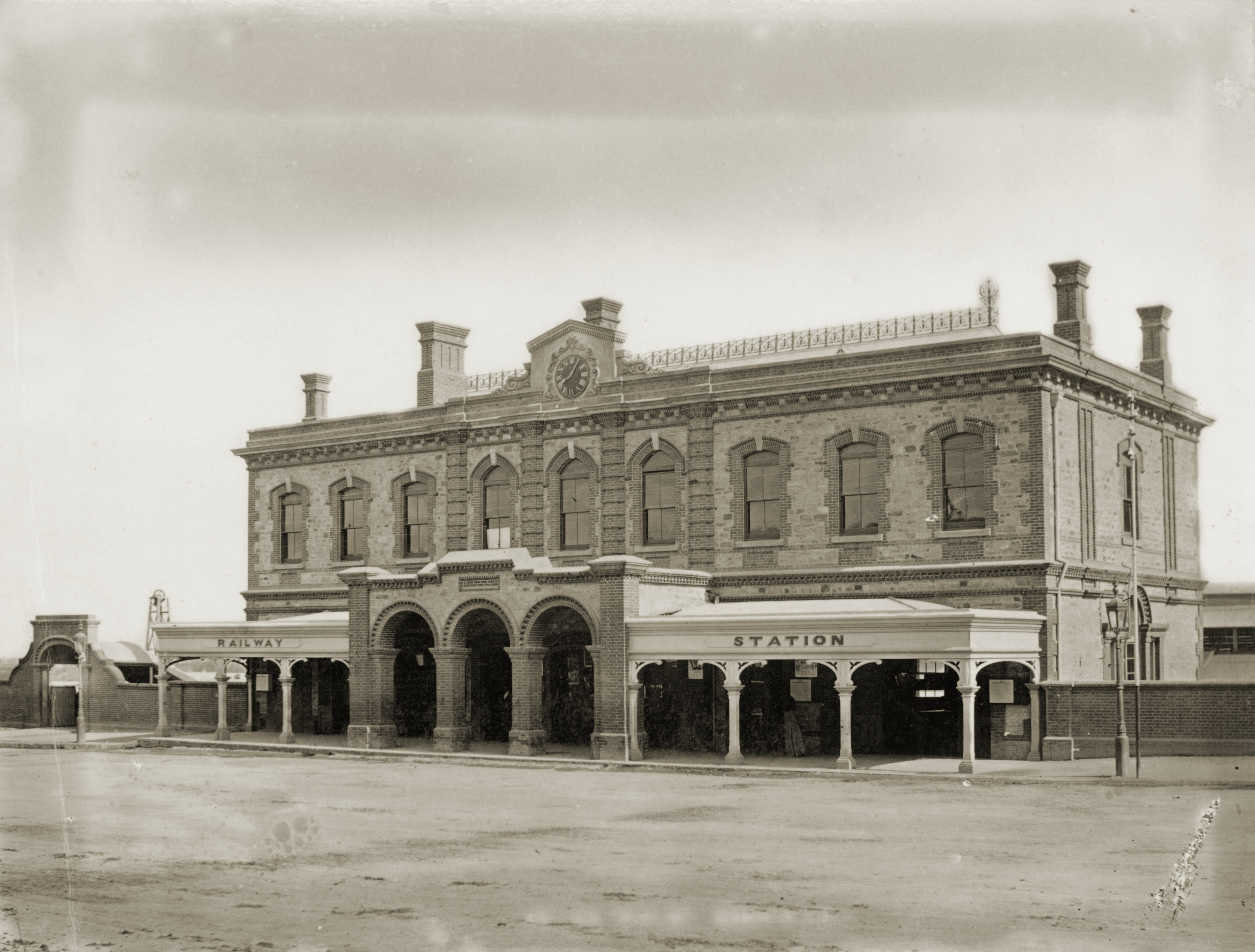
The Holdfast Bay railway line was a railway in western Adelaide. The line started in the city from the Adelaide railway station, and then headed west. From approximately where Henley Beach Road currently is, the railway then followed an almost direct route to the seaside suburb of Glenelg. Today, much of the corridor in which the line ran remains as a rail trail for cyclists, which is known as the Westside Bikeway. Part of the north section of the corridor has been built over as James Congdon Drive. A railway platform remains on the site of Plympton station near Marion Road in the suburb of Plympton. The line was closed in 1929, after which remnants remained for some time including rails across Marion Road in the 1950s. A signal from the line was preserved and put in the main pavilion of the National Railway Museum, Port Adelaide. History The line was constructed to compete with the existing Glenelg railway line, (now the Glenelg tram line), which ran from Victoria Squa ... [...More Info...] [...Related Items...] OR: [Wikipedia] [Google] [Baidu] |
Anzac Highway
Anzac Highway is an main arterial road heading southwest from the city of Adelaide, the capital of South Australia, to the beachside suburb of Glenelg. Originally named the Bay Road (which remains an informal synonym), it mostly follows the track made by the pioneer James ChambersKerr, Margaret Goyder ''Colonial dynasty: the Chambers family of South Australia'' Rigby Ltd., Adelaide, 1980. from Holdfast Bay, the first governor's landing site, to Adelaide. It gained its current name in 1923 to honour the contribution of the ANZACs (Australian and New Zealand Army Corps) in World War I. Route Commencing at the intersection with South Terrace, West Terrace and Goodwood Road on the Adelaide city centre's south-western corner, Anzac Highway heads southwest through the Adelaide Park Lands, through Plympton, before turning west through Camden Park and eventually terminating at the bayside suburb of Glenelg. The highway is serviced by a 15-minute "Go Zone", serviced by the 262, 2 ... [...More Info...] [...Related Items...] OR: [Wikipedia] [Google] [Baidu] |
Southern Expressway (Australia)
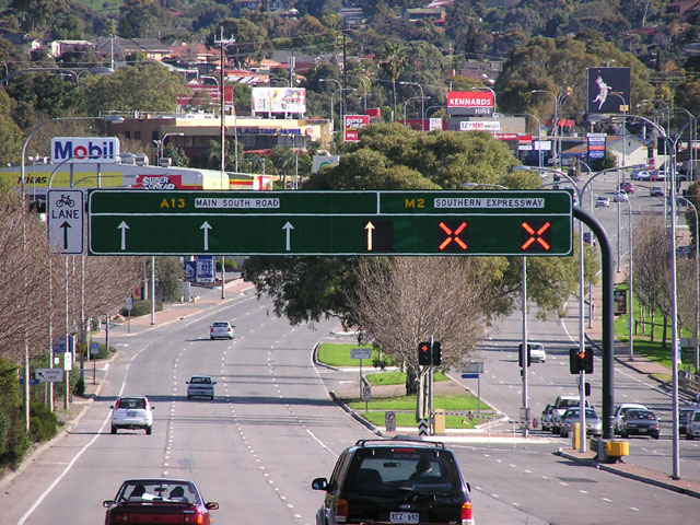
Southern Expressway is an freewayA guide to using the Southern Expressway Department of Planning, Transport and Infrastructure, Government of South Australia through the southern suburbs of , . It is the southern part of the North–South Corridor which extends the full length of Adelaide and is being built to urban freeway standard. It is designated part of route M2. The Sou ... [...More Info...] [...Related Items...] OR: [Wikipedia] [Google] [Baidu] |
South Road
South Road and its southern section as Main South Road outside of Adelaide is a major north–south conduit connecting Adelaide and the Fleurieu Peninsula, in South Australia. It is one of Adelaide's most important arterial and bypass roads. As South Road, it is designated part of route A2 within suburban Adelaide, and as Main South Road, it is designated part of routes A13 and B23. The northern part of South Road contributes the central component of the North–South Corridor, a series of road projects under construction or planning that will eventually provide a continuous expressway between Old Noarlunga and Gawler. Route South Road commences from the intersection with Port River Expressway and Salisbury Highway in Wingfield and runs directly south, through much of Adelaide's inner western suburbs, close to the Adelaide city centre; it is complimented by (and in some instances, subsumed into) the North-South Motorway and either runs directly underneath it at ground level w ... [...More Info...] [...Related Items...] OR: [Wikipedia] [Google] [Baidu] |
Yankalilla, South Australia
Yankalilla is an agriculturally based town situated on the Fleurieu Peninsula in South Australia, located 72 km south of the state's capital of Adelaide. The town is nestled in the Bungala River valley, overlooked by the southern Mount Lofty Ranges and acts as a service centre for the surrounding agricultural district. In the early stages of the colonisation of the state, Yankalilla was a highly important location, but its close proximity to Adelaide and the advent of fast transport has greatly diminished this position. Etymology The origin of the town's name is unclear, but it is known that Governor Hindmarsh recorded the Kaurna pronunciation of "Yoongalilla", as applied to the District and noted this in dispatches of 1837. Colonel Light, however wrote about it as Yanky-lilly and Yanky Point, giving rise to the unsubstantiated idea that it was named after an American whaler or an American ship named 'Lilly' which was wrecked off the coast. According to Geoff Manning, N ... [...More Info...] [...Related Items...] OR: [Wikipedia] [Google] [Baidu] |
Victor Harbor, South Australia
Victor Harbor is a town in the Australian state of South Australia located within the City of Victor Harbor on the south coast of the Fleurieu Peninsula, about south of the state capital of Adelaide. The town is the largest population centre on the peninsula, with an economy based upon agriculture, fisheries and various industries. It is also a highly popular tourist destination, with the area's population greatly expanded during the summer holidays, usually by Adelaide locals looking to escape the summer heat. It is a popular destination with South Australian high school graduates for their end of year celebrations, known colloquially as schoolies. History Victor Harbor lies in the traditional lands of the Ramindjeri clan of the Ngarrindjeri people. Matthew Flinders in visited the bay on 8 April 1802 while on the first circumnavigation of the continent, mapping the unsurveyed southern Australian coast from the west. He encountered Nicolas Baudin in '' Le Geographe'' ne ... [...More Info...] [...Related Items...] OR: [Wikipedia] [Google] [Baidu] |
Noarlunga Centre, South Australia
Noarlunga Centre is a suburb in the City of Onkaparinga in the southern suburbs of Adelaide, South Australia. The suburb is mostly commercial, being dominated by the Centro Colonnades shopping centre and the small 'Inspire Noarlunga' estate to the east of Goldsmith Road. The suburb is bordered by Beach Road to the north, Dyson Road to the west Goldsmith Road to the south and the Southern Expressway to the east. Burgess Drive, Seaman Road and David Witton Drive are the main thoroughfares inside the boundaries of the suburb. The name Noarlunga is an English adaptation of the native Kaurna word Nurlongga, meaning 'at the curvature', referring to the horseshoe bend near the mouth of the Onkaparinga River. Sharing the name Noarlunga are the two adjacent seaside suburbs Port Noarlunga and Port Noarlunga South and the historic township of Old Noarlunga that is located on the Onkaparinga River. Port Noarlunga was the original town centre prior to Noarlunga Centre being constructe ... [...More Info...] [...Related Items...] OR: [Wikipedia] [Google] [Baidu] |
Salisbury, South Australia
Salisbury is a northern suburb in Adelaide, South Australia. It is the seat of the City of Salisbury, and in the South Australian Legislative Assembly electoral district of Ramsay and the Australian House of Representatives division of Spence. The suburb is a service area for the City of Salisbury district, with an abundance of parklands, shops, cafes and restaurants. Parabanks Shopping Centre is also located in Salisbury, which includes Woolworths, Coles and Big W as its signature retailers. History Salisbury was founded when John Harvey began selling town allotments in 1848, from land he had purchased along the Little Para River in the previous year. The town was named after Salisbury in the United Kingdom which was close to his wife's hometown. There is a Wiltshire Street near Park Terrace in the city centre, parallel to John Street. Salisbury started its life as a service centre for the surrounding wheat and hay farms. Salisbury Post Office opened around March 1850. S ... [...More Info...] [...Related Items...] OR: [Wikipedia] [Google] [Baidu] |
Sellicks Beach, South Australia
__NOTOC__ Sellicks Beach, formerly spelt Sellick's Beach, is a suburb in the Australian state of South Australia located within Adelaide metropolitan area about from the Adelaide city centre. It is an outer southern suburb of Adelaide and is located in the local government area of the City of Onkaparinga at the southern boundary of the metropolitan area. It is known as Witawali or Witawodli by the Traditional Owners, the Kaurna people, and is of significance as being the site of a freshwater spring said to be created by the tears of Tjilbruke, the creator being. The beach lies within Aldinga Bay. The suburb consists of land bounded in the north by Button Road, in the east by the Main South Road, to the south by the boundary of the cadastral unit of the Hundred of Willunga and to the west by the coastline with Aldinga Bay. The 2016 Australian census reported that Sellicks Beach had 2,616 people living within its boundaries. History Before the British colonisation of South ... [...More Info...] [...Related Items...] OR: [Wikipedia] [Google] [Baidu] |
Elizabeth, South Australia
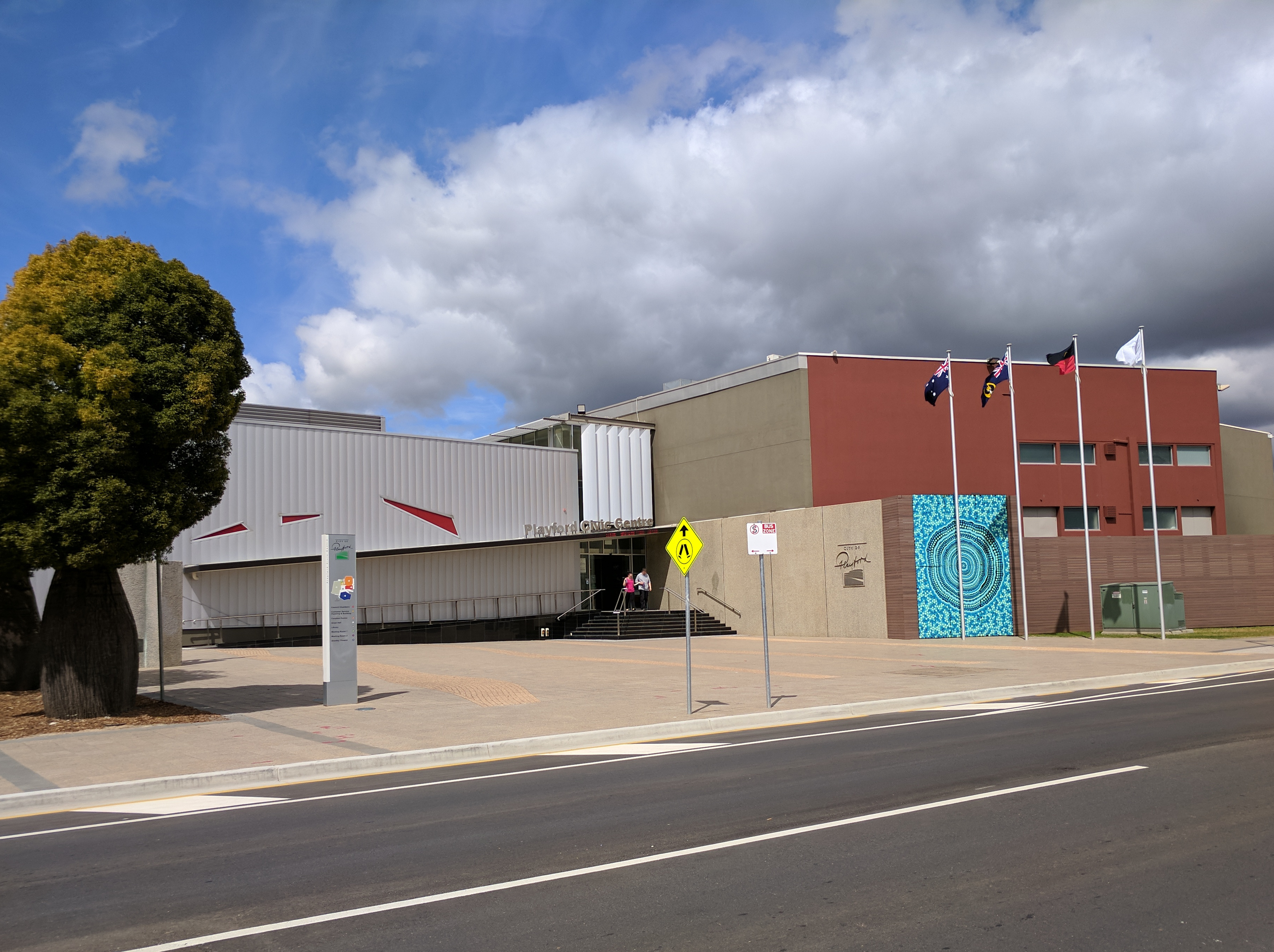
Elizabeth is an outer northern suburb of the Adelaide metropolitan area, South Australia, 24 km north of the Adelaide city centre. It is located in the City of Playford. At the 2016 census, Elizabeth had a population of 1,024. Established in 1955, it was the seat of the former local government body, the Old City of Elizabeth, which included Elizabeth as well as the immediately adjacent suburbs on all sides except the west. Although the City of Elizabeth no longer exists, having been amalgamated into the much larger City of Playford in 1997, the term "Elizabeth", in the context of Adelaide, typically refers to the historic municipality and the distinct community therein. History Before the 1950s, most of the area surrounding today's suburb of Elizabeth was farming land. After the end of the Second World War with its shortage of materials, the state government decided that South Australia needed to grow and become industrialised. A satellite city was planned for northern ... [...More Info...] [...Related Items...] OR: [Wikipedia] [Google] [Baidu] |


