|
Meteosat-8
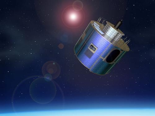
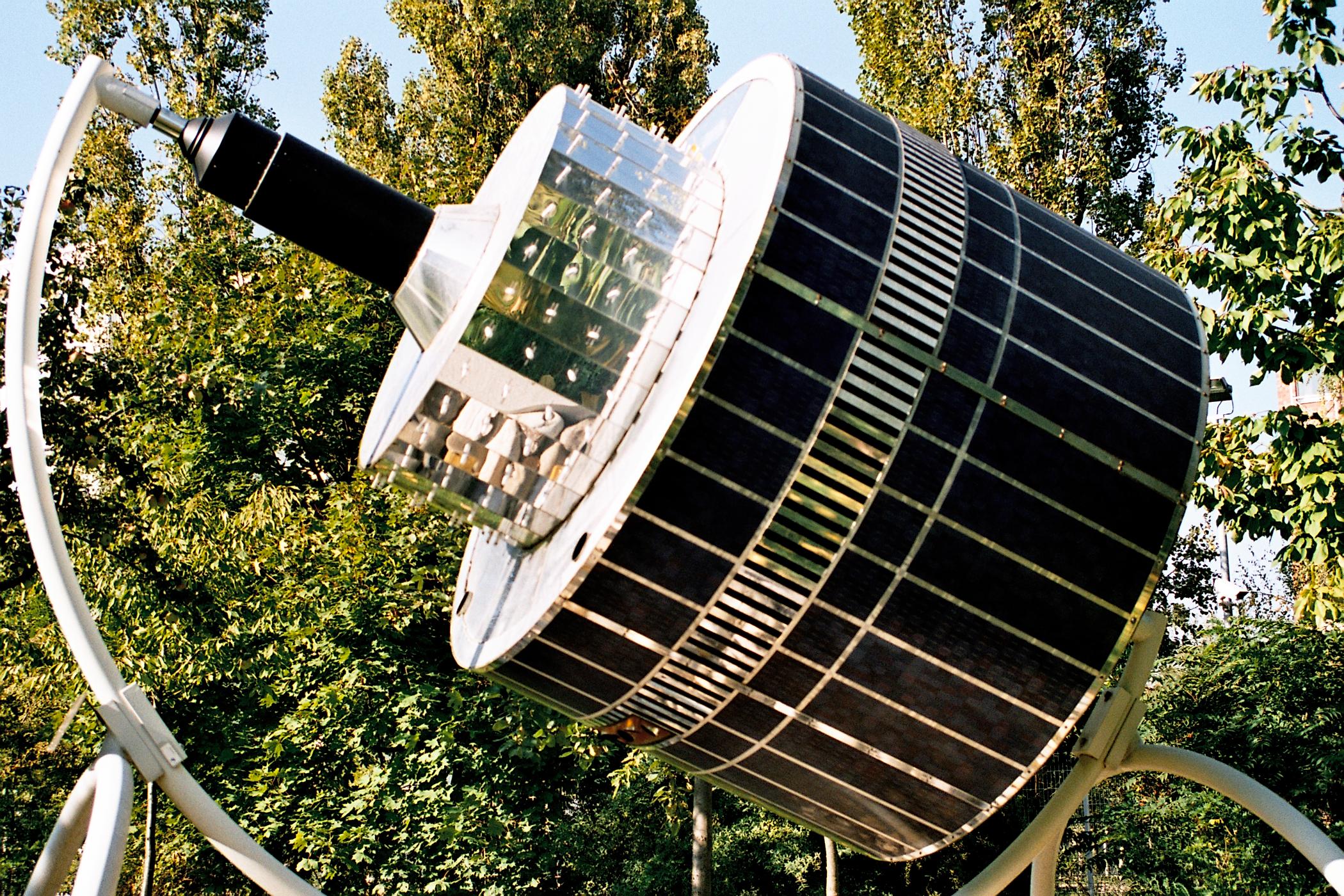
Meteosat 8 is a weather satellite, also known as MSG 1. The Meteosat series are operated by EUMETSAT under the Meteosat Transition Programme (MTP) and the Meteosat Second Generation (MSG) program. Notable for imaging the first meteor to be predicted to strike the earth, 2008 TC3. Launched 28 Aug 2002 by an Ariane V155, this European Meteorology satellite is in a Geostationary orbit. While Meteosat 8 meteorological instruments are working, solid state power amplifier SSPA-C failed in October 2002. On 22 May 2007, the satellite experienced an unexpected orbit change. This was initially assessed as due to a hit by an unknown object, but that was later assessed not to be credible. The thermal protection was damaged at the same time as the orbit change. Subsequent investigation assessed the Meteosat-8 spinning spacecraft's orbit change due to the mass release of thermal covering whose attachment failed. Meteosat-8 is still operating, and as of April 2013 is providing a backup capabi ... [...More Info...] [...Related Items...] OR: [Wikipedia] [Google] [Baidu] |
Meteosat
The Meteosat series of satellites are geostationary meteorological satellites operated by EUMETSAT under the Meteosat Transition Programme (MTP) and the Meteosat Second Generation (MSG) program. The MTP program was established to ensure the operational continuity between the end of the successful Meteosat Operational Programme in 1995 and Meteosat Second Generation (MSG), which came into operation at the start of 2004 using improved satellites. The MSG program will provide service until the MTG (Meteosat Third Generation) program takes over. __TOC__ First generation The first generation of Meteosat satellites, Meteosat-1 to Meteosat-7, provided continuous and reliable meteorological observations from space to a large user community. Meteosat-1 to -7 have all now retired. When operational, the Meteosat First Generation provided images every half-hour in three spectral channels (Visible, Infrared) and Water Vapour, via the Meteosat Visible and Infrared Imager (MVIRI) instrum ... [...More Info...] [...Related Items...] OR: [Wikipedia] [Google] [Baidu] |
Meteosat Second Generation
The Meteosat series of satellites are geostationary meteorological satellites operated by EUMETSAT under the Meteosat Transition Programme (MTP) and the Meteosat Second Generation (MSG) program. The MTP program was established to ensure the operational continuity between the end of the successful Meteosat Operational Programme in 1995 and Meteosat Second Generation (MSG), which came into operation at the start of 2004 using improved satellites. The MSG program will provide service until the MTG (Meteosat Third Generation) program takes over. __TOC__ First generation The first generation of Meteosat satellites, Meteosat-1 to Meteosat-7, provided continuous and reliable meteorological observations from space to a large user community. Meteosat-1 to -7 have all now retired. When operational, the Meteosat First Generation provided images every half-hour in three spectral channels (Visible, Infrared) and Water Vapour, via the Meteosat Visible and Infrared Imager (MVIRI) instrumen ... [...More Info...] [...Related Items...] OR: [Wikipedia] [Google] [Baidu] |
Meteosat 7
The Meteosat series of satellites are geostationary meteorological satellites operated by EUMETSAT under the Meteosat Transition Programme (MTP) and the Meteosat Second Generation (MSG) program. The MTP program was established to ensure the operational continuity between the end of the successful Meteosat Operational Programme in 1995 and Meteosat Second Generation (MSG), which came into operation at the start of 2004 using improved satellites. The MSG program will provide service until the MTG (Meteosat Third Generation) program takes over. __TOC__ First generation The first generation of Meteosat satellites, Meteosat-1 to Meteosat-7, provided continuous and reliable meteorological observations from space to a large user community. Meteosat-1 to -7 have all now retired. When operational, the Meteosat First Generation provided images every half-hour in three spectral channels (Visible, Infrared) and Water Vapour, via the Meteosat Visible and Infrared Imager (MVIRI) instrume ... [...More Info...] [...Related Items...] OR: [Wikipedia] [Google] [Baidu] |
Weather Satellite
A weather satellite or meteorological satellite is a type of Earth observation satellite that is primarily used to monitor the weather and climate of the Earth. Satellites can be polar orbiting (covering the entire Earth asynchronously), or geostationary (hovering over the same spot on the equator). While primarily used to detect the development and movement of storm systems and other cloud patterns, meteorological satellites can also detect other phenomena such as city lights, fires, effects of pollution, auroras, sand and dust storms, snow cover, ice mapping, boundaries of ocean currents, and energy flows. Other types of environmental information are collected using weather satellites. Weather satellite images helped in monitoring the volcanic ash cloud from Mount St. Helens and activity from other volcanoes such as Mount Etna. Smoke from fires in the western United States such as Colorado and Utah have also been monitored. El Niño and its effects on weather are monitored ... [...More Info...] [...Related Items...] OR: [Wikipedia] [Google] [Baidu] |
EUMETSAT
The European Organization for the Exploitation of Meteorological Satellites (EUMETSAT) is an intergovernmental organisation created through an international convention agreed by a current total of 30 European Member States. EUMETSAT's primary objective is to establish, maintain and exploit European systems of operational meteorological satellites. EUMETSAT is responsible for the launch and operation of the satellites and for delivering satellite data to end-users as well as contributing to the operational monitoring of climate and the detection of global climate changes. The activities of EUMETSAT contribute to a global meteorological satellite observing system coordinated with other space-faring nations. Satellite observations are an essential input to numerical weather prediction systems and also assist the human forecaster in the diagnosis of potentially hazardous weather developments. Of growing importance is the capacity of weather satellites to gather long-term measure ... [...More Info...] [...Related Items...] OR: [Wikipedia] [Google] [Baidu] |
Alcatel Space
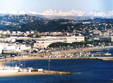
Thales Alenia Space () is a Franco-Italian aerospace manufacturer. A joint venture between the French technology corporation Thales Group (67%) and Italian defense conglomerate Leonardo (33%), the company is the largest satellite manufacturer in Europe. It is headquartered in Cannes, France. Thales Alenia Space designs and builds various space-related products, notably manufacturing numerous ranges of satellites for telecommunications, navigation, earth observation and space exploration purposes. The company is the second largest industrial participant in the International Space Station (ISS), having produced the European Space Agency's (ESA) modules for the ISS. It is also building satellites for Galileo, a European global satellite navigation system (GSNS). History Thales Alenia Space arose as a result of the French defense electronics specialist Thales Group deciding to buy out the participation of Alcatel in two joint-ventures between France's Alcatel and Italy's Finm ... [...More Info...] [...Related Items...] OR: [Wikipedia] [Google] [Baidu] |
Ariane 5
Ariane 5 is a European heavy-lift space launch vehicle developed and operated by Arianespace for the European Space Agency (ESA). It is launched from the Centre Spatial Guyanais (CSG) in French Guiana. It has been used to deliver payloads into geostationary transfer orbit (GTO) or low Earth orbit (LEO). The launch vehicle had a streak of 82 consecutive successful launches between 9 April 2003 and 12 December 2017. Since 2014, Ariane 6, a direct successor system, is in development. The system was designed as an expendable launch system by the ''Centre national d'études spatiales'' (CNES), the French government's space agency, in cooperation with various European partners. Despite not being a direct derivative of its predecessor launch vehicle program, it is classified as part of the Ariane rocket family. ArianeGroup is the prime contractor for the manufacturing of the vehicles, leading a multi-country consortium of other European contractors. Ariane 5 was originally intende ... [...More Info...] [...Related Items...] OR: [Wikipedia] [Google] [Baidu] |
Guiana Space Centre
The Guiana Space Centre (french: links=no, Centre spatial guyanais; CSG), also called Europe's Spaceport, is a European spaceport to the northwest of Kourou in French Guiana, a region of France in South America. Kourou is located approximately north of the equator, at a latitude of 5°. In operation since 1968, it is suitable as a location for a spaceport, because of its equatorial location and open sea to the east. The European Space Agency (ESA), the European Union Agency for the Space Programme (EUSPA), the French space agency CNES (National Centre for Space Studies), the Space Agency of the Republic of Azerbaijan (Azercosmos) and the commercial company Arianespace conduct launches from Kourou. It was used by the ESA to send supplies to the International Space Station using the Automated Transfer Vehicle. History In 1964 Guiana was selected to become the spaceport of France, replacing France's first launch site Centre interarmées d'essais d'engins spéciaux in Hammag ... [...More Info...] [...Related Items...] OR: [Wikipedia] [Google] [Baidu] |
ELA-3
ELA-3 (french: Ensemble de Lancement Ariane 3, lit=Ariane Launch Complex 3), is a launch pad and associated facilities at the Centre Spatial Guyanais in French Guiana. ELA-3 is operated by Arianespace as part of the expendable launch system for Ariane 5 launch vehicles A launch vehicle or carrier rocket is a rocket designed to carry a payload (spacecraft or satellites) from the Earth's surface to outer space. Most launch vehicles operate from a launch pads, supported by a launch control center and syste .... , 114 launches have been carried out from it, the first of which occurred on 4 June 1996. ELA-3 is 21 square kilometres in size. Launch history Scheduled flights References {{Ariane Guiana Space Centre ... [...More Info...] [...Related Items...] OR: [Wikipedia] [Google] [Baidu] |
Geocentric Orbit
A geocentric orbit or Earth orbit involves any object orbiting Earth, such as the Moon or artificial satellites. In 1997, NASA estimated there were approximately 2,465 artificial satellite payloads orbiting Earth and 6,216 pieces of space debris as tracked by the Goddard Space Flight Center. More than 16,291 objects previously launched have undergone orbital decay and entered Earth's atmosphere. A spacecraft enters orbit when its centripetal acceleration due to gravity is less than or equal to the centrifugal acceleration due to the horizontal component of its velocity. For a low Earth orbit, this velocity is about ; by contrast, the fastest crewed airplane speed ever achieved (excluding speeds achieved by deorbiting spacecraft) was in 1967 by the North American X-15. The energy required to reach Earth orbital velocity at an altitude of is about 36 MJ/kg, which is six times the energy needed merely to climb to the corresponding altitude. Spacecraft with a perigee belo ... [...More Info...] [...Related Items...] OR: [Wikipedia] [Google] [Baidu] |
Geostationary Orbit
A geostationary orbit, also referred to as a geosynchronous equatorial orbit''Geostationary orbit'' and ''Geosynchronous (equatorial) orbit'' are used somewhat interchangeably in sources. (GEO), is a circular geosynchronous orbit in altitude above Earth's equator ( in radius from Earth's center) and following the direction of Earth's rotation. An object in such an orbit has an orbital period equal to Earth's rotational period, one sidereal day, and so to ground observers it appears motionless, in a fixed position in the sky. The concept of a geostationary orbit was popularised by the science fiction writer Arthur C. Clarke in the 1940s as a way to revolutionise telecommunications, and the first satellite to be placed in this kind of orbit was launched in 1963. Communications satellites are often placed in a geostationary orbit so that Earth-based satellite antennas do not have to rotate to track them but can be pointed permanently at the position in the sky where the sat ... [...More Info...] [...Related Items...] OR: [Wikipedia] [Google] [Baidu] |
Weather Satellite
A weather satellite or meteorological satellite is a type of Earth observation satellite that is primarily used to monitor the weather and climate of the Earth. Satellites can be polar orbiting (covering the entire Earth asynchronously), or geostationary (hovering over the same spot on the equator). While primarily used to detect the development and movement of storm systems and other cloud patterns, meteorological satellites can also detect other phenomena such as city lights, fires, effects of pollution, auroras, sand and dust storms, snow cover, ice mapping, boundaries of ocean currents, and energy flows. Other types of environmental information are collected using weather satellites. Weather satellite images helped in monitoring the volcanic ash cloud from Mount St. Helens and activity from other volcanoes such as Mount Etna. Smoke from fires in the western United States such as Colorado and Utah have also been monitored. El Niño and its effects on weather are monitored ... [...More Info...] [...Related Items...] OR: [Wikipedia] [Google] [Baidu] |


