|
Mesopotamia (station)
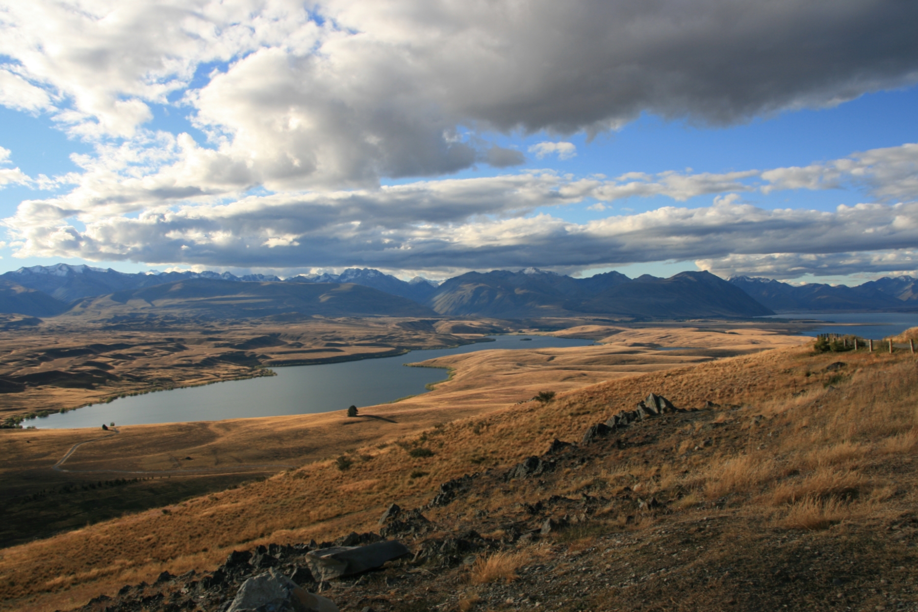
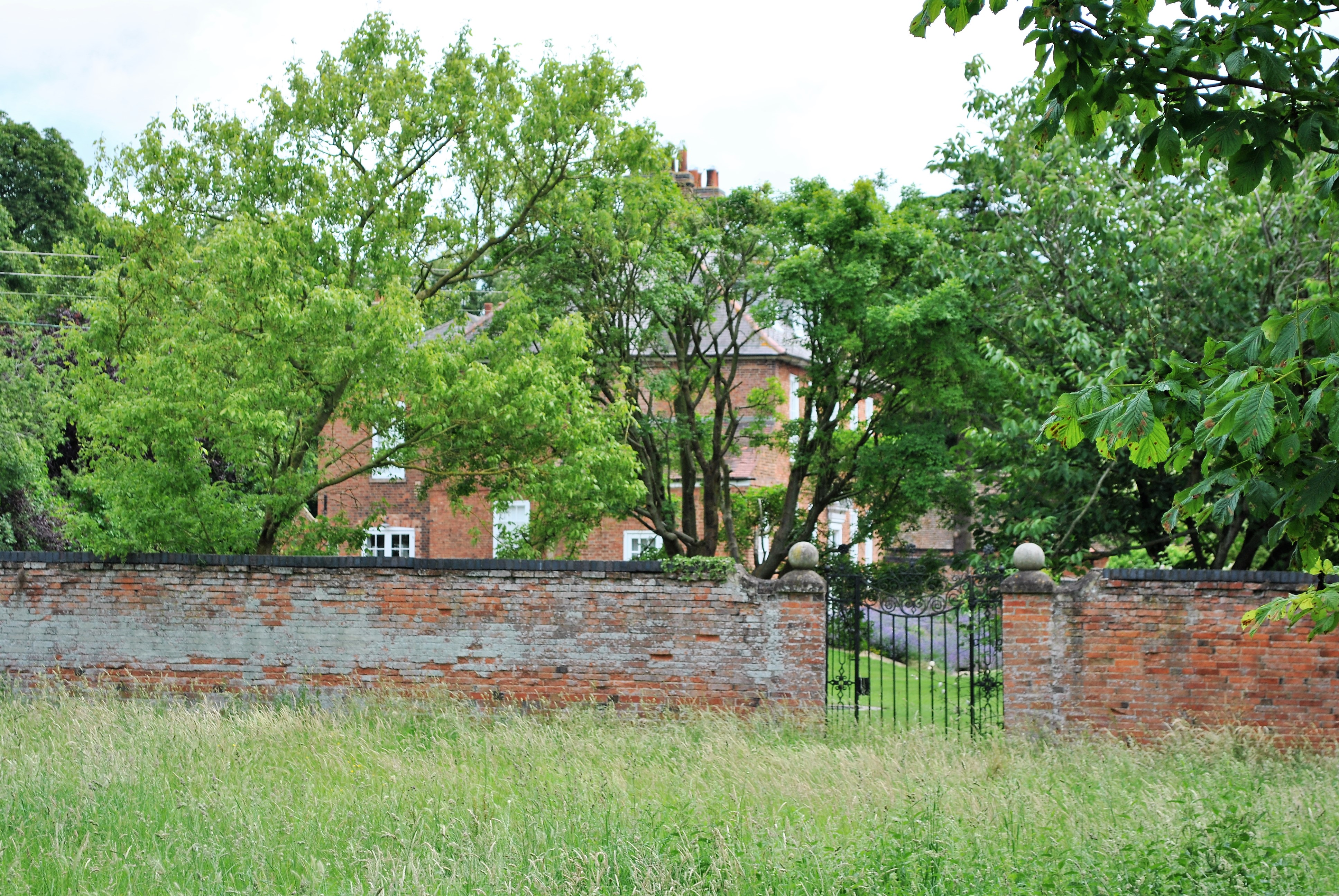
Mesopotamia Station is a high-country station in New Zealand's South Island. Known mainly for one of its first owners, the novelist Samuel Butler, it is probably the country's best known station. Despite popular belief, Butler was not the station's first owner. Geography Mesopotamia originally occupied the country between the Rangitata River and the top of the Two Thumb Range, from Forest Creek upwards, and for many years included the Cloudy Peak forks of the Rangitata, which later became part of Stronechrubie Station. Ownership While many attribute the formation of the station to Butler, most parts of the station had been allotted several years before to various individuals. Butler arrived in Lyttelton on 27 January 1860 on the '' Roman Emperor''. He left England to get away from his father, and to free himself from constraints imposed by religion and law. He explored the headwaters of several Canterbury rivers, helped by his background in cross-country running, a sport pione ... [...More Info...] [...Related Items...] OR: [Wikipedia] [Google] [Baidu] |
High Country (New Zealand)
High country is a New Zealand term for the elevated pastoral land of the South Island and – to a lesser extent – North Island. This terrain, which can be compared loosely with the outback of Australia, high veldt of South Africa and pampas of Argentina, lies in the rain shadow of the country's mountain ranges and tends to be extensively farmed land with a continental climate consisting of low rainfall, cold winters and hot summers. Livestock farmed in these regions include sheep and – increasingly – deer and alpaca, and a major ground-covering plant of the area is tussock. Regions of New Zealand closely associated with the high country include Central Otago and the Mackenzie Basin in the South Island, and parts of the North Island Volcanic Plateau. Much of the land is at a high altitude (hence its name), with the majority of the high country being more than 600 metres (2000 feet) above sea level. The land is marked with geological features associated with glaciation ... [...More Info...] [...Related Items...] OR: [Wikipedia] [Google] [Baidu] |
Station (New Zealand Agriculture)
A station or run, in the context of New Zealand agriculture, is a large farm dedicated to the grazing of sheep and cattle. The use of the word for the farm or farm buildings date back to the mid-nineteenth century. The owner of a station is called a runholder. Some of the stations in the South Island have been subject to the voluntary tenure review process. As part of this process the government has been buying out all or part of the leases. Poplars Station in the Lewis Pass area was purchased in part by the government in 2003. The Nature Heritage Fund was used to purchase 4000 ha for $1.89 million. Birchwood Station was bought in 2005 to form part of the Ahuriri Conservation Park St James Station was purchased by the Government in 2008. Notable stations * Akitio Station, formerly a property located in the Southern North Island province of Wairarapa and host to the touring English Cricket team in the 20th century. * Castle Hill Station, located on State Highway 73; location ... [...More Info...] [...Related Items...] OR: [Wikipedia] [Google] [Baidu] |
South Island
The South Island, also officially named , is the larger of the two major islands of New Zealand in surface area, the other being the smaller but more populous North Island. It is bordered to the north by Cook Strait, to the west by the Tasman Sea, and to the south and east by the Pacific Ocean. The South Island covers , making it the world's 12th-largest island. At low altitude, it has an oceanic climate. The South Island is shaped by the Southern Alps which run along it from north to south. They include New Zealand's highest peak, Aoraki / Mount Cook at . The high Kaikōura Ranges lie to the northeast. The east side of the island is home to the Canterbury Plains while the West Coast is famous for its rough coastlines such as Fiordland, a very high proportion of native bush and national parks, and the Fox and Franz Josef Glaciers. The main centres are Christchurch and Dunedin. The economy relies on agriculture and fishing, tourism, and general manufacturing and services. ... [...More Info...] [...Related Items...] OR: [Wikipedia] [Google] [Baidu] |
Samuel Butler (novelist)
Samuel Butler (4 December 1835 – 18 June 1902) was an English novelist and critic, best known for the satirical utopian novel ''Erewhon'' (1872) and the semi-autobiographical novel ''Ernest Pontifex or The Way of All Flesh'', published posthumously in 1903 in an altered version titled ''The Way of All Flesh'', and published in 1964 as he wrote it. Both novels have remained in print since their initial publication. In other studies he examined Christian orthodoxy, evolutionary thought, and Italian art, and made prose translations of the ''Iliad'' and ''Odyssey'' that are still consulted. Early life Butler was born on 4 December 1835 at the rectory in the village of Langar, Nottinghamshire. His father was Rev. Thomas Butler, son of Dr. Samuel Butler, then headmaster of Shrewsbury School and later Bishop of Lichfield. Dr. Butler was the son of a tradesman and descended from a line of yeomen, but his scholarly aptitude being recognised at a young age, he had been sent to Rugby ... [...More Info...] [...Related Items...] OR: [Wikipedia] [Google] [Baidu] |
Rangitata River
The Rangitata River is one of the braided rivers that helped form the Canterbury Plains in southern New Zealand. It flows southeast for from the Southern Alps (New Zealand), Southern Alps, entering the Pacific Ocean northeast of Timaru. The river has a catchment area of , and a mean annual flow of at Klondyke. The Māori language, Māori name "Rangitata" (Rakitata) has been variously translated as "day of lowering clouds", "close sky", and "the side of the sky". The river formed the Rangitata Valley, in the center of the Southern Alps, and the on-location photography of the Edoras set from ''The Lord of the Rings: The Two Towers'', and ''The Lord of the Rings: The Return of the King, The Return of the King'' was filmed in this valley, on and around Mount Sunday. Several remote sheep stations are located near Mount Sunday. These include Mesopotamia (station), Mesopotamia, Mt Potts, and Erewhon. Erewhon was named by Samuel Butler (novelist), Samuel Butler who was the first white ... [...More Info...] [...Related Items...] OR: [Wikipedia] [Google] [Baidu] |
Two Thumb Range
The Two Thumb Range (sometimes called the Two Thumbs Range) is a range of mountains in the Canterbury Region of New Zealand's South Island. It is located to the east of Lake Tekapo and has several peaks which rise to around .Two Thumb Range, Canterbury NZTopoMap. Retrieved 22 January 2022. The southern end of the range contains one of Canterbury's main skifields, Mount Dobson. Geography An eastern spur of the Southern Alps, the Two Thumb Range runs in a predominantly north-south direction for approximately . It and the smaller, mostly parallel, Sibbald Range branch from the Southern Alps close to Mount D'Archaic, northeast of Aoraki / Mount Cook. The two ranges are separated by the valley of the Macauley River and form a barrier between the valleys of the Godley River and Lak ...[...More Info...] [...Related Items...] OR: [Wikipedia] [Google] [Baidu] |
Lyttelton, New Zealand
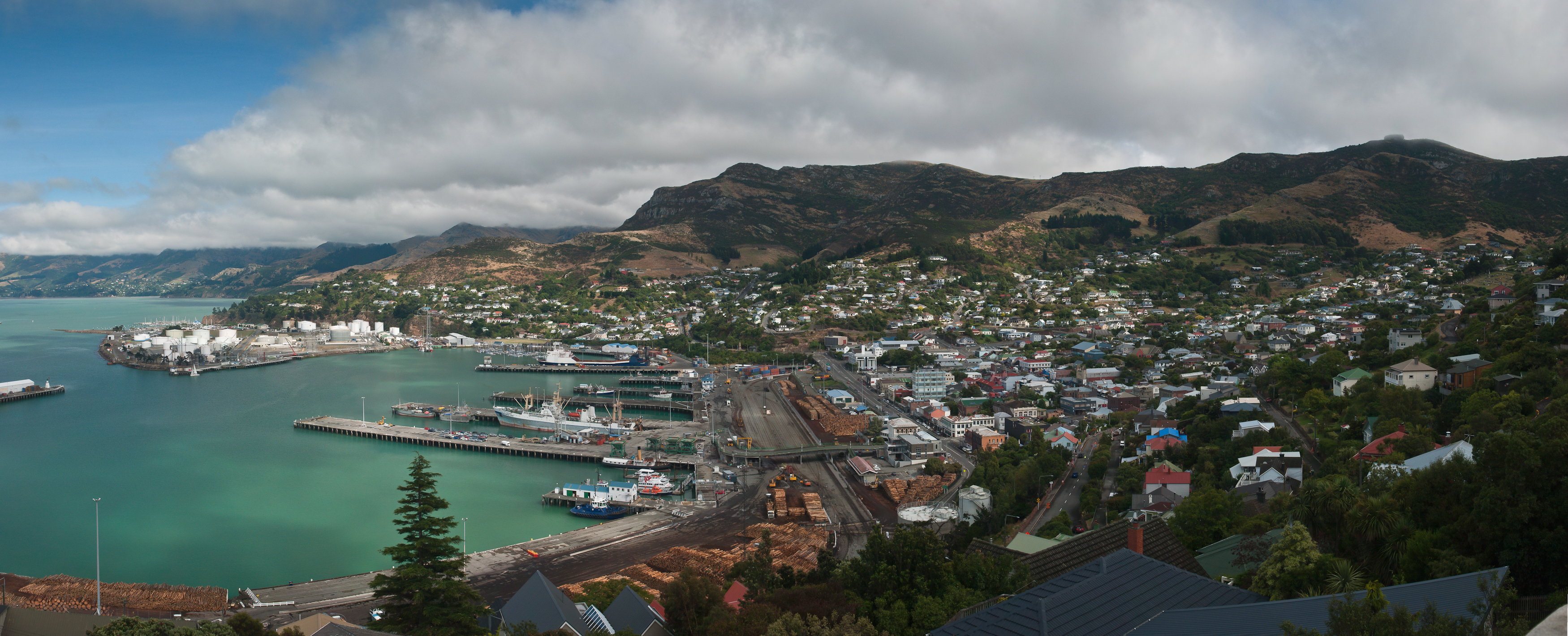
Lyttelton (Māori: ''Ōhinehou'') is a port town on the north shore of Lyttelton Harbour / Whakaraupō, at the northwestern end of Banks Peninsula and close to Christchurch, on the eastern coast of the South Island of New Zealand. As a landing point for Christchurch-bound seafarers, Lyttelton has historically been regarded as the "Gateway to Canterbury" for colonial settlers. Until the 2020 coronavirus pandemic, the port has been a regular destination for cruise ships. It is the South Island's principal goods-transport terminal, handling 34% of exports and 61% of imports by value. In 2009 Lyttelton was awarded Category I Historic Area status by the Historic Places Trust (NZHPT) defined as "an area of special or outstanding historical or cultural heritage significance or value", not long before much of the historic fabric was destroyed in the 2011 Christchurch earthquake. Location Lyttelton is the largest settlement on Lyttelton Harbour / Whakaraupō, an inlet on the northwe ... [...More Info...] [...Related Items...] OR: [Wikipedia] [Google] [Baidu] |
Roman Emperor (ship)
''Roman Emperor'' was a full-rigged ship built in 1848. The ''Roman Emperor'' made at least two voyages from England to New Zealand, arriving there in 1860 and 1863. Each voyage carried many immigrants to New Zealand. The English novelist Samuel Butler arrived in Christchurch Christchurch ( ; mi, Ōtautahi) is the largest city in the South Island of New Zealand and the seat of the Canterbury Region. Christchurch lies on the South Island's east coast, just north of Banks Peninsula on Pegasus Bay. The Avon River / ... (at the port of Lyttelton) on the ''Roman Emperor'' in January 1860.Lyttelton Times 28 January 1860 References {{Reflist 1848 ships ... [...More Info...] [...Related Items...] OR: [Wikipedia] [Google] [Baidu] |
Canterbury Region
Canterbury ( mi, Waitaha) is a region of New Zealand, located in the central-eastern South Island. The region covers an area of , making it the largest region in the country by area. It is home to a population of The region in its current form was established in 1989 during nationwide local government reforms. The Kaikoura District joined the region in 1992 following the abolition of the Nelson-Marlborough Regional Council. Christchurch, the South Island's largest city and the country's second-largest urban area, is the seat of the region and home to percent of the region's population. Other major towns and cities include Timaru, Ashburton, Rangiora and Rolleston. History Natural history The land, water, flora, and fauna of Waitaha/Canterbury has a long history stretching from creation of the greywacke basement rocks that make up the Kā Tiritiri o te Moana/Southern Alps to the arrival of the first humans. This history is linked to the creation of the earth, the so ... [...More Info...] [...Related Items...] OR: [Wikipedia] [Google] [Baidu] |
Shrewsbury School
Shrewsbury School is a public school (English independent boarding school for pupils aged 13 –18) in Shrewsbury. Founded in 1552 by Edward VI by Royal Charter, it was originally a boarding school for boys; girls have been admitted into the Sixth Form since 2008 and the school has been co-educational since 2015. As of Michaelmas Term 2020, the school has 807 pupils: 544 boys and 263 girls. There are eight boys' boarding houses, four girls' boarding houses and two for day pupils. There are approximately 130 day pupils.Independent Schools Inspectorate report 2007 Retrieved 19 March 2010 The present site, to which the school moved in 1882, is on the south bank of the |
Canterbury, New Zealand
Canterbury ( mi, Waitaha) is a region of New Zealand, located in the central-eastern South Island. The region covers an area of , making it the largest region in the country by area. It is home to a population of The region in its current form was established in 1989 during nationwide local government reforms. The Kaikoura District joined the region in 1992 following the abolition of the Nelson-Marlborough Regional Council. Christchurch, the South Island's largest city and the country's second-largest urban area, is the seat of the region and home to percent of the region's population. Other major towns and cities include Timaru, Ashburton, Rangiora and Rolleston. History Natural history The land, water, flora, and fauna of Waitaha/Canterbury has a long history stretching from creation of the greywacke basement rocks that make up the Kā Tiritiri o te Moana/Southern Alps to the arrival of the first humans. This history is linked to the creation of the earth, the s ... [...More Info...] [...Related Items...] OR: [Wikipedia] [Google] [Baidu] |
Tenure Review
Tenure review is a process of reviewing the leasehold tenure of some high country land in the South Island of New Zealand. It currently involves 20% of the South Island or 10% of the total land area of New Zealand. Tenure review began with the passing of the Crown Pastoral Land Act 1998. Historically, much of the high country area has been grazed by sheep and cattle. From the mid-1930s to the mid-1980s, about 27% of New Zealand's land area was either leased or licensed from the Crown. In the South Island pastoral farming relied on Crown leasehold land. About one-fifth of the occupied land in Otago was freehold. In Canterbury, about two-fifths of occupied land was freehold. In 2006, Lincoln University lecturer Ann Brower argued that the process is in favour of the lessees rather than the government. In 2008, the Parliamentary Commissioner for the Environment carried out an investigation into tenure review. A number of recommendations were made, including the establishment of a Hi ... [...More Info...] [...Related Items...] OR: [Wikipedia] [Google] [Baidu] |

.jpg)


