|
Merrimack Valley Regional Transit Authority
The Merrimack Valley Regional Transit Authority (MVRTA) is a public, non-profit organization in Massachusetts, United States, charged with providing public transportation to an area consisting of the cities and towns of Amesbury, Andover, Boxford, Georgetown, Groveland, Haverhill, Lawrence, Merrimac, Methuen, Newbury, Newburyport, North Andover, Rowley, Salisbury and West Newbury, as well as a seasonal service to the popular nearby summer destination of Hampton Beach, New Hampshire. The MVRTA provides fixed route bus services and paratransit services within its area, together with services to Lowell and Boston. MVRTA's buses provide interchange with commuter lines of the Massachusetts Bay Transportation Authority (MBTA) at Andover Station, Haverhill station, Lawrence station, Lowell station and Newburyport station. The MVRTA started operation in 1976, having been created under Chapter 161B of the Massachusetts General Laws. Since 1983, operation of the MVRTA has been s ... [...More Info...] [...Related Items...] OR: [Wikipedia] [Google] [Baidu] |
Haverhill, Massachusetts
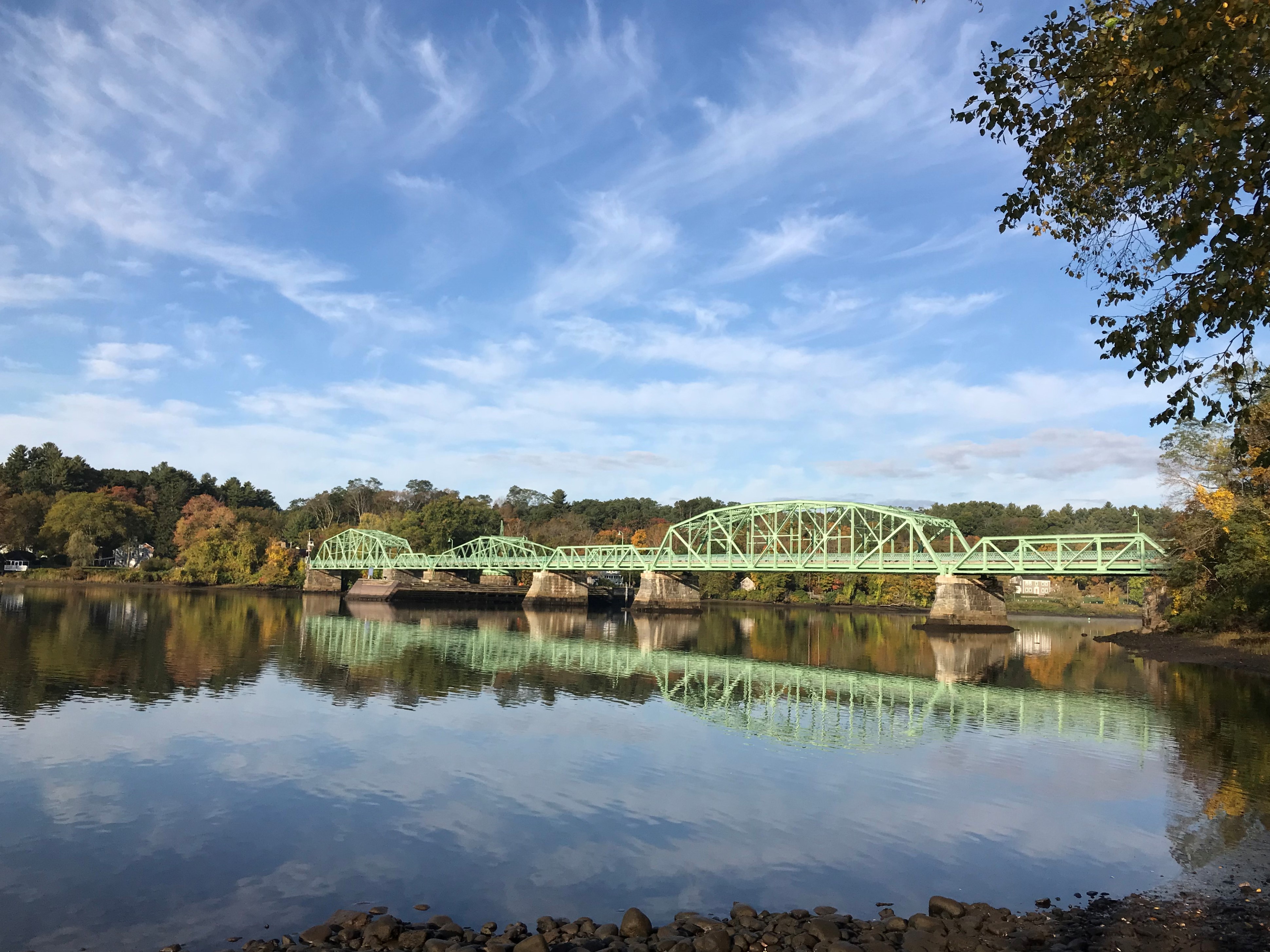
Haverhill ( ) is a city in Essex County, Massachusetts, United States. Haverhill is located 35 miles north of Boston on the New Hampshire border and about 17 miles from the Atlantic Ocean. The population was 67,787 at the 2020 United States Census. Located on the Merrimack River, Haverhill began as a farming community of Puritans, largely from Newbury Plantation. The land was officially purchased from the Pentuckets on November 15, 1642 (One year after incorporation) for three pounds, and ten shillings. Pentucket was renamed Haverhill (after the Ward family's hometown in England) and evolved into an important industrial center, beginning with sawmills and gristmills run by water power. In the 18th and 19th century, Haverhill developed woolen mills, tanneries, shipping and shipbuilding. The town was home to a significant shoe-making industry for many decades. By the end of 1913, one tenth of the shoes produced in the United States were made in Haverhill, and because of this t ... [...More Info...] [...Related Items...] OR: [Wikipedia] [Google] [Baidu] |
Methuen, Massachusetts
Methuen () is a 23 square mile (60 km2) city in Essex County, Massachusetts, United States. The population was 53,059 at the 2020 census. Methuen lies along the northwestern edge of Essex County, just east of Middlesex County and just south of Rockingham County, New Hampshire. The city is bordered by Haverhill to the northeast, North Andover to the southeast, Lawrence and Andover to the south, Dracut (Middlesex County) to the west, Pelham, New Hampshire ( Hillsborough County) to the northwest, and Salem, New Hampshire ( Rockingham County) to the north. Methuen is located southwest from Newburyport, north-northwest of Boston and south-southeast of Manchester, New Hampshire. History Methuen was first settled in 1642 and was officially incorporated in 1726. Methuen was originally part of Haverhill, Massachusetts. In 1724 Stephen Barker and others in the western part of that town petitioned the General Court to grant them permission to form a new town above Hawke's Mea ... [...More Info...] [...Related Items...] OR: [Wikipedia] [Google] [Baidu] |
Newburyport (MBTA Station)
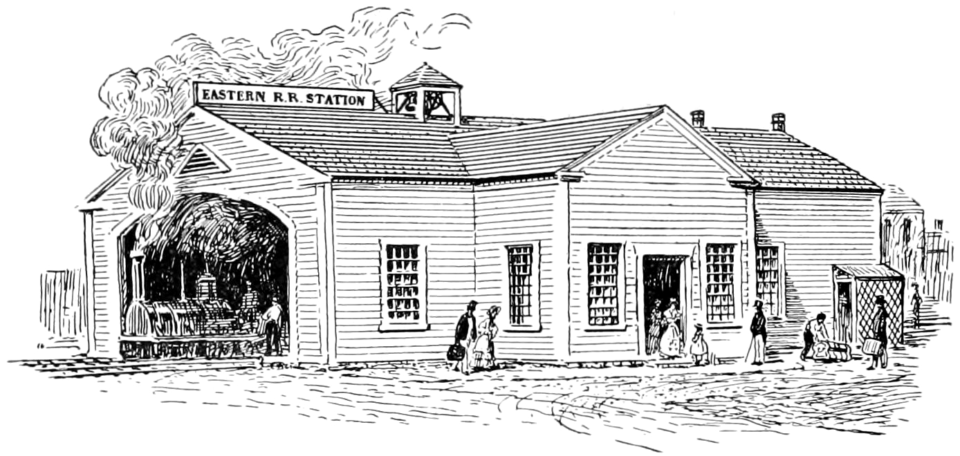
Newburyport station is an MBTA Commuter Rail station in Newburyport, Massachusetts. It is located between Parker Street and U.S. Route 1 south of downtown Newburyport, and serves the Newburyport/Rockport Line. The station is the terminus of the Newburyport Branch of the line, with three parking lots totalling over 800 spaces. The Clipper City Rail Trail, running along the former right-of-way, connects the station to the town center. Newburyport station is fully accessible. History Former station The Eastern Railroad's original Newburyport station was located in downtown Newburyport, near Washington Street. Opened in 1840, it was a small wooden structure with a two-track trainshed. It was replaced by a larger brick station just to the north in March 1854. The 1854 station was destroyed by fire on March 3, 1892; a large brick structure with a turret was constructed on the same spot. By 1962 the station was privately owned and in poor condition, with deep potholes in the parkin ... [...More Info...] [...Related Items...] OR: [Wikipedia] [Google] [Baidu] |
Lowell (MBTA Station)
Lowell station, officially the Charles A. Gallagher Transit Terminal, is an intermodal transit station in Lowell, Massachusetts. The transit complex includes an MBTA Commuter Rail station as well as the Robert B. Kennedy Bus Transfer Center, which serves local and intercity buses. It is located off Thorndike Street ( MA 3A) near the end of the Lowell Connector south of downtown Lowell. The commuter rail station is the northern terminus of the Lowell Line, and is a major park-and-ride station for the system, serving commuters from Lowell, northern Massachusetts, and southern New Hampshire. The Kennedy Bus Transfer Center is the transfer point for all Lowell Regional Transit Authority local bus routes and several intercity bus routes by other operators. Terminal and services The Charles A. Gallagher Transit Terminal is an intermodal transit center at 101 Thorndike Street ( MA 3A) near to Downtown Lowell. The station is the northern terminus of the MBTA Lowell Line, which provid ... [...More Info...] [...Related Items...] OR: [Wikipedia] [Google] [Baidu] |
Lawrence (MBTA Station)
The Senator Patricia McGovern Transportation Center, also known as the McGovern Transportation Center or simply Lawrence station, is a transit station in Lawrence, Massachusetts. It serves the MBTA Commuter Rail's Haverhill Line. The modern station, which opened in 2005, is the latest of seven distinct stations located in Lawrence since 1848; it is located in the city's Gateway District. History Early stations The city of Lawrence was chartered in 1846, several years after the Boston & Maine Railroad opened. In 1848, the original tracks from Ballardvale to North Andover were abandoned and the route was relocated to the modern routing through Lawrence south of the Merrimack River. That year, the B&M set a land speed record for railed vehicles by operating the first authenticated 60 mph (96.6 km/h) train, ''The Antelope'', from Boston to Lawrence, travelling 26 miles in 26 minutes. The first station in Lawrence, South Lawrence, was a wooden structure built in 1848 ... [...More Info...] [...Related Items...] OR: [Wikipedia] [Google] [Baidu] |
Haverhill (MBTA Station)
Haverhill station is an intercity and regional rail station located in downtown Haverhill, Massachusetts, United States. It is served by Amtrak's '' Downeaster'' service and the MBTA Commuter Rail Haverhill/Reading Line; it is the northern terminus of MBTA service. History The Boston and Portland Railroad opened to , across the Merrimack River from Haverhill, on October 26, 1837. A bridge across the river was built in 1839, with service extended to East Kingston, New Hampshire via Haverhill on January 1, 1840. The railroad was renamed as the Boston and Maine Railroad (B&M) in 1843. The original station, with colonnades on several sides, was soon supplemented with a brick freight house. Haverhill had service suitable for commuting to Boston almost immediately; even after became the outer limit for some commuter service in the 1850s, Haverhill remained the terminus of some trains. A new brick station with a four-sided clock tower, design by local architect Josiah Littlefield, wa ... [...More Info...] [...Related Items...] OR: [Wikipedia] [Google] [Baidu] |
Lowell, Massachusetts
Lowell () is a city in Massachusetts, in the United States. Alongside Cambridge, Massachusetts, Cambridge, It is one of two traditional county seat, seats of Middlesex County, Massachusetts, Middlesex County. With an estimated population of 115,554 in 2020, it was the List of municipalities in Massachusetts by population, fifth most populous city in Massachusetts as of the last census, and the third most populous in the Greater Boston, Boston metropolitan statistical area. The city also is part of a smaller Massachusetts statistical area, called Greater Lowell, and of New England's Merrimack Valley region. Incorporated in 1826 to serve as a mill town, Lowell was named after Francis Cabot Lowell (businessman), Francis Cabot Lowell, a local figure in the Industrial Revolution. The city became known as the cradle of the American Industrial Revolution because of Lowell mills, its textile mills and factories. Many of Lowell's historic manufacturing sites were later preserved by the Nat ... [...More Info...] [...Related Items...] OR: [Wikipedia] [Google] [Baidu] |
Hampton Beach, New Hampshire
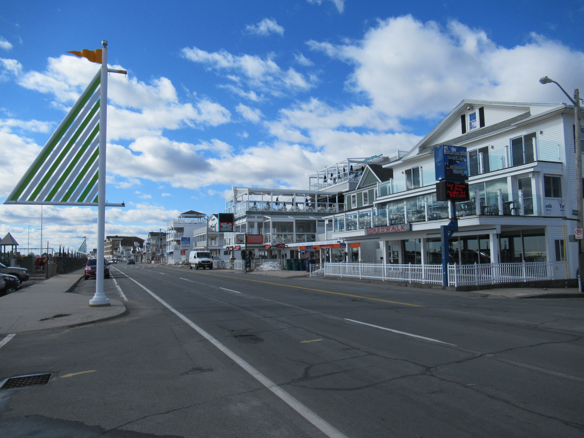
Hampton Beach is a village district, census-designated place, and beach resort in the town of Hampton, New Hampshire, United States, along the Atlantic Ocean. Its population at the 2020 census was 2,598. Hampton Beach is in Rockingham County, about south of Portsmouth. The community is a popular tourist destination and the busiest beach community in New Hampshire. Ocean Boulevard, the main street along the beach, includes a boardwalk, many shops and businesses, several seasonal hotels, and the Hampton Beach Casino Ballroom, which hosts national acts in the summer. Hampton Beach State Park was named one of four "Superstar" beaches in the United States in 2011, for having had perfect water-quality testing results in each of the previous three years. History The Hampton Beach Village District was established on June 26, 1907, to provide electric power and water to the summer tourist community. In 1923, the village's first fire station was built, after two fires destroyed a large ... [...More Info...] [...Related Items...] OR: [Wikipedia] [Google] [Baidu] |
West Newbury, Massachusetts
West Newbury is a town in Essex County, Massachusetts, United States. Situated on the Merrimack River, its population was 4,500 at the 2020 census. History Originally inhabited by Agawam or Naumkeag peoples, West Newbury was settled by English colonists in 1635 as part of neighboring Newbury. After 15 years of English colonization, a 30 acre section of land around Indian Hill in current day West Newbury was purchased from an indigenous man Great Tom for three pounds. On February 18, 1819, the General Court of Massachusetts passed an act "to incorporate the town of Parsons." The initial proposals had been made in the late 18th century, but determined resistance from the town of Newbury, which had already lost Newburyport, blocked the measure for decades. On June 14, 1820, the legislature passed another act to change the name to West Newbury. West Newbury has evolved from a rural farming town into an affluent community. Issues of balancing development and need for afforda ... [...More Info...] [...Related Items...] OR: [Wikipedia] [Google] [Baidu] |
Salisbury, Massachusetts
Salisbury is a small coastal beach town and summer tourist destination in Essex County, Massachusetts, United States. The community is a popular summer resort beach town situated on the Atlantic Ocean, north of Boston on the New Hampshire border. It is home to the new Salisbury Beach Boardwalk, full of souvenir shops, restaurants, cafes, arcades and panoramic views of the Atlantic Ocean. The population was 9,236 at the 2020 census. Parts of town comprise the census-designated place of Salisbury. History This was once territory of the Pentucket tribe of Pennacook Indians. It was settled by the English in 1638 as Colchester, and incorporated in 1640 as Salisbury, after Salisbury in Wiltshire, England. The original roads at the center of the town formed a compact semicircle, which allowed the residents to quickly reach the garrison house in case of attack. Those roads still exist, though the shape today is triangular, being bounded by Elm Street, School Street and Bridge Ro ... [...More Info...] [...Related Items...] OR: [Wikipedia] [Google] [Baidu] |
Rowley, Massachusetts
Rowley is a town in Essex County, Massachusetts, United States. The population was 6,161 at the 2020 census. Part of the town comprises the census-designated place of Rowley. History The area was inhabited by the Agawam people under sachem Masconomet. Although the area that would become Rowley was colonized by English settlers starting in 1639, it was not until 1700 that the town would pay Masoconomet's heirs nine pounds for a quitclaim deed. In spring of 1638 Rowley was originally colonized as a plantation by Reverend Ezekiel Rogers, who had arrived from England on the ship '' John of London'' with approximately twenty families. The ''John of London'' also brought over the first printing press in the colonies, which was later brought to Harvard University. The following fall, on September 4, 1639, the town was incorporated, and included portions of modern-day Byfield, Groveland, Georgetown, and Haverhill. The town was named after Rowley, East Riding of Yorkshire, where ... [...More Info...] [...Related Items...] OR: [Wikipedia] [Google] [Baidu] |


