|
Mehringdamm
The Mehringdamm is a street in southern Kreuzberg, Berlin. In the north it starts at Mehringbrücke and ends - with its southernmost houses already belonging to Tempelhof locality - on Platz der Luftbrücke. It is the historical southbound Berlin-Halle highway, now forming the federal route 96. The main junction of Mehringdamm is with the 19th-century ring road around Berlin's inner city, named Yorckstraße west, and Gneisenaustraße east of Mehringdamm. History The highway from Cölln (since 1710 a part of Berlin) to Halle upon Saale and Leipzig traverses the quarter of Tempelhofer Vorstadt (Bezirksregion II of Friedrichshain-Kreuzberg) from north to south on a length of .''Baedekers Berlin-Kreuzberg: Bezirksführer'' (11977), Ostfildern/Kemnat and Munich: Baedeker, 21988, p. 37. . Before it was paved, horses and coaches going up the highway to the level of the Teltow Plateau, rising between Bergmannstraße and Fidicinstraße by ,Klaus-Dieter Wille, ''Spaziergän ... [...More Info...] [...Related Items...] OR: [Wikipedia] [Google] [Baidu] |
Berlin Tram
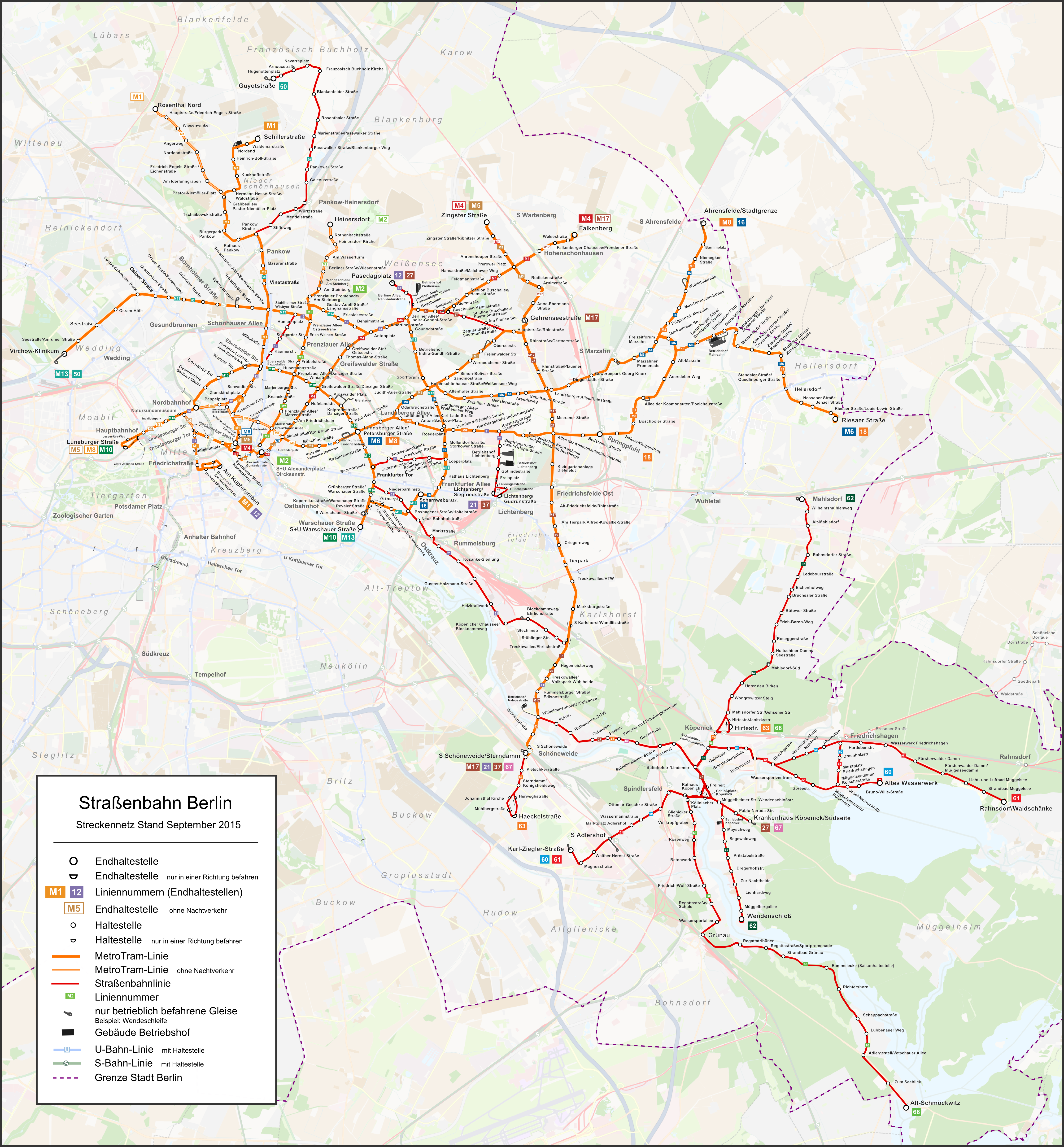
The Berlin tramway (german: Straßenbahn Berlin) is the main tram system in Berlin, Germany. It is one of the oldest tram networks in the world having its origins in 1865 and is operated by (BVG), which was founded in 1929. It is notable for being the third-largest tram system in the world, after Melbourne and St. Petersburg. Berlin's tram system is made up of 22 lines that operate across a standard gauge network, with almost 800 stops and measuring almost in route length and in line length. Nine of the lines, called Metrotram, operate 24 hours a day and are identified with the letter "M" before their number; the other thirteen lines are regular city tram lines and are identified by just a line number. Most of the recent network is within the confines of the former East Berlin—tram lines within West Berlin having been replaced by buses during the division of Berlin. However the first extension into West Berlin opened in 1994 on today's M13. In the eastern vi ... [...More Info...] [...Related Items...] OR: [Wikipedia] [Google] [Baidu] |
Berlin U-Bahn
The Berlin U-Bahn (; short for , "underground railway") is a rapid transit system in Berlin, the capital and largest city of Germany, and a major part of the city's public transport system. Together with the S-Bahn, a network of suburban train lines, and a tram network that operates mostly in the eastern parts of the city, it serves as the main means of transport in the capital. Opened in 1902, the serves 175 stations spread across nine lines, with a total track length of , about 80% of which is underground. Trains run every two to five minutes during peak hours, every five minutes for the rest of the day and every ten minutes in the evening. Over the course of a year, U-Bahn trains travel , and carry over 400 million passengers. In 2017, 553.1 million passengers rode the U-Bahn. The entire system is maintained and operated by the , commonly known as the BVG. Designed to alleviate traffic flowing into and out of central Berlin, the U-Bahn was rapidly expanded until the city w ... [...More Info...] [...Related Items...] OR: [Wikipedia] [Google] [Baidu] |
Kreuzberg
Kreuzberg () is a district of Berlin, Germany. It is part of the Friedrichshain-Kreuzberg borough located south of Mitte. During the Cold War era, it was one of the poorest areas of West Berlin, but since German reunification in 1990 it has become more gentrified and known for its arts scene. The borough is known for its large percentage of immigrants and descendants of immigrants, many of whom are of Turkish ancestry. As of 2006, 31.6% of Kreuzberg's inhabitants did not have German citizenship. Kreuzberg is noted for its diverse cultural life and experimental alternative lifestyles, and is an attractive area for many, however, some parts of the district are still characterized by higher levels of unemployment. The counterculture tradition of Kreuzberg led to a plurality of votes for the Green Party, which is unique among all Berlin boroughs. Geography Layout Kreuzberg is bounded by the river Spree in the east. The Landwehrkanal flows through Kreuzberg from east to ... [...More Info...] [...Related Items...] OR: [Wikipedia] [Google] [Baidu] |
Platz Der Luftbrücke
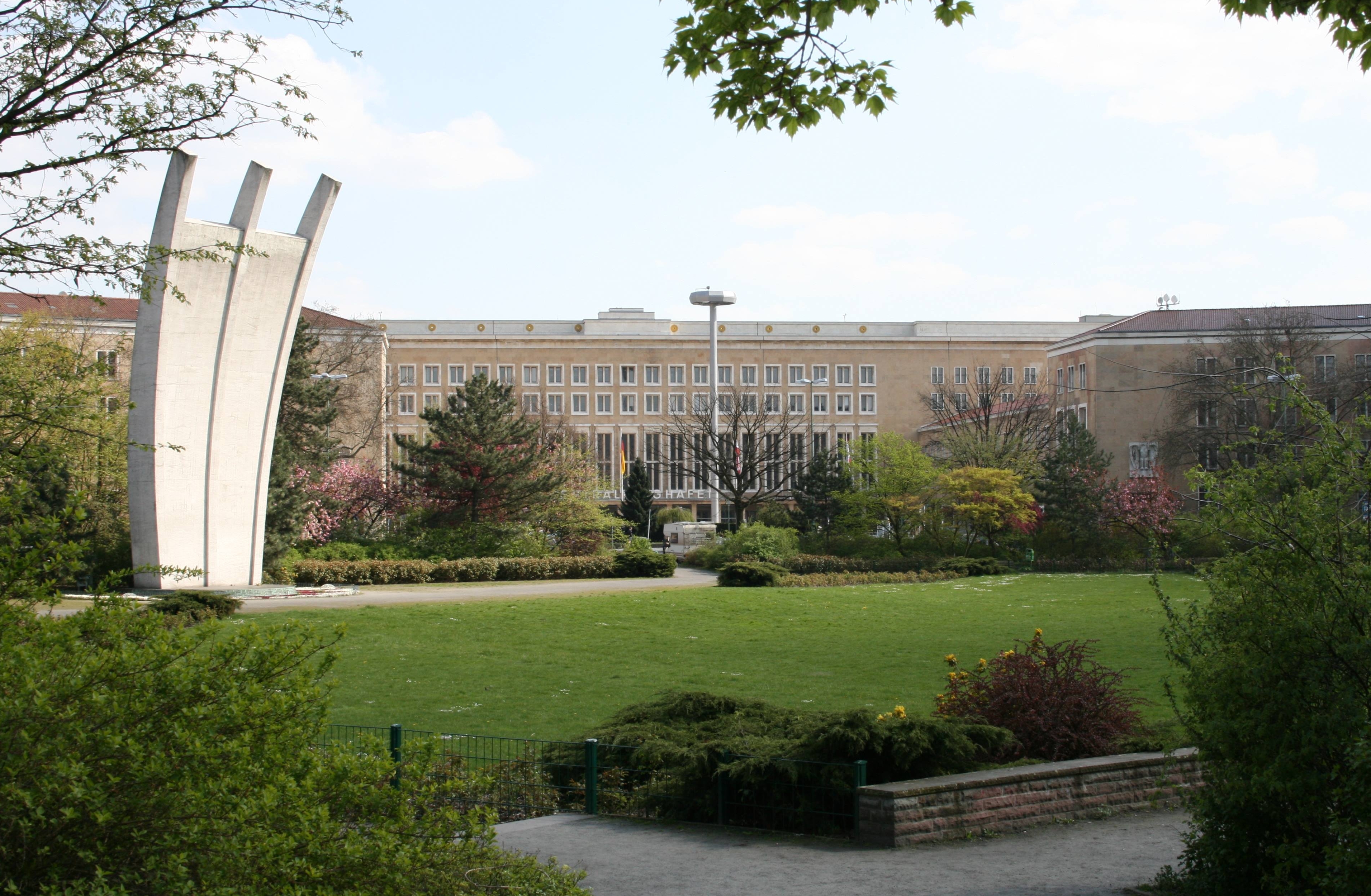
Platz der Luftbrücke is a landmarkedPlatz der Luftbrücke , Denkmale in Berlin, Berlin.de square and transport node in , , on the border between the localities of and |
Bundesstraße 96
The Bundesstraße 96 (B 96) is a federal highway in Germany. It begins in Zittau in Saxony, close to the border triangle between Germany, Poland, and the Czech Republic, heads north through Berlin and ends in Sassnitz on the island of Rügen in the Baltic Sea. Some sections of B 96 form a part of the European route E22. History Before the formation of East Germany the highway was known as ''Reichsstraße 96''. The former F (''Fernverkehrsstraße'') 96 was the longest road in the GDR and a major route in north-south direction. When the Berlin Wall was built in 1961 the route of the F 96 was altered so that it went through Mahlow just south East Berlin and Birkenwerder just north of East Berlin. This section is now called B 96a. South of Berlin was the B 96 different from today's route at Klausdorf Mellensee (both now at the municipality Am Mellensee) because of a diversion around Wünsdorf and Zossen the site of the headquarters of the Supreme Command of the Group of Soviet Force ... [...More Info...] [...Related Items...] OR: [Wikipedia] [Google] [Baidu] |
Berlin Tempelhof Airport
Berlin Tempelhof Airport (german: Flughafen Berlin-Tempelhof) was one of the first airports in Berlin, Germany. Situated in the south-central Berlin borough of Tempelhof-Schöneberg, the airport ceased operating in 2008 amid controversy, leaving Tegel and Schönefeld as the two main airports serving the city for another twelve years until both were replaced by Berlin Brandenburg Airport in 2020. Tempelhof was designated as an airport by the Reich Ministry of Transport on 8 October 1923. The old terminal was originally constructed in 1927. In anticipation of increasing air traffic, the Nazi government began an enormous reconstruction in the mid-1930s. While it was occasionally cited as the world's oldest operating commercial airport, the title was disputed by several other airports, and is no longer an issue since its closure. Tempelhof was one of Europe's three iconic pre-World War II airports, the others being London's now defunct Croydon Airport and the old Paris–Le Bou ... [...More Info...] [...Related Items...] OR: [Wikipedia] [Google] [Baidu] |
Teltow Plateau
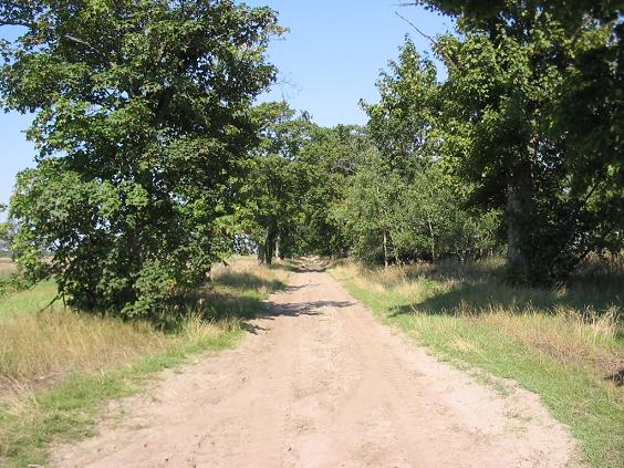
Teltow [] is both a geological plateau and also a historical region in the German states of Brandenburg and Berlin. As an historical region, the Teltow was one of the eight territories out of which the March of Brandenburg was formed in the 12th and 13th centuries. As a result of the (1239–1245) the question of territorial lordship of the newly created heart of the expanding march was finally decided here. Between 1835 and 1952 there was also a county, ; in addition a town immediately south of Berlin, in the present-day county of Potsdam-Mittelmark, bears the name Teltow. Geography and geology Boundary The Teltow is not a unified region, either from a historical or a landscape perspective. The present-day term is defined by an ice age plateau that consists mainly of ground moraine elements. Its natural northern border is defined by the range of the Tempelhofer Berge, among them the Kreuzberg rising to , along the southern bank of the Spree. To the east the borders are for ... [...More Info...] [...Related Items...] OR: [Wikipedia] [Google] [Baidu] |
Mehringplatz
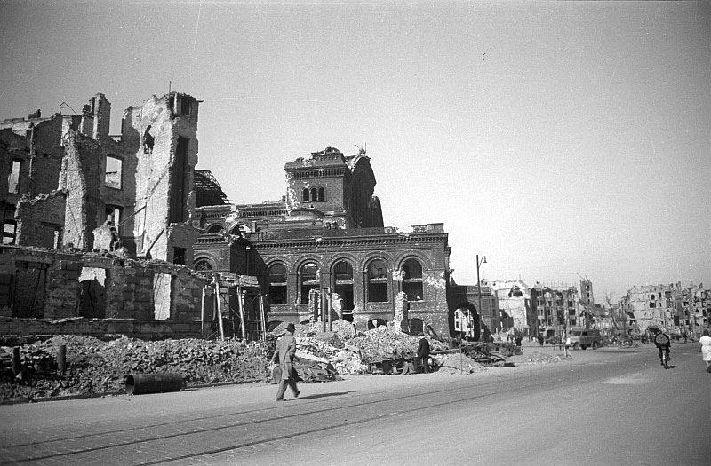
Mehringplatz is a round plaza (or circus)A circus is "circular open space at a street junction" at the southern tip of the Friedrichstadt (Berlin), Friedrichstadt Boroughs and neighborhoods of Berlin, neighborhood of Kreuzberg district, Berlin. It marks the southern end of Friedrichstraße. Until 1970 both Lindenstraße and Wilhelmstrasse led into it. In 1947 it was renamed after the publicist Franz Mehring (1846–1919). Mehringplatz is one of three prominent squares laid out about 1730 in the course of the city's Baroque architecture, Baroque extension under King Frederick William I of Prussia, along with Pariser Platz (former ''Karree'') and Leipziger Platz (''Octagon''). Due to its circular shape, Mehringplatz was initially named ''Rondell''; but on 22 October 1815, it was renamed ''Belle-Alliance-Platz'' after the ''Battle of La Belle Alliance'', an alternative name for the Battle of Waterloo that was then popular in Kingdom of Prussia, Prussia. ''Rondell'' was the souther ... [...More Info...] [...Related Items...] OR: [Wikipedia] [Google] [Baidu] |
La Belle Alliance
La Belle Alliance is an inn situated a few miles south of Brussels in Belgium, chiefly remembered for its significance in the aftermath of the Battle of Waterloo (18 June 1815). There are two plaques on the building: one is "In memory of the French Medical Corps who attended the wounded with devotion on 18 June 1815"; and the other commemorates the meeting of the two victorious field marshals at the end of the Battle of Waterloo. Contemporary use The building is currently used on Friday and Saturday evenings as a night club. Battle of Waterloo After the Battle of Waterloo, at around 21:00, Prince Blücher and the Duke of Wellington met close to the inn signifying the end of the fighting. There is a large mural within the Palace of Westminster painted by Daniel Maclise in 1861 that depicts the meeting taking place at La Belle Alliance. Blücher, the Prussian commander, suggested that the battle be remembered as ''la Belle Alliance'', to commemorate the European Seventh Coali ... [...More Info...] [...Related Items...] OR: [Wikipedia] [Google] [Baidu] |
First French Empire
The First French Empire, officially the French Republic, then the French Empire (; Latin: ) after 1809, also known as Napoleonic France, was the empire ruled by Napoleon Bonaparte, who established French hegemony over much of continental Europe at the beginning of the 19th century. It lasted from 18 May 1804 to 11 April 1814 and again briefly from 20 March 1815 to 7 July 1815. Although France had already established a colonial empire overseas since the early 17th century, the French state had remained a kingdom under the Bourbons and a republic after the French Revolution. Historians refer to Napoleon's regime as the ''First Empire'' to distinguish it from the restorationist ''Second Empire'' (1852–1870) ruled by his nephew Napoleon III. The First French Empire is considered by some to be a " Republican empire." On 18 May 1804, Napoleon was granted the title Emperor of the French (', ) by the French and was crowned on 2 December 1804, signifying the end of the French ... [...More Info...] [...Related Items...] OR: [Wikipedia] [Google] [Baidu] |
Hasso Spode
Hasso Spode (born 1951 in Friedrichshagen) is a German historian and sociologist. After his childhood in East Germany, Spode fled to West Berlin where he studied philosophy, history, theology, and sociology. He is professor in Hanover and director of the Historical Archive on Tourism at the Technical University in Berlin. The main focus of his research is on historical anthropology and cultural history, but he also works in the field of social and political history. He wrote over 200 articles, mostly in German, sometimes in English (translations in Czech, Greek, Romanian, Spanish, French, Danish, Italian, Japanese, Estonian, Russian), and wrote or edited more than a dozen books. He is co-editor of '' Annals of Tourism Research'', '' Voyage. Studies on Travel & Tourism'', and other journals. He is a member of the executive council of the Chinese Center of Drug Policy Studies and the Alcohol and Drugs History Society; until 2015 he was vice-president of the Tourism Committee of t ... [...More Info...] [...Related Items...] OR: [Wikipedia] [Google] [Baidu] |
Battle Of Waterloo
The Battle of Waterloo was fought on Sunday 18 June 1815, near Waterloo, Belgium, Waterloo (at that time in the United Kingdom of the Netherlands, now in Belgium). A French army under the command of Napoleon was defeated by two of the armies of the Seventh Coalition. One of these was a British-led coalition consisting of units from the United Kingdom of Great Britain and Ireland, United Kingdom, the Netherlands, Kingdom of Hanover, Hanover, Duchy of Brunswick, Brunswick, and Duchy of Nassau, Nassau, under the command of the Duke of Wellington (referred to by many authors as ''the Anglo-allied army'' or ''Wellington's army''). The other was composed of three corps of the Kingdom of Prussia, Prussian army under the command of Field Marshal Gebhard Leberecht von Blücher, von Blücher (the fourth corps of this army fought at the Battle of Wavre on the same day). The battle marked the end of the Napoleonic Wars. The battle was contemporaneously known as the Battle of Mont Saint-J ... [...More Info...] [...Related Items...] OR: [Wikipedia] [Google] [Baidu] |


.jpg)


