|
Mediene
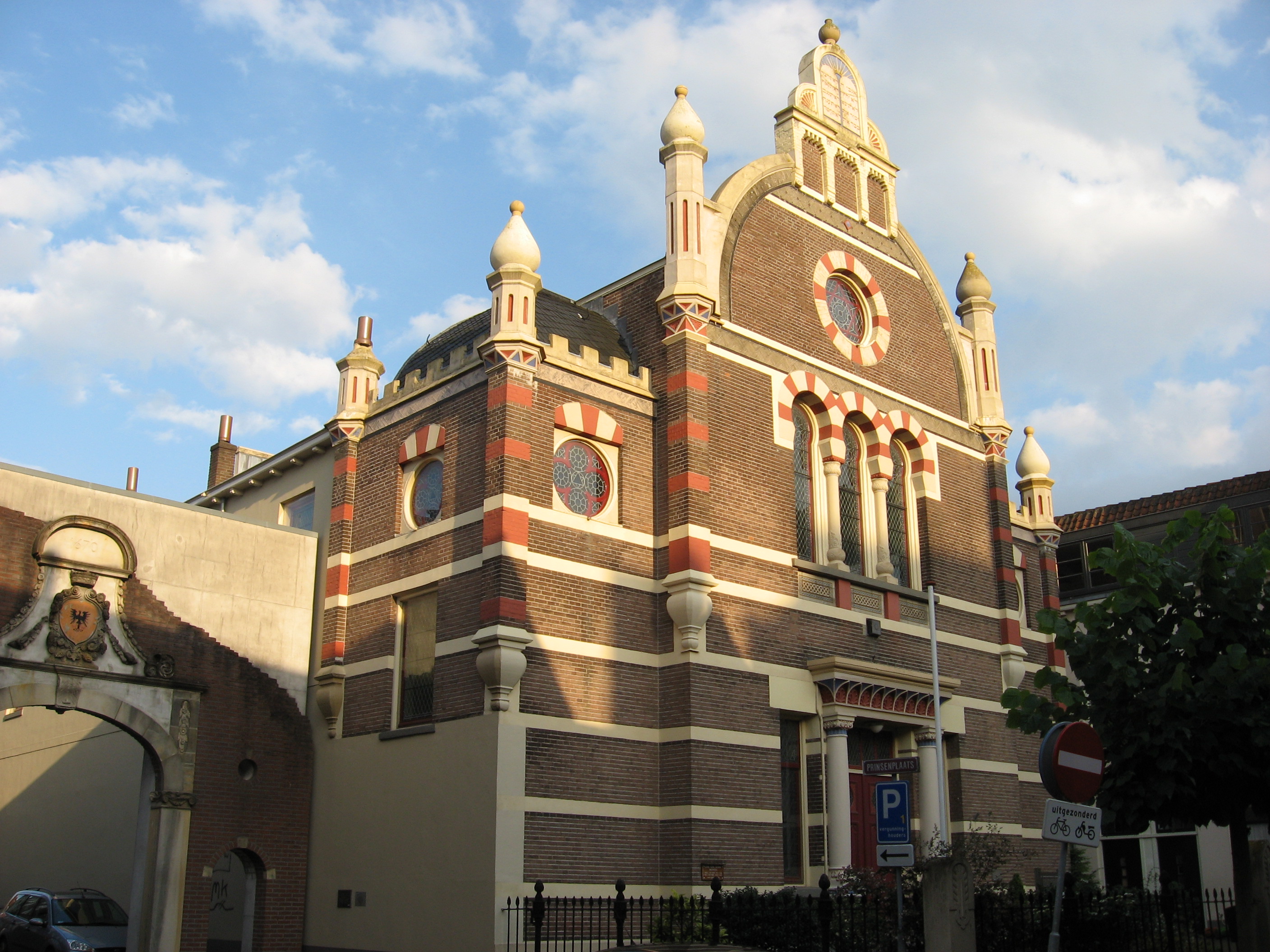
The Mediene is the name given to all the Jewish kehillot in the Netherlands outside of the capital Amsterdam, the historical center of Dutch Judaism. From the 18th century onwards up until the Holocaust, dozens of Jewish communities were created in towns big and small scattered throughout the Netherlands. At its height, some 180 ''kehillot'' existed throughout the country.History of the NIK (see History section) NIK.nl. ''Accessed 21 April 2007'' Disappeared Communities At the eve of the , some 140 Jewish communities existed throughout the Netherlands, many of them located outside of Amsterdam and the |
History Of The Jews In The Netherlands
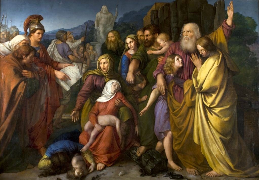
The history of the Jews in the Netherlands began largely in the 16th century when they began to settle in Amsterdam and other cities. It has continued to the present. During the occupation of the Netherlands by Nazi Germany in May 1940, the Jewish community was severely persecuted. The area now known as the Netherlands was once part of the Spanish Empire but in 1581, the Northern Dutch provinces declared independence. A principal motive was the wish to practice Protestant Christianity, then forbidden under Spanish rule. Religious tolerance was effectively an important constitutional element of the newly independent state. This inevitably attracted the attention of Jews who were religiously oppressed in different parts of the world. In pursuit of religious freedoms, many Jews migrated to the Netherlands where they flourished. During the Nazi occupation of the Netherlands in World War II, approximately 75 percent of the Jewish population of the Netherlands was murdered in th ... [...More Info...] [...Related Items...] OR: [Wikipedia] [Google] [Baidu] |
Judaism
Judaism ( he, ''Yahăḏūṯ'') is an Abrahamic, monotheistic, and ethnic religion comprising the collective religious, cultural, and legal tradition and civilization of the Jewish people. It has its roots as an organized religion in the Middle East during the Bronze Age. Modern Judaism evolved from Yahwism, the religion of ancient Israel and Judah, by the late 6th century BCE, and is thus considered to be one of the oldest monotheistic religions. Judaism is considered by religious Jews to be the expression of the covenant that God established with the Israelites, their ancestors. It encompasses a wide body of texts, practices, theological positions, and forms of organization. The Torah, as it is commonly understood by Jews, is part of the larger text known as the ''Tanakh''. The ''Tanakh'' is also known to secular scholars of religion as the Hebrew Bible, and to Christians as the " Old Testament". The Torah's supplemental oral tradition is represented by later texts s ... [...More Info...] [...Related Items...] OR: [Wikipedia] [Google] [Baidu] |
Zwolle
Zwolle () is a city and municipality in the Northeastern Netherlands. It is the capital of the province of Overijssel and the province's second-largest municipality after Enschede with a population of 130,592 as of 1 December 2021. Zwolle is on the border with Gelderland, which follows the river IJssel, and is located about 50 km north east of Utrecht and 85 km south west of Groningen. The current Mayor of Zwolle is Lorenzo Brands. History Archaeological findings indicate that the area surrounding Zwolle has been inhabited for a long time. A woodhenge that was found in the Zwolle-Zuid suburb in 1993 was dated to the Bronze Age period. During the Roman era, the area was inhabited by Salian Franks. The modern city was founded around 800 CE by Frisian merchants and troops of Charlemagne. Previous spellings of its name include the identically pronounced ''Suolle'', which means "hill" (cf. the English cognate verb "to swell"). This refers to an incline in the landscape betwee ... [...More Info...] [...Related Items...] OR: [Wikipedia] [Google] [Baidu] |
Delfzijl
Delfzijl (; gos, Delfsiel) is a city and former municipality with a population of 25,651 in the province of Groningen (province), Groningen in the northeast of the Netherlands. Delfzijl was a sluice between the Delf (canal), Delf and the Ems (river), Ems, which became fortified settlement in the 16th century. The fortifications were removed in the late 19th century. Delfzijl is the fifth largest seaport in the Netherlands, and the largest port in the North East of the country. Etymology The name ''Delfzijl'' means 'sluice of the Delf'. Ronald Stenvert, Chris Kolman, Ben Olde Meierink, Sabine Broekhoven & Redmer Alma,Delfzijl, ''Monumenten in Nederland: Groningen'', 1998. Retrieved on 27 March 2015. The Delf was a canal connecting the rivers Fivel and Ems (river), Ems, and is now part of the Damsterdiep. The Dutch verb ''delven'' means 'to delve' or 'to dig' and the Dutch noun ''zijl'' means 'water outlet' or 'sluice'. History Delfzijl was established at the location where t ... [...More Info...] [...Related Items...] OR: [Wikipedia] [Google] [Baidu] |
Beverwijk
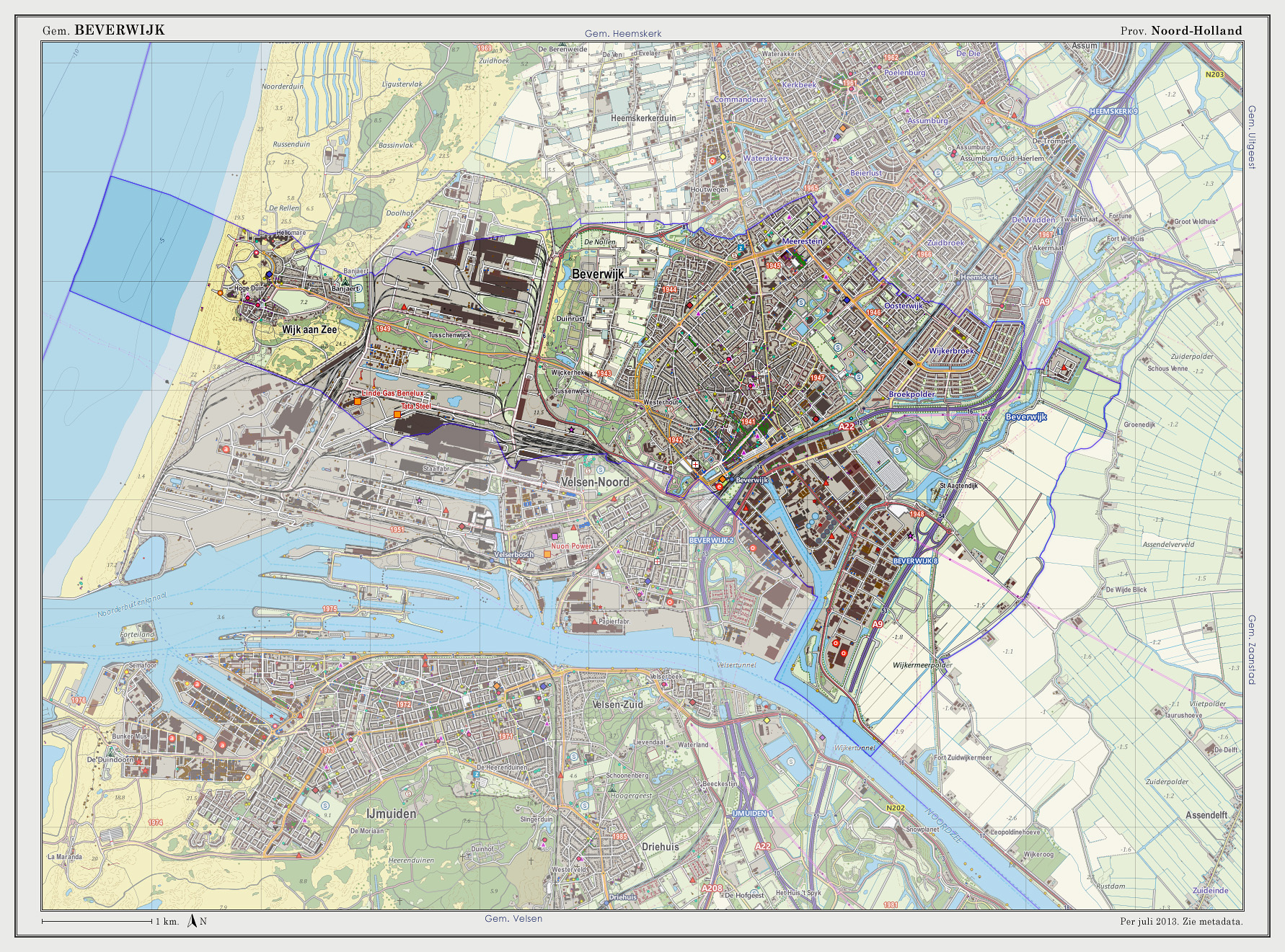
Beverwijk () is a municipality and a city in the Netherlands, in the province of North Holland. The town is located about northwest of Amsterdam in the Randstad metropolitan area, north of the North Sea Canal very close to the North Sea coast. A railway tunnel and two motorway tunnels cross the canal between Beverwijk and the nearby city of Haarlem on the south side of the canal. Around 1640, a town called Beverwyck was founded in the Dutch colony of New Netherland. That town's modern name is Albany, New York. Population centres The municipality of Beverwijk consists of two cores, Beverwijk proper and Wijk aan Zee, to the west, right on the coast. History The name Beverwijk comes from ''Bedevaartswijk'', meaning "pilgrimage neighbourhood". The town formed at the Saint Agatha Church which was a pilgrimage location in the Middle Ages. Allegedly Agatha of Sicily appeared there in the 9th century to a virgin from Velsen who was fleeing from the Count of Kennemerland. In 127 ... [...More Info...] [...Related Items...] OR: [Wikipedia] [Google] [Baidu] |
Winterswijk
Winterswijk (; also known as ''Winterswiek'' or ''Wenters'') is a municipality and a town in the eastern Netherlands. It has a population of and is situated in the Achterhoek, which lies in the easternmost part of the province of Gelderland in the Netherlands. It was also known as ''Winethereswick'', ''Winriswic'' or ''Wenterswic''; the Anglo Saxon '' wich'' or ''wic'' means the living place of a certain person. The person would likely have been called ''Wenether'', ''Winitar'' or ''Winter''. Geography Winterswijk is located in east of the province of Gelderland in the east of the Netherlands. It is part of the region of Achterhoek. History Founded around 1000 AD it remained an isolated farming community until 1830 when the road from Borken to Zutphen via Winterswijk and Groenlo was built. Around 1840 many emigrated to America — Michigan in particular. After 1870 the town became a centre for textiles, such as spinning and weaving and indeed the Tricot fabriek employed a ... [...More Info...] [...Related Items...] OR: [Wikipedia] [Google] [Baidu] |
Borculo
Borculo is a city in the eastern Netherlands, in the municipality of Berkelland, Gelderland. Borculo was an independent municipality until 2005, when it merged with Eibergen, Neede, and Ruurlo. Other population centers in the municipality of Borculo were nearby Geesteren, Gelselaar, and Haarlo. History Borculo began as a settlement near where, at the time, the Berkel joined a smaller stream called the Grolse Slinge. In the 12th century a castle called Hof van Borculo was built. A defensive wall surrounding the village was constructed in 1348. The village received city rights in 1375. The city wall has been demolished, but parts of the defensive moat, which was also used as a trading route over the Berkel to the cities along the Berkel (such as Zutphen), can still be found in Borculo. Borculo was then ruled by the counts of Limburg and Bronkhorst. In the long conflict (known as the "Borculo question") between the heirs of the last count of Bronkhorst (deceased in 1553 withou ... [...More Info...] [...Related Items...] OR: [Wikipedia] [Google] [Baidu] |
Pekela
Pekela () is a municipality in the province of Groningen in the Netherlands. It was created in 1990 when Oude Pekela and Nieuwe Pekela were merged. History The municipality of Pekela was created when the municipalities of Oude Pekela and Nieuwe Pekela were merged in 1990. Geography Pekela is located at in the southeast of the province of Groningen in the northeast of the Netherlands. It is bordered by the municipalities of: The river Pekel Aa crosses the municipality from north to south. The main population centres in the municipality are the villages of (Upper Pekela), Nieuwe Pekela (New Pekela), and Oude Pekela (Old Pekela). Part of the village of Alteveer and the hamlets of Bronsveen and are also in the municipality. The municipality has a total area of , of which is land and is water. Governance Mayor (''burgemeester'') of Pekela is Jaap Kuin of the Labour Party. The municipal council of Pekela consists of 15 seats, which are divided as follows: Demograp ... [...More Info...] [...Related Items...] OR: [Wikipedia] [Google] [Baidu] |
Groningen (city)
Groningen (; gos, Grunn or ) is the capital city and main municipality of Groningen province in the Netherlands. The ''capital of the north'', Groningen is the largest place as well as the economic and cultural centre of the northern part of the country; as of December 2021, it had 235,287 inhabitants, making it the sixth largest city/municipality of the Netherlands and the second largest outside the Randstad. Groningen was established more than 950 years ago and gained city rights in 1245. Due to its relatively isolated location from the then successive Dutch centres of power (Utrecht, The Hague, Brussels), Groningen was historically reliant on itself and nearby regions. As a Hanseatic city, it was part of the North German trade network, but later it mainly became a regional market centre. At the height of its power in the 15th century, Groningen could be considered an independent city-state and it remained autonomous until the French era. Today Groningen is a university ci ... [...More Info...] [...Related Items...] OR: [Wikipedia] [Google] [Baidu] |
Rijssen
Rijssen (; nds-nl, Riesn, ) is a city in the Dutch province of Overijssel. It is part of Rijssen-Holten, one of thirteen municipalities in Twente. It has almost 28,000 inhabitants. The economy of Rijssen relies mostly on commerce and construction and transport companies. History Archeological evidence shows that the monk Lebuinus founded a church in Rijssen, as early as the seventh century, as part of a coordinated attempt to convert the local pagan Saxons to Christianity, though other archaeological finds, such as urns and grave mounds suggest habitation dating back as far as 5,000 years. Rijssen was first mentioned as ''Parrochia Risnen'' on a freight letter dating from 1188 by the Count of Dalen. After having a disagreement with the Viscount of Goor, Bishop Otto III van Holland granted city rights to Rijssen on 5 May 1243. The original city rights bill was lost in a large fire that swept through the town, reducing the town hall and the keep to rubble. In 2006, however, a c ... [...More Info...] [...Related Items...] OR: [Wikipedia] [Google] [Baidu] |
Hoogezand-Sappemeer
Hoogezand-Sappemeer () is a former municipality in the Northeastern Netherlands. It was the third most-populous municipality in the province of Groningen, after Groningen and Oldambt. It was formed in 1949 by the merger of the former municipalities of Hoogezand (well-known for its ship building industry) and Sappemeer. On 1 January 2018, Hoogezand-Sappemeer merged with Slochteren and Menterwolde, forming the new municipality Midden-Groningen. Geography Population centres in the municipality were: * Achterdiep * Borgercompagnie * Borgweg * Foxham * Foxhol * Foxholsterbosch * Hoogezand * Jagerswijk * Kalkwijk * Kiel-Windeweer * Kleinemeer * Kropswolde * Lula * Martenshoek * Meerwijck * Nieuwe Compagnie * Sappemeer * Tripscompagnie * Waterhuizen * Westerbroek * Wolfsbarge Transportation The A7 motorway (European Highway E 22, Amsterdam-Groningen-Germany) crosses the municipality. There is also a railway line providing service to Groningen and Nieuweschans/Le ... [...More Info...] [...Related Items...] OR: [Wikipedia] [Google] [Baidu] |
Gouda, South Holland
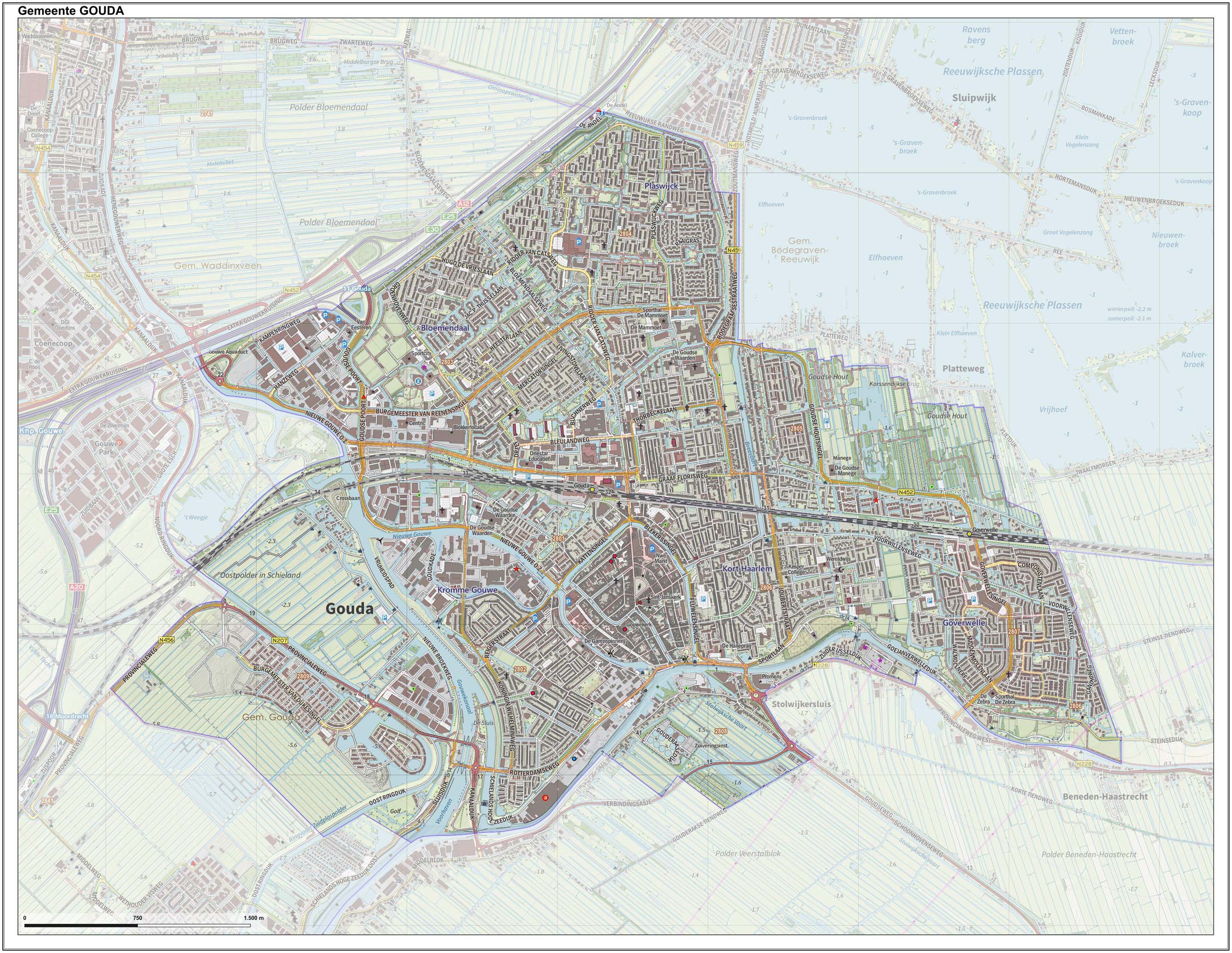
Gouda () is a city and municipality in the west of the Netherlands, between Rotterdam and Utrecht, in the province of South Holland. Gouda has a population of 75,000 and is famous for its Gouda cheese, stroopwafels, many grachten, smoking pipes, and its 15th-century city hall. Its array of historic churches and other buildings makes it a very popular day trip destination. In the Middle Ages, a settlement was founded at the location of the current city by the Van der Goude family, who built a fortified castle alongside the banks of the Gouwe River, from which the family and the city took its name. The area, originally marshland, developed over the course of two centuries. By 1225, a canal was linked to the Gouwe and its estuary was transformed into a harbour. City rights were granted in 1272. History Around the year 1100, the area where Gouda now is located was swampy and covered with a peat forest, crossed by small creeks such as the Gouwe. Along the shores of this st ... [...More Info...] [...Related Items...] OR: [Wikipedia] [Google] [Baidu] |


.jpg)


