|
Medaković
Medaković ( sr-Cyrl, Медаковић, ), or colloquially Medak (), is an urban neighborhood of Belgrade, the capital of Serbia. It is located in Belgrade's municipality of Voždovac, with the easternmost part of Medaković III being in the municipality of Zvezdara. Location It is located in the valley of the Mokroluški potok, south of the Belgrade-Niš highway and consists of three parts, Medaković I on the west, Medaković II in the center and Medaković III on the east, the latter two being divided by the ''Vojislava Ilića'' street. Demographics The combined population of the entire neighborhood was 23,758 by the 2011 census of population. Medaković I Medaković I or colloquially Medak I, is the western and oldest section of the neighborhood. It is bounded by the streets ''Medakovićeva'' on the north, where it borders the neighborhood of Marinkova Bara), ''Zaplanjska'' on the west where it borders Dušanovac and ''Ignjata Joba'' on the south where i ... [...More Info...] [...Related Items...] OR: [Wikipedia] [Google] [Baidu] |
Marinkova Bara
Marinkova Bara () is an urban neighborhood of Belgrade, the capital of Serbia. It is located in the municipality of Voždovac. Location Marinkova Bara (Serbian for "Marinko's bog") is located in the northern section of the municipality, along the southern side of the Belgrade-Niš highway, in the valley of the Mokroluški potok. It is bordered by the neighborhoods of Dušanovac (west), Braće Jerković (south), Medaković (south-east & east) and Konjarnik (north, across the highway). History Before the settlement was founded, it was a wooded area below what is today Central Cemetery. In the early 19th century it was part of the domain of Marinko Marinković, obor-knez of Avala. After him, the wood was called ''Marinkova šuma'' (Marinko's wood) and later, when the village developed, it was also named after him. Marinkova Bara originates from the 1920s and 1930s when the small village was the eastern suburb of Belgrade. One half of the settlement developed in the valley ... [...More Info...] [...Related Items...] OR: [Wikipedia] [Google] [Baidu] |
Padina (Belgrade)
Padina ( sr-Cyrl, Падина) is an urban neighborhood of Belgrade, the capital of Serbia. It is located in Belgrade's municipality of Zvezdara. After one of the central streets, it is also called Vojvoda Vlahović, but is also referred to as Braće Jerković II, because it makes urban connection to it. The neighborhood is sometimes also referred to as Medaković Padina ( sr-Cyrl, Медаковић Падина, ). Location Padina is located in the south-western section of the municipality, right on the border of the municipality of Voždovac, on the northern slope of the hill of Mokroluško Brdo, thus the name (Serbian ''padina'', slope). It borders the neighborhoods of Medaković III on the north, Braće Jerković Braće Jerković or colloquially Jerković ( sr-cyr, Браће Јерковић or Јерковић; ) is an urban neighborhood of Belgrade, the capital of Serbia. It is located in Belgrade's municipality of Voždovac. Location Braće Jerkovi ... on the ... [...More Info...] [...Related Items...] OR: [Wikipedia] [Google] [Baidu] |
Voždovac
Voždovac ( sr-Cyrl, Вождовац, ) is a Subdivisions of Belgrade, municipality of the city of Belgrade. According to the 2022 census results, the municipality has a population of 174,864 inhabitants. The municipality is located in the south-central part of the urban area of Belgrade and in the central section of the wider Belgrade City area. It stretches meridionally (north to south) for almost , spreading to the south more than any other municipality of Belgrade. Due to its shape, it borders more municipalities than any other: Vračar on the north, Zvezdara on the north-east, Grocka on the east, Sopot, Serbia, Sopot on the south, Barajevo on the south-west, Čukarica and Rakovica, Belgrade, Rakovica on the west and Savski Venac on the north-west. History The municipality of Voždovac originates from 1904. In 1945 Belgrade was divided into districts (''rejon'') and Voždovac became part of District VI. In 1952 the districts were abolished and the municipalities re-establish ... [...More Info...] [...Related Items...] OR: [Wikipedia] [Google] [Baidu] |
Belgrade
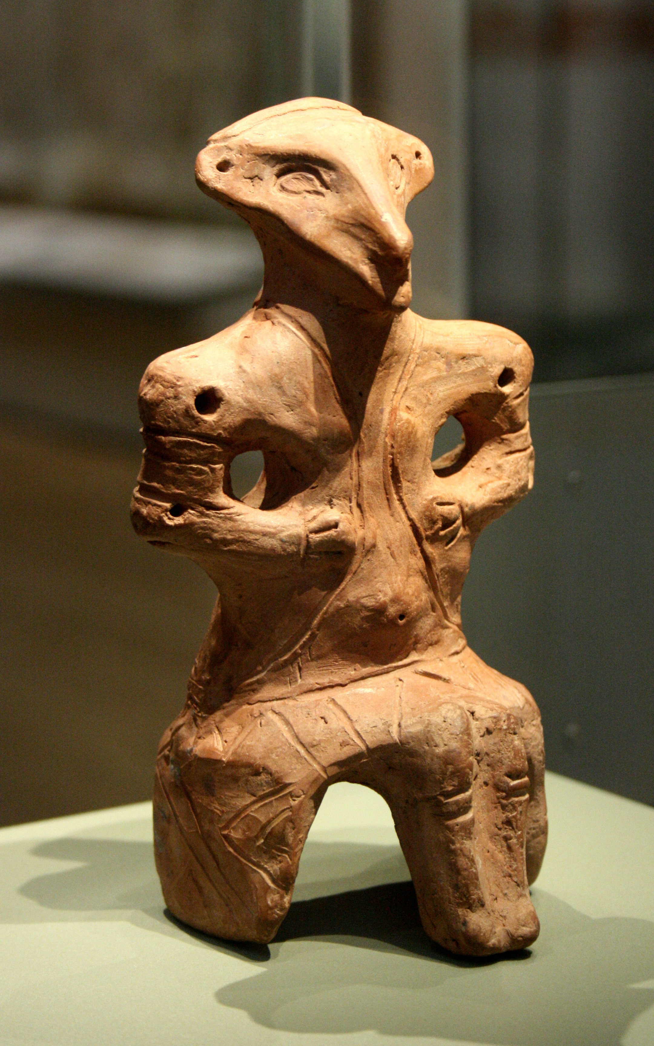
Belgrade is the Capital city, capital and List of cities in Serbia, largest city of Serbia. It is located at the confluence of the Sava and Danube rivers and at the crossroads of the Pannonian Basin, Pannonian Plain and the Balkan Peninsula. The population of the Belgrade metropolitan area is 1,685,563 according to the 2022 census. It is one of the Balkans#Urbanization, major cities of Southeast Europe and the List of cities and towns on the river Danube, third-most populous city on the river Danube. Belgrade is one of the List of oldest continuously inhabited cities, oldest continuously inhabited cities in Europe and the world. One of the most important prehistoric cultures of Europe, the Vinča culture, evolved within the Belgrade area in the 6th millennium BC. In antiquity, Thracians, Thraco-Dacians inhabited the region and, after 279 BC, Celts settled the city, naming it ''Singidunum, Singidūn''. It was Roman Serbia, conquered by the Romans under the reign of Augustus and ... [...More Info...] [...Related Items...] OR: [Wikipedia] [Google] [Baidu] |
Braće Jerković
Braće Jerković or colloquially Jerković ( sr-cyr, Браће Јерковић or Јерковић; ) is an urban neighborhood of Belgrade, the capital of Serbia. It is located in Belgrade's municipality of Voždovac. Location Braće Jerković is located between the valleys of the former creeks of ''Kumodraški potok'' and Mokroluški potok. It borders the neighborhoods of Marinkova Bara (north), Dušanovac (north-west), Voždovac (west), Medaković II (north-east), Padina (east), while in the south it extends into the neighborhood of Braće Jerković II. It is bounded by the elbow-shaped street of the same name (on the west and south) and the street of ''Ignjata Joba'' (on the east). Northern border to Dušanovac and Marinkova Bara, just as it case with many neighborhoods of Belgrade, can not be clearly established, though majority of city maps place it between the '' Darvinova'' and ''Ignjata Joba'' streets. Name and history The name of the neighborhood means "Jerk ... [...More Info...] [...Related Items...] OR: [Wikipedia] [Google] [Baidu] |
Dušanovac, Belgrade
Dušanovac ( sr-cyr, Душановац, ), is an urban and historical neighbourhood of Belgrade, the capital of Serbia. It is located in the municipality of Voždovac. Location The Dušanovac is bounded by the other Belgrade neighbourhoods: Autokomanda to the west, Pašino Brdo to the north, Šumice, Konjarnik, Marinkova Bara, Medaković and Braće Jerković to the east, and Voždovac itself to the south. History As a pre-World War I suburb of Belgrade, in the area that was eastern border of the city at that time, Dušanovac was administratively part of the municipality of Kumodraž. After the liberation in World War I in 1918, the neighborhood came under Belgrade's administrative rule. A string of new or expanded and renovated neighborhoods encircled eastern outskirts of Belgrade after the war. The inspiration for the design of the neighborhoods came from the complex built in 1912 along the in Paris. It consisted of 40 one-floor houses with gardens, indented from the ... [...More Info...] [...Related Items...] OR: [Wikipedia] [Google] [Baidu] |
European Route E75
European route E 75 is part of the International E-road network, which is a series of main roads in Europe. The E 75 starts at the town of Vardø (town), Vardø in Norway by the Barents Sea, and it runs south through Finland, Poland, Czech Republic, Slovakia, Hungary, Serbia, North Macedonia, and Greece. The road ends after about (not counting ferries) at the town of Sitia on the eastern end of the island of Crete in the Mediterranean Sea, it being the most southerly point reached by an E-road. (The northernmost one is the European road E69, E69.) From the beginning of the 1990s until 2009, there was no ferry connection between Helsinki and Gdańsk. However, Finnlines started a regular service between Helsinki and Gdynia. It is also possible to take a ferry from Helsinki to Tallinn and drive along the European route E67, E67 from Tallinn to Piotrków Trybunalski in Poland and then continue with the E75. Settlements Major towns and cities on the E75 are: Route Nor ... [...More Info...] [...Related Items...] OR: [Wikipedia] [Google] [Baidu] |
Roundabout
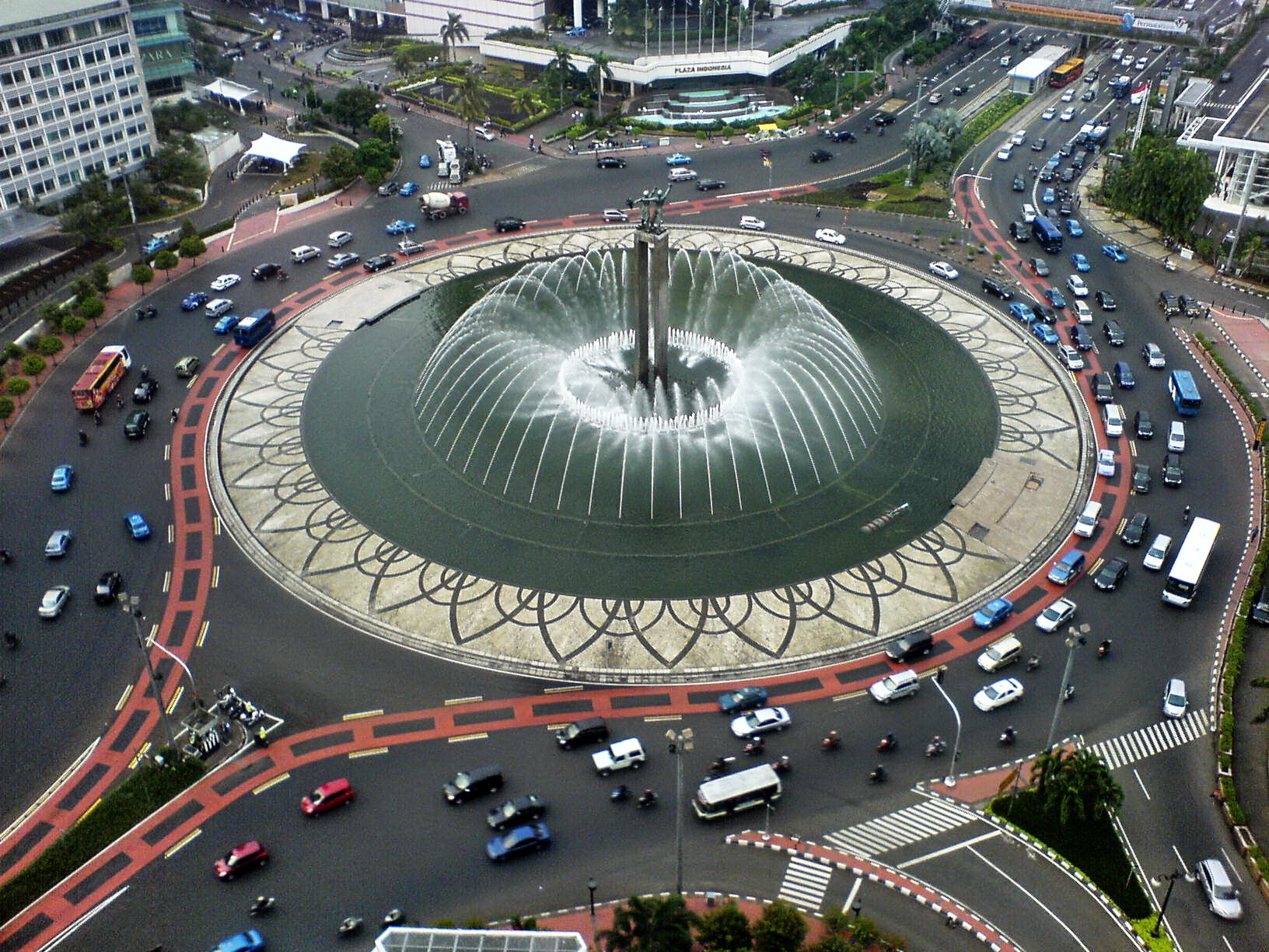
A roundabout, a rotary and a traffic circle are types of circular intersection or junction in which road traffic is permitted to flow in one direction around a central island, and priority is typically given to traffic already in the junction.''The New Shorter Oxford English Dictionary,'' Volume 2, Clarendon Press, Oxford (1993), page 2632 In the United States, engineers use the term modern roundabout to refer to junctions installed after 1960 that incorporate design rules to increase safety. Compared to stop signs, traffic signals, and earlier forms of roundabouts, modern roundabouts reduce the likelihood and severity of collisions greatly by reducing traffic speeds through horizontal deflection and minimising T-bone and head-on collisions. Variations on the basic concept include integration with tram or train lines, two-way flow, higher speeds and many others. For pedestrians, traffic exiting the roundabout comes from one direction, instead of three, simplifying the p ... [...More Info...] [...Related Items...] OR: [Wikipedia] [Google] [Baidu] |
Highrise
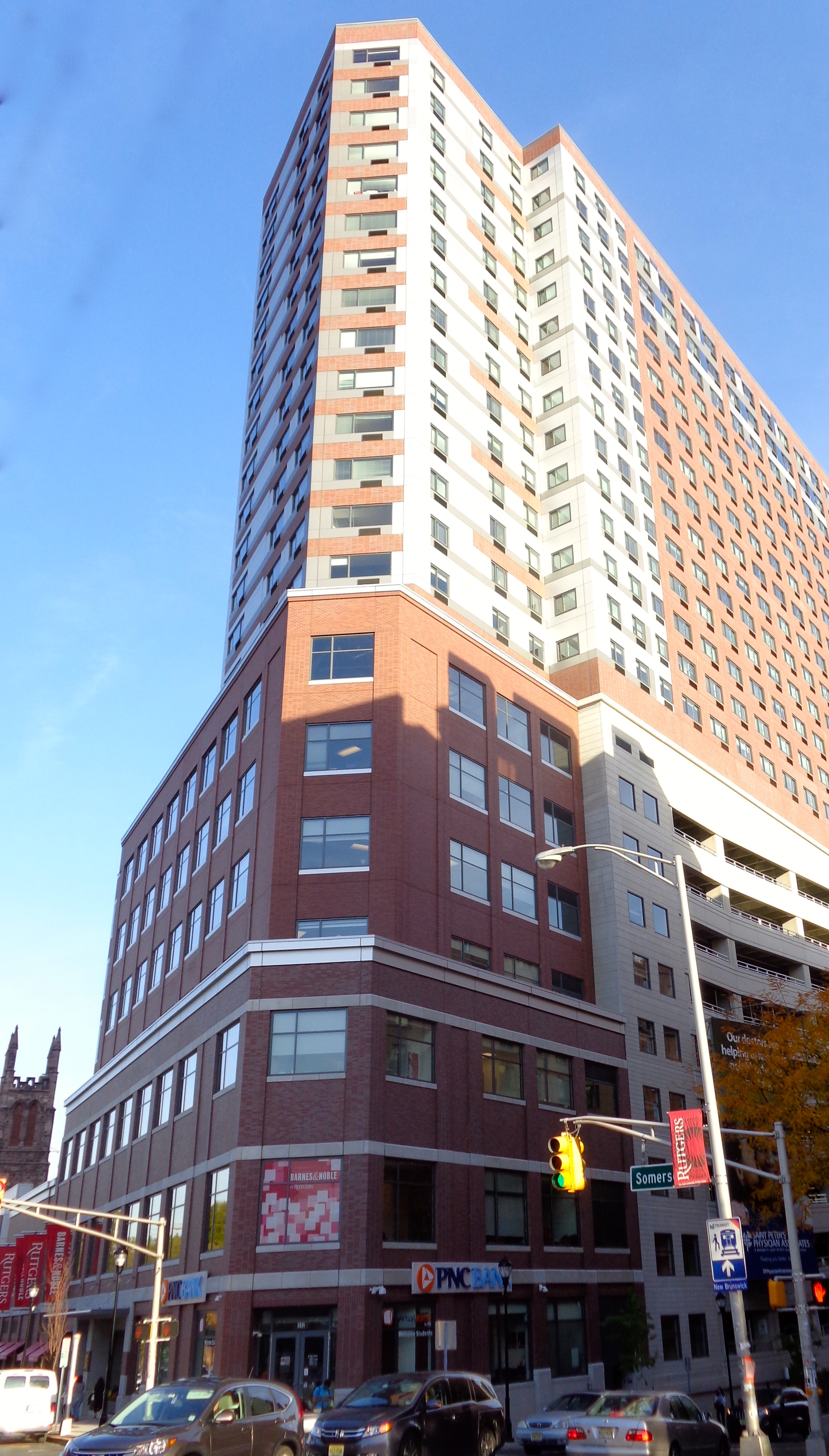
A tower block, high-rise, apartment tower, residential tower, apartment block, block of flats, or office tower is a tall building, as opposed to a low-rise building and is defined differently in terms of height depending on the jurisdiction. It is used as a residential or office building, or has other functions, including hotel, retail, or with multiple purposes combined. Residential high-rise buildings are also known in some varieties of English, such as British English, as tower blocks and may be referred to as MDUs, standing for multi-dwelling units. A very tall high-rise building is referred to as a skyscraper. High-rise buildings became possible to construct with the invention of the elevator (lift) and with less expensive, more abundant building materials. The materials used for the structural system of high-rise buildings are reinforced concrete and steel. Most North American–style skyscrapers have a steel frame, while residential blocks are usually constructed of ... [...More Info...] [...Related Items...] OR: [Wikipedia] [Google] [Baidu] |


