|
McAllister, Wisconsin
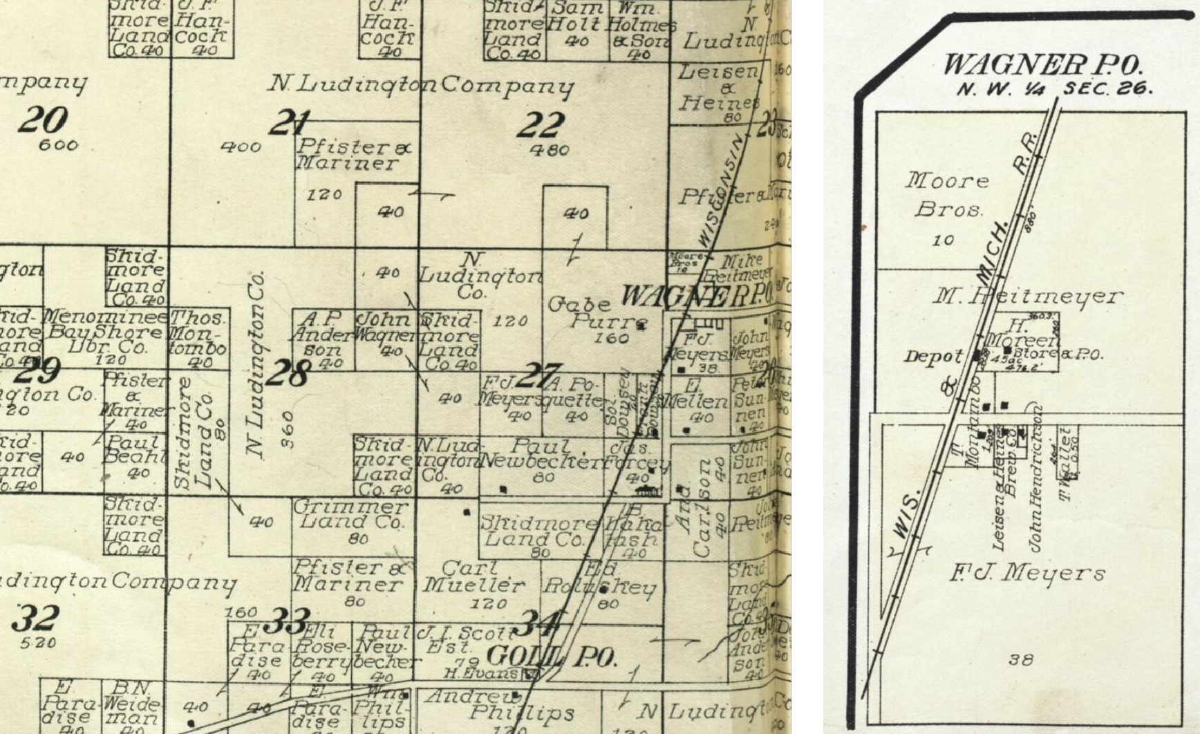
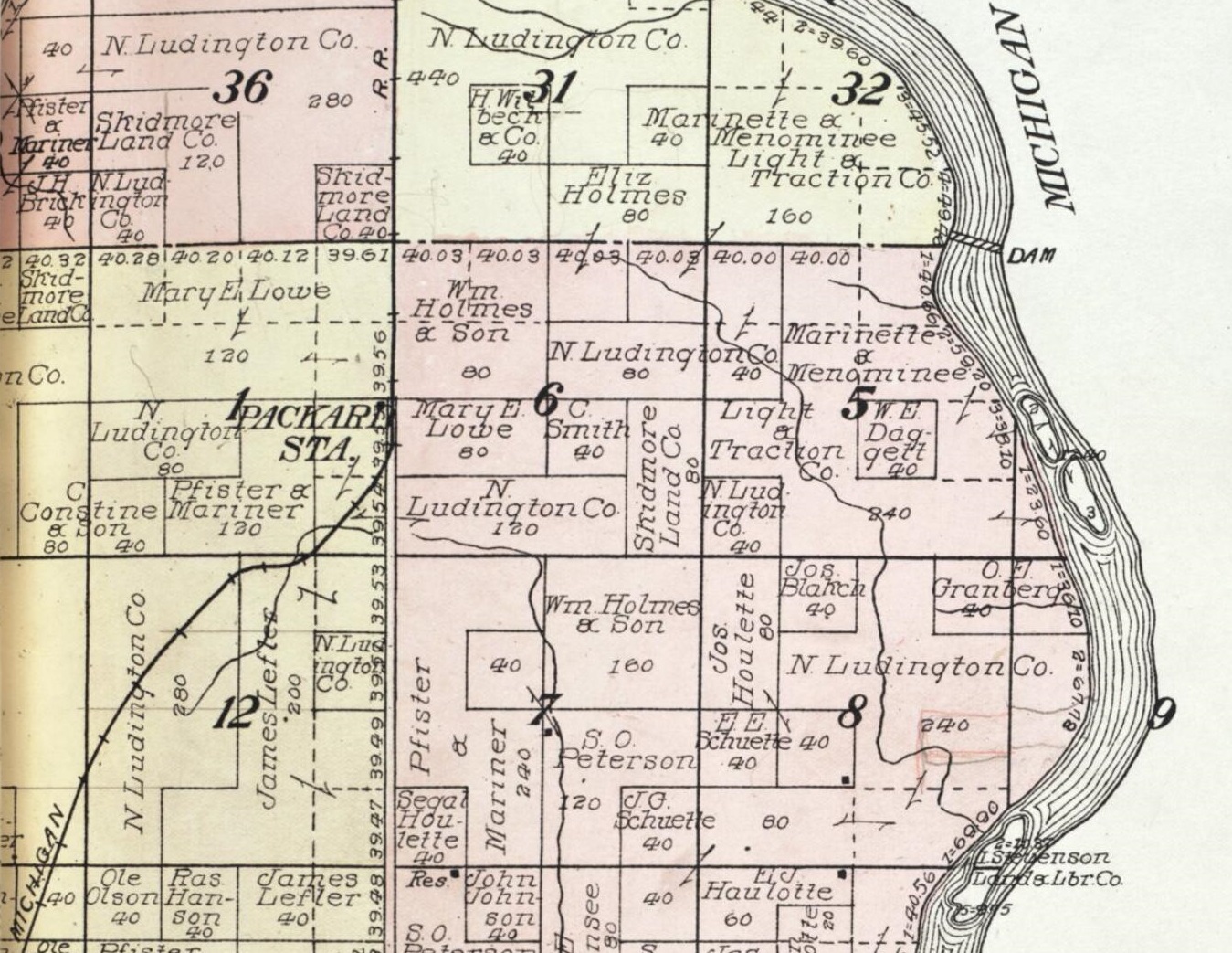
McAllister is an unincorporated community located in the town of Wagner, Marinette County, Wisconsin, United States. Geography McAllister is located at the intersection of Wisconsin Highway 180 and County Highway JJ east-southeast of Wausaukee at an elevation of . It is connected by road to Wausaukee to the west, Packard to the north, Wagner to the south, and Wallace, Michigan to the east via a bridge across the Menominee River.''Stephenson Quadrangle Wisconsin–Michigan, 15 Minute Series (Topographic)''. 1963. Map, 1:62,500. Washington, DC: U. S. Geological Survey. There is a Lutheran church in the community, and the Wagner town hall and Tabor Lutheran Cemetery are located to the east. History McAllister was a stop between Wagner and Packard on the Wisconsin & Michigan (W. & M.) Railway line from Bagley Junction to Iron Mountain. The rail line through McAllister was discontinued in 1938, when the tracks were torn out and the rolling stock sold off. A post office was est ... [...More Info...] [...Related Items...] OR: [Wikipedia] [Google] [Baidu] |
Unincorporated Area
An unincorporated area is a region that is not governed by a local municipal corporation. Widespread unincorporated communities and areas are a distinguishing feature of the United States and Canada. Most other countries of the world either have no unincorporated areas at all or these are very rare: typically remote, outlying, sparsely populated or List of uninhabited regions, uninhabited areas. By country Argentina In Argentina, the provinces of Chubut Province, Chubut, Córdoba Province (Argentina), Córdoba, Entre Ríos Province, Entre Ríos, Formosa Province, Formosa, Neuquén Province, Neuquén, Río Negro Province, Río Negro, San Luis Province, San Luis, Santa Cruz Province, Argentina, Santa Cruz, Santiago del Estero Province, Santiago del Estero, Tierra del Fuego Province, Argentina, Tierra del Fuego, and Tucumán Province, Tucumán have areas that are outside any municipality or commune. Australia Unlike many other countries, Australia has only local government in Aus ... [...More Info...] [...Related Items...] OR: [Wikipedia] [Google] [Baidu] |
Wisconsin Department Of Transportation
The Wisconsin Department of Transportation (WisDOT) is a governmental agency of the U.S. state of Wisconsin responsible for planning, building and maintaining the state's highways. It is also responsible for planning transportation in the state relating to rail, including passenger rail, public transit, freight water transport and air transport, including partial funding of the Milwaukee-to-Chicago Hiawatha Service provided by Amtrak. The Wisconsin DOT is made up of three executive offices and five divisions organized according to transportation function. WisDOT's main office is located at Hill Farms State Transportation Building in Madison, and it maintains regional offices throughout the state. History In 1905 the state legislature introduced an amendment to the state constitution that would allow the state to fund construction and improvement of roads. It was approved by voters in 1908. On June 14, 1911 governor Francis McGovern signed legislation that created the State Hi ... [...More Info...] [...Related Items...] OR: [Wikipedia] [Google] [Baidu] |
Pulaski, Wisconsin
Pulaski is a village in Brown, Oconto, and Shawano counties in the U.S. state of Wisconsin. The population was 3,539 at the 2010 census. Of this, 3,321 were in Brown County, 218 in Shawano County, and none in Oconto County. The Brown and Oconto County portions of Pulaski are part of the Green Bay Metropolitan Statistical Area. History The village was named after the Polish Revolutionary War general Casimir Pulaski, who was responsible for creating America's first cavalry. Geography Pulaski is located at (44.669220, -88.236994). According to the United States Census Bureau, the village has a total area of , of which, of it is land and is water. Most of the village is located in Brown County, with only small portions extending north into Oconto County and west into Shawano County. Climate Demographics 2010 census As of the census of 2010, there were 3,539 people, 1,418 households, and 934 families living in the village. The population density was . There were 1,525 h ... [...More Info...] [...Related Items...] OR: [Wikipedia] [Google] [Baidu] |
Newspapers
A newspaper is a periodical publication containing written information about current events and is often typed in black ink with a white or gray background. Newspapers can cover a wide variety of fields such as politics, business, sports and art, and often include materials such as opinion columns, weather forecasts, reviews of local services, obituaries, birth notices, crosswords, editorial cartoons, comic strips, and advice columns. Most newspapers are businesses, and they pay their expenses with a mixture of subscription revenue, newsstand sales, and advertising revenue. The journalism organizations that publish newspapers are themselves often metonymically called newspapers. Newspapers have traditionally been published in print (usually on cheap, low-grade paper called newsprint). However, today most newspapers are also published on websites as online newspapers, and some have even abandoned their print versions entirely. Newspapers developed in the 17 ... [...More Info...] [...Related Items...] OR: [Wikipedia] [Google] [Baidu] |
Iron Mountain, Michigan
Iron Mountain is a city in the U.S. state of Michigan. The population was 7,518 at the 2020 census, down from 7,624 at the 2010 census. It is the county seat of Dickinson County, in the state's Upper Peninsula. Iron Mountain was named for the valuable iron ore found in the vicinity. Iron Mountain is the principal city of the Iron Mountain, MI-WI Micropolitan Statistical Area, which includes all of Dickinson County, Michigan and Florence County in Wisconsin. Iron Mountain hosts a few points of interest such as the Millie Hill bat cave, The Cornish Pump, and is located adjacent to Pine Mountain ski jump/ski resort, one of the largest artificial ski jumps in the world. It shares Woodward Avenue with the neighboring town, Kingsford. In addition, Iron Mountain is known for its pasties, Bocce Ball Tournaments, World Cup Ski Jumps, and Italian cuisine. Iron Mountain was also named a "Michigan Main Street" community by Michigan Governor Jennifer Granholm in 2006. It is one o ... [...More Info...] [...Related Items...] OR: [Wikipedia] [Google] [Baidu] |
Bagley Junction, Wisconsin
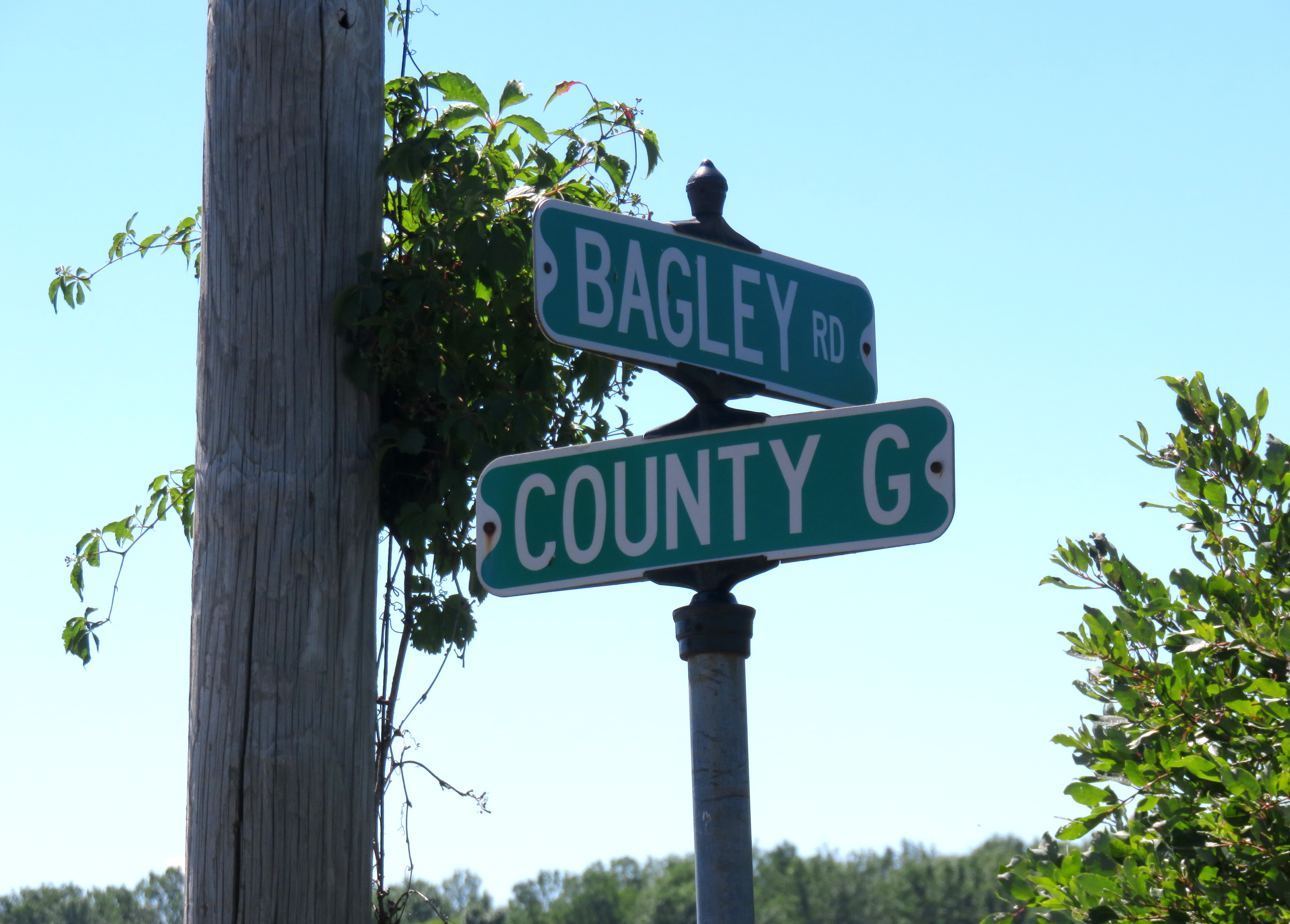
Bagley Junction is an unincorporated community located in the town of Porterfield, Marinette County, Wisconsin, United States. Geography Bagley Junction is located on Bagley Road on the left bank of the Peshtigo River, at the north end of the Potato Rapids Reservoir,''Porterfield Quadrangle, Wisconsin—Marinette Co., 7.5-Minute Series (Topographic)''. 1982. Map, 1:24,000. Reston, VA: United States Department of the Interior Geological Survey. at an elevation of . It is connected by road to Walsh to the north, Porterfield to the west (via Grasser Road), Peshtigo to the south (via Right of Way Road), and Marinette to the east (via Wisconsin Highway 64). Name Bagley Junction and Bagley Road, which passes through the community, are named for John Bagley (June 20, 1852 Quebec – August 17, 1920 Tacoma, Washington),"John Bagley" (obituary). ''Chicago Lumberman'' 39, page 45. a lumberman. After his early activity in Wisconsin, Bagley was active in Washington and later becam ... [...More Info...] [...Related Items...] OR: [Wikipedia] [Google] [Baidu] |
Menominee River
The Menominee River is a river in northwestern Michigan and northeastern Wisconsin in the United States. It is approximately long,U.S. Geological Survey. National Hydrography Dataset high-resolution flowline dataThe National Map, accessed December 19, 2011 draining a rural forested area of northern Wisconsin and the Upper Peninsula of Michigan into Lake Michigan. Its entire course, with that of its tributary, the Brule River, forms part of the boundary between the two states. Description It is formed approximately northwest of Iron Mountain, Michigan, by the confluence of the Brule and Michigamme rivers. As the Menominee flows southeast it picks up the Pine River and travels past Kingsford, Michigan and Niagara, Wisconsin. It then flows generally south, making broad meanders collecting the Sturgeon, Pemebonwon and Pike rivers. It enters Green Bay on Lake Michigan from the north between Marinette, Wisconsin and Menominee, Michigan. Along its course the Menominee Riv ... [...More Info...] [...Related Items...] OR: [Wikipedia] [Google] [Baidu] |
Wagner (community), Wisconsin
Wagner is an unincorporated community located in the town of Wagner, Marinette County, Wisconsin, United States. Wagner is east-southeast of Wausaukee. Geography Wagner is located at the intersection of Old Rail Road (formerly Right of Way Road) and Wagner Road,''Stephenson Quadrangle Wisconsin–Michigan, 15 Minute Series (Topographic)''. 1963. Map, 1:62,500. Washington, DC: U. S. Geological Survey. at an elevation of . It is connected by road to McAllister to the north, Goll to the south, and Wisconsin Highway 180 to the east. Name Wagner is named after Joseph Wagner (1850–1925), an early settler of the area. Wagner was born in Austria and emigrated to the United States in 1865, initially to Chicago and then relocating to Mankato, Minnesota, where he met and married Susan Dauffenbach (1860–1941). They later moved to what is now Wagner, where Joseph Wagner was the first white settler. Wagner built a cabin there and worked for the sawmills in nearby Wallace, Michiga ... [...More Info...] [...Related Items...] OR: [Wikipedia] [Google] [Baidu] |
Packard, Wisconsin
Packard is an unincorporated community located in the town of Wagner, Marinette County, Wisconsin, United States. Geography Packard is located at the intersection of Country Trunk Highway RR and Chapin Road,''Stephenson Quadrangle Wisconsin–Michigan, 15 Minute Series (Topographic)''. 1963. Map, 1:62,500. Washington, DC: U. S. Geological Survey. at an elevation of . It is connected by road to McAllister to the south and Koss, Michigan Koss is an unincorporated community in Menominee County, Michigan, United States. Koss is located in Lake Township, west-southwest of Stephenson. Geography Koss is located at the junction of S-1 Road and S-4 Road on the left bank of the Menom ... to the north. History Packard was a stop between McAllister and Koss on the Wisconsin & Michigan (W. & M.) Railway line from Bagley Junction to Iron Mountain. The rail line through Packard was discontinued in 1938, when the tracks were torn out and the rolling stock sold off. The entire town w ... [...More Info...] [...Related Items...] OR: [Wikipedia] [Google] [Baidu] |
Wausaukee, Wisconsin
Wausaukee is a village in Marinette County, Wisconsin, in the United States. The population was 575 at the 2010 census. The village is part of the Marinette, WI– MI Micropolitan Statistical Area. History Wausaukee is a Menominee word that means “river in the hills.”Gary G. Knowles. ''The Great Wisconsin Touring Book: 30 Spectacular Auto Trips''. The town was started in 1863 by John S. Monroe, who bought 160 acres of land from business tycoon Lars Kovala and built a mill to supply the railroads with lumber for bridges and culverts. His first building was a log cabin home that was also used to board the mill workers. As the town grew and more settlers moved in, his log cabin grew into an inn that was the only public eating establishment north of Green Bay. On August 19, 2011 at 4:45pm, an EF1 tornado struck Wausaukee. One fatality was recorded. Geography Wausaukee is located at (45.3767, -87.9561). According to the United States Census Bureau, the village has a ... [...More Info...] [...Related Items...] OR: [Wikipedia] [Google] [Baidu] |
List Of Sovereign States
The following is a list providing an overview of sovereign states around the world with information on their status and recognition of their sovereignty. The 206 listed states can be divided into three categories based on membership within the United Nations System: 193 member states of the United Nations, UN member states, 2 United Nations General Assembly observers#Present non-member observers, UN General Assembly non-member observer states, and 11 other states. The ''sovereignty dispute'' column indicates states having undisputed sovereignty (188 states, of which there are 187 UN member states and 1 UN General Assembly non-member observer state), states having disputed sovereignty (16 states, of which there are 6 UN member states, 1 UN General Assembly non-member observer state, and 9 de facto states), and states having a political status of the Cook Islands and Niue, special political status (2 states, both in associated state, free association with New Zealand). Compi ... [...More Info...] [...Related Items...] OR: [Wikipedia] [Google] [Baidu] |


