|
Mawsynram
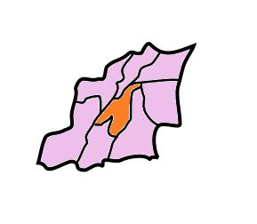
Mawsynram () is a town in the East Khasi Hills district of Meghalaya state in Northeastern India, 69 kilometres from Shillong, the state capital. Mawsynram receives the highest rainfall in India. It is reportedly the wettest place on Earth, with an average annual rainfall of , According to the ''Guinness Book of World Records'', Mawsynram received of rainfall in 1985. Mawsynram received 745.2 mm of rainfall on 19 August 2015, probably the highest rainfall received by the town in recent times. On June 17th 2022, Mawsynram set a new record by receiving 1003.6 mm in a span of 24 hours which has now become its highest single day record for the month of June and for its all time single day record beating its former record of 944.7 mm on June 7th 1966. Location Mawsynram is located at 25° 18′ N, 91° 35′ E, at an altitude of about 1,400 meters (4,600 ft), 15 km west of Cherrapunji, in the Khasi Hills in the state of Meghalaya (India). Climate and rainfall Unde ... [...More Info...] [...Related Items...] OR: [Wikipedia] [Google] [Baidu] |
Rainfall
Rain is water droplets that have condensed from atmospheric water vapor and then fall under gravity. Rain is a major component of the water cycle and is responsible for depositing most of the fresh water on the Earth. It provides water for hydroelectric power plants, crop irrigation, and suitable conditions for many types of ecosystems. The major cause of rain production is moisture moving along three-dimensional zones of temperature and moisture contrasts known as weather fronts. If enough moisture and upward motion is present, precipitation falls from convective clouds (those with strong upward vertical motion) such as cumulonimbus (thunder clouds) which can organize into narrow rainbands. In mountainous areas, heavy precipitation is possible where upslope flow is maximized within windward sides of the terrain at elevation which forces moist air to condense and fall out as rainfall along the sides of mountains. On the leeward side of mountains, desert climates ... [...More Info...] [...Related Items...] OR: [Wikipedia] [Google] [Baidu] |
East Khasi Hills
East Khasi Hills is an administrative district in the state of Meghalaya in India. The district headquarters are located at Shillong. The district occupies an area of 2752 km² and has a population of 825,922 (as of 2011). , it is the most populous district of Meghalaya's 12 districts. History The former Khasi Hills district was divided into East and West Khasi Hills districts on 28 October 1976. On 4 June 1992, East Khasi Hills District was further divided into two administrative districts of East Khasi Hills District and Ri-Bhoi District. Geography Shillong is the district headquarters of East Khasi Hills District. East Khasi Hills District forms a central part of Meghalaya and covers a total geographical area of 2,748 km2. It lies approximately between 25°07" & 25°41" N Lat. And 91°21" & 92°09" E Long. The north of the district is bounded by the plain of Ri-Bhoi District gradually rising to the rolling grasslands of the Shillong Plateau interspersed wit ... [...More Info...] [...Related Items...] OR: [Wikipedia] [Google] [Baidu] |
Meghalaya
Meghalaya (, or , meaning "abode of clouds"; from Sanskrit , "cloud" + , "abode") is a state in northeastern India. Meghalaya was formed on 21 January 1972 by carving out two districts from the state of Assam: (a) the United Khasi Hills and Jaintia Hills and (b) the Garo Hills.History of Meghalaya State Government of India Meghalaya was previously part of Assam, but on 21 January 1972, the districts of Khasi, Garo and Jaintia Hills became the new state of Meghalaya. The population of Meghalaya as of 2014 is estimated to be 3,211,474. Meghalaya covers an area of approximately 22,430 square kilometres, with a length-to-breadth ratio of about 3:1.Meghalaya IBEF, India (2013) T ... [...More Info...] [...Related Items...] OR: [Wikipedia] [Google] [Baidu] |
Cherrapunji
Cherrapunji () or Sohra is a subdivisional town (Proposed District) East Khasi Hills district in the Indian state of Meghalaya. It is the traditional capital of ka ''hima'' Sohra (Khasi tribal kingdom). Sohra has often been credited as being the wettest place on Earth, but for now nearby Mawsynram currently holds that distinction. It still holds the all-time record for the most rainfall in a calendar month and in a year, however: it received in July 1861 and between 1 August 1860 and 31 July 1861. History The history of the Khasi people – native inhabitants of Sohra– may be traced from the early part of the 16th century. Between the 16th and 18th centuries, these people were ruled by their tribal 'Syiems (rajas or chiefs) of Khyriem' in the Khasi Hills. The Khasi hills came under British authority in 1833 with the submission of the last of the important Syiem, Tirot Sing Syiem. The main pivot on which the entire superstructure of Khasi society rests is the matrilineal ... [...More Info...] [...Related Items...] OR: [Wikipedia] [Google] [Baidu] |
Monsoon Of India
The Monsoon of South Asia is among several geographically distributed global monsoons. It affects the Indian subcontinent, where it is one of the oldest and most anticipated weather phenomena and an economically important pattern every year from June through September, but it is only partly understood and notoriously difficult to predict. Several theories have been proposed to explain the origin, process, strength, variability, distribution, and general vagaries of the monsoon, but understanding and predictability are still evolving. The unique geographical features of the Indian subcontinent, along with associated atmospheric, oceanic, and geophysical factors, influence the behavior of the monsoon. Because of its effect on agriculture, on flora and fauna, and on the climates of nations such as Bangladesh, Bhutan, India, Nepal, Pakistan, and Sri Lanka – among other economic, social, and environmental effects – the monsoon is one of the most anticipated, tracked, and studied ... [...More Info...] [...Related Items...] OR: [Wikipedia] [Google] [Baidu] |
Villages In East Khasi Hills District
A village is a clustered human settlement or community, larger than a hamlet but smaller than a town (although the word is often used to describe both hamlets and smaller towns), with a population typically ranging from a few hundred to a few thousand. Though villages are often located in rural areas, the term urban village is also applied to certain urban neighborhoods. Villages are normally permanent, with fixed dwellings; however, transient villages can occur. Further, the dwellings of a village are fairly close to one another, not scattered broadly over the landscape, as a dispersed settlement. In the past, villages were a usual form of community for societies that practice subsistence agriculture, and also for some non-agricultural societies. In Great Britain, a hamlet earned the right to be called a village when it built a church. [...More Info...] [...Related Items...] OR: [Wikipedia] [Google] [Baidu] |
Speleothem
A speleothem (; ) is a geological formation by mineral deposits that accumulate over time in natural caves. Speleothems most commonly form in calcareous caves due to carbonate dissolution reactions. They can take a variety of forms, depending on their depositional history and environment. Their chemical composition, gradual growth, and preservation in caves make them useful paleoclimatic proxies. Chemical and physical characteristics More than 300 variations of cave mineral deposits have been identified. The vast majority of speleothems are calcareous, composed of calcium carbonate (CaCO3) minerals ( calcite or aragonite). Less commonly, speleothems are made of calcium sulfate (gypsum or mirabilite) or opal. Speleothems of pure calcium carbonate or calcium sulfate are translucent and colorless. The presence of iron oxide or copper provides a reddish brown color. The presence of manganese oxide can create darker colors such as black or dark brown. Speleothems can also be br ... [...More Info...] [...Related Items...] OR: [Wikipedia] [Google] [Baidu] |
Stalagmites
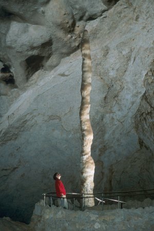
A stalagmite (, ; from the Greek , from , "dropping, trickling") is a type of rock formation that rises from the floor of a cave due to the accumulation of material deposited on the floor from ceiling drippings. Stalagmites are typically composed of calcium carbonate, but may consist of lava, mud, peat, pitch, sand, sinter, and amberat (crystallized urine of pack rats). The corresponding formation hanging down from the ceiling of a cave is a stalactite. Mnemonics have been developed for which word refers to which type of formation; one is that ''stalactite'' has a C for "ceiling", and ''stalagmite'' has a G for "ground", another is that, as with ants in the pants, the mites go up and the tights (tites) come down. Formation and type Limestone stalagmites The most common stalagmites are speleothems, which usually form in limestone caves. Stalagmite formation occurs only under certain pH conditions within the cavern. They form through deposition of calcium carbonate an ... [...More Info...] [...Related Items...] OR: [Wikipedia] [Google] [Baidu] |
Atmosphere
An atmosphere () is a layer of gas or layers of gases that envelop a planet, and is held in place by the gravity of the planetary body. A planet retains an atmosphere when the gravity is great and the temperature of the atmosphere is low. A stellar atmosphere is the outer region of a star, which includes the layers above the opaque photosphere; stars of low temperature might have outer atmospheres containing compound molecules. The atmosphere of Earth is composed of nitrogen (78%), oxygen (21%), argon (0.9%), carbon dioxide (0.04%) and trace gases. Most organisms use oxygen for respiration; lightning and bacteria perform nitrogen fixation to produce ammonia that is used to make nucleotides and amino acids; plants, algae, and cyanobacteria use carbon dioxide for photosynthesis. The layered composition of the atmosphere minimises the harmful effects of sunlight, ultraviolet radiation, the solar wind, and cosmic rays to protect organisms from genetic damage. The ... [...More Info...] [...Related Items...] OR: [Wikipedia] [Google] [Baidu] |
Tectonic Uplift
Tectonic uplift is the geologic uplift of Earth's surface that is attributed to plate tectonics. While isostatic response is important, an increase in the mean elevation of a region can only occur in response to tectonic processes of crustal thickening (such as mountain building events), changes in the density distribution of the crust and underlying mantle, and flexural support due to the bending of rigid lithosphere. Tectonic uplift results in denudation (processes that wear away the earth's surface) by raising buried rocks closer to the surface. This process can redistribute large loads from an elevated region to a topographically lower area as well – thus promoting an isostatic response in the region of denudation (which can cause local bedrock uplift). The timing, magnitude, and rate of denudation can be estimated by geologists using pressure-temperature studies. Crustal thickening Crustal thickening has an upward component of motion and often occurs when continenta ... [...More Info...] [...Related Items...] OR: [Wikipedia] [Google] [Baidu] |
Bay Of Bengal
The Bay of Bengal is the northeastern part of the Indian Ocean, bounded on the west and northwest by India, on the north by Bangladesh, and on the east by Myanmar and the Andaman and Nicobar Islands of India. Its southern limit is a line between Sangaman Kanda, Sri Lanka, and the north westernmost point of Sumatra, Indonesia. It is the largest water region called a bay in the world. There are countries dependent on the Bay of Bengal in South Asia and Southeast Asia. During the existence of British India, it was named as the Bay of Bengal after the historic Bengal region. At the time, the Port of Kolkata served as the gateway to the Crown rule in India. Cox's Bazar, the longest sea beach in the world and Sundarbans, the largest mangrove forest and the natural habitat of the Bengal tiger, are located along the bay. The Bay of Bengal occupies an area of . A number of large rivers flow into the Bay of Bengal: the Ganges– Hooghly, the Padma, the Brahmaputra– Yamuna, t ... [...More Info...] [...Related Items...] OR: [Wikipedia] [Google] [Baidu] |


