|
Mattertal
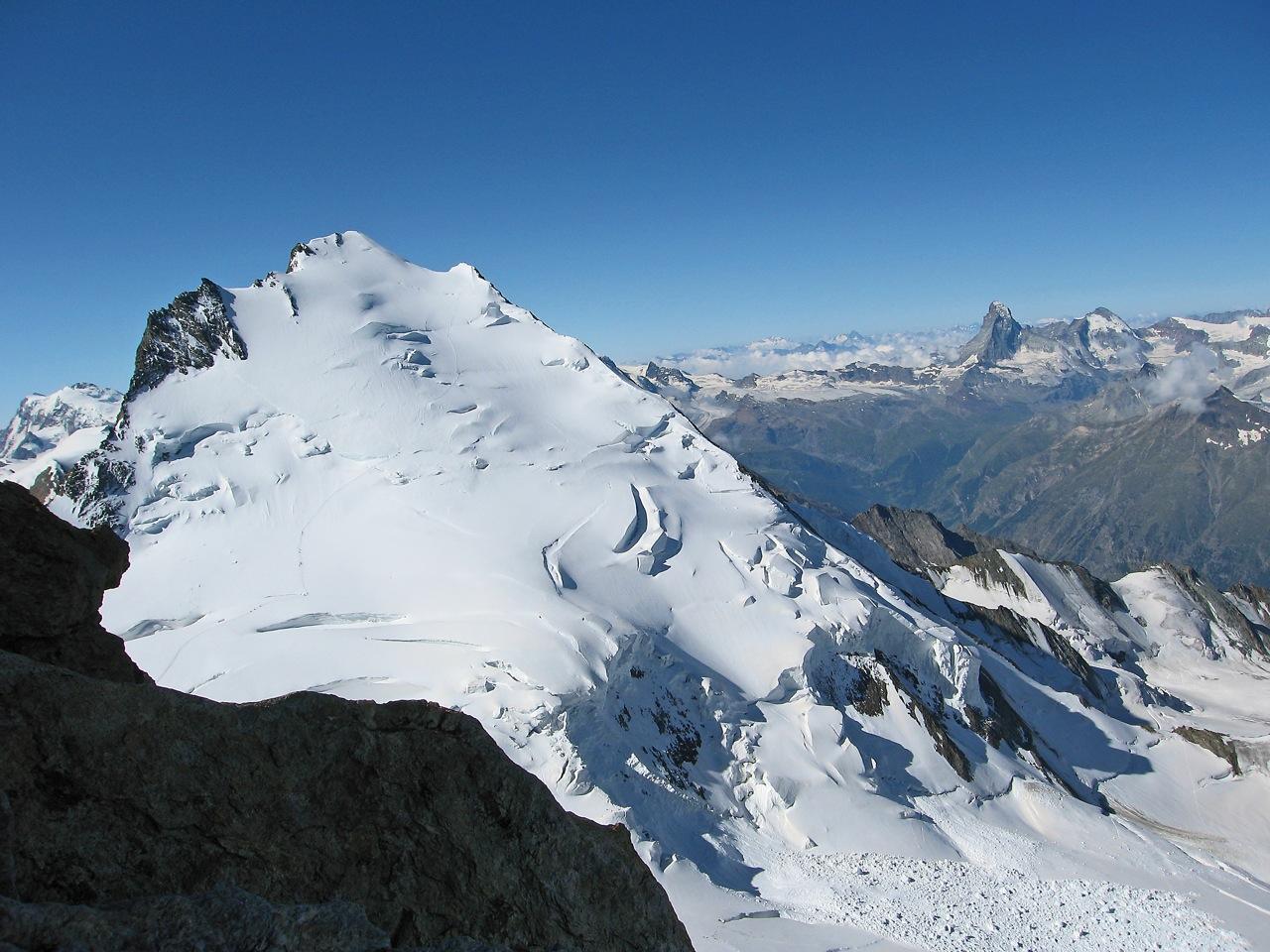
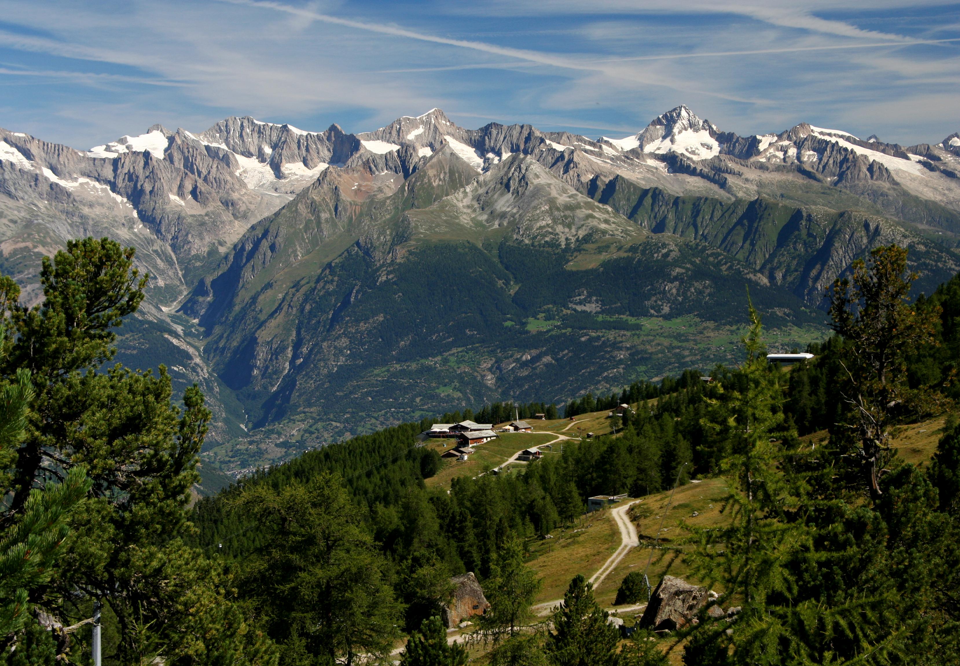
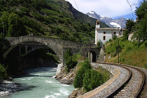
The Matter Valley (German: Mattertal, or sometimes ''Nikolaital'') is located in southwestern Switzerland, south of the Rhone valley in the canton of Valais. The village of Zermatt is the most important settlement of the valley, which is surrounded by many four-thousanders, including the Matterhorn. Geography Located in the Pennine Alps, the Matter Valley is drained by the Matter Vispa, a tributary of the Rhone. The valley itself ends at Stalden where it meets the Saas Valley. The resulting Visp Valley continues for a few kilometres until it reaches the town of Visp on the young river Rhone. The valley starts between the high summits south of Zermatt (Monte Rosa, Matterhorn) on the border with Italy. The upper side is glaciated, the second largest glacier of the Alps, the Gorner Glacier lies at the foot of Monte Rosa (4,634 m), while the Zmutt Glacier lies at the foot of the Matterhorn (4,478 m). Around the village of Randa are located the Weisshorn (4,505 m) and the Dom (4,5 ... [...More Info...] [...Related Items...] OR: [Wikipedia] [Google] [Baidu] |
Matterhorn
The (, ; it, Cervino, ; french: Cervin, ; rm, Matterhorn) is a mountain of the Alps, straddling the main watershed and border between Switzerland and Italy. It is a large, near-symmetric pyramidal peak in the extended Monte Rosa area of the Pennine Alps, whose summit is high, making it one of the highest summits in the Alps and Europe.Considering summits with at least 300 metres prominence, it is the 6th highest in the Alps and Europe outside the Caucasus Mountains. The four steep faces, rising above the surrounding glaciers, face the four compass points and are split by the ''Hörnli'', ''Furggen'', ''Leone''/''Lion'', and ''Zmutt'' ridges. The mountain overlooks the Swiss town of Zermatt, in the canton of Valais, to the northeast; and the Italian town of Breuil-Cervinia in the Aosta Valley to the south. Just east of the Matterhorn is Theodul Pass, the main passage between the two valleys on its north and south sides, which has been a trade route since the Roman Era. The M ... [...More Info...] [...Related Items...] OR: [Wikipedia] [Google] [Baidu] |
Dom (Mischabel)
The Dom is a mountain of the Pennine Alps, located between Randa, Switzerland, Randa and Saas-Fee in the canton of Valais in Switzerland. With a height of , it is the List of Alpine four-thousanders, seventh highest summit in the Alps, overall. Based on topographic prominence, prominence, it can be regarded as the List of prominent mountains of the Alps above 3000 m, third highest mountain in the Alps, and the List of prominent mountains of Switzerland, second highest in Switzerland, after Monte Rosa. The Dom is the main summit of the Mischabel group (German: ''Mischabelhörner''), which is the highest massif lying entirely in Switzerland. The Dom is noteworthy for its 'normal route' of ascent having the greatest vertical height gain of all the alpine 4000 metre peaks, and none of that route's 3,100 metres of height can be achieved using mechanical means. Although ''Dom'' is a German language, German cognate for 'dome', it can also mean 'cathedral' and the mountain is named after ... [...More Info...] [...Related Items...] OR: [Wikipedia] [Google] [Baidu] |
Monte Rosa
: , other_name = Monte Rosa massif , translation = Mount Rose , photo = Dufourspitze (Monte Rosa) and Monte Rosa Glacier as seen from Gornergrat, Wallis, Switzerland, 2012 August.jpg , photo_caption = Central Monte Rosa massif, with Dufourspitze to the south (right) and Nordend to the north (left), the Monte Rosa Glacier right below on its western wing, the upper Gorner Glacier on the left, and the Grenzgletscher to the right , country_type = Countries , country = , subdivision1_type = Canton, Regions , subdivision1 = , parent = Pennine Alps, Western Alps , listing = Country high point Canton high pointUltra , length_km = , length_orientation= , width_km = , width_orientation = , geology = , orogeny = , highest = Dufourspitze , elevation_m = 4634 , range_coordinates = , coordinates = , map = Switzerland , map_ ... [...More Info...] [...Related Items...] OR: [Wikipedia] [Google] [Baidu] |
Weisshorn
The Weisshorn (German, lit. ''white peak/mountain'') is a major peak of Switzerland and the Alps, culminating at above sea level. It is part of the Pennine Alps and is located between the valleys of Anniviers and Zermatt in the canton of Valais. In the latter valley, the Weisshorn is one of the many 4000ers surrounding Zermatt, with Monte Rosa and the Matterhorn. The Weisshorn was first climbed in 1861 from Randa by the Irish physicist John Tyndall, accompanied by the guides J.J. Bennen and Ulrich Wenger. Nowadays, the Weisshorn Hut is used on the normal route. The Weisshorn is considered by many mountaineers to be the most beautiful mountain in the Alps and Switzerland for its pyramidal shape and pure white slopes. In April and May 1991, two consecutive rockslides took place from a cliff above the town of Randa on the east side of the massif, below the Bis Glacier. Geography The Weisshorn is situated in the southern canton of Valais, about 25 km southwards from the ... [...More Info...] [...Related Items...] OR: [Wikipedia] [Google] [Baidu] |
Zermatt
Zermatt () is a municipality in the district of Visp in the German-speaking section of the canton of Valais in Switzerland. It has a year-round population of about 5,800 and is classified as a town by the Swiss Federal Statistical Office (FSO). It lies at the upper end of Mattertal at an elevation of , at the foot of Switzerland's highest peaks. It lies about from the over high Theodul Pass bordering Italy. Zermatt is the southernmost commune of the German ''Sprachraum''. Zermatt is famed as a mountaineering and ski resort of the Swiss Alps. Until the mid-19th century, it was predominantly an agricultural community; the first and tragic ascent of the Matterhorn in 1865 was followed by a rush on the mountains surrounding the village, leading to the construction of many tourist facilities. The year-round population () is , though there may be several times as many tourists in Zermatt at any one time. Much of the local economy is based on tourism, with about half of the jobs in t ... [...More Info...] [...Related Items...] OR: [Wikipedia] [Google] [Baidu] |
Weisshorn North
The Weisshorn (German, lit. ''white peak/mountain'') is a major peak of Switzerland and the Alps, culminating at above sea level. It is part of the Pennine Alps and is located between the valleys of Anniviers and Zermatt in the canton of Valais. In the latter valley, the Weisshorn is one of the many 4000ers surrounding Zermatt, with Monte Rosa and the Matterhorn. The Weisshorn was first climbed in 1861 from Randa by the Irish physicist John Tyndall, accompanied by the guides J.J. Bennen and Ulrich Wenger. Nowadays, the Weisshorn Hut is used on the normal route. The Weisshorn is considered by many mountaineers to be the most beautiful mountain in the Alps and Switzerland for its pyramidal shape and pure white slopes. In April and May 1991, two consecutive rockslides took place from a cliff above the town of Randa on the east side of the massif, below the Bis Glacier. Geography The Weisshorn is situated in the southern canton of Valais, about 25 km southwards from the ... [...More Info...] [...Related Items...] OR: [Wikipedia] [Google] [Baidu] |
Glacier Express
The Glacier Express (GEX) is a direct train connecting railway stations of the two major mountain resorts of Zermatt and St. Moritz via Andermatt in the central Swiss Alps. The train is not an "express" in the sense of being a high-speed train, but rather, in the sense that it provides a one-seat ride for an 8-hours-long end-to-end journey, and omits stops made by local trains. The Glacier Express is known as the slowest express train in the world. As St. Moritz and Zermatt are home to two well-known mountains, the Glacier Express is also said to travel from Matterhorn to Piz Bernina. The journey from Zermatt starts at the dead end of an Alpine valley, the Mattertal, just below the world-renowned Matterhorn at an elevation of before it descends to the huge valley of the Valais in Brig. It traverses the journey through the center of the Swiss Alps, over 291 bridges, through 91 tunnels, such as the Furka Tunnel at an elevation of to circumvent the Furka Pass, makes an inter ... [...More Info...] [...Related Items...] OR: [Wikipedia] [Google] [Baidu] |
Valais
Valais ( , , ; frp, Valês; german: Wallis ), more formally the Canton of Valais,; german: Kanton Wallis; in other official Swiss languages outside Valais: it, (Canton) Vallese ; rm, (Chantun) Vallais. is one of the cantons of Switzerland, 26 cantons forming the Switzerland, Swiss Confederation. It is composed of thirteen districts and its capital and largest city is Sion, Switzerland, Sion. The flag of the canton is made of thirteen stars representing the districts, on a white-red background. Valais is situated in the southwestern part of Switzerland, the country. It borders the cantons of Canton of Vaud, Vaud and Canton of Bern, Bern to the north, the cantons of Canton of Uri, Uri and Ticino to the east, as well as Italy to the south and France to the west. It is one of the three large southern Alps, Alpine cantons, along with Ticino and the Grisons, which encompass a vast diversity of ecosystems. It is a bilingual canton, French language, French and German language, German ... [...More Info...] [...Related Items...] OR: [Wikipedia] [Google] [Baidu] |
Grächen
Grächen is a Municipalities of Switzerland, municipality in the district of Visp (district), Visp in the Cantons of Switzerland, canton of Valais in Switzerland. The village is situated at an altitude of on a terrace above St. Niklaus in the Mattertal, north of the Mischabel range (and Dom (Mischabel), Dom). History Settlements in the area of Grächen probably date back to neolithic times. It certainly was a hunting ground for early Bronze Age alpine people (celts List of Celts). Around 750 (CE), the Alamanni started to settle in the upper (German-speaking) part of what is now the canton of Valais. Grächen is first mentioned in 1210 as ''de Grachan''. In 1250 it was mentioned as ''de Granges''. Grächen developed into a community of farmers in servitude and paying tribute to various feudal lords, until they finally reached their independence as a community (from the Bishop of Sion) in the 19th century. Thomas Platter, a famous citizen of 16th century Grächen, published his ... [...More Info...] [...Related Items...] OR: [Wikipedia] [Google] [Baidu] |
Valleys Of The Alps
The main valleys of the Alps, orographically by drainage basin. Rhine basin (North Sea) High Rhine *Aare **Limmat ***Linth (Glarus) ****Lake Walen *****Seeztal **** Klöntal ****Sernftal **Reuss ***Lake Lucerne ****Sarner Aa (Brünig Pass connects to the Aare basin) ****Muota ***Schächental, Klausen Pass connects to Glarus ***Urseren ***Susten Pass connects to the Gadmertal ***Furka Pass connects to the Goms **Saane/Sarine ***Sense **Gürbetal **Lake Thun, Bernese Oberland *** Kander ****Simmental *****Diemtigental (Chirel, Fildrich (Narebach, Senggibach, Gurbsbach)) **** Suldtal **** Kiental **** Engstligental ****Kandertal ***, Habkern *** Brienzersee, Interlaken ****Lütschine ***** Saxettal ***** Schwarze Lütschine, Lütschental, Grindelwald, Grosse Scheidegg connects to Reichenbachtal ***** Weisse Lütschine, Lauterbrunnental, Lauterbrunnen ******Sefinental **** Giessbach ****Haslital, Meiringen *****Reichenbachtal (Rychenbach, Seilibach), Grosse Scheidegg connects to ... [...More Info...] [...Related Items...] OR: [Wikipedia] [Google] [Baidu] |
Visp Valley
The Vispa is a river in the canton of Valais, located in the Visp area. It is essentially composed of two large branches: the Matter Vispa and the Saaser Vispa, converging at Stalden, then forming the Vispa proper, flowing for less than before converging with the Rhône at Visp. The Vispa is a left and major affluent of the Rhône, before it enters Lake Geneva. The Vispa collects the waters from the Mattertal (formed by the Matter Vispa) and the Saastal (formed by the Saaser Vispa), the two highest valleys in Switzerland and the Pennine Alps. Both valleys have mountains over above sea level, the highest being Monte Rosa, the Dom and the Weisshorn, and include numerous glaciers, large and small. As a result, the river is characterized by a glacial regime, similarly to the Massa, another nearby affluent of the Rhône. The Matter Vispa is the longest of the two branches. It is over long, from the mouth of the Gorner Glacier to Stalden. It comprehends small but numerous affluents ... [...More Info...] [...Related Items...] OR: [Wikipedia] [Google] [Baidu] |


