|
Matsubara
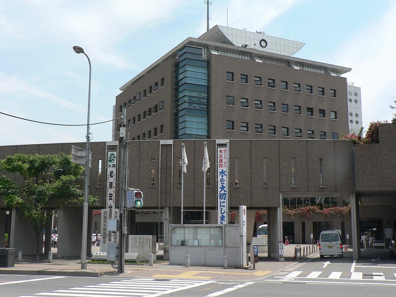
is a city located in Osaka Prefecture, Japan. , the city had an estimated population of 117,811 in 57351 households and a population density of 7100 persons per km². The total area of the city is . Geography Matsubara is located in the center of Osaka Prefecture. The city measures approximately 5.8 kilometers east-west by 5.1 kilometers north-south, and is mostly flatland. Neighboring municipalities Osaka Prefecture *Osaka ( Sumiyoshi-ku, Higashi Sumiyoshi-ku, Hirano-ku) *Sakai ( Kita-ku, Mihara-ku) * Yao *Fujiidera * Habikino Climate Matsubara has a Humid subtropical climate (Köppen ''Cfa'') characterized by warm summers and cool winters with light to no snowfall. The average annual temperature in Matsubara is 14.9 °C. The average annual rainfall is 1475 mm with September as the wettest month. The temperatures are highest on average in August, at around 27.0 °C, and lowest in January, at around 3.5 °C. Demographics Per Japanese census data, t ... [...More Info...] [...Related Items...] OR: [Wikipedia] [Google] [Baidu] |
Osaka Prefecture
is a prefecture of Japan located in the Kansai region of Honshu. Osaka Prefecture has a population of 8,778,035 () and has a geographic area of . Osaka Prefecture borders Hyōgo Prefecture to the northwest, Kyoto Prefecture to the north, Nara Prefecture to the southeast, and Wakayama Prefecture to the south. Osaka is the capital and largest city of Osaka Prefecture, and the third-largest city in Japan, with other major cities including Sakai, Higashiōsaka, and Hirakata. Osaka Prefecture is the third-most-populous prefecture, but by geographic area the second-smallest; at it is the second-most densely populated, below only Tokyo. Osaka Prefecture is one of Japan's two " urban prefectures" using the designation ''fu'' (府) rather than the standard '' ken'' for prefectures, along with Kyoto Prefecture. Osaka Prefecture forms the center of the Keihanshin metropolitan area, the second-most-populated urban region in Japan after the Greater Tokyo area and one of the world ... [...More Info...] [...Related Items...] OR: [Wikipedia] [Google] [Baidu] |
Habikino, Osaka
270px, Habikino city office is a city located in Osaka Prefecture, Japan. , the city had an estimated population of 109,479 in 50918 households and a population density of 4100 persons per km². The total area of the city is . The city is known for its grapes, and also for its large number of ancient '' kofun'' burial mounds. The city is also sometimes referred to by its former name . Geography Habikino is located in the southeastern part of Osaka Prefecture, in the Kawachi Plain surrounded by Ikoma, Kongō, and Katsuragi Mountains and Mount Nijō. It is within about 20 kilometers from the center of Osaka metropolis. Neighboring municipalities Osaka Prefecture * Sakai *Matsubara * Fujiidera * Kashiwara *Tondabayashi * Taishi Nara Prefecture *Kashiba Climate Habikino has a Humid subtropical climate (Köppen ''Cfa'') characterized by warm summers and cool winters with light to no snowfall. The average annual temperature in Habikino is 14.2 °C. The average annual rai ... [...More Info...] [...Related Items...] OR: [Wikipedia] [Google] [Baidu] |
Sakai, Osaka
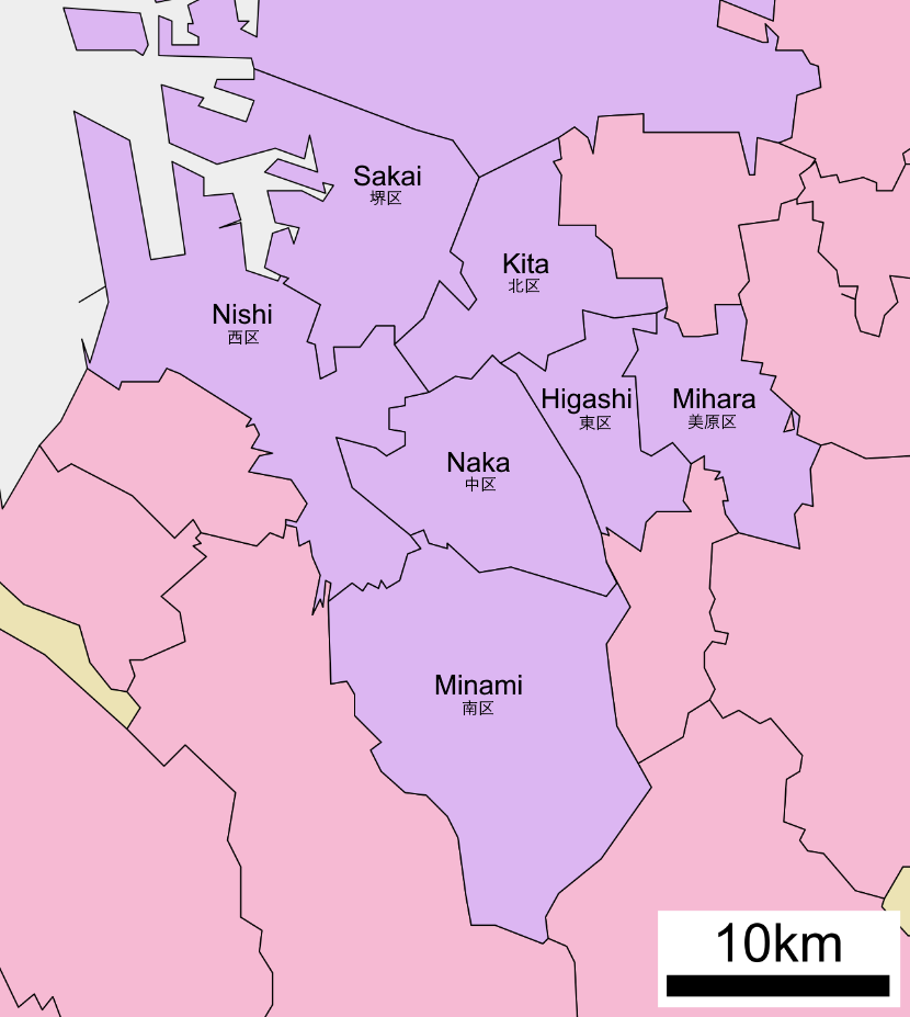
is a city located in Osaka Prefecture, Japan. It has been one of the largest and most important seaports of Japan since the medieval era. Sakai is known for its keyhole-shaped burial mounds, or kofun, which date from the fifth century and include Mozu Tombs, Daisen Kofun, the largest grave in the world by area. Once known for Katana, swords, Sakai is now famous for the quality of its Japanese kitchen knife, cutlery. , the city had an estimated population of 819,965, making it the fourteenth most populous city in Japan (excluding Tokyo). Geography Sakai is located in southern Osaka Prefecture, on the edge of Osaka Bay and directly south of the city of Osaka. Neighboring municipalities Osaka Prefecture *Osaka *Matsubara, Osaka, Matsubara *Habikino, Osaka, Habikino *Ōsakasayama, Osaka, Ōsakasayama *Kawachinagano, Osaka, Kawachinagano *Izumi, Osaka, Izumi *Takaishi, Osaka, Takaishi Climate Sakai has a Humid subtropical climate (Köppen ''Cfa'') characterized by warm summers and ... [...More Info...] [...Related Items...] OR: [Wikipedia] [Google] [Baidu] |
Tannan Domain
was a feudal domain under the Tokugawa shogunate of Edo period Japan, located in Kawachi Province in what is now the southeastern portion of modern-day Osaka Prefecture. It was centered around Tannan ''jin'ya'' in what is now the city of Matsubara and was controlled by the ''fudai daimyō'' Takagi clan all of its history. History Takagi Masatsugu was the son of Takagi Kiyohide, one of Tokugawa Ieyasu's 16 Generals. With holdings of 9000 '' koku'' scattered across Sagami, Musashi, Kazusa, Shimōsa, and Ōmi Province, he was ranked as a ''hatamoto''. In 1623, he was appointed to the post of , a minor post which was responsible for guarding the Kyōbashiguchi and Tamazoguchi gates of Osaka Castle for which he received an additional 1000 ''koku'' in revenue. This placed his ''kokudaka'' over the 10,000 ''koku'' mark requited to qualify as a ''daimyō'', and his holdings were consolidated to 22 village in Kawachi Province,where he constructed a ''jin'ya''. His son, Takagi ... [...More Info...] [...Related Items...] OR: [Wikipedia] [Google] [Baidu] |
Kawachi Province
was a province of Japan in the eastern part of modern Osaka Prefecture. It originally held the southwestern area that was split off into Izumi Province. It was also known as . Geography The area was radically different in the past, with Kawachi Bay and lake dominating the area over what is now land. ''Chiku'' Kawachi was divided into three : , , and . * The northern county comprised the modern Hirakata, Neyagawa, Kadoma, Moriguchi, Shijōnawate, Daitō, and Katano, Osaka areas. * The central county comprised the modern Higashiōsaka, Yao, and Kashiwara, Osaka areas. * The southern county comprised the modern Sakai's eastern part (all of Higashi-ku and Mihara-ku, and part of Kita-ku), Matsubara, Habikino, Fujiidera, Tondabayashi, Kawachinagano, Ōsakasayama, and Minamikawachi District areas. Development Kawachi province was established in the 7th century. On 11 May 716, the Ōtori, Izumi, and Hine districts were split off to form . In December 720, the and dis ... [...More Info...] [...Related Items...] OR: [Wikipedia] [Google] [Baidu] |
Fujiidera, Osaka
270px, The temple of Fujii-dera, after which the city is named is a city located in Osaka Prefecture, Japan. , the city had an estimated population of 63,446 in 29501 households and a population density of 7100 persons per km². The total area of the city is . Geography Fujiidera is located in the southeastern part of the Osaka Plain, at the confluence of the Yamato and the Ishikawa rivers. The city area is almost flat and the rivers are bounded by high levees that protect low-lying areas from flooding. Sections of both river banks are maintained for recreation. Neighboring municipalities Osaka Prefecture * Yao * Kashiwara * Habikino * Matsubara Climate Fujiidera has a Humid subtropical climate (Köppen ''Cfa'') characterized by warm summers and cool winters with light to no snowfall. The average annual temperature in Fujiidera is 14.9 °C. The average annual rainfall is 1475 mm with September as the wettest month. The temperatures are highest on average in Augus ... [...More Info...] [...Related Items...] OR: [Wikipedia] [Google] [Baidu] |
Yao, Osaka
is a city located in Osaka Prefecture, Japan. , the city had an estimated population of 263,436 in 126509 households and a population density of 6300 persons per km². The total area of the city is . The city is the birthplace of the Kawachi ondo style of folk singing. Geography Yao is locate adjacent to the central part of the Osaka Plain and southeast of Osaka metropolis. The west side of the city area is almost flat with an average elevation of only ten meters above sea level. The land rises in the east, with the Ikoma Mountains forming the prefectural border with Nara Prefecture. In addition to the Yamato River flowing at the southern end of the city, there are many small rivers. Neighboring municipalities Osaka Prefecture *Hirano-ku, Osaka * Higashiōsaka * Kashiwara * Fujiidera * Matsubara Nara Prefecture * Heguri * Sangō Climate Yao has a Humid subtropical climate (Köppen ''Cfa'') characterized by warm summers and cool winters with light to no snowfall. The ave ... [...More Info...] [...Related Items...] OR: [Wikipedia] [Google] [Baidu] |
Emperor Hanzei
was the 18th legendary Emperor of Japan,Imperial Household Agency (''Kunaichō'') 反正天皇 (18) retrieved 2013-8-28. according to the traditional order of succession. Ponsonby-Fane, Richard. (1959). ''The Imperial House of Japan,'' p. 38. No firm dates can be assigned to this Emperor's life or reign, but he is conventionally considered to have reigned from 406 CE to 410 CE. Legendary narrative Hanzei is regarded by historians as a "legendary Emperor" of the 5th century. The reign of Emperor Kinmei ( – 571 AD), the 29th Emperor,Titsinghpp. 34–36 Brown pp. 261–262 Varley, pp. 123–124. is the first for which contemporary historiography is able to assign verifiable dates; however, the conventionally accepted names and dates of the early Emperors were not to be confirmed as "traditional" until the reign of Emperor Kanmu (737–806), the 50th sovereign of the Yamato dynasty. Hanzei was the son of Emperor Nintoku and Princess Iwano-hime, his name was . He was the b ... [...More Info...] [...Related Items...] OR: [Wikipedia] [Google] [Baidu] |
Cities Of Japan
A is a local administrative unit in Japan. Cities are ranked on the same level as and , with the difference that they are not a component of . Like other contemporary administrative units, they are defined by the Local Autonomy Law of 1947. City status Article 8 of the Local Autonomy Law sets the following conditions for a municipality to be designated as a city: *Population must generally be 50,000 or greater (原則として人口5万人以上) *At least 60% of households must be established in a central urban area (中心市街地の戸数が全戸数の6割以上) *At least 60% of households must be employed in commerce, industry or other urban occupations (商工業等の都市的業態に従事する世帯人口が全人口の6割以上) *Any other conditions set by prefectural ordinance must be satisfied (他に当該都道府県の条例で定める要件を満たしていること) The designation is approved by the prefectural governor and the Minister for Inter ... [...More Info...] [...Related Items...] OR: [Wikipedia] [Google] [Baidu] |
Edo Period
The or is the period between 1603 and 1867 in the history of Japan, when Japan was under the rule of the Tokugawa shogunate and the country's 300 regional ''daimyo''. Emerging from the chaos of the Sengoku period, the Edo period was characterized by economic growth, strict social order, isolationist foreign policies, a stable population, perpetual peace, and popular enjoyment of arts and culture. The period derives its name from Edo (now Tokyo), where on March 24, 1603, the shogunate was officially established by Tokugawa Ieyasu. The period came to an end with the Meiji Restoration and the Boshin War, which restored imperial rule to Japan. Consolidation of the shogunate The Edo period or Tokugawa period is the period between 1603 and 1867 in the history of Japan, when Japan was under the rule of the Tokugawa shogunate and the country's regional ''daimyo''. A revolution took place from the time of the Kamakura shogunate, which existed with the Tennō's court, to th ... [...More Info...] [...Related Items...] OR: [Wikipedia] [Google] [Baidu] |


