|
Mathraki
Mathraki ( el, Μαθράκι, grc, Μαθράκιον) is an island and a former community of the Ionian Islands, Greece. It is one of the Diapontian Islands. Since the 2019 local government reform it is part of the municipality of Central Corfu and Diapontian Islands, of which it is a municipal unit. The municipal unit has an area of 3.532 km2. Population 329 (2011). Mathraki is a 45-minute boat ride off the coast of Corfu (4 NM from Cape Arilas). It has three restaurants that double as general stores, villas and "rooms to let". Mathraki is a quiet island that manages to stay clear of tourists except for the occasional hikers that brave the rocky coastline. The municipal unit includes the three nearby islets Diakopo, Diaplo and Tracheia. History Mathraki was inhabited since the 16th century by settlers from the nearby islands of Paxoi and Othonoi Othonoi ( el, Οθωνοί, also rendered as Othoni, grc, Ὀθρωνός , translit=Othrōnós) is a small and inhabited Greek ... [...More Info...] [...Related Items...] OR: [Wikipedia] [Google] [Baidu] |
Diapontia Islands
The Diapontian Islands or Diapontia Islands ( el, Διαπόντια Νησιά, Diapontia Νisia, also known as Othonoi Islands ( el, Νήσοι Οθωνοί, Νisoi Othonoi) are a Greek island group in the Ionian Sea. They are located the northwest of Corfu. The main and the only inhabited islands of the archipelago are Othoni, Ereikoussa and Mathraki. The complex includes also the islets and rocks of Diakopo, Diaplo, Karavi, Kastrino, Leipso, Ostrako, Plaka, Plateia and Tracheia. The largest island is Othoni, with an area of 10.8 km2 while the most populated is Ereikoussa with 496 inhabitants according to the 2011 census. The islands are the westernmost point in Greece and administratively belong to Corfu regional unit. The islands today are a tranquil place for holidays. Geography The archipelago of Diapontia consists of 12 islands and islets. Othoni Othonoi (Greek: Οθωνοί, Italian: Fanò or Othoni) is the westernmost point of Greece and the largest ... [...More Info...] [...Related Items...] OR: [Wikipedia] [Google] [Baidu] |
Othonoi
Othonoi ( el, Οθωνοί, also rendered as Othoni, grc, Ὀθρωνός , translit=Othrōnós) is a small and inhabited Greek island in the Ionian Sea, located northwest of Corfu, and is the westernmost point of Greece. Othonoi is the largest of the Diapontian Islands. Since the 2019 local government reform it is part of the municipality of Central Corfu and Diapontian Islands. In the 19th century the island was the capital of the Diapontia Islands municipality, which also included nearby islands of Ereikoussa, Mathraki, islets and rocks of Diakopo, Diaplo, Karavi, Kastrino, Leipso, Ostrako, Plaka, Plateia and Tracheia. Othonoi is about 47 nautical miles from Santa Maria di Leuca cape, Italy. Name The first name according to ancient texts (Hesychius, 3rd cent. BC) was "Othronos" (Ὀθρωνός), "Othronoi" (Ὀθρωνοί) and by Procopius seems to be "Othonē" (Ὀθωνή) (6th c.). According to Pliny (1st cent.), it was "Thoronos" (Θόρονος). Other names were ... [...More Info...] [...Related Items...] OR: [Wikipedia] [Google] [Baidu] |
Islands Of Greece
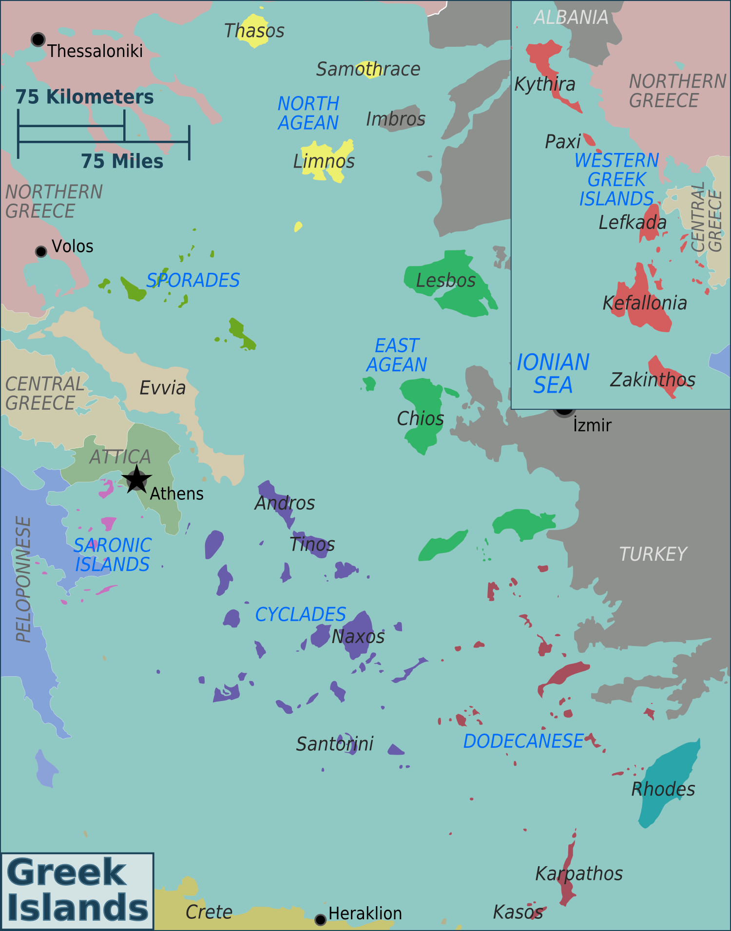
Greece has many islands, with estimates ranging from somewhere around 1,200 to 6,000, depending on the minimum size to take into account. The number of inhabited islands is variously cited as between 166 and 227. The largest Greek island by area is Crete, located at the southern edge of the Aegean Sea. The second largest island is Euboea or Evvia, which is separated from the mainland by the 60m-wide Euripus Strait, and is administered as part of the Central Greece region. After the third and fourth largest Greek islands, Lesbos and Rhodes, the rest of the islands are two-thirds of the area of Rhodes, or smaller. The Greek islands are traditionally grouped into the following clusters: the Argo-Saronic Islands in the Saronic Gulf near Athens; the Cyclades, a large but dense collection occupying the central part of the Aegean Sea; the North Aegean islands, a loose grouping off the west coast of Turkey; the Dodecanese, another loose collection in the southeast between Crete ... [...More Info...] [...Related Items...] OR: [Wikipedia] [Google] [Baidu] |
Corfu (regional Unit)
Corfu ( el, Περιφερειακή ενότητα Κερκύρας) is one of the regional units of Greece. It is part of the region of Ionian Islands. The capital of the regional unit is the town of Corfu. The regional unit consists of the islands of Corfu, Paxoi, Othonoi, Ereikoussa, Mathraki and several smaller islands, all in the Ionian Sea. Administration Since 2019, the regional unit Corfu is subdivided into 4 municipalities: *Central Corfu and Diapontian Islands * North Corfu * Paxoi * South Corfu Prefecture As a part of the 2011 Kallikratis government reform, the regional unit Corfu was created out of the former prefecture Corfu ( el, Νομός Κερκύρας). The prefecture, created in 1864, had the same territory as the present regional unit. Provinces The provinces A province is almost always an administrative division within a country or state. The term derives from the ancient Roman ''provincia'', which was the major territorial and administrati ... [...More Info...] [...Related Items...] OR: [Wikipedia] [Google] [Baidu] |
Central Corfu And Diapontian Islands
Central Corfu and Diapontian Islands ( el, Κεντρική Κέρκυρα και Διαπόντια Νησιά ''Kentriki Kerkyra kai Diapontia Nisia'') is a municipality in the Ionian Islands region in Greece. It covers the central part of the island of Corfu and the Diapontian Islands. The municipality was formed at the 2019 local government reform, when the pre-existing municipality of Corfu was divided in three. Its seat is the city Corfu Corfu (, ) or Kerkyra ( el, Κέρκυρα, Kérkyra, , ; ; la, Corcyra.) is a Greek island in the Ionian Sea, of the Ionian Islands, and, including its small satellite islands, forms the margin of the northwestern frontier of Greece. The isl .... The municipality consists of the following eight subdivisions (municipal units): * Achilleio * Corfu (city) * Ereikoussa * Faiakes * Mathraki * Othonoi * Palaiokastritsa * Parelioi References {{Central Corfu div Populated places in Corfu (regional unit) 2019 establishments in Gree ... [...More Info...] [...Related Items...] OR: [Wikipedia] [Google] [Baidu] |
Ionian Islands (region)
The Ionian Islands Region ( el, Περιφέρεια Ιονίων Νήσων, translit=Periféria Ioníon Níson, ) is the smallest by area of the thirteen administrative regions of Greece located in the Ionian Sea. It comprises all the Ionian Islands except Kythera, which, although historically part of the island group, was separated and integrated to the Attica Region. Demographics The population of the Ionian Islands in 2011 was 207,855, decreased by 1.5% compared to the population in 2001. Nevertheless, the region remains the third by population density with 90.1/km2 nationwide, well above the national of 81.96/km2. The most populous of the major islands is Corfu with a population of 104,371, followed by Zante (40,759), Cephalonia (35,801), Leucas (23,693) and Ithaca (3,231). In 2001, the foreign-born population was 19,360 or 9.3%, the majority of which was concentrated in Corfu and Zante. Most of them originate from Albania (13,536). The fertility rate for 2011 according ... [...More Info...] [...Related Items...] OR: [Wikipedia] [Google] [Baidu] |
Greece
Greece,, or , romanized: ', officially the Hellenic Republic, is a country in Southeast Europe. It is situated on the southern tip of the Balkans, and is located at the crossroads of Europe, Asia, and Africa. Greece shares land borders with Albania to the northwest, North Macedonia and Bulgaria to the north, and Turkey to the northeast. The Aegean Sea lies to the east of the mainland, the Ionian Sea to the west, and the Sea of Crete and the Mediterranean Sea to the south. Greece has the longest coastline on the Mediterranean Basin, featuring thousands of islands. The country consists of nine traditional geographic regions, and has a population of approximately 10.4 million. Athens is the nation's capital and largest city, followed by Thessaloniki and Patras. Greece is considered the cradle of Western civilization, being the birthplace of democracy, Western philosophy, Western literature, historiography, political science, major scientific and mathematical p ... [...More Info...] [...Related Items...] OR: [Wikipedia] [Google] [Baidu] |
Government Gazette (Greece)
The ''Government Gazette'' ( el, Εφημερίς της Κυβερνήσεως, translit=Efimeris tis Kyverniseos, translit-std=ISO, lit=Government Gazette) is the official journal of the Government of Greece which lists all laws passed in a set time period ratified by Cabinet and President. It was first issued in 1833. Until 1835, during the regency on behalf of King Otto, the gazette was bilingual in Greek and German. No law in Greece is valid until is published in this journal. Foundations, duties and rights of juridical persons should be published in this journal. The printed issues of the Government Gazette are sold by the National Printing House of Greece. They can also be searched and downloaded from the official site of the House. An issue of the gazette is called "Government Gazette Issue" (, ''ΦΕΚ'', ''FEK''), Each issue is separated into volumes called «Τεύχος» with distinct roles. References Publications established in 1833 Newspapers published in ... [...More Info...] [...Related Items...] OR: [Wikipedia] [Google] [Baidu] |
Paxoi
Paxos ( gr, Παξός) is a Greek island in the Ionian Sea, lying just south of Corfu. As a group with the nearby island of Antipaxos and adjoining islets, it is also called by the plural form Paxi or Paxoi ( gr, Παξοί, pronounced in English and in Greek). The main town and the seat of the municipality is Gaios. The smallest of the seven main Ionian Islands (the Heptanese), Paxos has an area of , while the municipality has an area of and a population of about 2300. Paxos lies some 15 km from the southern tip of Corfu, and at about the same distance from the town of Parga on the mainland. It is connected by ferry lines from Igoumenitsa and Corfu with Gaios. The island is hilly, the highest point having an elevation of 230 m. In Greek mythology, Poseidon created the island by striking Corfu with his trident, so that he and his wife Amphitrite could have some peace and quiet. History Although it was possibly inhabited from prehistoric times, the Phoenicians ... [...More Info...] [...Related Items...] OR: [Wikipedia] [Google] [Baidu] |


