|
Massachusetts Route 151
Route 151 is a east–west state highway in Massachusetts. The route is located on Cape Cod and runs through the towns of Falmouth and Mashpee. Route 151 essentially acts as a bypass of the busier Route 28 through Falmouth and Mashpee centers. The route provides a more direct link for those wishing to travel from North Falmouth to Hyannis. In conjunction with Route 28, Route 151 also serves as an alternate route of U.S. Route 6 for those wishing to travel from the Bourne Bridge to Hyannis. Route description Route 151 begins at an intersection with Route 28A in North Falmouth. The roadway continues west from this intersection towards Buzzards Bay, but that portion is not signed as Route 151. Route 151 proceeds east, and intersects with the freeway portion of Route 28 approximately thereafter. The highway then proceeds eastward through the northern portion of Falmouth, roughly parallel to the town line between Falmouth and Bourne. Route 151 passes the village of Hatc ... [...More Info...] [...Related Items...] OR: [Wikipedia] [Google] [Baidu] |
Falmouth, Massachusetts
Falmouth ( ) is a town in Barnstable County, Massachusetts, United States. The population was 32,517 at the 2020 census, making Falmouth the second-largest municipality on Cape Cod after Barnstable. The terminal for the Steamship Authority ferries to Martha's Vineyard is located in the village of Woods Hole in Falmouth. Woods Hole also contains several scientific organizations such as the Woods Hole Oceanographic Institution (WHOI), the Marine Biological Laboratory (MBL), the Woodwell Climate Research Center, NOAA's Woods Hole Science Aquarium, and the scientific institutions' various museums. For geographic and demographic information on specific parts of the town of Falmouth, please see the articles on East Falmouth, Falmouth Village, North Falmouth, Teaticket, West Falmouth, and Woods Hole. Falmouth also encompasses the villages of Hatchville and Waquoit, which are not census-designated places and fall within the village of East Falmouth based on postal service. History ... [...More Info...] [...Related Items...] OR: [Wikipedia] [Google] [Baidu] |
Buzzards Bay
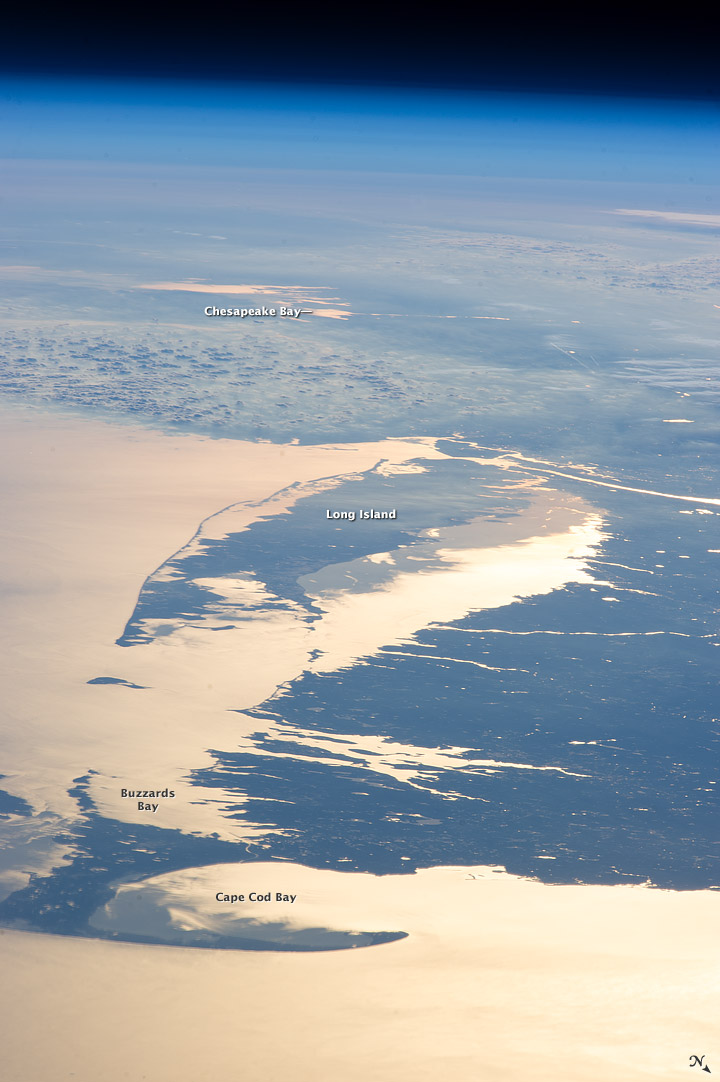
Buzzards Bay is a bay of the Atlantic Ocean adjacent to the U.S. state of Massachusetts. It is approximately 28 miles (45 kilometers) long by 8 miles (12 kilometers) wide. It is a popular destination for fishing, boating, and tourism. Since 1914, Buzzards Bay has been connected to Cape Cod Bay by the Cape Cod Canal. In 1988, under the Clean Water Act, the Environmental Protection Agency and the Commonwealth of Massachusetts designated Buzzards Bay to the National Estuary Program, as "an estuary of national significance" that is threatened by pollution, land development, or overuse. Geography It is surrounded by the Elizabeth Islands on the south, by Cape Cod on the east, and the southern coasts of Bristol and Plymouth counties in Massachusetts to the northwest. To the southwest, the bay is connected to Rhode Island Sound. The city of New Bedford, Massachusetts is a historically significant port on Buzzards Bay; it was the world's most successful whaling port during the ... [...More Info...] [...Related Items...] OR: [Wikipedia] [Google] [Baidu] |
Roundabout
A roundabout is a type of circular intersection or junction in which road traffic is permitted to flow in one direction around a central island, and priority is typically given to traffic already in the junction.''The New Shorter Oxford English Dictionary,'' Volume 2, Clarendon Press, Oxford (1993), page 2632 Engineers use the term modern roundabout to refer to junctions installed after 1960 that incorporate various design rules to increase safety. Both modern and non-modern roundabouts, however, may bear street names or be identified colloquially by local names such as rotary or traffic circle. Compared to stop signs, traffic signals, and earlier forms of roundabouts, modern roundabouts reduce the likelihood and severity of collisions greatly by reducing traffic speeds and minimizing T-bone and head-on collisions. Variations on the basic concept include integration with tram or train lines, two-way flow, higher speeds and many others. For pedestrians, traffic exiting th ... [...More Info...] [...Related Items...] OR: [Wikipedia] [Google] [Baidu] |
Partial Cloverleaf Interchange
A partial cloverleaf interchange or parclo is a modification of a cloverleaf interchange. The design has been well received, and has since become one of the most popular freeway-to-arterial interchange designs in North America. It has also been used occasionally in some European countries, such as Germany, Hungary, Italy, the Netherlands, and the United Kingdom. Comparison with other interchanges *A diamond interchange has four ramps. *A cloverleaf interchange has eight ramps, as does a stack interchange. They are fully grade separated, unlike a parclo, and have traffic flow without stops on all ramps and throughways. *A parclo generally has either four or six ramps but less commonly has five ramps. Naming In Ontario, the specific variation is identified by a letter/number suffix after the name. Ontario's naming conventions are used in this article. The letter ''A'' designates that two ramps meet the freeway ''ahead'' of the arterial road, while ''B'' designates that two ram ... [...More Info...] [...Related Items...] OR: [Wikipedia] [Google] [Baidu] |
Falmouth (CDP), Massachusetts
Falmouth is a census-designated place (CDP) consisting of the primary settlement in the town of Falmouth in Barnstable County, Massachusetts, United States. The population of the CDP was 3,799 at the 2010 census, out of 31,532 in the town as a whole. It was named after Falmouth, Cornwall, England. Geography Falmouth CDP is located in the southern part of Falmouth town at (41.548504, -70.604842). It is bordered to the east by the Teaticket CDP and to the south by Vineyard Sound. Woods Hole is to the southwest, and West Falmouth is to the northwest. Massachusetts Route 28 (Palmer Avenue and Main Street) is the main road through the community. According to the United States Census Bureau, the CDP has a total area of . of it is land, and of it (7.50%) is water. Demographics As of the census of 2000, there were 4,115 people, 2,125 households, and 988 families residing in the CDP. The population density was 767.5/km2 (1,992.5/mi2). There were 3,088 housing units at an average ... [...More Info...] [...Related Items...] OR: [Wikipedia] [Google] [Baidu] |
New Silver Beach
New Silver Beach is a beach and village of the same name. It is primarily a summer colony and is the largest settlement at Wild Harbor, a natural bay on the north shore of Buzzards Bay. It is located on Massachusetts's famous Cape Cod in the census-designated place (CDP) of North Falmouth, in the town of Falmouth, Massachusetts. The area was first settled in 1893 as a seasonal seaside resort for the growing upper middle class of Boston, Massachusetts. History The original planned settlement was first constructed in 1893 as sea bathing was gaining widespread popularity in Europe and the United States. The first street pattern resembled a star with four avenues radiating out from the waterfront intersection of Ocean View Avenue and Moses Road (then called Beach Road). Building proved profitable for developers and by 1898 Joseph Dahlburg and his Silver Beach Water Company had laid out the plans for New Silver Heights, an expansion of development in the area of higher elevation t ... [...More Info...] [...Related Items...] OR: [Wikipedia] [Google] [Baidu] |
Traffic Circle
A roundabout is a type of circular intersection (road), intersection or junction in which road traffic is permitted to flow in one direction around a central island, and priority is typically given to traffic already in the junction.''The New Shorter Oxford English Dictionary,'' Volume 2, Clarendon Press, Oxford (1993), page 2632 Engineers use the term modern roundabout to refer to junctions installed after 1960 that incorporate various design rules to increase safety. Both modern and non-modern roundabouts, however, may bear street names or be identified colloquially by local names such as rotary or traffic circle. Compared to stop signs, traffic signals, and earlier forms of roundabouts, modern roundabouts reduce the likelihood and severity of collisions greatly by reducing traffic speeds and minimizing Side collision#Broadside or T-bone collision, T-bone and head-on collisions. Variations on the basic concept include integration with tram or train lines, two-way flow, hi ... [...More Info...] [...Related Items...] OR: [Wikipedia] [Google] [Baidu] |
Mashpee Commons
Mashpee Commons is located in Mashpee, Massachusetts, United States. It is an open-air shopping center that is built in the style of New England town centers. It is world-renowned, winning many awards and recognitions over the years because of its style. History Early years Mashpee Commons originally started out in the 1960s as any other shopping center would. Then, it was known as the New Seabury Shopping Center. There was originally of retail floor area and a large, asphalt parking lot in front of it. The food store evolved into a Star Market over time until it was eventually closed around 2006 and divided up into shops. The theater lived on into today's Regal Cinemas. Transformation In 1986, the shopping center was bought and redeveloped over the years into Mashpee Commons. The original building at the site took place in the Stop & Shop section of the development, the east side of Route 151. Areas fronting 151 also were part of the original development. Over the years the o ... [...More Info...] [...Related Items...] OR: [Wikipedia] [Google] [Baidu] |
Bourne, Massachusetts
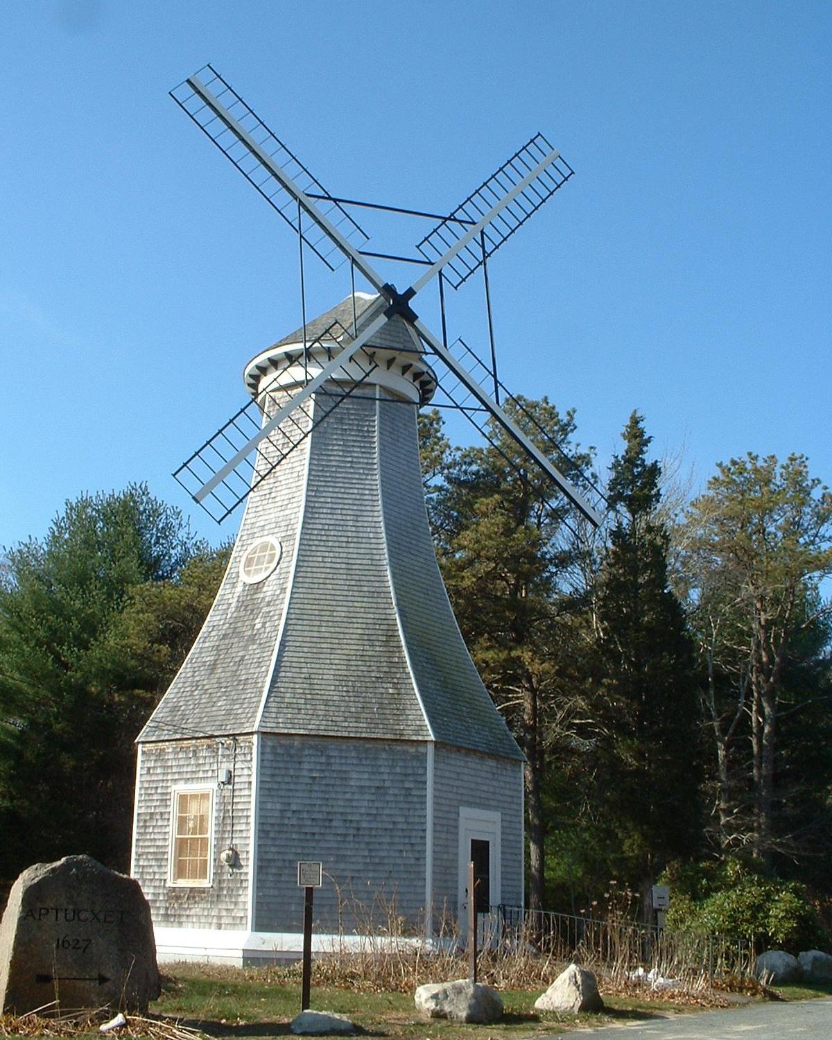
Bourne ( ) is a town in Barnstable County, Massachusetts, United States. The population was 20,452 at the 2020 census. For geographic and demographic information on specific parts of the town of Bourne, please see the articles on Bourne (CDP), Buzzards Bay, Monument Beach, Pocasset, Sagamore, and Sagamore Beach. History Bourne was first settled in 1640 by Ezra Perry as a part of the town of Sandwich. Prior to its separation from Sandwich, the area was referred to as West Sandwich. It was officially incorporated in 1884, the last town to be incorporated in Barnstable County. It was named for Jonathan Bourne Sr. (1811–1889), whose ancestor Richard Bourne represented Sandwich in the first Massachusetts General Court and was the first preacher to the Mashpee Wampanoag on Cape Cod. The town lies at the northeast corner of Buzzards Bay and is the site of Aptucxet Trading Post, the nation's oldest store. It was founded by the Pilgrims in 1627 at a site halfway between the two riv ... [...More Info...] [...Related Items...] OR: [Wikipedia] [Google] [Baidu] |
Freeway
A controlled-access highway is a type of highway that has been designed for high-speed vehicular traffic, with all traffic flow—ingress and egress—regulated. Common English terms are freeway, motorway and expressway. Other similar terms include '' throughway'' and '' parkway''. Some of these may be limited-access highways, although this term can also refer to a class of highways with somewhat less isolation from other traffic. In countries following the Vienna convention, the motorway qualification implies that walking and parking are forbidden. A fully controlled-access highway provides an unhindered flow of traffic, with no traffic signals, intersections or property access. They are free of any at-grade crossings with other roads, railways, or pedestrian paths, which are instead carried by overpasses and underpasses. Entrances and exits to the highway are provided at interchanges by slip roads (ramps), which allow for speed changes between the highway and arter ... [...More Info...] [...Related Items...] OR: [Wikipedia] [Google] [Baidu] |
Massachusetts Route 28A
Route 28 is a nominally south–north state highway in the U.S. state of Massachusetts, running from the town of Eastham via Boston to the New Hampshire state line in Methuen. Following the route from its nominally southern end, Route 28 initially heads south to the town of Chatham then turns west to follow along the south shore of Cape Cod. In Falmouth, Route 28 turns north and continues through the western part of Plymouth County and the eastern part of Norfolk County; it then passes through downtown Boston before heading north via Lawrence to the New Hampshire state line, where it continues as New Hampshire Route 28. Route 28 was originally formed as a New England interstate route established in 1922 to run from Buzzards Bay to New Hampshire. The route itself was overlaid on several early turnpike roads constructed in the early 19th century. Except for an extension into Cape Cod in 1926, the overall highway layout and routing is largely unchanged from its original de ... [...More Info...] [...Related Items...] OR: [Wikipedia] [Google] [Baidu] |
Mashpee, Massachusetts
Mashpee ( wam, Mâseepee) is a town in Barnstable County, Massachusetts, United States, on Cape Cod. The population was 15,060 as of 2020. The town is the site of the headquarters and most members of the Mashpee Wampanoag Tribe, one of two federally recognized Wampanoag groups. For geographic and demographic information on specific parts of the town of Mashpee, please see the articles on Mashpee Neck, Monomoscoy Island, New Seabury, Popponesset, Popponesset Island, Seabrook, and Seconsett Island. History Cape Cod was occupied for more than ten thousand years by indigenous peoples. The historic Algonquian-speaking Wampanoag were the native people encountered by the English colonists here and in the area of the Massachusetts Bay Colony in the seventeenth century. The Wampanoag also controlled considerable coastal area. These two cultures would interact, shaping each other for decades. After English colonists arrived, they began to settle the area of present-day Mashpe ... [...More Info...] [...Related Items...] OR: [Wikipedia] [Google] [Baidu] |


