|
Massachusetts Route 133
Route 133 is a east–west Massachusetts state route that runs from Route 38 and Route 110 in Lowell to Route 127 in Gloucester. Route description Route 133 begins at the junction of Route 38 and Route 110 in Lowell, where Route 110 begins a concurrency with Route 38 northbound. Route 133 heads east from this point, heading through the northern end of Tewksbury, where it has a junction with I-495 at Exit 94. Shortly after crossing the highway, Route 133 enters Essex County and the town of Andover. In Andover, Route 133 crosses I-93 at Exit 39 and continues eastward, bypassing the town center to the north as it crosses Route 28 in Shawsheen Village. From Shawsheen Village, Route 133 heads northward into North Andover, where the road crosses Route 114 (the Salem Turnpike) just north of Merrimack College. It then joins Route 125 for a concurrency that lasts for . The two routes split next to Lawrence Municipal Airport, with Route 133 passing the northern banks of L ... [...More Info...] [...Related Items...] OR: [Wikipedia] [Google] [Baidu] |
Massachusetts Department Of Transportation
The Massachusetts Department of Transportation (MassDOT) oversees roads, public transit, aeronautics, and transportation licensing and registration in the US state of Massachusetts. It was created on November 1, 2009, by the 186th Session of the Massachusetts General Court upon enactment of the ''2009 Transportation Reform Act.'' History In 2009, Governor Deval Patrick proposed merging all Massachusetts transportation agencies into a single Department of Transportation. Legislation consolidating all of Massachusetts' transportation agencies into one organization was signed into law on June 26, 2009. The newly established Massachusetts Department of Transportation (MASSDOT) assumed operations from the existing conglomeration of state transportation agencies on November 1, 2009. This change included: * Creating the Highway Division from the former Massachusetts Turnpike Authority and Massachusetts Highway Department, MassHighways. * Assuming responsibility for the planning and ... [...More Info...] [...Related Items...] OR: [Wikipedia] [Google] [Baidu] |
Massachusetts Route 28
Route 28 is a nominally south–north state highway in the U.S. state of Massachusetts, running from the town of Eastham via Boston to the New Hampshire state line in Methuen. Following the route from its nominally southern end, Route 28 initially heads south to the town of Chatham then turns west to follow along the south shore of Cape Cod. In Falmouth, Route 28 turns north and continues through the western part of Plymouth County and the eastern part of Norfolk County; it then passes through downtown Boston before heading north via Lawrence to the New Hampshire state line, where it continues as New Hampshire Route 28. Route 28 was originally formed as a New England interstate route established in 1922 to run from Buzzards Bay to New Hampshire. The route itself was overlaid on several early turnpike roads constructed in the early 19th century. Except for an extension into Cape Cod in 1926, the overall highway layout and routing is largely unchanged from its original de ... [...More Info...] [...Related Items...] OR: [Wikipedia] [Google] [Baidu] |
Newburyport/Rockport Line
The Newburyport/Rockport Line is a branch of the MBTA Commuter Rail system, running northeast from downtown Boston, Massachusetts towards Cape Ann and the Merrimack Valley, serving the North Shore. The first leg, operating via the Eastern Route of the former Boston and Maine Railroad, serves Chelsea, Lynn, Swampscott, Salem, and Beverly. From there, a northern branch continues via the Eastern Route to serve Hamilton, Ipswich, Rowley, and Newburyport, while other trains operate east from Beverly via the Gloucester Branch, serving Manchester, Gloucester, and Rockport. A bicycle coach is offered on the Rockport branch during the summer. With over 11,000 daily riders in October 2022, the line is the second-busiest on the system. History The Eastern Route main line between Boston and Portsmouth, New Hampshire opened in 1836 as the Eastern Railroad. Ferries were used to transport passengers between the East Boston terminal and Boston proper. The line was extended to Portlan ... [...More Info...] [...Related Items...] OR: [Wikipedia] [Google] [Baidu] |
Ipswich, Massachusetts
Ipswich is a coastal town in Essex County, Massachusetts, United States. The population was 13,785 at the 2020 census. Home to Willowdale State Forest and Sandy Point State Reservation, Ipswich includes the southern part of Plum Island. A residential community with a vibrant tourism industry, the town is famous for its clams, celebrated annually at the Ipswich Chowderfest, and for Crane Beach, a barrier beach near the Crane estate. Ipswich was incorporated as a town in 1634. History Ipswich was founded by John Winthrop the Younger, son of John Winthrop, one of the founders of the Massachusetts Bay Colony in 1630 and its first governor, elected in England in 1629. Several hundred colonists sailed from England in 1630 in a fleet of 11 ships, including Winthrop's flagship, the ''Arbella''. Investigating the region of Salem and Cape Ann, they entertained aboard the ''Arbella'' for a day, June 12, 1630, a native chief of the lands to the north, Chief Masconomet. The event was record ... [...More Info...] [...Related Items...] OR: [Wikipedia] [Google] [Baidu] |
Massachusetts Route 1A
Route 1A is a north–south state highway in Massachusetts. It is an alternate route to U.S. 1 with three signed sections and two unsigned sections where the highway is concurrent with its parent. Due to the reconfiguration of tunnel interchanges brought on by the completion of the Big Dig, Route 1A is discontinuous in the downtown Boston area. Vehicles entering Downtown Boston via the Sumner Tunnel must take I-93 north to the exit for Government Center and make a U-turn to access the entrance ramp to I-93 south (which silently carries Route 1A south as well) and vice versa. Route description Rhode Island border to Attleboro A short segment of Route 1A, in length, in Attleboro runs from U.S. Route 1A at the Rhode Island border through a junction with Interstate 95, before heading north and merging with Route 1. The entire length of this segment is known as Newport Avenue. North Attleborough to Dedham This segment of Route 1A extends roughly north from North Attleborough ... [...More Info...] [...Related Items...] OR: [Wikipedia] [Google] [Baidu] |
Interstate 95 In Massachusetts
Interstate 95 (I-95) is a part of the Interstate Highway System that parallels the East Coast of the United States from Miami, Florida in the south to Houlton, Maine, in the north. In the U.S. state of Massachusetts, it spans along a north–south axis. It is the third-longest Interstate Highway in Massachusetts, behind I-90 (the Massachusetts Turnpike) and I-495, while I-95 in full is the longest north–south Interstate, and sixth-longest Interstate Highway in the United States. Its southern terminus within the state is located in Attleboro, where I-95 enters from Pawtucket, Rhode Island. It intersects with U.S. Route 1 (US 1) and the northern terminus of I-295 within Attleboro, I-495 in Mansfield, and US 1 in Sharon before arriving at an interchange with I-93, US 1, and Route 128 in Canton. At this interchange, I-95 begins running concurrently with US 1 and Route 128 along a beltway roughly outside of Boston. While earlier plans c ... [...More Info...] [...Related Items...] OR: [Wikipedia] [Google] [Baidu] |
Massachusetts Route 97
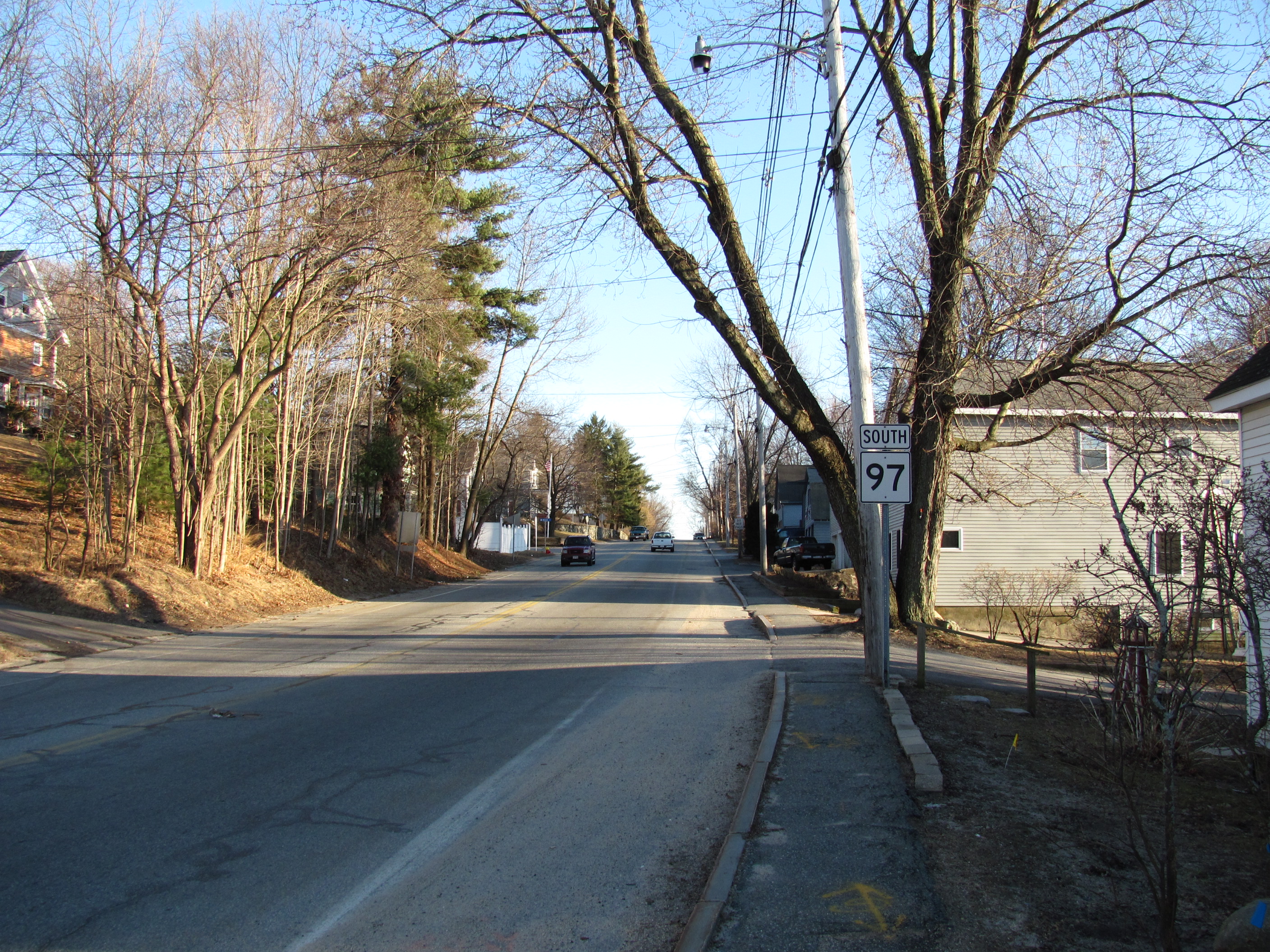
Route 97 is a south–north highway in Essex County in northeastern Massachusetts, United States. It connects the cities of Beverly and Haverhill before continuing into Salem, New Hampshire as New Hampshire Route 97. Route description Route 97 begins at Route 1A in Beverly, north of the downtown area. Almost immediately, it crosses under Route 128 without intersection; the nearest exit is Exit 45 (formerly 20) to Route 1A. Route 97 passes the Beverly Municipal Airport before crossing into Wenham. Route 97 passes through the western end of town, passing the Ipswich River Wildlife Sanctuary before meeting the northern end of Route 35 in Topsfield, just over the town lines of Wenham and Danvers. Once in Topsfield, Route 97 crosses the Ipswich River just east of the Topsfield Fairgrounds. It crosses U.S. Route 1 (the Newburyport Turnpike) before heading into the center of town. From there, it continues northward, entering the town of Boxford. Route 97 passes throu ... [...More Info...] [...Related Items...] OR: [Wikipedia] [Google] [Baidu] |
Haverhill, Massachusetts
Haverhill ( ) is a city in Essex County, Massachusetts, United States. Haverhill is located 35 miles north of Boston on the New Hampshire border and about 17 miles from the Atlantic Ocean. The population was 67,787 at the 2020 United States Census. Located on the Merrimack River, Haverhill began as a farming community of Puritans, largely from Newbury Plantation. The land was officially purchased from the Pentuckets on November 15, 1642 (One year after incorporation) for three pounds, and ten shillings. Pentucket was renamed Haverhill (after the Ward family's hometown in England) and evolved into an important industrial center, beginning with sawmills and gristmills run by water power. In the 18th and 19th century, Haverhill developed woolen mills, tanneries, shipping and shipbuilding. The town was home to a significant shoe-making industry for many decades. By the end of 1913, one tenth of the shoes produced in the United States were made in Haverhill, and because of this the ... [...More Info...] [...Related Items...] OR: [Wikipedia] [Google] [Baidu] |
Lake Cochichewick
Lake Cochichewick is a lake in North Andover, Massachusetts that collects water from Weir Hill and other local uplands. Its overflow drains into the Cochichewick River, which joins the Merrimack. Brooks School, a private co-educational prep school, is located on the shores of the lake. Etymology The name for Lake Cochichewick reportedly comes from the Pennacook word for "dashing stream" or "place of the great cascade" and during the early years of Andover it was called "The Great Pond". Public access restrictions For the past century, Lake Cochichewick has been North Andover's main supply of drinking water and public access to the lake was forbidden. In May 2002, however, the town began issuing boating permits: Certain watercraft are allowed and must be designed to be manually propelled, by oars or paddles. Rowing shells, johnboats, dinghies, rowboats, canoes and kayaks are acceptable as long as the occupants are isolated from contact with the lake. Boats must not have any ... [...More Info...] [...Related Items...] OR: [Wikipedia] [Google] [Baidu] |
Lawrence Municipal Airport (Massachusetts)
Lawrence Municipal Airport is two miles east of Lawrence, in Essex County, Massachusetts, United States. It is owned by the City of Lawrence, though it is in North Andover. Northeast DC-3s stopped at Lawrence from 1946 to 1965; from 1952 to 1960, it rated nonstops to New York La Guardia. The airport is home to the Essex County Composite Squadron of the Civil Air Patrol. Facilities The airport covers and has two paved runways: 5/23 is 4,997 x 150 ft (1,524 x 46 m) and 14/32 is 3,901 x 100 ft (1,189 x 30 m). Fuel is offered by four fixed-base operators. In the year ending September 1, 2006 the airport had 83,200 aircraft operations, average 227 per day: 85% general aviation, 13% air taxi, 1% military. 234 aircraft are based at the airport: 86% single-engine, 11% multi-engine, 2% helicopter and <1% jet. Aviation services * |
Massachusetts Route 125
Route 125 is an north–south Massachusetts state route. It runs from Interstate 93 in Wilmington to the Massachusetts-New Hampshire state line in Haverhill, where it continues as New Hampshire Route 125 through Plaistow to Wakefield, New Hampshire. After the first , which are in Middlesex County, the rest of the route passes through Essex County. Route description Route 125 begins at I-93, at exit 35 (formerly 41), just south of where I-93 drops from four lanes to three. It passes through an area of industrial parks before clipping the northwest corner of North Reading and entering Andover. Once in Andover, the road serves as a bypass road around much of Andover's busier sections. It intersects Route 28 with a cloverleaf interchange as it bends northward through town. The route then enters North Andover, becoming concurrent with Route 114 for half a mile as the two routes pass Merrimack College. Route 125 then splits northward, becoming concurrent with Route 133 ... [...More Info...] [...Related Items...] OR: [Wikipedia] [Google] [Baidu] |


.jpg)


