|
Marsdiep
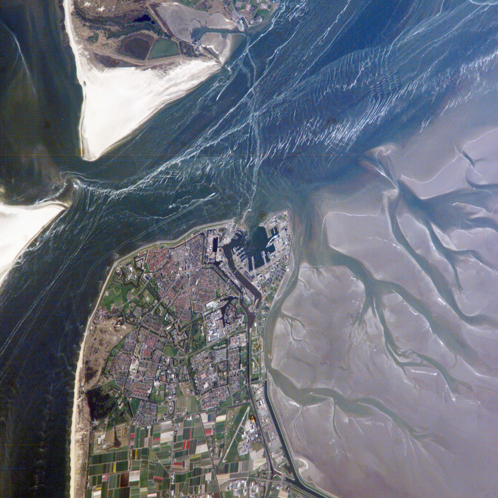
The Marsdiep is a deep tide-race between Den Helder and Texel in the Netherlands, and running southwards between sandbanks. That gap connects the North Sea and the Waddenzee. Around 1000 AD and before, much of the modern Waddenzee and IJsselmeer was land and the Marsdiep was an ordinary brook. An early form of its name is Maresdeop, a name probably related to modern Dutch ''moerasdiep'' ("swamp deep"). During the All Saints' Flood of 1170, the sea broke through the original dune barrier and created the channel. The ''Marsdiep'' was in the age of sail The Age of Sail is a periodization, period that lasted at the latest from the mid-16th century, 16th (or mid-15th century, 15th) to the mid-19th century, 19th centuries, in which the dominance of sailing ships in globalization, global trade and ... in English called ''the'' Texel, in distinction from the island of Texel. Straits of the Netherlands Texel Den Helder {{NorthHolland-geo-stub ... [...More Info...] [...Related Items...] OR: [Wikipedia] [Google] [Baidu] |
Den Helder
Den Helder () is a municipality and a city in the Netherlands, in the province of North Holland. Den Helder occupies the northernmost point of the North Holland peninsula. It is home to the country's main naval base. From here the Royal TESO ferryboat service operates the transportation link between Den Helder and the nearby Dutch Wadden island of Texel to the north. Etymology Before the year 1928 the official name of Den Helder was Helder. The origin of the name Helder is not entirely clear. The name Helder may have come from ''Helle/Helde'', which means "hill" or "hilly grounds", or from ''Helre'', which means a sandy ridge. Another explanation is that the name derived from ''Helsdeur'' (Hell's Door), likely because in the water between Den Helder and Texel (called Marsdiep) the current was so strong that many ships were lost. History Huisduinen was the original older part of the city, whereas Helder itself was a nearby smaller hamlet. When a harbour was built near ... [...More Info...] [...Related Items...] OR: [Wikipedia] [Google] [Baidu] |
Waddenzee
The Wadden Sea ( nl, Waddenzee ; german: Wattenmeer; nds, Wattensee or ; da, Vadehavet; fy, Waadsee, longname=yes; frr, di Heef) is an intertidal zone in the southeastern part of the North Sea. It lies between the coast of northwestern continental Europe and the range of low-lying Frisian Islands, forming a shallow body of water with tidal flats and wetlands. It has a high biological diversity and is an important area for both breeding and migrating birds. In 2009, the Dutch and German parts of the Wadden Sea were inscribed on UNESCO's World Heritage List and the Danish part was added in June 2014. The Wadden Sea stretches from Den Helder, in the northwest of the Netherlands, past the great river estuaries of Germany to its northern boundary at Skallingen in Denmark along a total coastline of some and a total area of about . Within the Netherlands, it is bounded from the IJsselmeer by the Afsluitdijk. Historically, the coastal regions were often subjected to large floods ... [...More Info...] [...Related Items...] OR: [Wikipedia] [Google] [Baidu] |
Texel
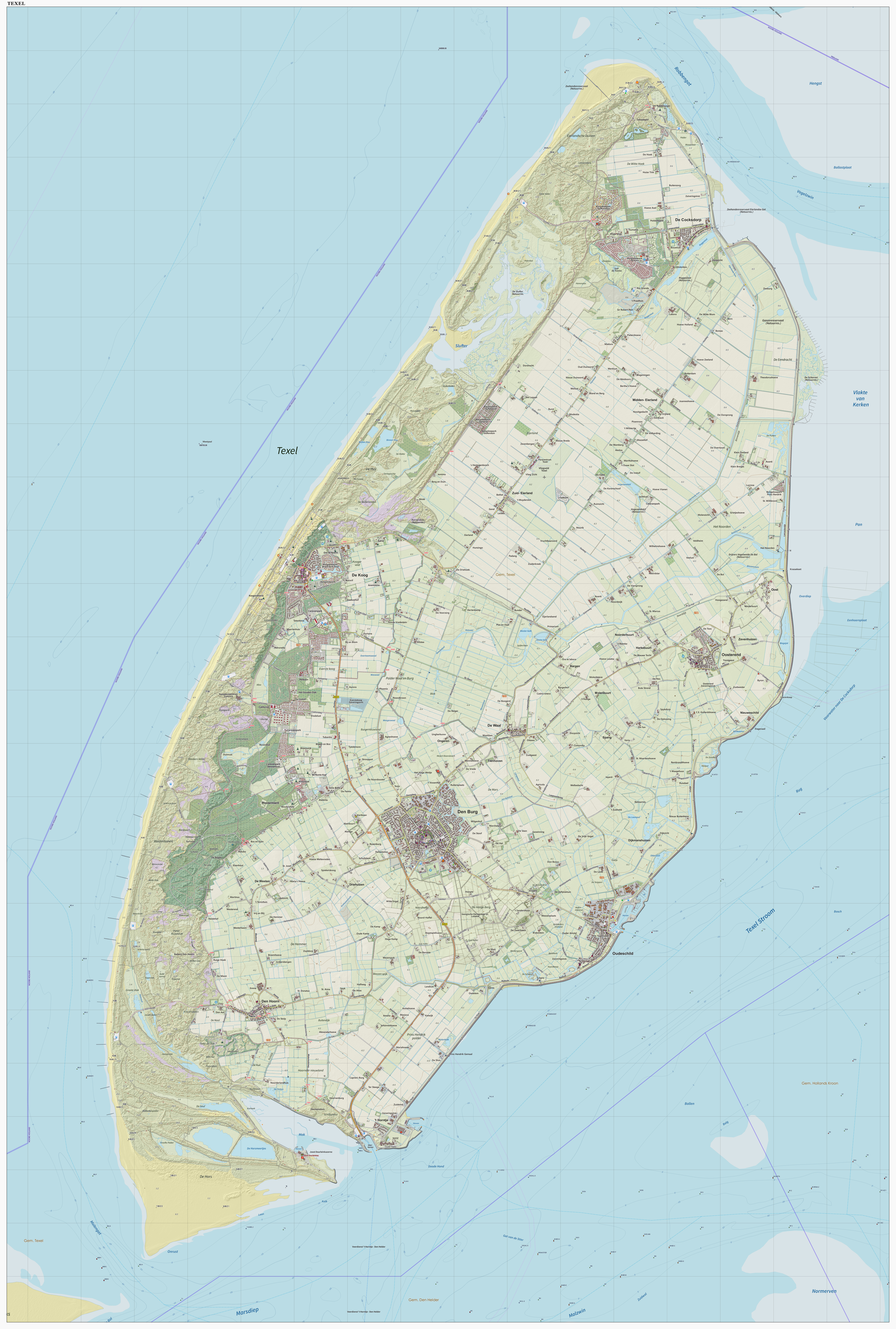
Texel (; Texels dialect: ) is a municipality and an island with a population of 13,643 in North Holland, Netherlands. It is the largest and most populated island of the West Frisian Islands in the Wadden Sea. The island is situated north of Den Helder, northeast of Noorderhaaks, and southwest of Vlieland. Name The name ''Texel'' is Frisian, but because of historical sound-changes in Dutch, where all -x- sounds have been replaced with -s- sounds (compare for instance English ''fox'', Frisian ''fokse'', German ''Fuchs'' with Dutch ''vos''), the name is typically pronounced ''Tessel'' in Dutch. History The All Saints' Flood (1170) created the islands of Texel and Wieringen from North Holland. In the 13th century Ada, Countess of Holland was held prisoner on Texel by her uncle, William I, Count of Holland. Texel received city rights in 1415. The first Dutch expedition to the Northwest Passage departed from the island on the 5th of June, 1594. Texel was involved i ... [...More Info...] [...Related Items...] OR: [Wikipedia] [Google] [Baidu] |
NASA 20070501 Den Helder NL
The National Aeronautics and Space Administration (NASA ) is an independent agency of the US federal government responsible for the civil space program, aeronautics research, and space research. NASA was established in 1958, succeeding the National Advisory Committee for Aeronautics (NACA), to give the U.S. space development effort a distinctly civilian orientation, emphasizing peaceful applications in space science. NASA has since led most American space exploration, including Project Mercury, Project Gemini, the 1968-1972 Apollo Moon landing missions, the Skylab space station, and the Space Shuttle. NASA supports the International Space Station and oversees the development of the Orion spacecraft and the Space Launch System for the crewed lunar Artemis program, Commercial Crew spacecraft, and the planned Lunar Gateway space station. The agency is also responsible for the Launch Services Program, which provides oversight of launch operations and countdown m ... [...More Info...] [...Related Items...] OR: [Wikipedia] [Google] [Baidu] |
North Sea
The North Sea lies between Great Britain, Norway, Denmark, Germany, the Netherlands and Belgium. An epeiric sea on the European continental shelf, it connects to the Atlantic Ocean through the English Channel in the south and the Norwegian Sea in the north. It is more than long and wide, covering . It hosts key north European shipping lanes and is a major fishery. The coast is a popular destination for recreation and tourism in bordering countries, and a rich source of energy resources, including wind and wave power. The North Sea has featured prominently in geopolitical and military affairs, particularly in Northern Europe, from the Middle Ages to the modern era. It was also important globally through the power northern Europeans projected worldwide during much of the Middle Ages and into the modern era. The North Sea was the centre of the Vikings' rise. The Hanseatic League, the Dutch Republic, and the British each sought to gain command of the North Sea and access ... [...More Info...] [...Related Items...] OR: [Wikipedia] [Google] [Baidu] |
IJsselmeer
The IJsselmeer (; fy, Iselmar, nds-nl, Iesselmeer), also known as Lake IJssel in English, is a closed off inland bay in the central Netherlands bordering the provinces of Flevoland, North Holland and Friesland. It covers an area of with an average depth of . The river IJssel flows into the IJsselmeer. History Two thousand years ago Pomponius Mela, a Roman geographer, mentioned a complex of lakes at the current location of the IJsselmeer. He called it '' Lacus Flevo''. Over the centuries, the lake banks crumbled away due to flooding and wave action and the lake, now called the Almere, grew considerably. During the 12th and 13th centuries, storm surges and rising sea levels flooded large areas of land between the lake and the North Sea, turning the lake into a bay of the North Sea, called the Zuiderzee. The Zuiderzee continued to be a threat to the Dutch, especially when northwesterly storms funnel North Sea waters towards the English Channel, creating very high tides ... [...More Info...] [...Related Items...] OR: [Wikipedia] [Google] [Baidu] |
All Saints' Flood (1170)
The All Saints' Flood of 1170 (Allerheiligenvloed) was a catastrophic flood in the Netherlands that took place in 1170. Large parts of the Northern Netherlands, and Holland territories were overflowed. The flooding North Sea created the islands of Wieringen and Texel. Lake Flevo was once a fresh water lake, but . The Creiler Woods vanished under the waves. The sea area increased inside the Netherlands and large peat areas developed, which were easily washed away. The flood rendered the settlement of Rotta (the predecessor of Rotterdam) uninhabitable, and marked the beginning of Amsterdam, where the area gained an open connection to the sea, and where a dam was built in the Amstel The Amstel () is a river in the province of North Holland in the Netherlands. It flows from the Aarkanaal and Drecht in Nieuwveen northwards, passing Uithoorn, Amstelveen, and Ouderkerk aan de Amstel, to the IJ in Amsterdam. Annually, the ... to protect the land from future floods. See also ... [...More Info...] [...Related Items...] OR: [Wikipedia] [Google] [Baidu] |
Age Of Sail
The Age of Sail is a periodization, period that lasted at the latest from the mid-16th century, 16th (or mid-15th century, 15th) to the mid-19th century, 19th centuries, in which the dominance of sailing ships in globalization, global trade and warfare culminated, particularly marked by the introduction of Naval artillery in the Age of Sail, naval artillery, and ultimately reached its highest extent at the advent of the analogue Steam power during the Industrial Revolution, Age of Steam. Enabled by the advances of the related Maritime history#Age of Navigation, Age of Navigation, it is identified as a distinctive element of the early modern period and the Age of Discovery. Especially in context of the latter, it refers to a more particular Eurocentric Age of Sail, while generally the Age of Sail is the culminating period of a long intercontinental Sailing#History, history of sailing. Periodization Like most History by period, periodic eras, the definition is inexact but instead ... [...More Info...] [...Related Items...] OR: [Wikipedia] [Google] [Baidu] |
Straits Of The Netherlands
A strait is an oceanic landform connecting two seas or two other large areas of water. The surface water generally flows at the same elevation on both sides and through the strait in either direction. Most commonly, it is a narrow ocean channel that lies between two land masses. Some straits are not navigable, for example because they are either too narrow or too shallow, or because of an unnavigable reef or archipelago. Straits are also known to be loci for sediment accumulation. Usually, sand-size deposits occur on both the two opposite strait exits, forming subaqueous fans or deltas. Terminology The terms '' channel'', ''pass'', or ''passage'' can be synonymous and used interchangeably with ''strait'', although each is sometimes differentiated with varying senses. In Scotland, ''firth'' or ''Kyle'' are also sometimes used as synonyms for strait. Many straits are economically important. Straits can be important shipping routes and wars have been fought for control of ... [...More Info...] [...Related Items...] OR: [Wikipedia] [Google] [Baidu] |


