|
Mantšonyane Airport
Mantšonyane Airport is an airport serving the town of Mantšonyane in Thaba-Tseka District, Lesotho. The runway is on a low ridge in a dry oxbow off the Mantšonyane River. There is a hill at the north end of the runway, and higher terrain in all quadrants. The Maseru VOR-DME (Ident: MZV) is west of the airport. See also * *Transport in Lesotho *List of airports in Lesotho This is a list of airports in Lesotho, sorted by location. __TOC__ List Airport names that are indicated in bold indicate that the facility has scheduled service on commercial airlines. * not officially identified by ICAO See also * Tran ... References External links OpenStreetMap - Mantsonyane* * Google Earth Airports in Lesotho {{Lesotho-airport-stub ... [...More Info...] [...Related Items...] OR: [Wikipedia] [Google] [Baidu] |
Mantšonyane
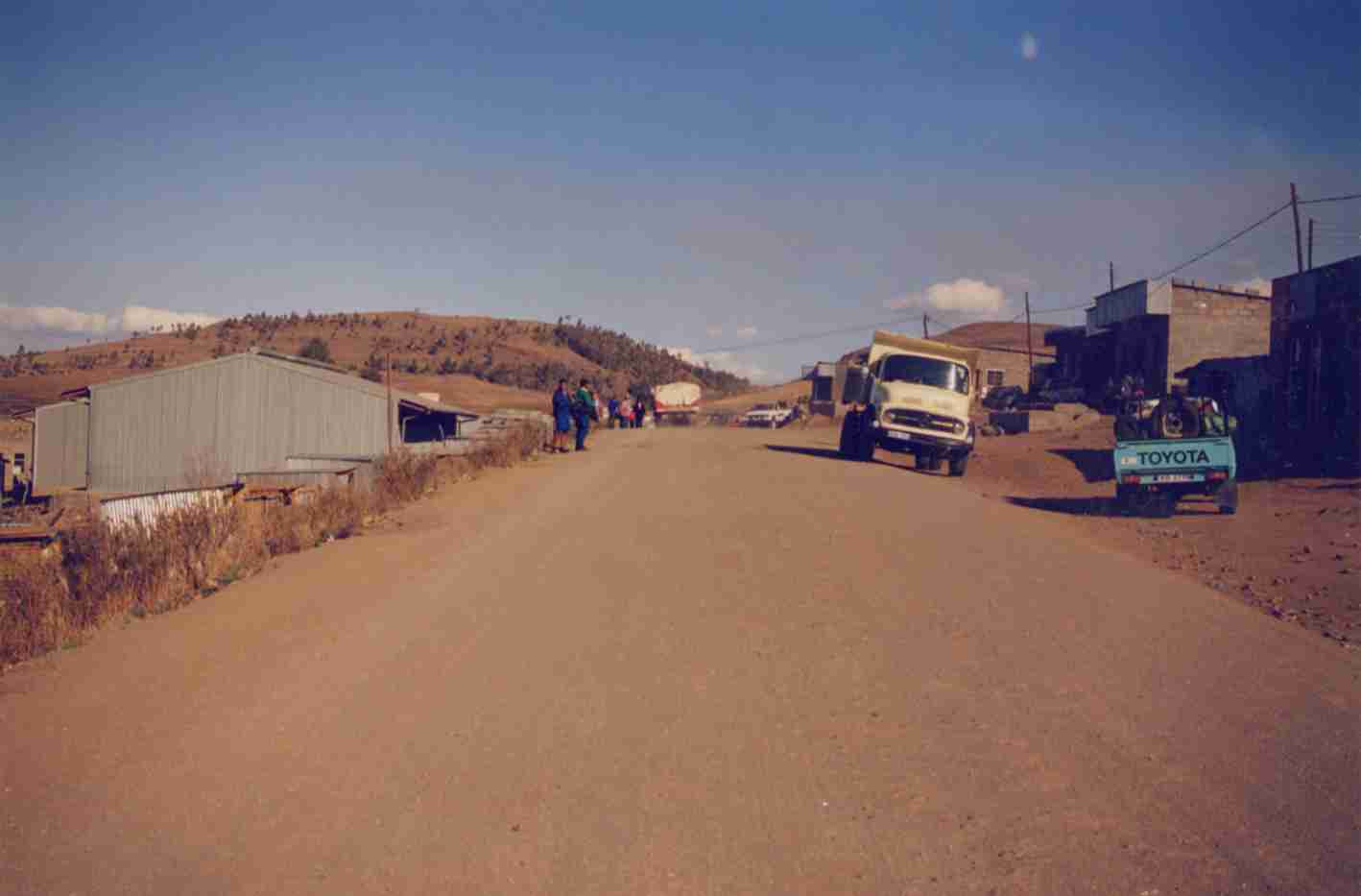
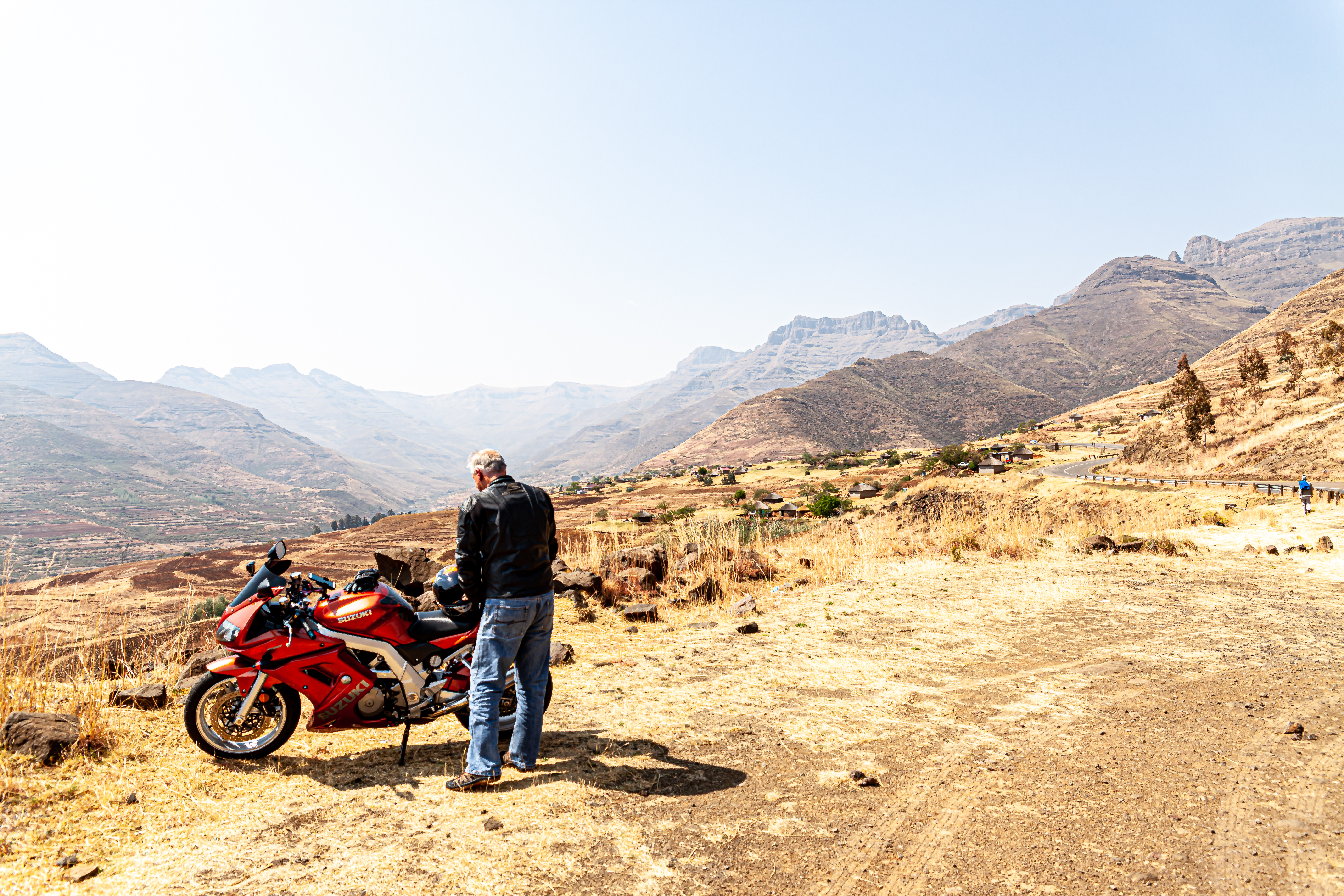
Mantšonyane is a town in central Lesotho. It is located southeast of the capital Maseru, close to the western approach to the Mokhoabong Pass, on a high mountain plateau between the towns of Marakabei and Thaba-Tseka, in the Thaba-Tseka District. Located on the central mountain plateau of Lesotho, Mantšonyane is difficult to reach by ground transport. In the official biography of Archbishop Desmond Tutu, who was the Bishop of Lesotho in the late 1970s, the difficulty of travel around the mountainous central region of Lesotho is illustrated by a detailed account of the Bishop's journey from his official residence in Maseru to St James's Hospital in Mantšonyane. St James' Hospital and regional health care In 1963 the Anglican Church opened, through its USPG mission agency, a mission hospital in Mantšonyane. St James' Hospital has grown significantly and is now a major feature of the community. In addition to providing full hospital facilities (with 60 beds) to local residents, ... [...More Info...] [...Related Items...] OR: [Wikipedia] [Google] [Baidu] |
Lesotho
Lesotho ( ), officially the Kingdom of Lesotho, is a country landlocked country, landlocked as an Enclave and exclave, enclave in South Africa. It is situated in the Maloti Mountains and contains the Thabana Ntlenyana, highest mountains in Southern Africa. It has an area of over and has a population of about million. It was previously the British Crown colony of Basutoland, which declared independence from the United Kingdom on 4 October 1966. It is a fully sovereign state and is a member of the United Nations, the Commonwealth of Nations, the African Union, and the Southern African Development Community. The name ''Lesotho'' roughly translates to "land of the Sotho". History Basutoland Basutoland emerged as a single body politic, polity under King Moshoeshoe I in 1822. Moshoeshoe, a son of Mokhachane, a minor tribal chief, chief of the Bakoteli lineage, formed his own clan and became a chief around 1804. Between 1820 and 1823, he and his followers settled at the Buth ... [...More Info...] [...Related Items...] OR: [Wikipedia] [Google] [Baidu] |
Thaba-Tseka District
Thaba-Tseka is a district of Lesotho. Thaba-Tseka is also the name of the district's capital or camptown, which is the only town in the district. In the east, Thaba-Tseka borders on the KwaZulu-Natal Province of South Africa. Domestically, it borders on Mokhotlong District in northeast, Leribe District in north, Berea District in northwest, Maseru District in west, Mohale's Hoek District in southwest and Qacha's Nek District in the southern direction. The district is one of the major tourist attractions in Lesotho because of the second largest arch dam in Africa Katse Dam. As of 2016, the district had a population of 135,347 which was 6.92 per cent of the total population of the country. The total area of the district was 4,270 which was 14.07 per cent of the total area of the country. The density of population in the district was 30.00 per km2. As of 2008, there were 38 per cent economically active people in the district. There were totally 77,836 employed people out of a total of ... [...More Info...] [...Related Items...] OR: [Wikipedia] [Google] [Baidu] |
Meander
A meander is one of a series of regular sinuous curves in the channel of a river or other watercourse. It is produced as a watercourse erodes the sediments of an outer, concave bank ( cut bank) and deposits sediments on an inner, convex bank which is typically a point bar. The result of this coupled erosion and sedimentation is the formation of a sinuous course as the channel migrates back and forth across the axis of a floodplain. The zone within which a meandering stream periodically shifts its channel is known as a meander belt. It typically ranges from 15 to 18 times the width of the channel. Over time, meanders migrate downstream, sometimes in such a short time as to create civil engineering challenges for local municipalities attempting to maintain stable roads and bridges.Neuendorf, K.K.E., J.P. Mehl Jr., and J.A. Jackson, J.A., eds. (2005) ''Glossary of Geology'' (5th ed.). Alexandria, Virginia, American Geological Institute. 779 pp. Charlton, R., 2007. ''Fundamentals ... [...More Info...] [...Related Items...] OR: [Wikipedia] [Google] [Baidu] |
Mantšonyane River
Mantšonyane is a town in central Lesotho. It is located southeast of the capital Maseru, close to the western approach to the Mokhoabong Pass, on a high mountain plateau between the towns of Marakabei and Thaba-Tseka, in the Thaba-Tseka District. Located on the central mountain plateau of Lesotho, Mantšonyane is difficult to reach by ground transport. In the official biography of Archbishop Desmond Tutu, who was the Bishop of Lesotho in the late 1970s, the difficulty of travel around the mountainous central region of Lesotho is illustrated by a detailed account of the Bishop's journey from his official residence in Maseru to St James's Hospital in Mantšonyane. St James' Hospital and regional health care In 1963 the Anglican Church opened, through its USPG mission agency, a mission hospital in Mantšonyane. St James' Hospital has grown significantly and is now a major feature of the community. In addition to providing full hospital facilities (with 60 beds) to local residents, ... [...More Info...] [...Related Items...] OR: [Wikipedia] [Google] [Baidu] |
VOR-DME
In radio navigation, a VOR/DME is a radio beacon that combines a VHF omnidirectional range (VOR) with a distance-measuring equipment (DME). The VOR allows the receiver to measure its bearing to or from the beacon, while the DME provides the slant distance between the receiver and the station. Together, the two measurements allow the receiver to compute a position fix. The VOR system was first introduced in the 1930s, but didn't enter significant commercial use until the early 1950s. It became much more practical with the introduction of low-cost Solid state (electronics), solid state receivers in the 1960s. DME was a modification of World War II-era navigation systems like Gee-H, and began development in 1946. Like VOR, it only became practical with the introduction of solid state receivers during the 1960s. During the mid-1960s, ICAO began the process of introducing a standardized radio navigation system for medium-area coverage on the order of a few hundred kilometres. This ... [...More Info...] [...Related Items...] OR: [Wikipedia] [Google] [Baidu] |
Transport In Lesotho
This article concerns systems of transport in Lesotho. As a landlocked country, Lesotho has no seaports or harbours, but does have road, air transport, and limited rail infrastructure. Roads Prior to Lesotho's independence in 1966, the only paved road in the country was the Kingsway in the capital, Maseru, between the Mejametalana Airport and the Royal Palace. Since the early 1970s, the road infrastructure has been substantially developed. In 1999, Lesotho had a road network measuring at in length, of which were paved. The most weight has been given to connecting the district centres, but the roads within central Lesotho have also been improved, as part of the construction needs of the Lesotho Highlands Water Project. Railways The only railway line in Lesotho is the Maseru branch line, which connects the capital city Maseru to the Bloemfontein–Bethlehem line in the railway network of South Africa. The final of this line, which opened on 18 December 1905, lies within t ... [...More Info...] [...Related Items...] OR: [Wikipedia] [Google] [Baidu] |
List Of Airports In Lesotho ...
This is a list of airports in Lesotho, sorted by location. __TOC__ List Airport names that are indicated in bold indicate that the facility has scheduled service on commercial airlines. * not officially identified by ICAO See also * Transport in Lesotho * List of airports by ICAO code: F#FX - Lesotho * Wikipedia: WikiProject Aviation/Airline destination lists: Africa#Lesotho References * * External links * Lists of airports in Lesotho: *Great Circle Mapper**World Aero Data {{Africa in topic, List of airports in Lesotho Airports Airports Lesotho Lesotho ( ), officially the Kingdom of Lesotho, is a country landlocked country, landlocked as an Enclave and exclave, enclave in South Africa. It is situated in the Maloti Mountains and contains the Thabana Ntlenyana, highest mountains in Sou ... [...More Info...] [...Related Items...] OR: [Wikipedia] [Google] [Baidu] |

.jpg)

