|
Manitoba Highway 12
Provincial Trunk Highway 12 (PTH 12) is a provincial primary highway located in the Canadian province of Manitoba. It runs from the U.S. border (where it meets with Minnesota State Highway 313) to a dead end in Grand Beach. PTH 12 forms the Manitoba section of MOM's Way, a tourist route from Thunder Bay to Winnipeg.PTH 2-49 - Manitoba Highways PTH 12 is primarily a two-lane highway except for two four-lane stretch between Steinbach and PTH 1 (22 kilometres) and a ten-kilometre concurrency with PTH 44. [...More Info...] [...Related Items...] OR: [Wikipedia] [Google] [Baidu] |
Department Of Infrastructure (Manitoba)
Manitoba Transportation and Infrastructure () is the provincial government department responsible for managing infrastructure in Manitoba. It is in charge of "the development of transportation policy and legislation, and fthe management of the province’s vast infrastructure network." Manitoba Infrastructure was initially known as Public Works, which changed to Government Services in 1968, when the province expanded the department to include the provision of common services for other governmental departments. In 2016, the department name would be changed to its current one. The department operates under the oversight of the Minister of Transportation and Infrastructure (), currently Doyle Piwniuk, who was appointed to the portfolio on 18 January 2022 by the Progressive Conservative government of Heather Stefanson. Organization Manitoba Infrastructure oversees the provision of such services as property management, procurement, water bomber operations, air ambulance flights, fl ... [...More Info...] [...Related Items...] OR: [Wikipedia] [Google] [Baidu] |
Sprague, Manitoba
Sprague is a community within the Rural Municipality of Piney in the Canadian province of Manitoba. It is named after D.E. Sprague, a prominent Winnipeg lumber merchant. The community is located in the extreme southeast corner of the province near the Canada–United States border (Warroad–Sprague Border Crossing), at the junction of Manitoba Highway 12 and Provincial Road 308. The nearest major centres include Warroad and Thief River Falls, Minnesota; Fort Frances, Ontario; and Steinbach, Manitoba. Climate Sprague has a humid continental climate (Köppen ''Dfb'') with strong seasonal swings. Although winters are very cold, snowfall is normally not excessive compared to areas further east. Summer afternoons are warm and variable with cool nights. See also * Northwest Angle * Warroad–Sprague Border Crossing The Warroad–Sprague Border Crossing connects the city of Warroad, Minnesota and community of Sprague, Manitoba on the Canada–United States border. Minnesota State ... [...More Info...] [...Related Items...] OR: [Wikipedia] [Google] [Baidu] |
Zhoda, Manitoba
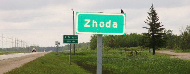
Zhoda is a community in southeastern Manitoba, Canada, approximately 20 km north of the town of Vita. Although "Zhoda Corner" is situated at the intersection of PTH 12 and Manitoba Provincial Road 302, in the Rural Municipality of La Broquerie, the "heart" of Zhoda is the area located near the Zhoda Community Hall and the Ukrainian Catholic Church in the centre of the community, which is also part of the Rural Municipality of Stuartburn. Zhoda—which means 'agreement' in Ukrainian Ukrainian may refer to: * Something of, from, or related to Ukraine * Something relating to Ukrainians, an East Slavic people from Eastern Europe * Something relating to demographics of Ukraine in terms of demography and population of Ukraine * So ...—was first settled mostly by Ukrainian farmers around 1909. Since then, many families have left farming and moved away, and the current residents come from a variety of ethnic backgrounds. The area hosts a few businesses, including an auto shop, a ... [...More Info...] [...Related Items...] OR: [Wikipedia] [Google] [Baidu] |
Sarto, Manitoba
Sarto is an unincorporated community in Manitoba, Canada, within the Rural Municipality of Hanover. The community is centred on PR 205, 7.5 kilometres (4.7 miles) west of Grunthal and 16 kilometres (10 miles) south-west of Steinbach. It was originally called ''New York'' by the French Canadians who settled there. The post office was opened in 1904, and it was named after Pope Pius X, born Giuseppe Melchiorre Sarto. Some have claimed that the community had been named after Andrea del Sarto Andrea del Sarto (, , ; 16 July 1486 – 29 September 1530) was an Italian painter from Florence, whose career flourished during the High Renaissance and early Mannerism. He was known as an outstanding fresco decorator, painter of altar-pieces, ..., a noted Italian Renaissance painter. Sarto has two churches, St. Michael's Ukrainian Catholic Church and Sts. Peter and Paul Ukrainian Orthodox Church. References Unincorporated communities in Eastman Region, Manitoba {{Manitoba-geo ... [...More Info...] [...Related Items...] OR: [Wikipedia] [Google] [Baidu] |
Old Dawson Trail
The colonization roads were created during the 1840s and 1850s to open up or provide access to areas in Central and Eastern Ontario for settlement and agricultural development. The colonization roads were used by settlers to lead them toward areas for settlement, much like modern-day highways. History The colonization roads of the 1840s and 1850s were preceded by other government-sponsored road programmes going back to the period immediately after the American Revolutionary War. One early road was cut through the geographic Beverley Township from Ancaster westward toward the Grand River by two Englishmen named Ward and Smith in 1799–1800. This allowed European settlers to access the northern part of the Grand River Valley. During and after the War of 1812, government spending on roads in Upper Canada (present-day Ontario) increased significantly, leading to the improvement and extension of a number of roads. Roads into the interior were still not plentiful, however. By thi ... [...More Info...] [...Related Items...] OR: [Wikipedia] [Google] [Baidu] |
Manitoba Highway 44
Provincial Trunk Highway 44 (PTH 44) is a provincial highway in the Canadian province of Manitoba. It begins at Highway 9 near Lockport, north of Winnipeg. The highway travels east through Beausejour before heading southeast in concurrency with Highway 11 for approximately and then continues southeast through Whiteshell Provincial Park. PTH 44 ends at the Trans-Canada Highway near the Ontario boundary. It is a substandard highway through Whiteshell Park, more comparable to a Provincial Road with little to no shoulder and an uneven driving surface. The speed limit along Highway 44 is outside Whiteshell Park and between and within the park. History PTH 44 was originally part of ''Highway 1''. When the new Highway 1 route was completed as part of the Trans-Canada Highway The Trans-Canada Highway ( French: ; abbreviated as the TCH or T-Can) is a transcontinental federal–provincial highway system that travels through all ten provinces of Canada, from the Pacific Oc ... [...More Info...] [...Related Items...] OR: [Wikipedia] [Google] [Baidu] |
Manitoba Highway 1
Provincial Trunk Highway 1 (PTH 1) is Manitoba's section of the Trans-Canada Highway. It is a heavily used, 4-lane divided highway, with the exception of a short 18 km section in the southeastern corner of the province. It is the main link between southern Manitoba's largest cities, and also serves as the province's main transportation link to the neighbouring provinces of Saskatchewan (to the west) and Ontario (to the east). The highway is the only major east-west divided highway in Manitoba, and carries a large majority of east-west traffic within and through the province. It has full freeway status sections at Portage la Prairie and Winnipeg. The total distance of the Trans-Canada Highway in Manitoba is approximately . PTH 1 is a very important part of the national highway system. It is the only road that links the province of Manitoba (and thus the entirety of Western Canada) with the province of Ontario, making it a major section of Canada's primary commercial and leisu ... [...More Info...] [...Related Items...] OR: [Wikipedia] [Google] [Baidu] |
Grand Beach (Manitoba)
Grand Beach is a freshwater beach located within the Rural Municipality of St. Clements on the eastern shore of Lake Winnipeg in Manitoba, Canada. It is located on the northern edge of the town of Grand Marais, Manitoba. Grand Beach is on the historic La Vérendrye Trail . History Founded by homesteaders, it was home to a substantial community of Métis, who were the only settlers until the Canadian Northern Railway built its line and set up the resort along the Grand Beach in 1917. After it was made accessible by the railway, it became a very popular resort for Manitobans. In the early days, the grandest building in the resort was the Dance Pavilion, built in 1918 and rated by some as the largest dance hall of its time in the Commonwealth, but it was destroyed in a fire that began at 11 am on September 5, 1950. Prior to the fire, CNR had put the resort buildings up for sale. Along with the incredible beaches, the dance hall made Grand Beach a very attractive day trip destinat ... [...More Info...] [...Related Items...] OR: [Wikipedia] [Google] [Baidu] |
Minnesota State Highway 313
Minnesota State Highway 313 (MN 313) is a highway in northwest Minnesota, which runs from its Intersection (road), intersection with Minnesota State Highway 11, State Highway 11 in Warroad, Minnesota, Warroad and continues north to its northern terminus at the Canada–United States border, Canada–US border; where the route becomes Manitoba Highway 12 upon crossing the border, near the communities of Middlebro and Sprague, Manitoba. The route is in length. Route description Highway 313 serves as a short north–south route in northwest Minnesota between the city of Warroad and the Canada–US border. The roadway is part of the promoted route MOM's Way, a tourist route from Thunder Bay to Winnipeg. Highway 313 generally follows not far from the southwest corner of the Lake of the Woods throughout its route. The route is legally defined as Route 313 in the Minnesota Statutes. History Highway 313 was authorized on April 24, 1959. The route was paved in 1962. Major in ... [...More Info...] [...Related Items...] OR: [Wikipedia] [Google] [Baidu] |
Canada–United States Border
The border between Canada and the United States is the longest international border in the world. The terrestrial boundary (including boundaries in the Great Lakes, Atlantic, and Pacific coasts) is long. The land border has two sections: Canada's border with the contiguous United States to its south, and with the U.S. state of Alaska to its west. The bi-national International Boundary Commission deals with matters relating to marking and maintaining the boundary, and the International Joint Commission deals with issues concerning boundary waters. The agencies currently responsible for facilitating legal passage through the international boundary are the Canada Border Services Agency (CBSA) and U.S. Customs and Border Protection (CBP). History 18th century The Treaty of Paris of 1783 ended the American Revolutionary War between Great Britain and the United States. In the second article of the Treaty, the parties agreed on all boundaries of the United States, including, but ... [...More Info...] [...Related Items...] OR: [Wikipedia] [Google] [Baidu] |


