|
Mamaku Ranges
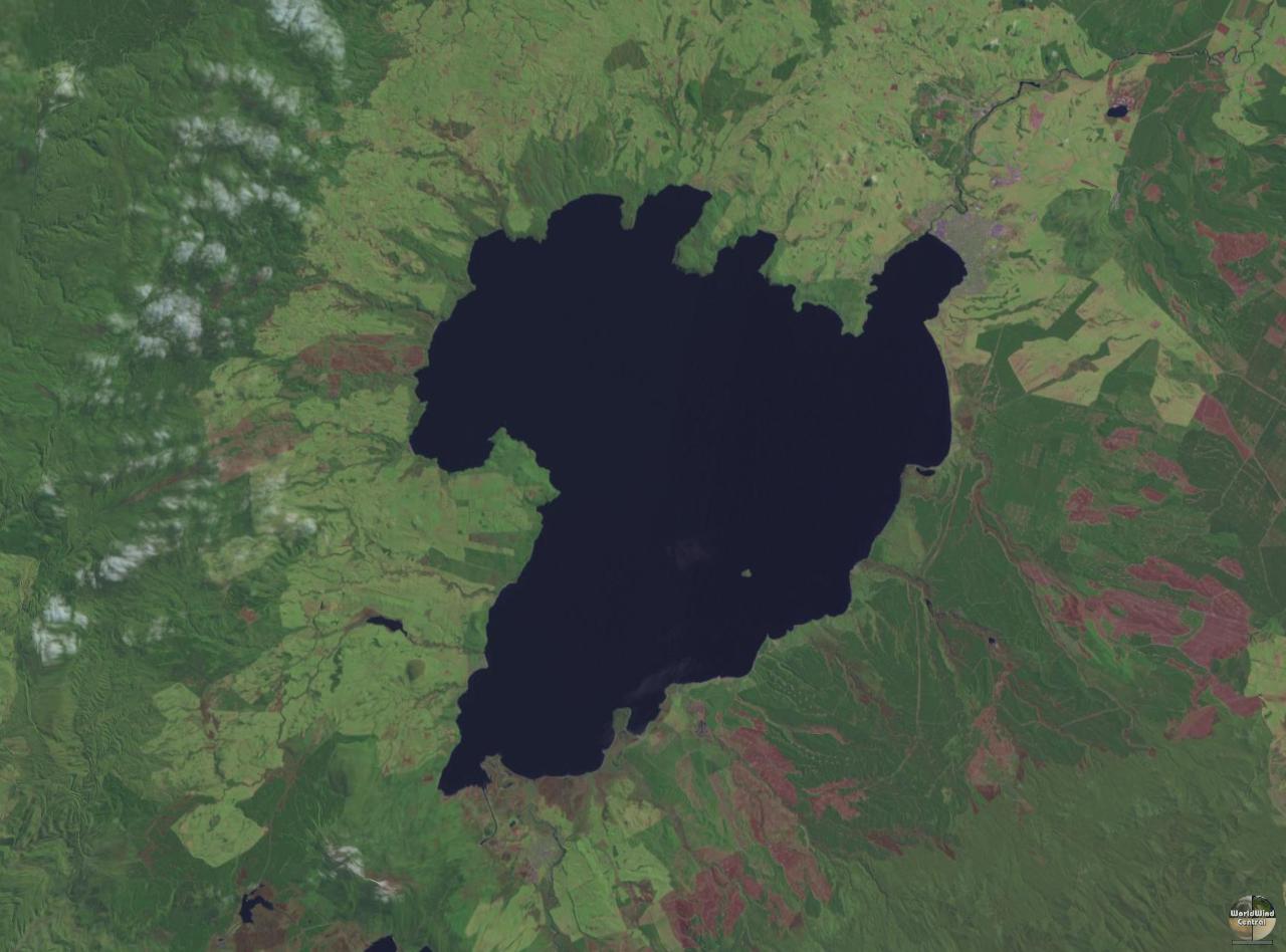
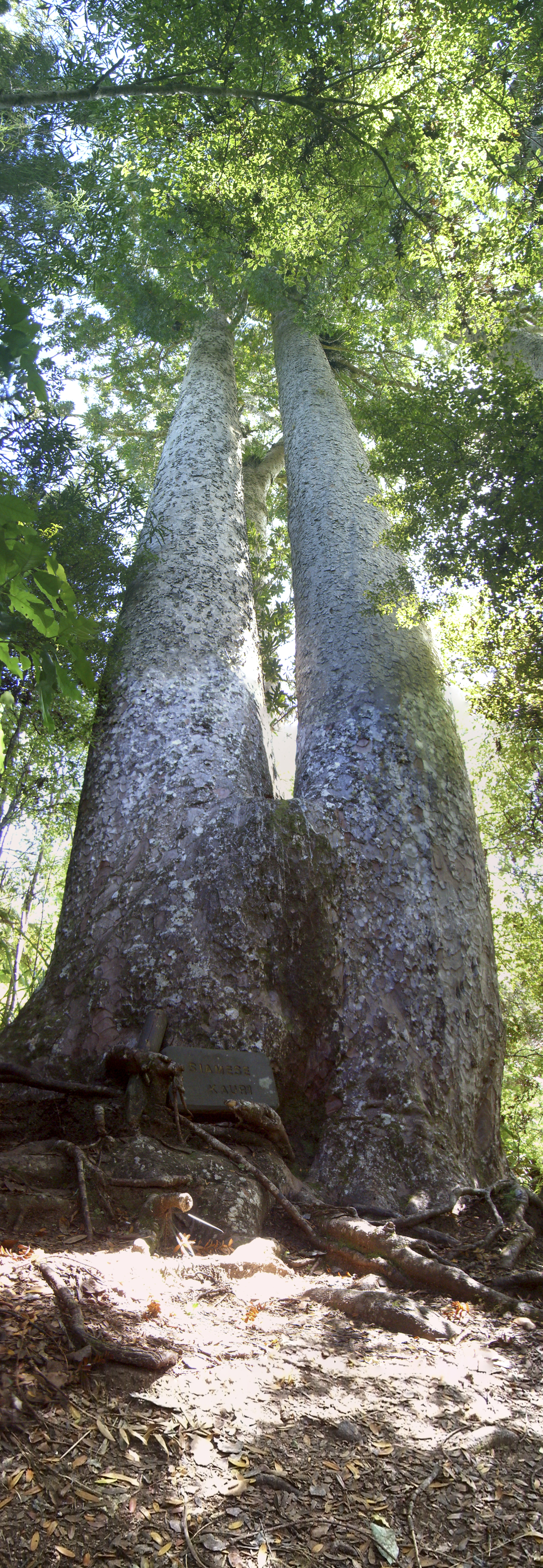
The Mamaku Ranges are a mountain range in the North Island of New Zealand. Located to the west of Lake Rotorua and north of Lake Taupō, they lie to the immediate south of the Kaimai Range and can be thought of as an extension of it, in much the same way that the Kaimai Range can be considered an extension of the Coromandel Range. The hills terminate in the south with the valley of the Waikato River. There were at one time numerous bush railways that ran over and through the Ranges.Green, "Rails Over the Mamakus." (1988, Railway Enthusiasts Society). At their highest, the Mamaku Ranges rise to over 600 metres, and much of the high ground within the hills forms a plateau. The range is extensively forested, with the Kaimai-Mamaku State Forest and Kinleith Forest both covering a considerable part of them. The forest includes kauri ''Agathis'', commonly known as kauri or dammara, is a genus of 22 species of evergreen tree. The genus is part of the ancient conifer family Araucari ... [...More Info...] [...Related Items...] OR: [Wikipedia] [Google] [Baidu] |
North Island
The North Island, also officially named Te Ika-a-Māui, is one of the two main islands of New Zealand, separated from the larger but much less populous South Island by the Cook Strait. The island's area is , making it the world's 14th-largest island. The world's 28th-most-populous island, Te Ika-a-Māui has a population of accounting for approximately % of the total residents of New Zealand. Twelve main urban areas (half of them officially cities) are in the North Island. From north to south, they are Whangārei, Auckland, Hamilton, Tauranga, Rotorua, Gisborne, New Plymouth, Napier, Hastings, Whanganui, Palmerston North, and New Zealand's capital city Wellington, which is located at the south-west tip of the island. Naming and usage Although the island has been known as the North Island for many years, in 2009 the New Zealand Geographic Board found that, along with the South Island, the North Island had no official name. After a public consultation, the board officially ... [...More Info...] [...Related Items...] OR: [Wikipedia] [Google] [Baidu] |
New Zealand
New Zealand ( mi, Aotearoa ) is an island country in the southwestern Pacific Ocean. It consists of two main landmasses—the North Island () and the South Island ()—and over 700 smaller islands. It is the sixth-largest island country by area, covering . New Zealand is about east of Australia across the Tasman Sea and south of the islands of New Caledonia, Fiji, and Tonga. The country's varied topography and sharp mountain peaks, including the Southern Alps, owe much to tectonic uplift and volcanic eruptions. New Zealand's capital city is Wellington, and its most populous city is Auckland. The islands of New Zealand were the last large habitable land to be settled by humans. Between about 1280 and 1350, Polynesians began to settle in the islands and then developed a distinctive Māori culture. In 1642, the Dutch explorer Abel Tasman became the first European to sight and record New Zealand. In 1840, representatives of the United Kingdom and Māori chiefs ... [...More Info...] [...Related Items...] OR: [Wikipedia] [Google] [Baidu] |
Lake Rotorua
, image = Lake Rotorua.jpg , caption = Lake Rotorua , alt = Lake Rotorua , image_bathymetry = , pushpin_map=New Zealand#North Island , pushpin_map_alt = Location of Lake Rotorua , pushpin_relief=yes , caption_bathymetry = , location = Rotorua Lakes, Bay of Plenty Region, North Island , coords = , type = crater lake , inflow = Utuhina, Hamurana Spring, Ngongotahā , outflow = Ohau Channel , catchment = , basin_countries = New Zealand , length = , width = , area = , depth = , max-depth = , volume = , residence_time = , shore = , elevation = , islands = Mokoia Island , cities = Rotorua , reference = Lake Rotorua ( mi, Te Rotorua nui ā Kahumatamomoe) is the second largest lake in the North Island of New Zealand by surface area, and covers 79.8 km2. With a mean depth of only 10 metres it is considerably smaller than nearby Lake Tarawera in terms of volume of water. It is located within the Rotorua Caldera in the Bay of Plenty region. ... [...More Info...] [...Related Items...] OR: [Wikipedia] [Google] [Baidu] |
Lake Taupō
Lake Taupō (also spelled Taupo; mi, Taupō-nui-a-Tia or ) is a large crater lake in New Zealand's North Island, located in the caldera of the Taupō Volcano. The lake is the namesake of the town of Taupō, which sits on a bay in the lake's northeastern shore. With a surface area of , it is the largest lake by surface area in New Zealand, and the second largest freshwater lake by surface area in geopolitical Oceania after Lake Murray in Papua New Guinea. Motutaiko Island lies in the southeastern area of the lake. Lake Taupō has a perimeter of approximately and a maximum depth of . It is drained by the Waikato River (New Zealand's longest river), and its main tributaries are the Waitahanui River, the Tongariro River, and the Tauranga Taupō River. It is a noted trout fishery with stocks of introduced brown and rainbow trout. The level of the lake is controlled by Mercury Energy, the owner of the eight hydroelectric dams on the Waikato River downstream of Lake Taupō, usin ... [...More Info...] [...Related Items...] OR: [Wikipedia] [Google] [Baidu] |
Kaimai Range
The Kaimai Range (sometimes referred to as the ''Kaimai Ranges'') is a mountain range in the North Island of New Zealand. It is part of a series of ranges, with the Coromandel Range to the north and the Mamaku Ranges to the south. The Kaimai Range separates the Waikato in the west from the Bay of Plenty in the east. The highest point of the range is Mount Te Aroha (952 m), at the foot of which is the town of Te Aroha. The range's terrain is rough, and only two roads pass over it: State Highway 2, across the northern end of the range through Karangahake Gorge, and State Highway 29 from Tauranga to Hamilton, New Zealand, Hamilton. Mt Te Aroha can be described as the northern head peak of the Kaimai Range. The New Zealand Ministry for Culture and Heritage gives a translation of "eat fermented food" for ''Kaimāī''. The Kaimai Ranges feature in local Maori folklore. The name Te Aroha translates from Maori as Te - The & Aroha - Love. Literally "the love". The name comes from a ... [...More Info...] [...Related Items...] OR: [Wikipedia] [Google] [Baidu] |
Coromandel Range
A true-colour image showing Auckland city (left), the Hauraki Gulf (centre) and the Coromandel Peninsula (right). The scene was acquired by NASA's Terra satellite, on October 23, 2002. The Coromandel Range is a mountain range running the length of the Coromandel Peninsula in the North Island of New Zealand. It is located east of the city of Auckland, and runs north–south for approximately 110 kilometres. It is at a right angle to the Tararua ranges. The highest point in the range is Mount Moehau (892 metres/2927 feet), at the northern end of the peninsula within the Moehau Range. There are numerous peaks over 600 metres in height. In pre-European times, the southern Coromandel Range was densely forested by trees such as kauri, mataī and tawa, and was a home for birds such as kererū, tui, kākā and kiwi. Greywacke from the ranges was a source for many stone tools used by Hauraki Māori. The range is one of several that form a bone running through the northern North Island ... [...More Info...] [...Related Items...] OR: [Wikipedia] [Google] [Baidu] |
Waikato River
The Waikato River is the longest river in New Zealand, running for through the North Island. It rises on the eastern slopes of Mount Ruapehu, joining the Tongariro River system and flowing through Lake Taupō, New Zealand's largest lake. It then drains Taupō at the lake's northeastern edge, creates the Huka Falls, and flows northwest through the Waikato Plains. It empties into the Tasman Sea south of Auckland, at Port Waikato. It gives its name to the Waikato region that surrounds the Waikato Plains. The present course of the river was largely formed about 17,000 years ago. Contributing factors were climate warming, forest being reestablished in the river headwaters and the deepening, rather than widening, of the existing river channel. The channel was gradually eroded as far up river as Piarere, leaving the old Hinuera channel through the Hinuera Gap high and dry. The remains of the old course are seen clearly at Hinuera, where the cliffs mark the ancient river edges. The Wai ... [...More Info...] [...Related Items...] OR: [Wikipedia] [Google] [Baidu] |
Agathis Australis
''Agathis australis'', commonly known by its Māori name kauri (), is a coniferous tree in the family ''Araucariaceae'', found north of 38°S in the northern regions of New Zealand's North Island. It is the largest (by volume) but not tallest species of tree in New Zealand, standing up to 50 m tall in the emergent layer above the forest's main canopy. The tree has smooth bark and small narrow leaves. Other common names to distinguish ''A. australis'' from other members of '' Agathis'' are southern kauri and New Zealand kauri. With its novel soil interaction and regeneration pattern it can compete with faster growing angiosperms. Because it is such a conspicuous species, forest containing kauri is generally known as kauri forest, although kauri need not be the most abundant tree. In the warmer northern climate, kauri forests have a higher species richness than those found further south. Kauri even act as a foundation species that modify the soil under their canopy to cre ... [...More Info...] [...Related Items...] OR: [Wikipedia] [Google] [Baidu] |
Landforms Of The Bay Of Plenty Region
A landform is a natural or anthropogenic land feature on the solid surface of the Earth or other planetary body. Landforms together make up a given terrain, and their arrangement in the landscape is known as topography. Landforms include hills, mountains, canyons, and valleys, as well as shoreline features such as bays, peninsulas, and seas, including submerged features such as mid-ocean ridges, volcanoes, and the great ocean basins. Physical characteristics Landforms are categorized by characteristic physical attributes such as elevation, slope, orientation, stratification, rock exposure and soil type. Gross physical features or landforms include intuitive elements such as berms, mounds, hills, ridges, cliffs, valleys, rivers, peninsulas, volcanoes, and numerous other structural and size-scaled (e.g. ponds vs. lakes, hills vs. mountains) elements including various kinds of inland and oceanic waterbodies and sub-surface features. Mountains, hills, plateaux, and plains are the fou ... [...More Info...] [...Related Items...] OR: [Wikipedia] [Google] [Baidu] |
Mountain Ranges Of New Zealand
A mountain is an elevated portion of the Earth's crust, generally with steep sides that show significant exposed bedrock. Although definitions vary, a mountain may differ from a plateau in having a limited summit area, and is usually higher than a hill, typically rising at least 300 metres (1,000 feet) above the surrounding land. A few mountains are isolated summits, but most occur in mountain ranges. Mountains are formed through tectonic forces, erosion, or volcanism, which act on time scales of up to tens of millions of years. Once mountain building ceases, mountains are slowly leveled through the action of weathering, through slumping and other forms of mass wasting, as well as through erosion by rivers and glaciers. High elevations on mountains produce colder climates than at sea level at similar latitude. These colder climates strongly affect the ecosystems of mountains: different elevations have different plants and animals. Because of the less hospitable terrain ... [...More Info...] [...Related Items...] OR: [Wikipedia] [Google] [Baidu] |


.jpg)
